All posts by admin

Raspberry Shakes at Palu schools keep on keeping on, providing us a picture of the recent earthquake

Written by Ben Payne

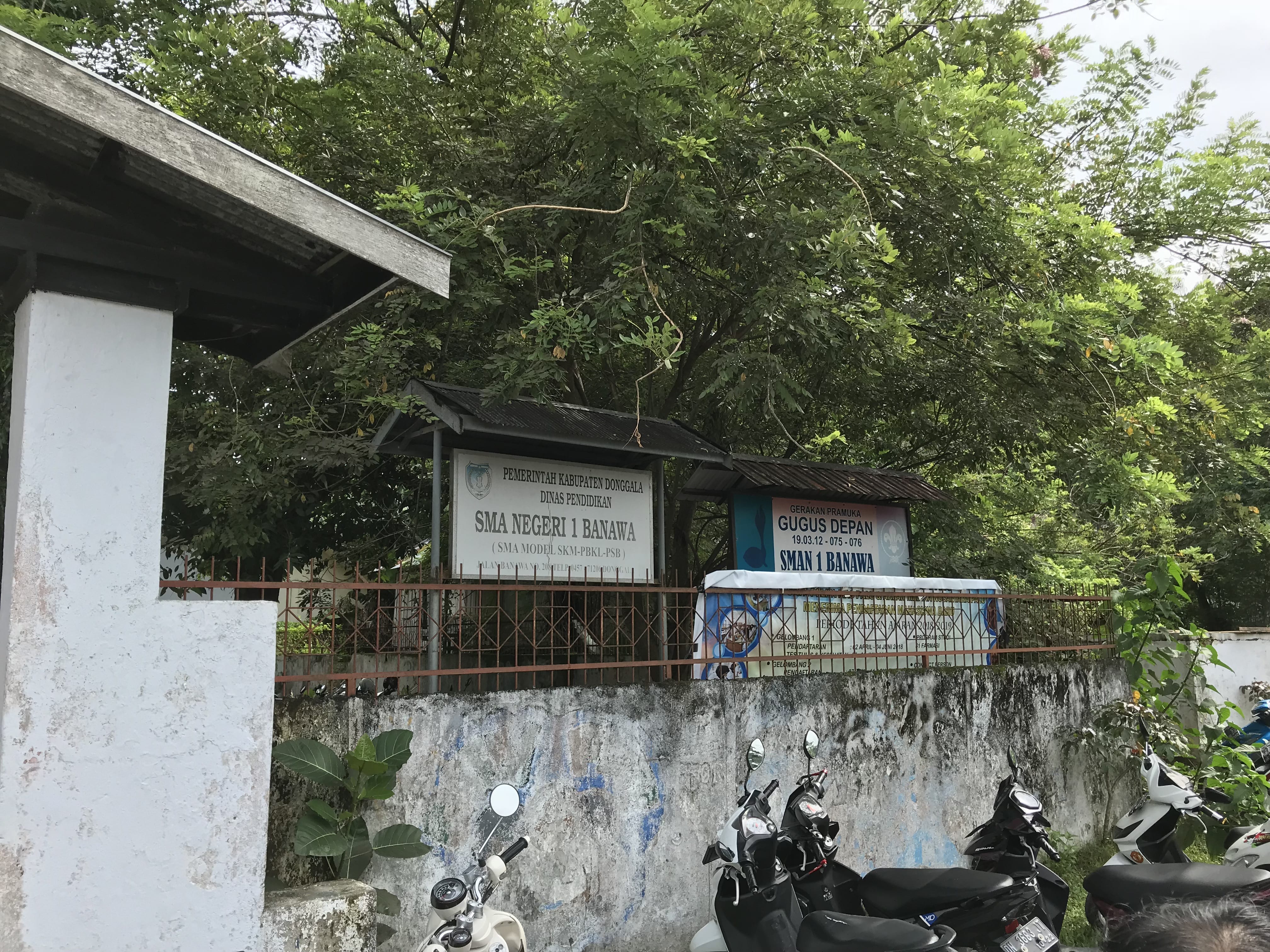
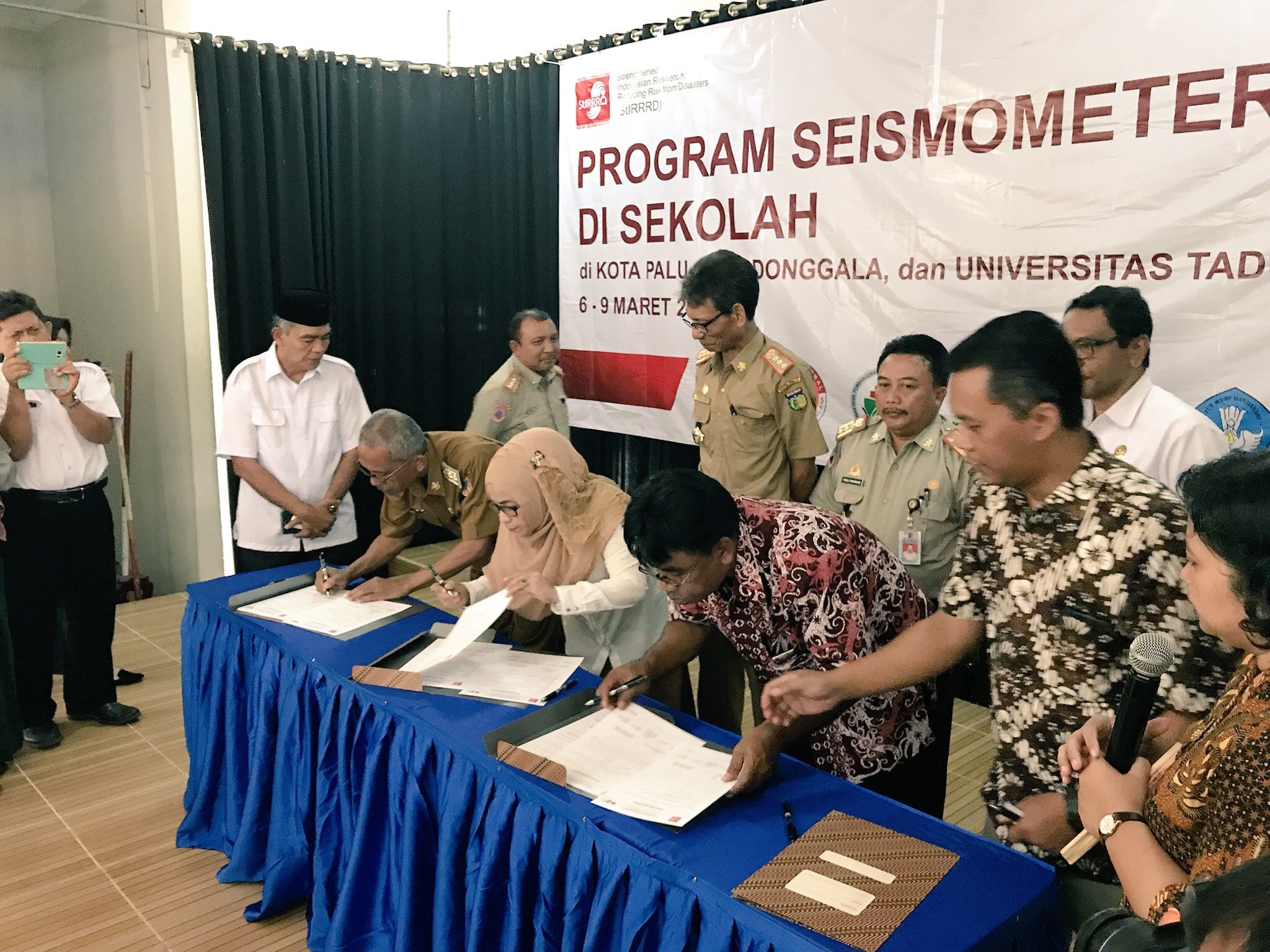
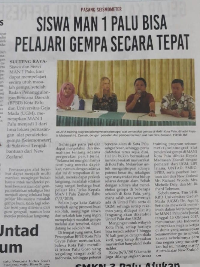
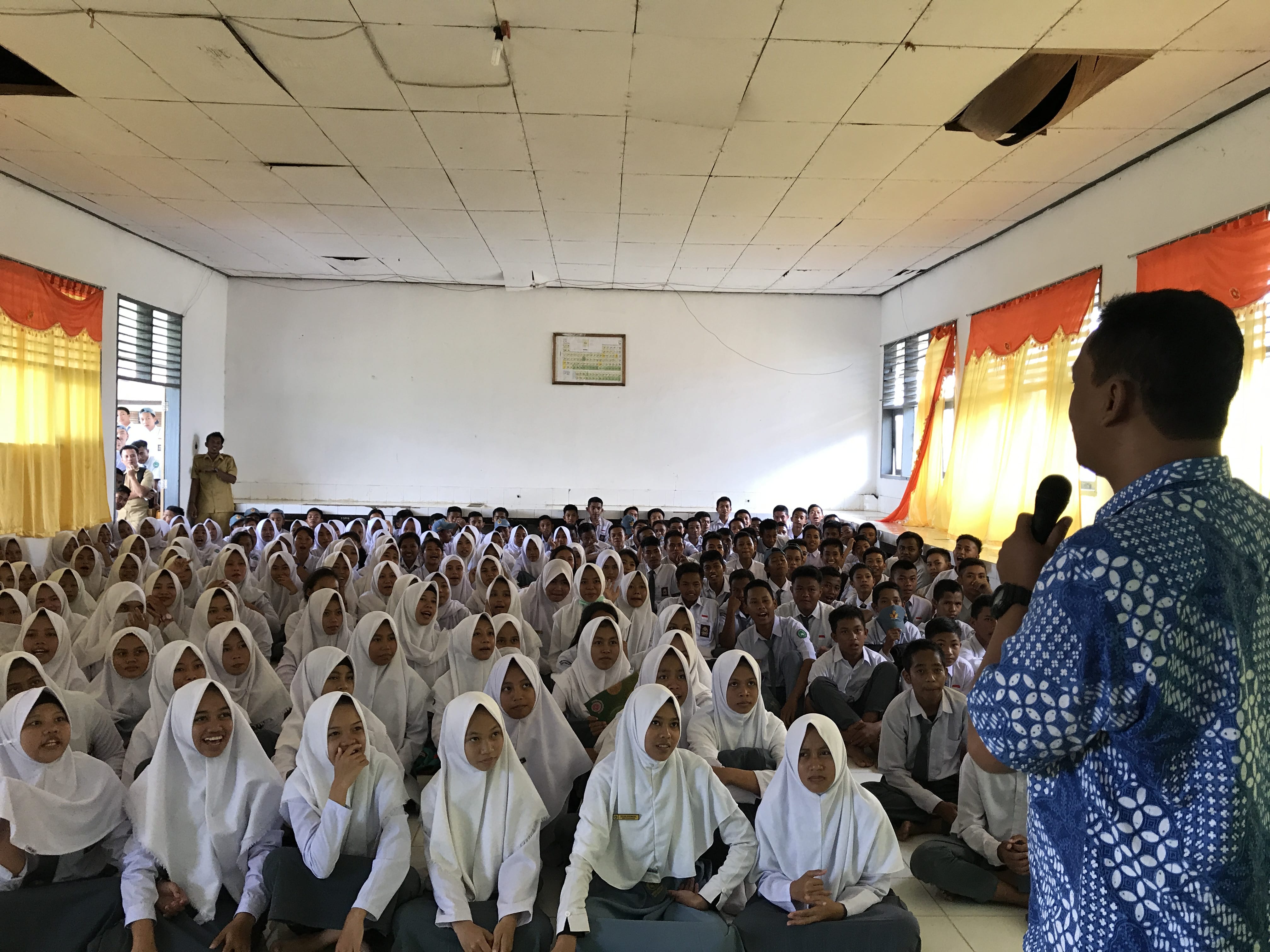
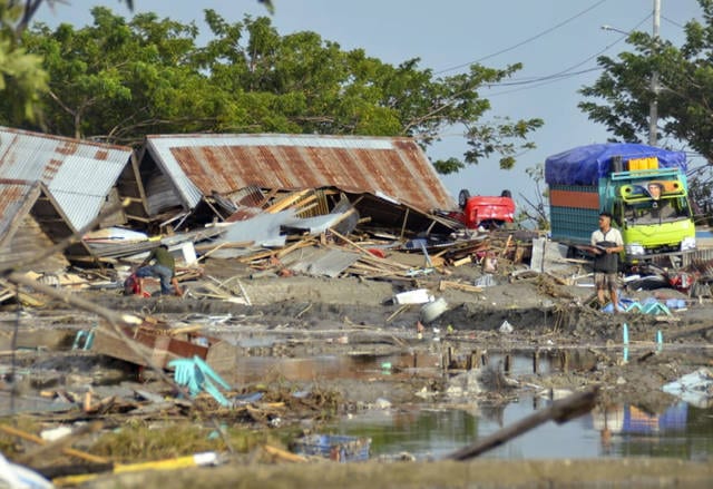
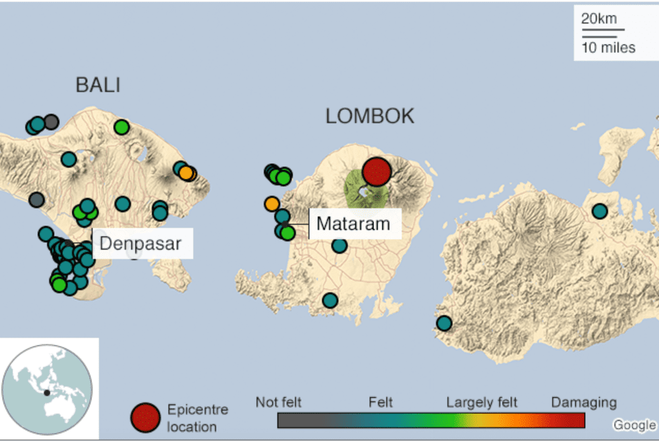
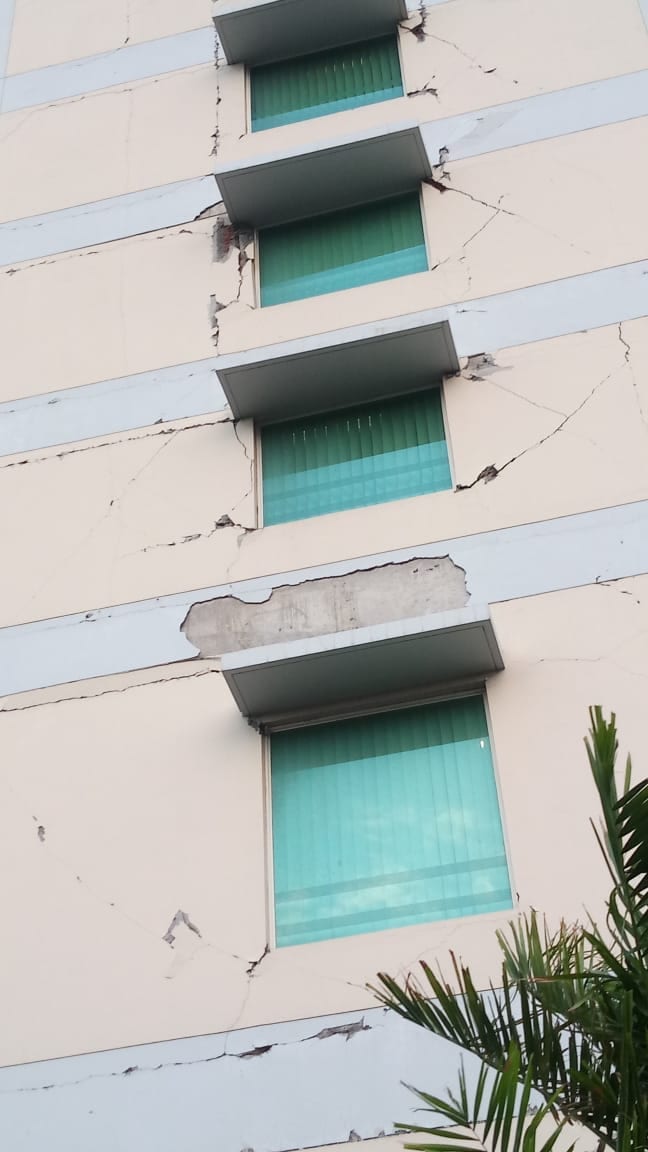
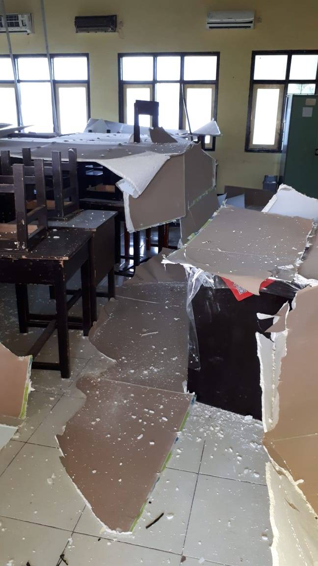
No-one involved in the Seismometers in Schools project wanted to see their work put into action as quickly as it was in Palu. In March 2018, three schools in the City of Palu had Raspberry Shake seismometers installed; on 28 September, a 7.5 magnitude quake in the North Sulawesi subduction zone and a subsequent tsunami killed at least 2100 people in Palu City, Donggala and Sigi. Nearly 700 are still missing and close to 80,000 people remain displaced.

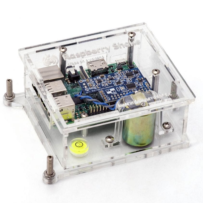
A couple of days later, Richard Woods from the StIRRRD team noticed that the Raspberry Shake at the SMA Negeri Model Terpadu Madani (located in the north of the city of Palu) was back online, as power was restored to the school.

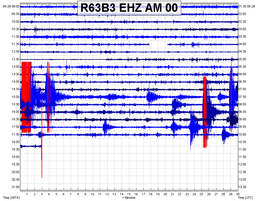
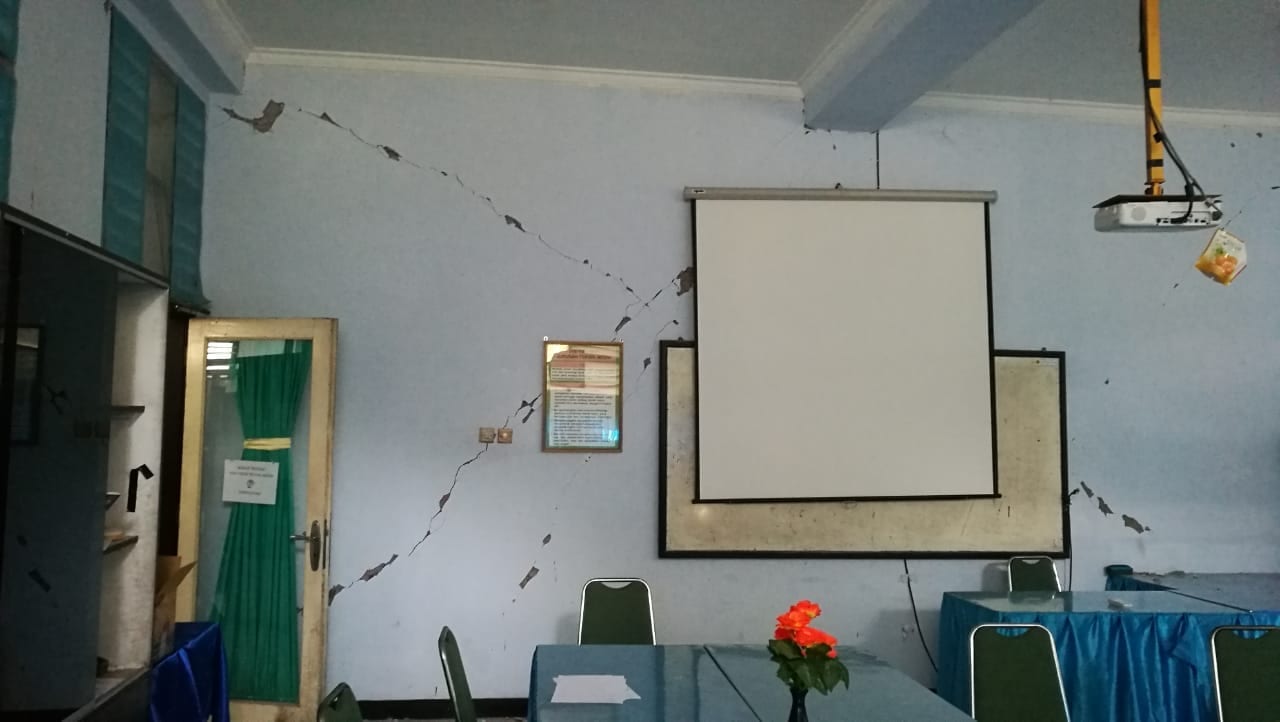
The seismometers in the three schools helped to build a picture of what happened that day. The severity of the shaking was obvious, and we can only imagine how terrifying the earthquake must have been.

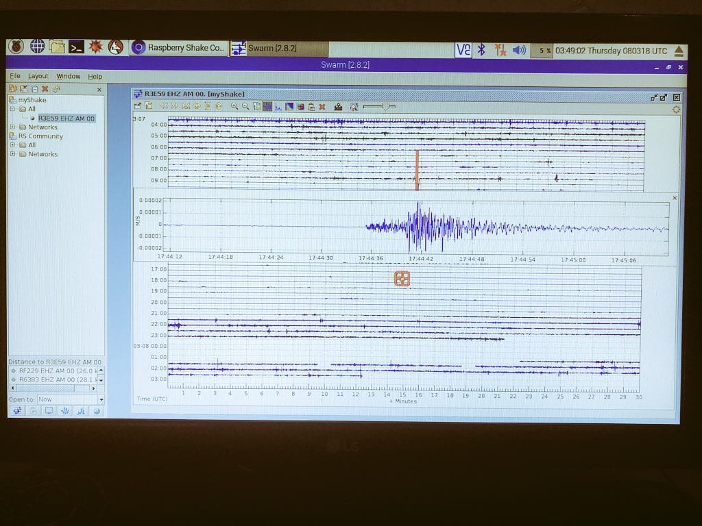
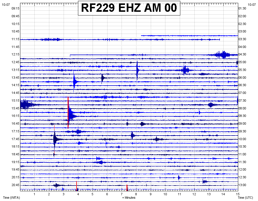
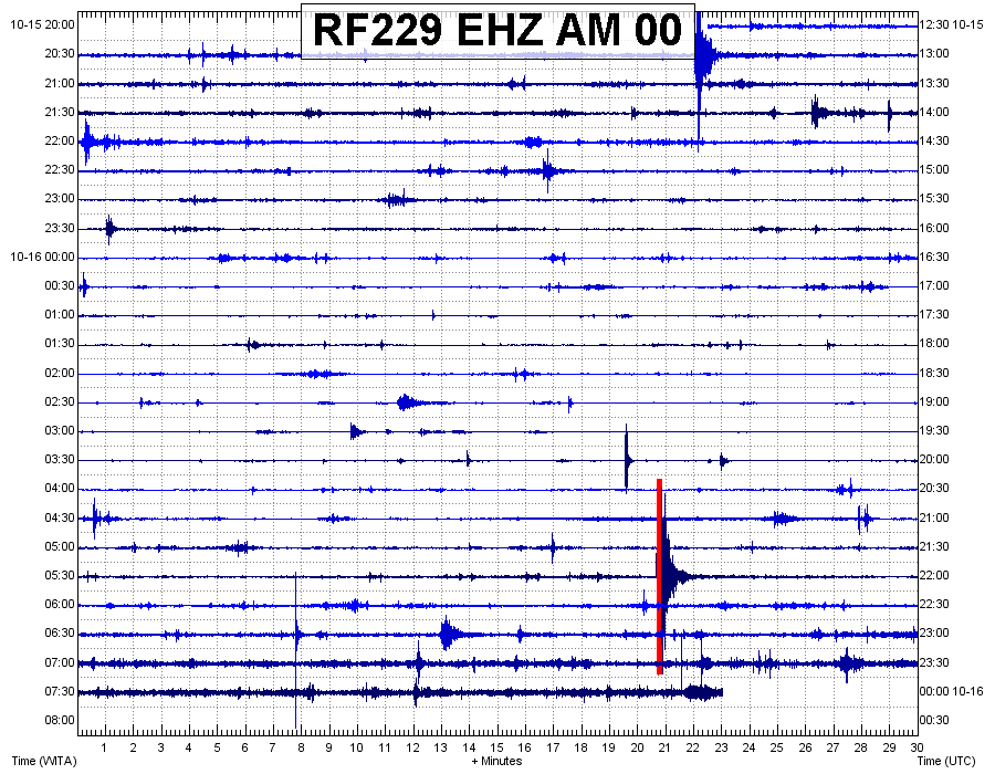
The first image below shows the seismic trace up until the M7.5 struck just after 6pm. You can see the M6.1 foreshock earlier in the day and the aftershocks in between the two earthquakes. The second image shows the seismometer had power restored just after 12.15pm on 07/10, and the third image shows the UNTAD seismic trace on the 16th of October, interspersed with many aftershocks.

Image 1 20180928 RF229_EHZ_AM_00
The ‘Raspberry Shake’ seismometer installed at SMA Negeri Model Terpadu Madani school in March, captured the Seismic trace up until the M7.5 struck just after 6pm on September 28. You can see the M6.1 foreshock earlier in the day and the aftershocks in between the two earthquakes.
Image 2 20181007 RF229_EHZ_AM_00
A second image from the Raspberry Shake at SMA Negeri Model Terpadu Madani, which shows that the seismometer had power restored just after 12.15pm on October 7.
Image 3 20181016 RF229_EHZ_AM_00
The image above shows that aftershock sequence is continuing, on seismic trace captured by the raspberry shake on 16 October.

Richard then noticed that the Raspberry Shake located at MAN 1 school in the city  of Palu, had also come back online, and like the first image above, the severity of the shaking is very clear.

R63B3_EHZ_AM_00-1
The Seismic trace up until the M7.5 struck just after 6pm on September 28 captured on the Raspberry Shake seismometer at MAN 1 School in Palu.

For StIRRRD program leader Michele Daly and the wider team, the realities of the recent earthquake and tsunami are confronting. It’s one thing to be aware of the destructive potential of these natural hazards, but quite another to see events play out so soon. The StIRRRD team had visited Palu just six months before, and no-one could have predicted having to deal with such severe impacts so soon.

Michele described it as ‘heart-breaking’ to see so much destruction and human cost. But she was also amazed at how rapidly people have mobilised to support each other. She says that going by her experience of the wonderful people of Palu, she is sure this will continue throughout the recovery.

So, what are GNS Science and the StIRRD team doing to help?

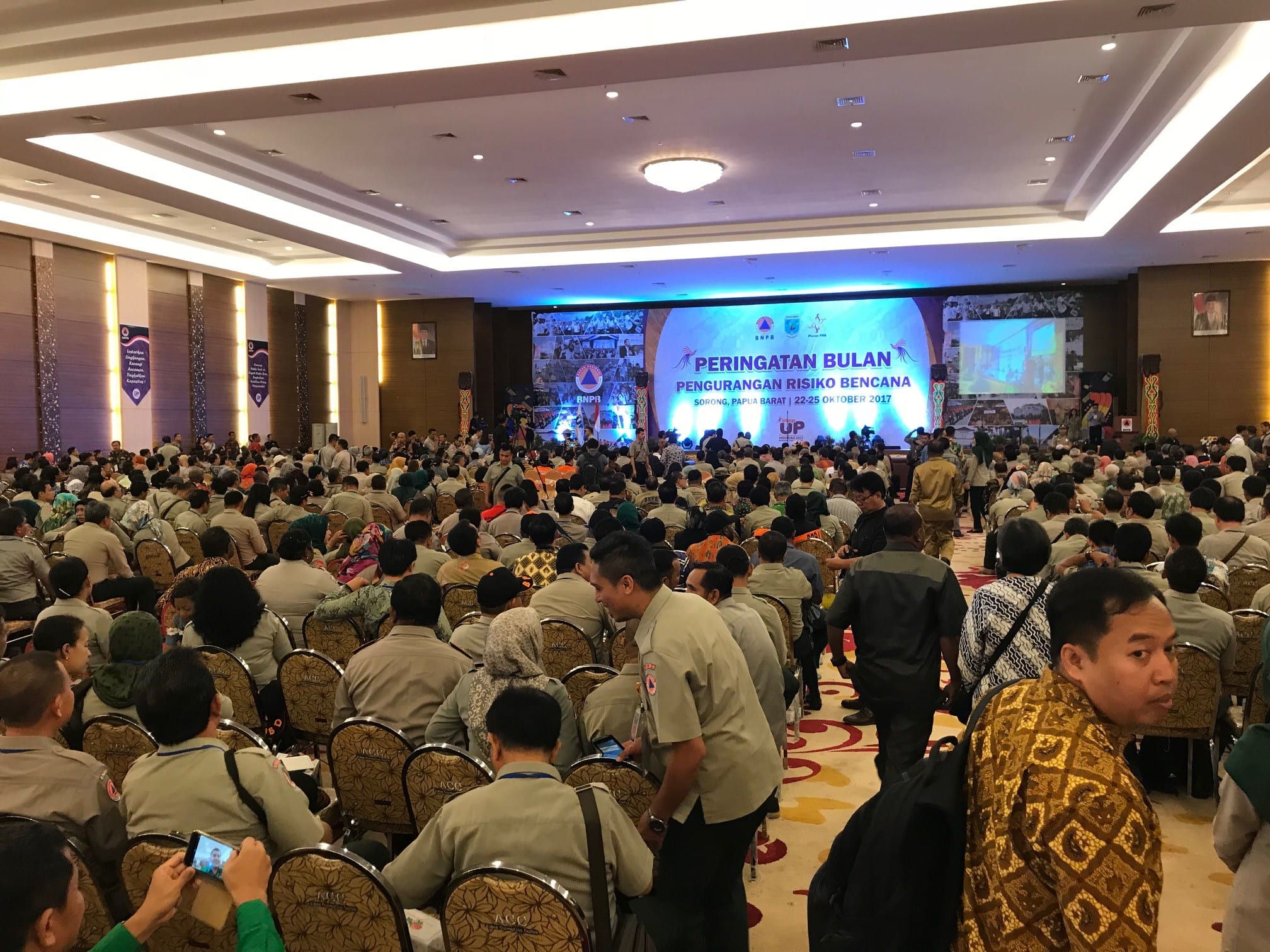
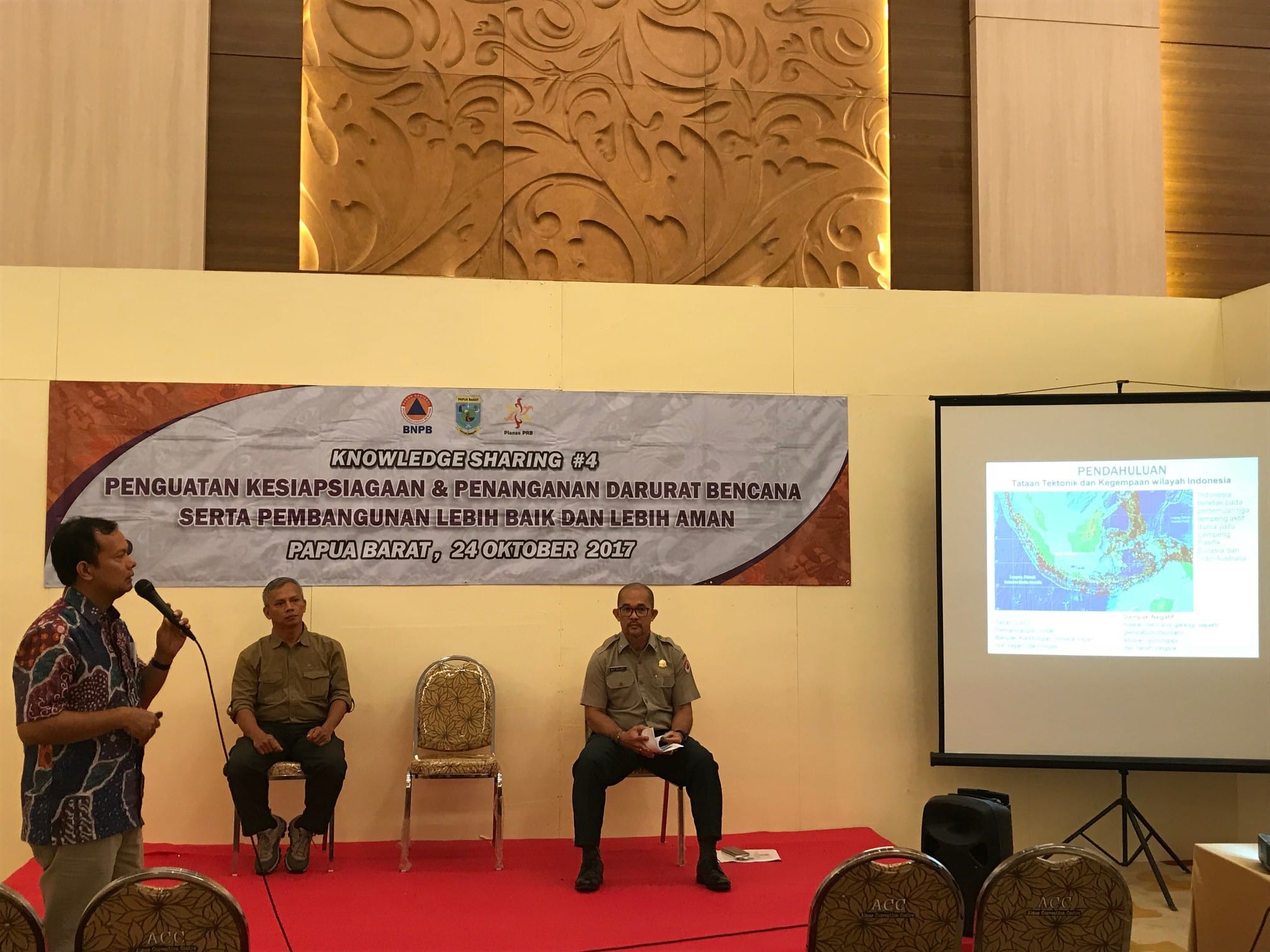
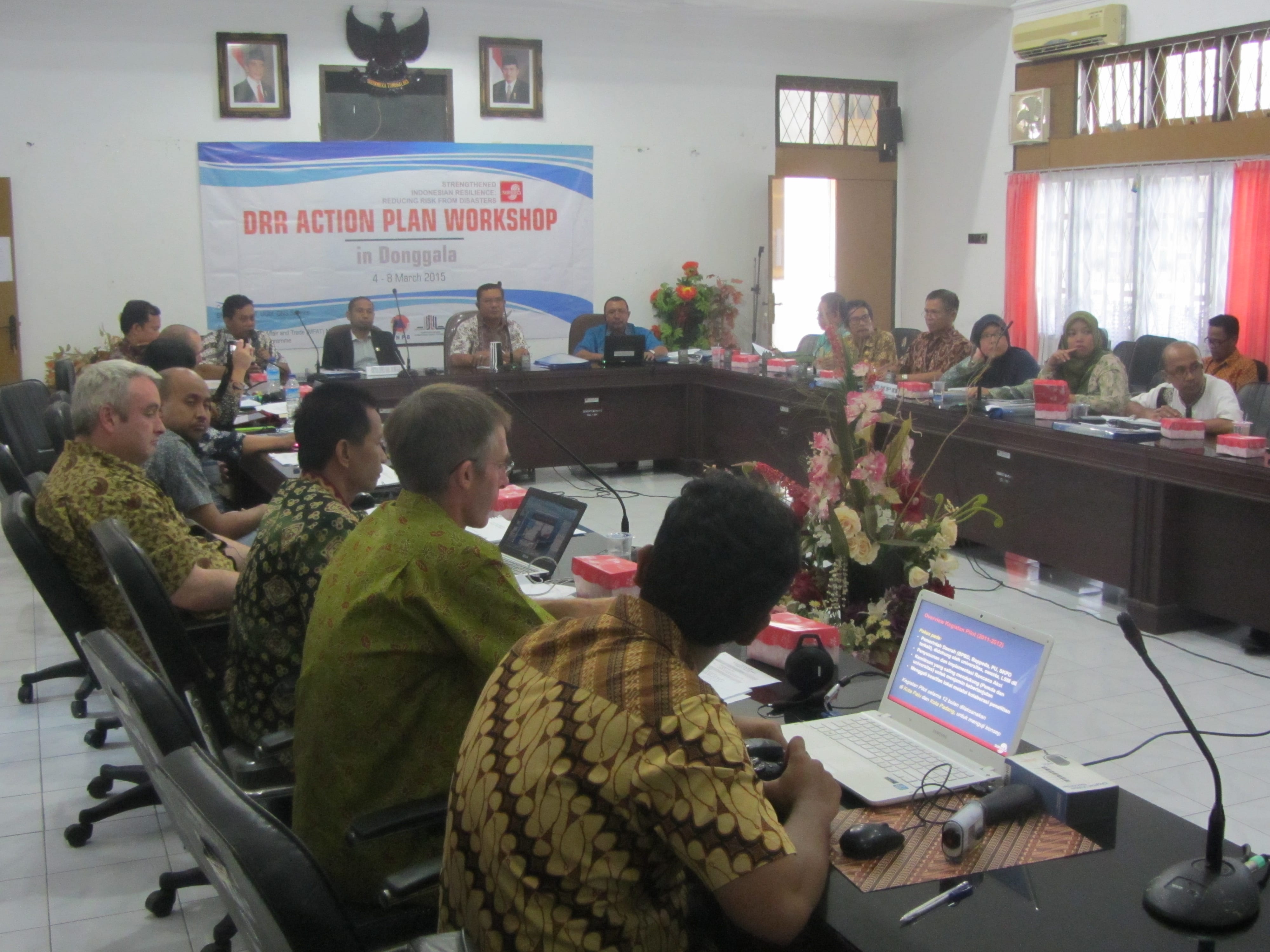
The StIRRRD team is part of the response effort, supporting the Indonesian government and in-country partners with their response efforts. GNS Science has many experts in response and recovery following earthquake and tsunami events, and New Zealand’s Ministry of Foreign Affairs and Trade (MFAT) asked GNS and the StIRRRD team to lead a NZ inclusive approach, providing Palu with technical support in the transition from response to rehabilitation and recovery.

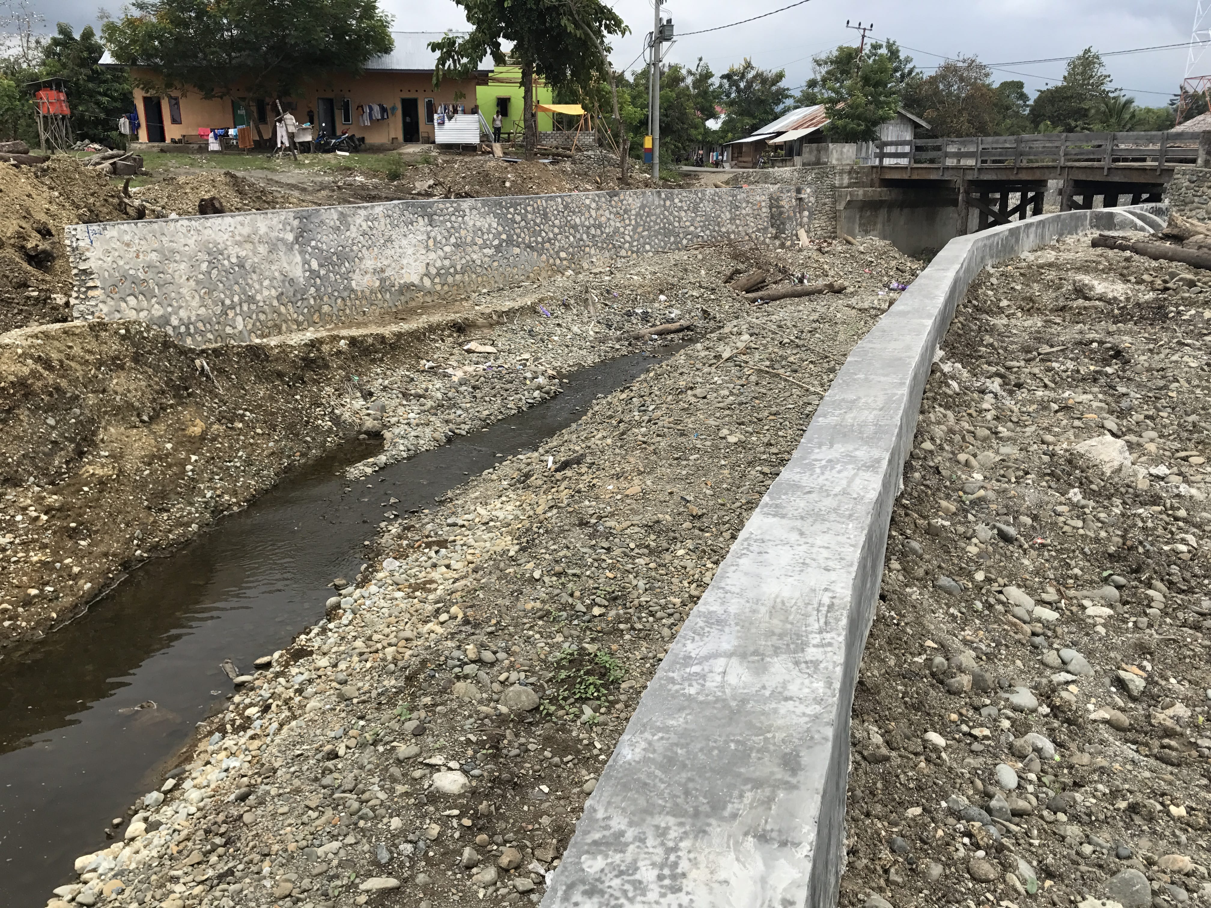
The immediate focus is to support MFAT and local agencies in Indonesia to carry out earthquake damaged building assessments and landslide risk assessment. The StIRRRD team are working with GNS experts and liaising with a variety of NZ and Indonesian partners, and this work is likely to continue in the longer term – with an emphasis on resilience and building back, better.

From Balclutha, with love: Rotary and StIRRRD help Rawa Indah school

Written by Michael Goldsmith & Jessica Williams

Sometimes our work for StIRRRD throws up unexpected opportunities to support the communities we work with – not just in our normal resilience projects, either. The story of Rawa Indah school shows what can happen when scientists and communities work together – with a little fundraising help from our friends.

During our three visits to Rawa Indah in Seluma this year, the StIRRRD team noticed the local school needed more than a bit of help. (You can read more about our visits to the village here (http://stirrrd.wg.ugm.ac.id/2018/03/05/initiating-tsunami-awareness-community-engagement-rawa-indah-seluma/).

The buildings and grounds of Rawa Indah school were in urgent need of rehabilitation. Take the school yard, for example. The School Principal, Laurensius Pambudi, had previously told us this was a priority project for them, as it is the evacuation meeting point for the entire school in the event of an emergency. The yard is not currently suitable for this purpose, as it is dusty and pitted in the dry season, and becomes very muddy during the rainy season.

children-in-yard-20180723_092450.jpg

Building & Yeard 20180723_103036
Photos showing the condition of Rawa Indah School Yard. Photo credit: Michael Goldsmith.
aerial-view-dji_0289.jpg
Rawa Indah School from the air (centre of image). It is located near the coast, and therefore has a high risk from tsunami. Photo Credit: Egy Erzagian.

Back home in NZ, one of the StIRRRD team members was asked to present to Balclutha Rotary Club about StIRRRD, particularly about the DRR work being undertaken in Seluma. Following this presentation, Rotary offered to donate $500 to Rawa Indah School so they could pave the yard.

Balclutha Rotary supports both local and international projects, particularly in developing nations. In the past they’ve supplied emergency response kits and supported an expert dental and educational support group to work in Cambodia. Rotary member Gabrielle Schou said that the project fitted well with Rotary’s core values, and supporting projects aligned to Rotary’s six areas of focus (includes basic education and child health) is very important.

The StIRRRD team were more than happy to facilitate this donation, and we will continue to look for other opportunities which can help Rawa Indah become more resilient. We made some great friendships within the village through this project, and look forward to seeing their progress in coming years.

Wahyu & Mayor 20180723_114533
School Principal Laurensius Pambudi (left) and StIRRRD Province Coordinator Dr. Wahyu Wilopo. An Information Board prepared specifically for the School as part of the Tsunami Preparedness project can be seen on the wall. Photo credit: Phil Glassey


Palu and Donggala: working towards resiliency

AP Image
A man stands amid the damage caused by a tsunami in Palu, Central Sulawesi, Indonesia, Saturday, Sept. 29, 2018. [source: Associated Press Photo]
We can only imagine how horrific it currently is for the people of Central Sulawesi, following the magnitude 7.5 earthquake that struck Donggala and Palu on late Friday afternoon 28th Sept 2018.  The damaging tsunami which struck Palu Bay at incredible speeds a reported 30mins after the quake happened, caused wide spread destruction.  This was on top of significant damage due to the earthquakes north of the city and also along the Palu-Koru Fault. Tsunami waves as high as 5.5m crashed ashore in the already damaged city, destroying buildings, smashing vehicles and killing hundreds of people.

Palu and Donggala are both StIRRRD districts and the StIRRRD team have been working in these areas over the past 7 years. We have many colleagues and friends in the community and we wait anxiously for news of how they are.

The team were last in Palu and Donggala in March 2018, installing seismometers in 3 schools in the area plus one at the university. The seismometers are intended as an educational tool to help the students understand the seismology of the area and to stimulate discussions about earthquakes and tsunami; their causes, hazard mitigation, preparedness and response actions. Students learned the importance of natural warnings for tsunami, and how to Drop, Cover and Hold. We hope these discussions in March were able to help those teachers and students with their actions in this event.

The current death toll has exceeded 840 and is expected to rise sharply over the coming days and weeks, leaving the StIRRRD team deeply concerned for our friends and colleagues who we’ve not been able to contact. In addition to the death toll, an estimated 2.4M people have been affected, with six hundred people hospitalised and 48,000 people displaced. The isolation of affected communities and the scarcity of resources is making response efforts difficult.

images
Map and location of Palu and Donggala. [source: The Sun]
The tsunami was bigger than anticipated and the generation mechanism likely more complex than originally thought. The fault that ruptured on Friday was a so-called strike-slip fault, in which the earth movement is largely horizontal. That kind of movement would not ordinarily create a tsunami. However, a strike-slip fault might have some amount of vertical motion that could displace seawater. The fault’s rupture zone, may pass through an area where the seafloor rises or drops off, so that when the fault moves during the quake, it pushes seawater in front of it. Another possibility is that the tsunami was created by an undersea landslide, caused by the intense shaking. Determining the exact cause of the tsunami will have to wait until the sea floor can be examined.  The shape of Palu Bay has no doubt contributed to the size of the waves in Palu, with the waves’ energy being focused (amplified) along the hairpin shaped bay.

DocLj8QW4AEViH7
Map of the Palu-Koru Fault showing the direction of displacement and areas with the greatest shaking.  [source: Dr Valkaniotis Sotiris @Planet 2018] 
In the 7 years the StIRRRD team have been working with Palu, and more recently Donggala, the districts have been making steady progress in improving their resilience. The team have been impressed by the dedication of the local government staff working in this field and Tadulako University’s efforts to improve their teaching programmes.

Palu and Donggala have been working towards the implementation of Risk Reduction Action Plans – a set of actions inspired by NZ and Indonesia working and learning together.  Since they have been introduced, they have resulted in a number of enhancements: expansion of earth sciences and risk modeling at Tadulako University, a new public education programme, micro-zonation studies in Palu, increased budget for risk reduction, the establishment of a spatial mapping capability in the planning department and a collaborative research and awareness raising programme into the Palu-Koru Fault (http://voinews.id/index.php/component/k2/item/2109-palu-koro-expedition-unveils-the-great-earthquake-potential-in-central-sulawesi ).

Tadulako University was also about to host its first international conference on Urban Disaster Resilience in November 2018: (http://fatek.untad.ac.id/icudr/)

It’s still early days, and building resilience requires a sustained effort over generations. This combined earthquake and tsunami event has been devastating. This has always been possible in this part of the world but it’s not what you ever anticipate will actually happen. This will set Palu and Donggala back, but it has redoubled our resolve to work with our friends and colleagues there to   look to the future and ensure risk reduction is built into the recovery process.

IMG_3699
Donggala DRR Action Plan Workshop, March 2015.


Concluding the Tsunami Safe Community Project in Rawa Indah, Seluma

Written by Elizabeth Garlick, Michael Goldsmith & Phil Glassey

Following our previous two visits, the StIRRRD team were again in Rawa Indah, Indonesia in July 2018 to build on the work they’ve already undertaken in developing a Tsunami Safe Community Action Plan with locals. This visit was focussed on facilitating a village-wide tsunami evacuation simulation. It involved working with village leaders, local schools, community groups and the district Disaster Management Agency (BPBD) to finalise the arrangements for the evacuation; as well as measure and observe the evacuation itself to get a better understanding of how the locals responded.  The team was once again assisted by its experienced project partners – The University of Bengkulu (UNIB), Indonesian Red Cross (PMI) and the National Board for Disaster Management (BPBD).  The team was once again assisted by its experienced project partners – The University of Bengkulu (UNIB), Indonesian Red Cross (PMI) and the National Board for Disaster Management (BPBD).

map
Location of Rawa Indah village, Seluma Regency, Indonesia

The day before the simulation we visited Rawa Indah school to hand over the resources developed with them during previous visits.   These included framed tsunami evacuation posters for each class, signs for the assembly area, evacuation signs and a large information poster to be displayed in a high-traffic area by the school gate. These resources were much-needed and attracted the attention of many students who were eager to learn tsunami safety information. While at the school, we made final plans for the simulation and encouraged the principal to let all classes participate, even new entrants. Children that know about tsunami hazard and response will go home and educate their families, which in turn leads to safer communities.

Information board at Rawa Indah School.  The board includes maps of the school and the evacuation route to the shelter, and tsunami hazard information.


20180723_110045

The simulation worked well, with around 240 people from the village making their way to the tsunami shelter – 177 of these people were children – with most people arriving by motor-scooter.   The simulation started at 9.04 am and most people had arrived at the shelter by 9.30 am. After everyone had gathered, local agencies kept the children engaged with hazard education including songs. PMI distributed food packages and we gave away a ‘grab and go’ emergency bag from New Zealand.

We worked with local agencies to debrief after the simulation and created some action points for improvement. Most people heard a warning, either the siren or kentongan (traditional wooden instrument that makes a noise when struck), which was a great start. The kentongan is robust and reliable and has been used for centuries by locals to warn of threats. It was noted that multiple sources of warnings should be used though, and it was noted that BPBD hope to install a system which can provide official warnings directly to the village in the near future.

20180723_151222

Training workshop with local volunteers, to finalise arrangements for the tsunami simulation

After the simulation, we initiated some actions that will have an impact on how ready the community will be in the event of a tsunami.   Another positive outcome from this project is that the school has agreed to run the simulation at the start of every school year to keep the information fresh in the children’s minds. The schoolchildren also picked up the evacuation information quickly due to being familiar with the shelter and from the songs previously learnt.

Also, during the week, we undertook a repeat survey about tsunami hazard and response. The survey will give an insight into the effectiveness of our community education programme as well as highlight issues.

20180723_153937
Training local volunteers to undertake the community survey

In addition to the Community Project work, the team met with BPBD leaders in Seluma District and also in nearby Bengkulu City, to get an update on the DRR activities they have implemented recently, or are planning in the coming year. Both agencies are making good progress, and are building on the original DRR Action Plans they developed as part of the StIRRRD project. Highlights include:

  • Bengkulu BPBD working with the private sector to formalise access to buildings near the coast, so they can be used in the event of a tsunami warning.
  • Bengkulu BPBD participating in a large-scale Pacific Partnership Exercise that coordinated a field response to many emergency simulation situations including devastating earthquakes. They were proud of their involvement in this and it has given them further confidence in their response capabilities.
  • Bengkulu BPBD are hoping to erect a building using sound construction techniques, that would become an example of sturdy design for locals to adopt themselves. The building could also be used as a station for disaster risk reduction training. The StIRRRD team offered help to gain some additional funding for this project.
  • Seluma BPBD have a number of projects underway. These include adding to their early warning system network, evacuation simulations, and facilitating additional ‘disaster resilient village’ programs.

In addition, some of our team attended a workshop about the Safe Schools programme in Seluma.  A short presentation was given regarding the simple-action messages used in New Zealand, such as “drop, cover, hold” and “long or strong, get gone” as well as the emergency ‘go bag’ concept. Some of our insights and experiences of the Rawa Indah School evacuation simulation were also shared.

The StIRRRD team have returned to New Zealand with several action points to work on to keep the progress moving along in Rawa Indah.  The team is happy with the progress made by local agencies and the community throughout the project, and especially with how well the schoolchildren responded to the evacuation simulation. Thanks to everyone who generously hosted the team during the 3 project visits, and to the local volunteers who gave up their time for an important community cause.

20180723_161041

Tsunami information boards at the shelter

Earthquake hits Lombok – some reflections from the StIRRRD Team

On Sunday 5 August 2018 at 7.46 pm (local time) a powerful, magnitude 6.9, earthquake hit the Indonesian tourist island of Lombok, killing at least 250 people and caused damage in neighbouring Bali.

This was the second deadly quake in a week to hit Lombok. A July 29 quake killed 17 people and damaged hundreds of houses, some of which collapsed in last Sunday evening’s quake, killing those inside. Poor construction techniques used for houses is a big issue for Indonesia and requires significant education and capacity building amongst the community.

National Disaster Mitigation Agency spokesman Sutopo Purwo Nugroho told a news conference that damage was “massive” in northern Lombok, and in several districts, more than half the homes were destroyed or severely damaged.

Although none of the New Zealand based team members are in Indonesia currently, Michele Daly (Project Director of StIRRRD) said that Mataram City on Lombok Island is in the thick of the earthquake’s impact zone. Mataram City is one of the StIRRRD case study cities and is in the West Nusa Tenggara province.

Mataram City in relation to Bali and epicentre

Image: Lombok and Mataram City in relation to the quake’s epicentre. Tremors were felt across the neighbouring island of Bali (Source: BBC)

On hearing about the quake, the team’s immediate concerns turned to the people in Indonesia, and especially those who the StIRRRD team work closely with within the local Emergency Agency and other government Agencies and the University of Mataram. Due to the quake’s size, many of them and their families have been badly impacted.

Staff from Gadjah Mada University (UGM) in Yogyakarta visited Mataram City to undertake building damage and community vulnerability assessments, and sent through photos that show the extent of damage around the University of Mataram’s campus, see below:

IMG-20180806-WA0000
Structural damage Golden Palace Hotel, Mataram
IMG-20180806-WA0001
Structural damage engineering Faculty University of Mataram
IMG-20180806-WA0002
Non -structural (ceiling) damage University of Mataram

Mataram City is at risk from a range of natural hazards including floods and extreme weather, drought, landslides volcanic eruptions and earthquakes, and due to high population density and poor construction methods, large scale events affect many people.

Phil Glassey, a Disaster Risk Reduction Scientist at GNS Science, reflected on the StIRRRD team’s visit to Gol Village in North Lombok in 2014. The team observed several houses that had been damaged or were being rebuilt after a magnitude 5.1 earthquake the year before, so the impacts from the recent quakes will take a long time for communities to recover from.

While a tsunami was not observed following last Sunday’s quake, this is a potential hazard due to the Mataram’s proximity to the ocean. The Lombok Strait is located on the City’s western margin and the Sunda Trench, to the south of Mataram, experiences large earthquakes capable of generating tsunamis.

Dr John Ristau, a seismologist at GNS Science comments:

The magnitude 6.9 Loloan, Indonesia earthquake was a reverse faulting earthquake at a depth of 31 km.

Reverse thrusting fault

Image Credit: California geological Survey

In this area the Sunda plate to the north subducts beneath the Indonesian Arc, and the mechanism of the earthquake is consistent with reverse-faulting on the Indonesian Arc thrust.

The Pacific Island arc from Samoa to Indonesia is one of the most seismically active regions on Earth, and earthquakes of this size are not unusual. In the region within about 500 km of the epicentre there have been at least 15 earthquakes of magnitude 6.5 and above in the last 10 years.

Earthquakes of this size will produce significant aftershock activity. However, plate interface earthquakes tend to have less vigorous aftershock sequences than shallow crustal earthquakes of comparable size.

Developing a Tsunami Safe Community in Rawa Indah, Seluma

Following on from our visit in March 2018, the StIRRRD team visited Rawa Indah to engage with the community and stakeholders to further develop a draft Tsunami Safe Action Plan. The team spent 5 days in the village conducting and participating in various village activities, with the help of BPBD (Emergency Management Agency), Seluma and Bengkulu University. Specifically, we

Attended, on invitation, 2 women’s prayer groups and one men’s prayer group and discussed tsunami awareness and preparedness.

Womens group 180424

Engaged with the local community groups (POLMAS – Community Police, Tagana (Youth) BANSER and KSB) and sought their input into Actions to be taken, within 5 overlapping themes that had emerged from the initial visit, namely; 1) Shelter Management, 2) Evacuation Planning, 3) Local Access, 4) Resilient Infrastructure and 5) Prepared and Knowledgeable Community.

Poster Mitigasi Bencana Tsunami Desa Rawa Indah
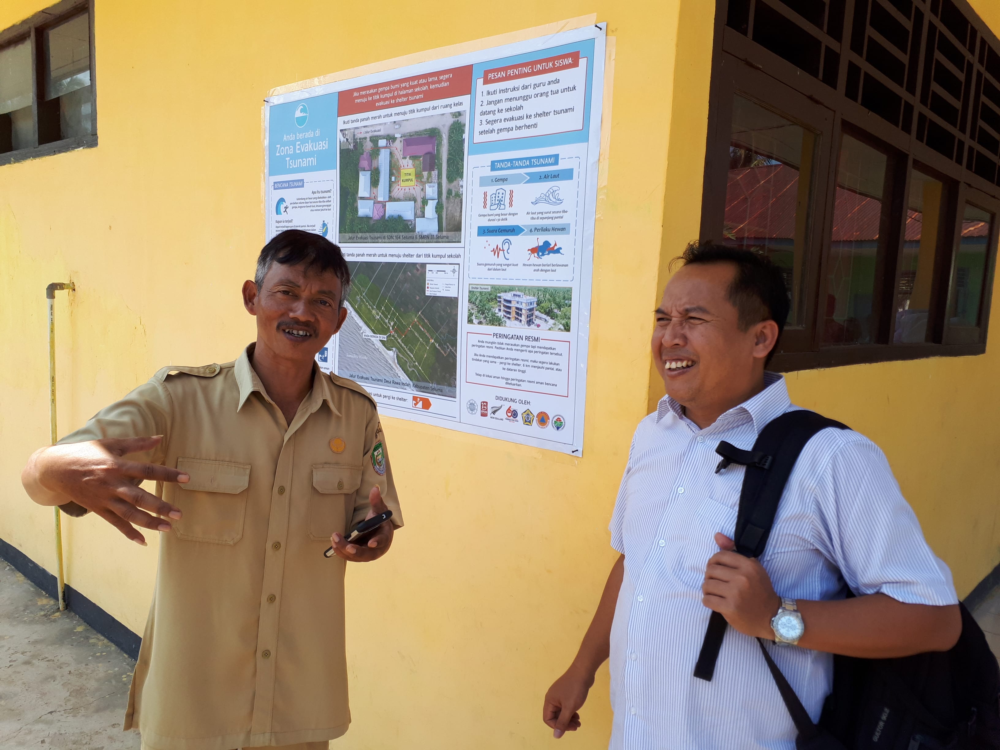
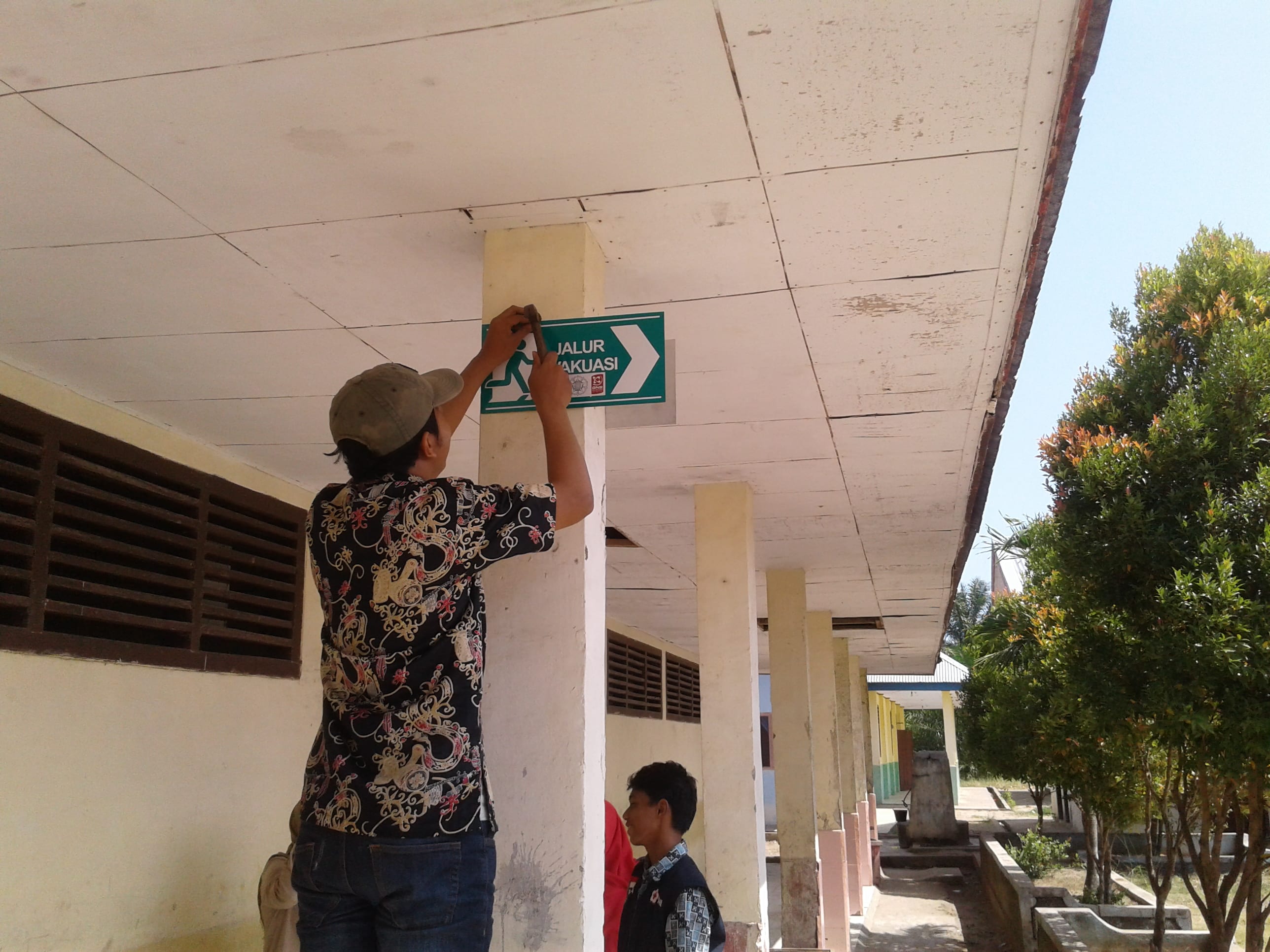
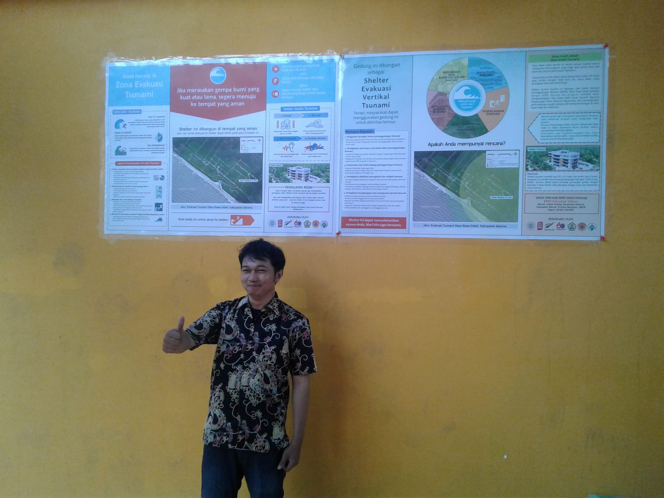
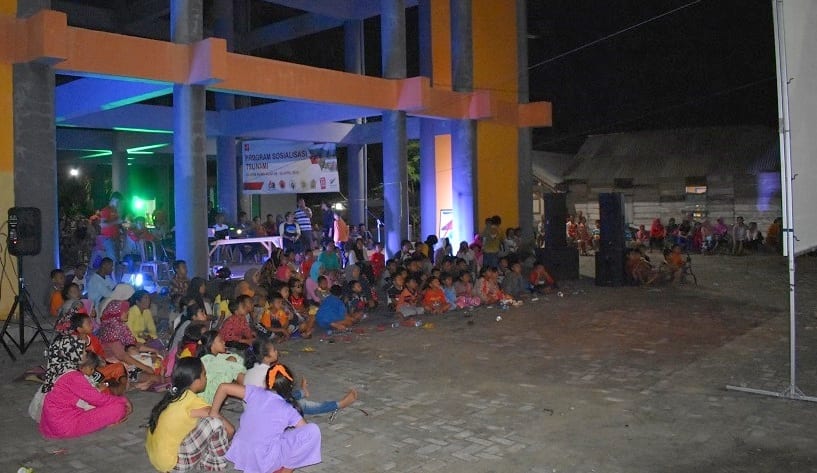
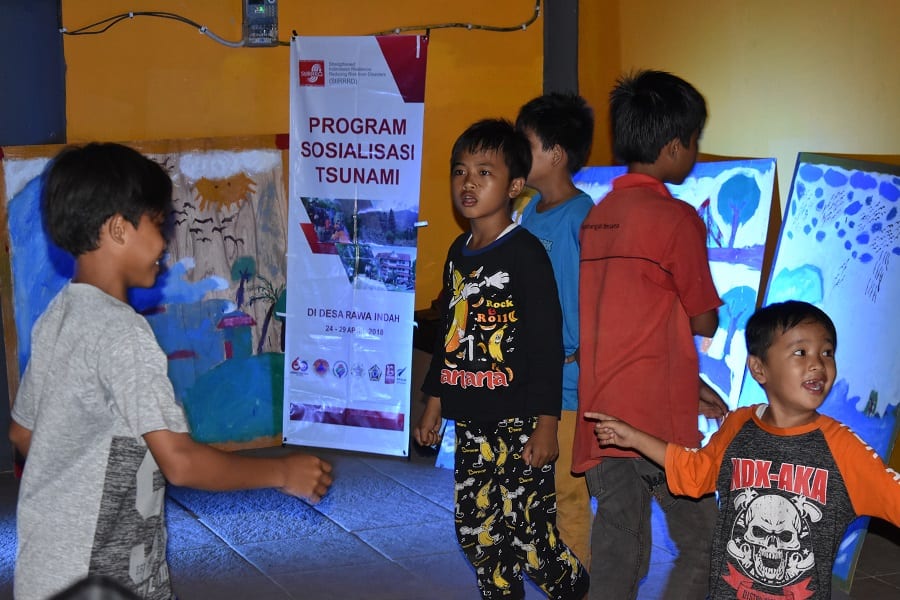
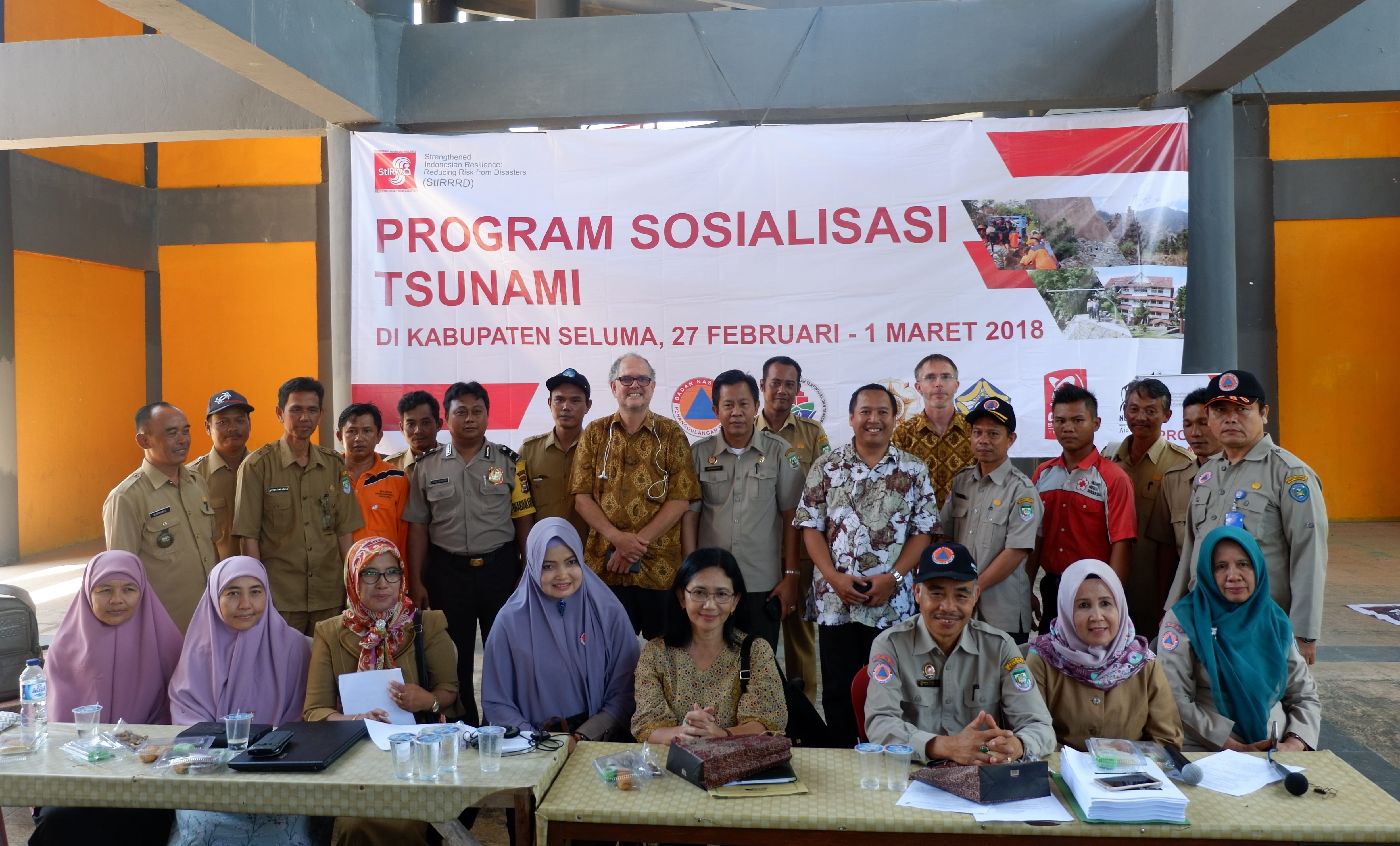
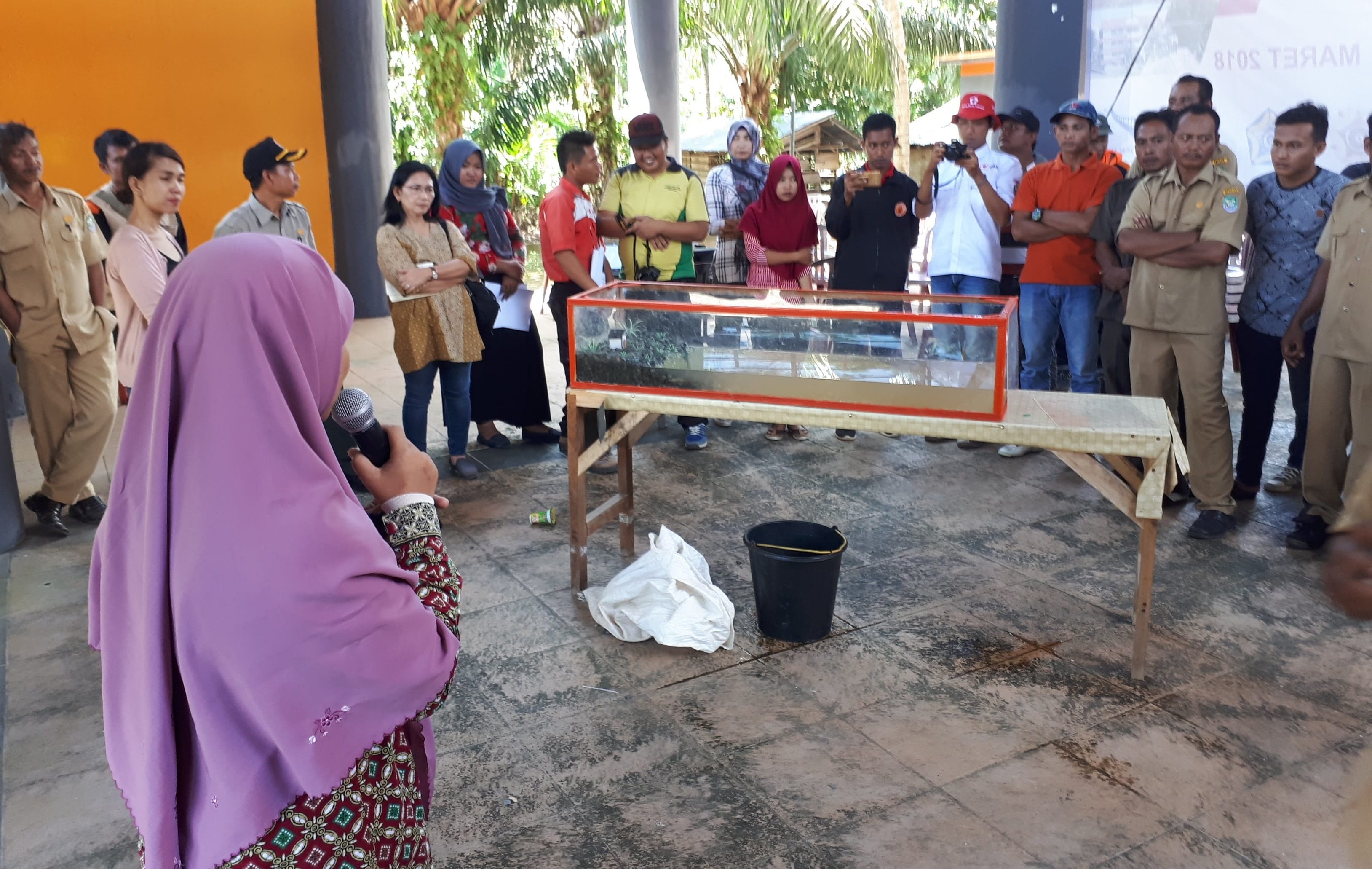
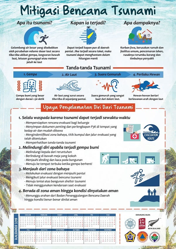
Distributed tsunami awareness and response posters/calendars developed by the team to each household and gifted maps and drone video footage flown on first visit, along with other tsunami preparedness literature and videos.

Attended Friday morning women’s aerobics at the tsunami shelter and were given an opportunity to talk about tsunami preparedness.Friday aerobics 180427Friday aerobics 180427 (2)

Held a meeting with District OPDs (Social, Public Works (PU), Bappeda (Planning), Education, Health, Marine and Fisheries) at the shelter to present the plan and convey the actions in the plan that were their responsibility. Implementing the plan requires a trusted partnership between the district agencies and the village.

School Simulation 180426 (19)
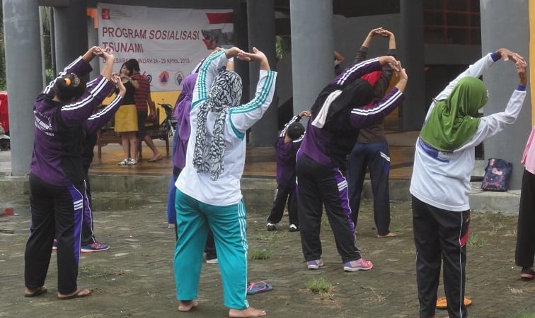
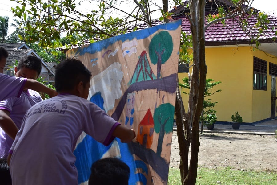
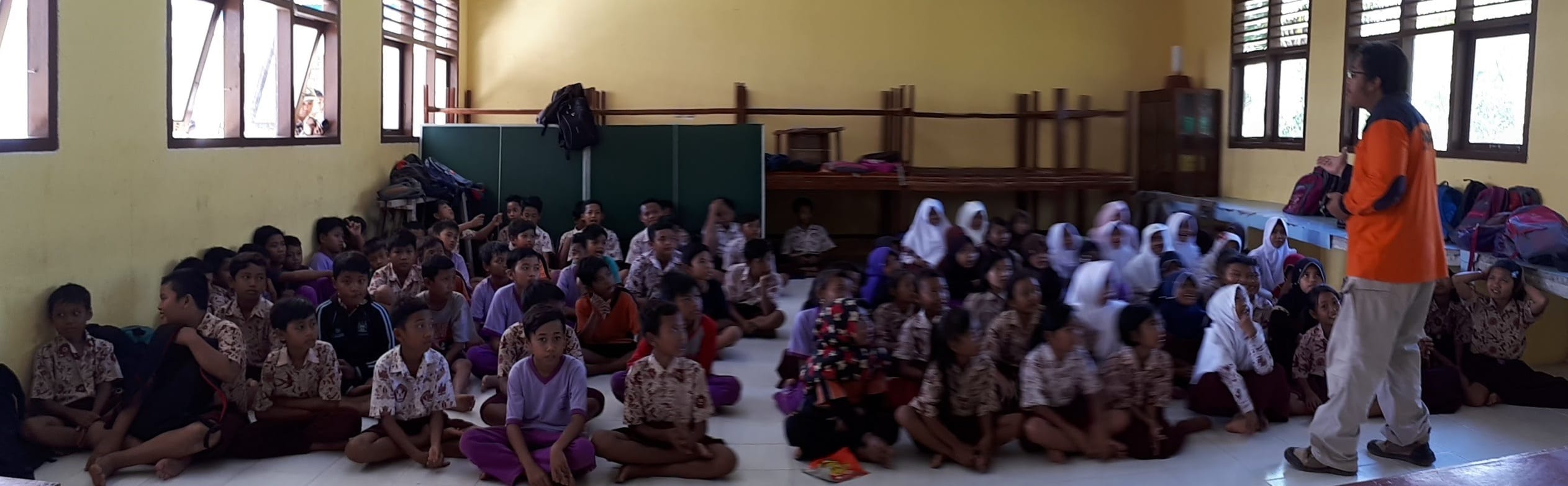
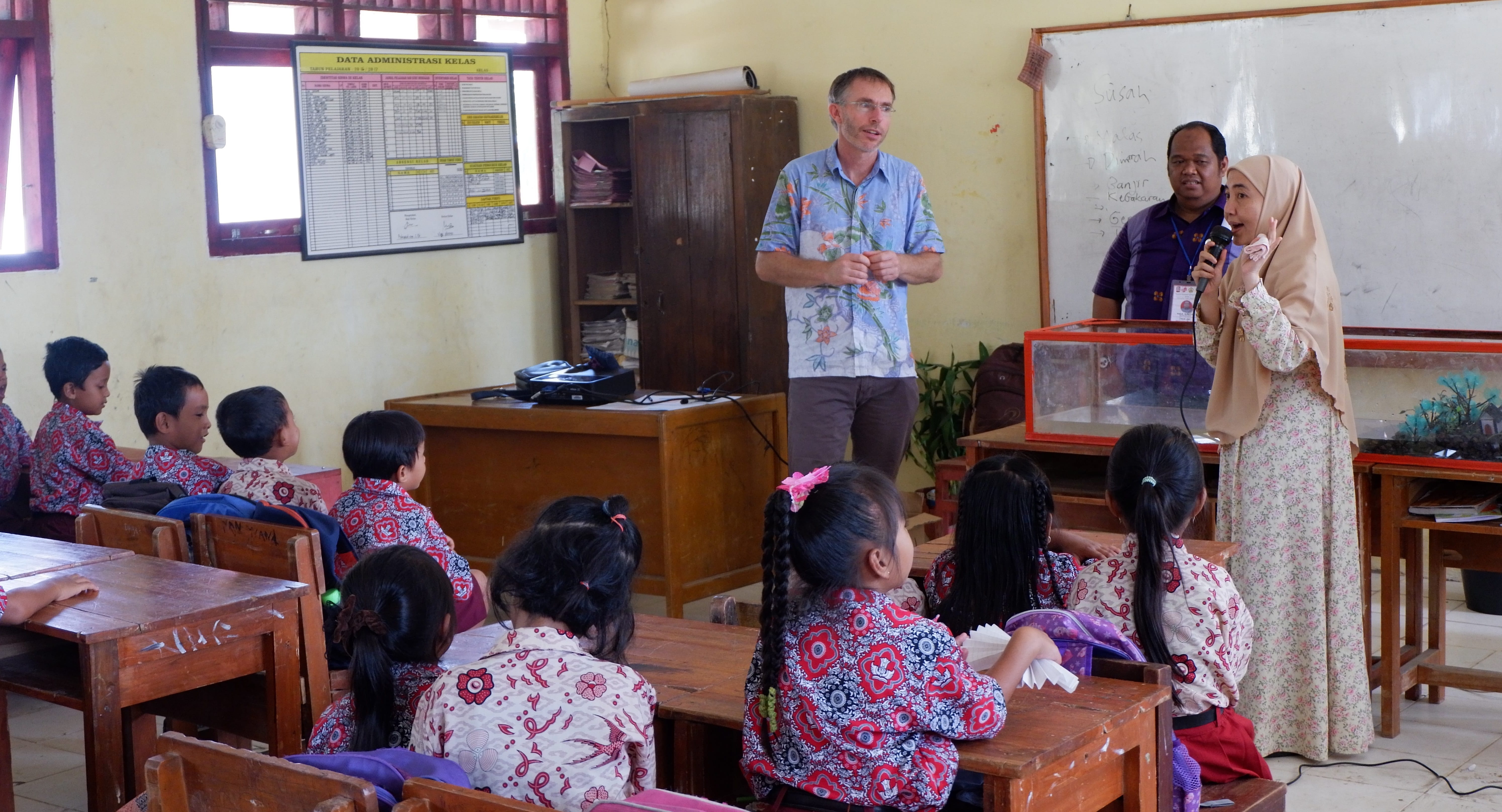
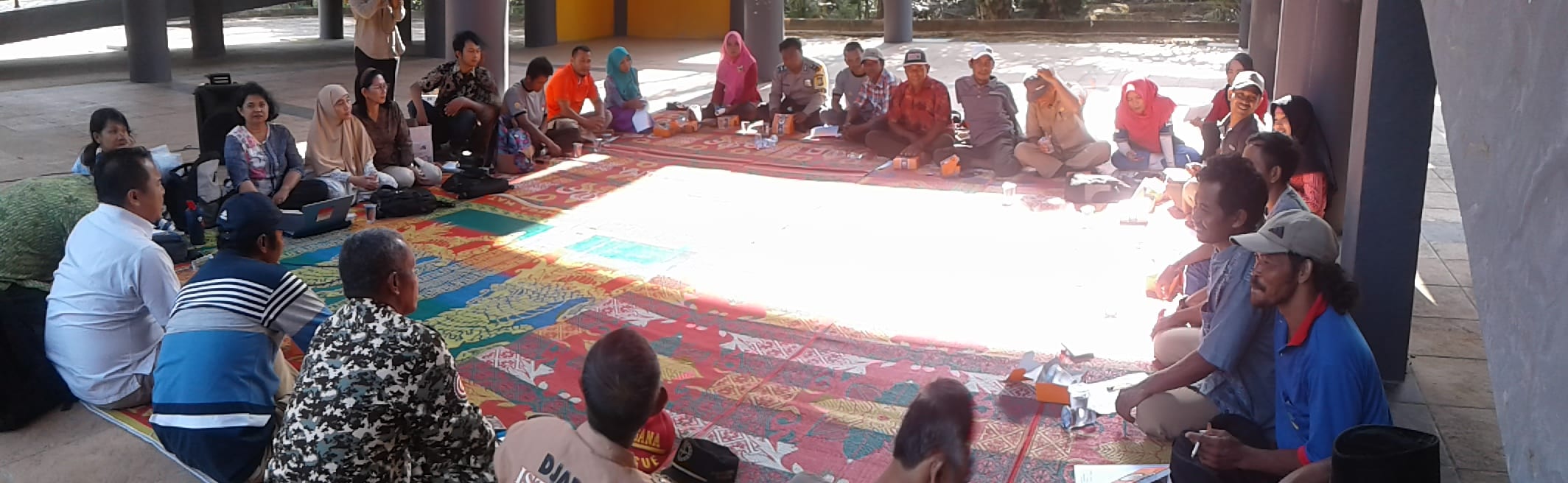
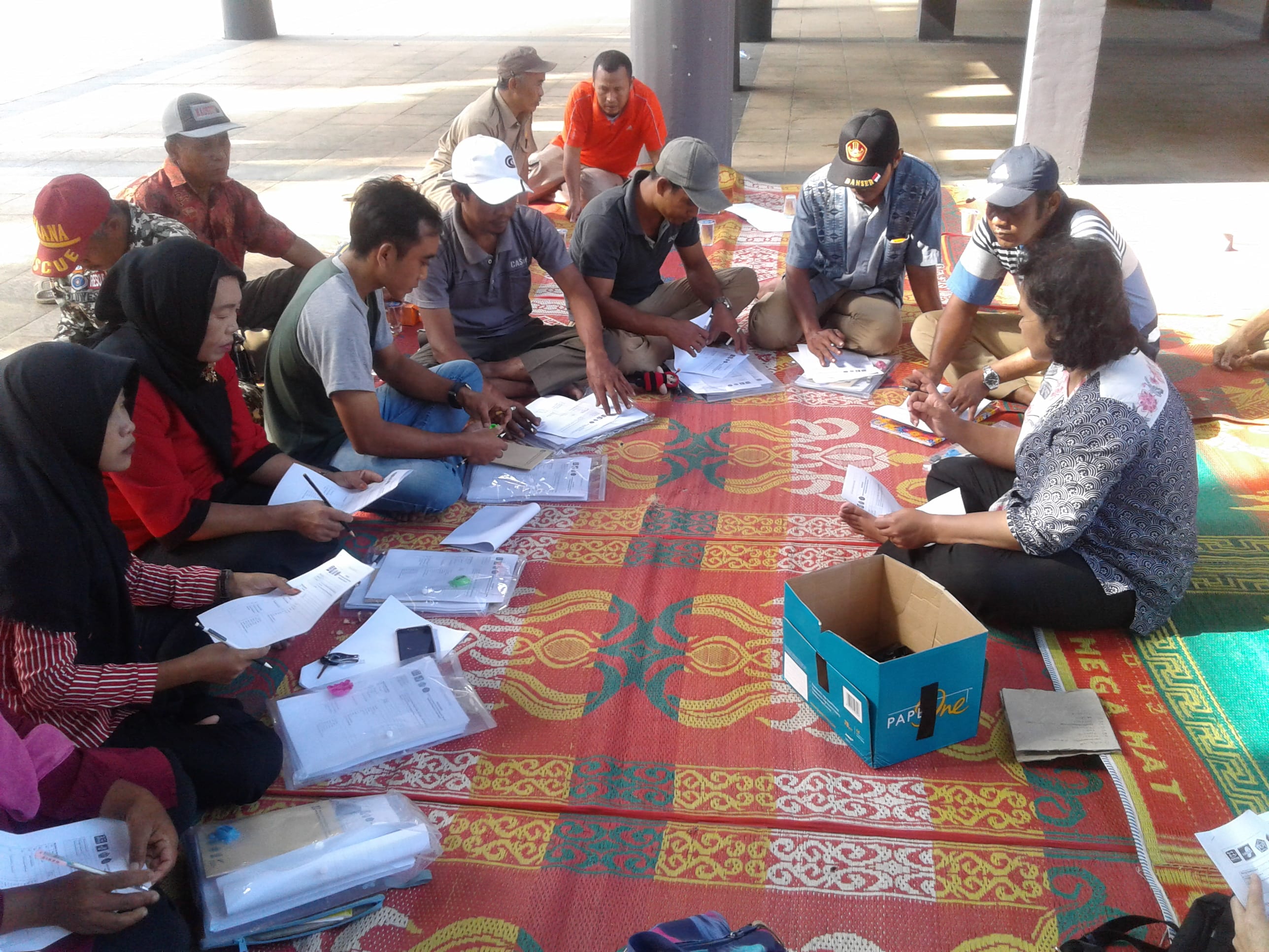
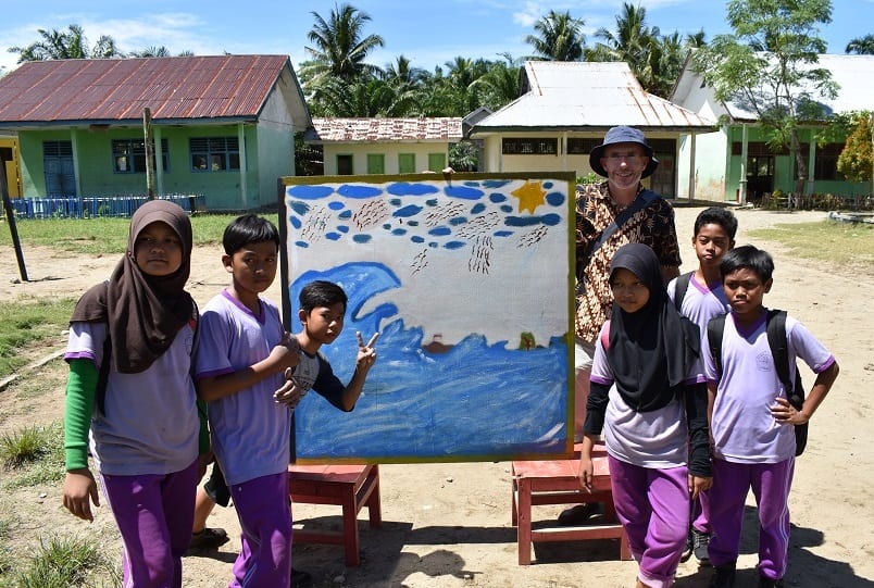
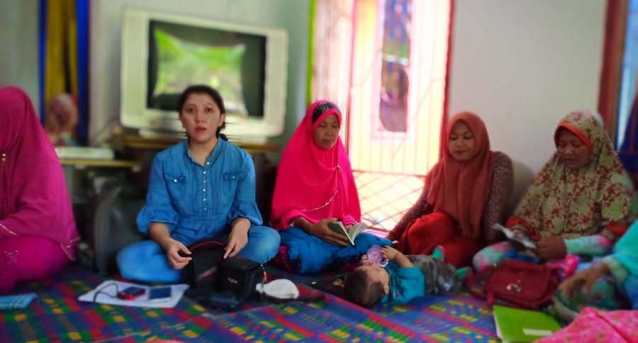
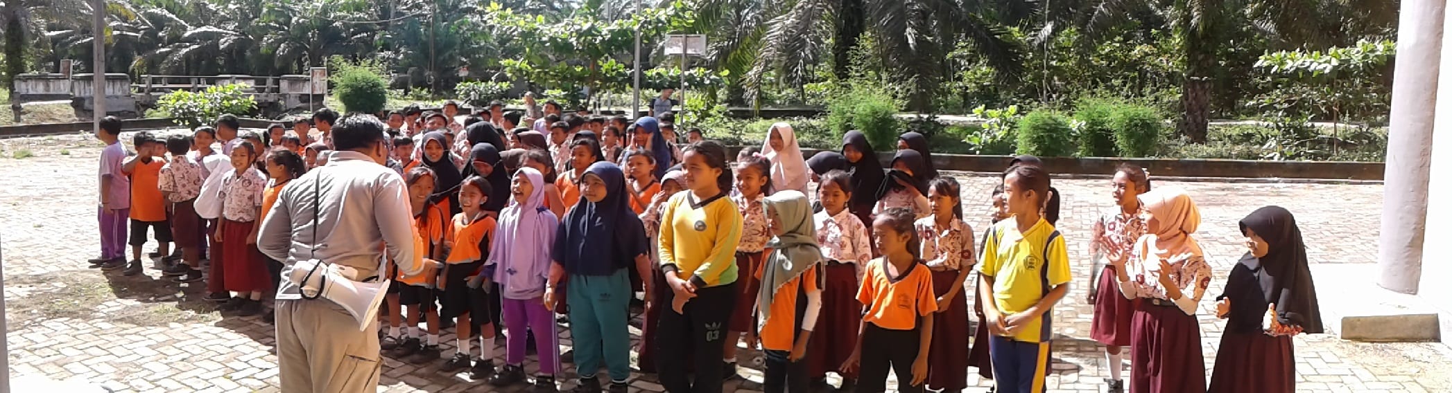
Participated in an evacuation simulation with children in years 4-6 from the local school and then spent some time at the shelter discussing tsunami and disaster preparedness.

Facilitated a tsunami/disaster art competition for years 5 and 6 at the school, supplying plywood sheets, paint and some concepts. The artwork produced in a 3-hour session is spectacular, and the children stayed well after school was finished to complete their group projects. The intent is that these will be on display in the tsunami shelter.

School Art 180428 (5)

The activities culminated in a movie night at the shelter that about 500 people attended. Prior to the feature movies we showed some tsunami safe preparedness videos in Bahasa Indonesian developed by IOTIC/UNESCO, as well as the aerial video of Rawa Indah taken during the first visit. The school artwork created earlier in the day was on display. The mobile cinema was rented from the Ministry of Education, Seluma.

Movie Night 180428 (7)

Movie Night 180428 (18)

The village head, Pak Rubimanto, expressed his commitment, and that of the village to the plan and restated the intent to help facilitate similar plans in nearby villages also at risk from tsunami. Hopefully the plan and the process will provide a template for the BPBD along with PMI (Indonesian Red Cross) to extend awareness and preparedness.

We are grateful Pak Rubimanto, his family and the villagers who generously hosted us for 5 nights and engaged with enthusiasm. We have developed trusted relationships with community leaders and they are extremely keen to instigate the actions they have identified as best they can. We’ll be following up with progress in July 2018 when we hope to finalise the plan and have a village-wide simulation.

Seismometer in Schools Pilot Launched in Central Sulawesi

During the week 5 to 9 March, StIRRRD team members were based in Palu, Central Sulawesi to launch Indonesia’s first Seismometers in Schools (SIS) programme.  Seismometers in Schools is an education initiative already present in Australia, New Zealand and the United States which involves installing seismometers in schools as tools to increase awareness of seismic hazards and risks.  Information from the seismometers can be analysed by mathematics, physics or geography students to assess earthquakes recorded locally or from around the world.

raspberry-shake-original-pi-full-kit-844x844
Raspberry Shake seismometers are commonly used in school education programmes around the world.

As a part of the StIRRRD programme, the pilot SIS programme has been established in Central Sulawesi province with seismometers installed in four schools and a more sophisticated three component device installed at the University of Tadulako, Palu.  The participating schools are SMA Negeri Model Terpadu Madani and MAN 1 in Palu City, SMA N 1 Banawa in Donggala and SMA N 1 Bahadopi in Morowali.  Only public schools were selected to be involved in the pilot study.  All installations were undertaken in the first week of March, except for Morowali which will be installed in the coming weeks.

IMG_2072
SMA N 1 Banawa school in Donggala

On Monday 5 March, StIRRRD team members visited all schools, in Palu and Donggala, to begin installing the equipment and meeting the school principals and teachers.  The team were warmly welcomed to all schools with teachers expressing gratitude and excitement that their schools were chosen to be a part of the project.  In the following days, installation of the equipment would be completed in each school and training workshops for teachers to increase their knowledge of earthquake and tsunami risks were undertaken.

Importantly, the project has been supported by a range of Indonesian agencies willing to assist the schools with technical support and further training.  Their commitment was recognised in a MoU signing ceremony on 5 March.  The agencies signing the MoU include:

  • Palu’s local university – Universitas of Tadulako (UNTAD)
  • The provincial office of the national seismic monitoring agency – Kantor Stasiun Geofisika Palu (BMKG)
  • The local emergency management offices – BPBD Kota Palu & BPBD Kabupaten Donggala
  • The provincial office of the national education office – Dinas Pendidikan Provinsi Sulawesi Tengah­­­­­
  • The provincial office of the national Ministry of Religion – Kakanwil Kemenag Provinai Sulawesi Tengah
IMG_2261
Principals from SIS schools in Palu and Donggala sign the MoU with other agencies
WhatsApp Image 2018-03-08 at 4.47.46 PM
Local Palu newspaper report detailing the SIS pilot activity

All agencies were very enthusiastic about the SIS programme and agreed to help with technical assistance, further capacity building for teachers, help with assessing earthquake traces and providing ideas on how students might develop future projects.  This enthusiasm was further reflected by the extensive media coverage the project received during the week in Palu, some which can be found here:

http://www.kailipost.com/2018/03/ancaman-palu-koro-dalam-konteks-sekolah.html

https://paluekspres.fajar.co.id/deteksi-getaran-palu-koro-terpantau-7-seismometer/

https://paluekspres.fajar.co.id/program-seismometer-di-sekolah-ajarkan-tentang-gemp

IMG_2141
Opening ceremony and morning session at SMA Negeri model Terpadu Madani school, Palu

On Tuesday 6 March, the StIRRRD team visited SMA Negeri Model Terpadu Madani where an initial ceremony was followed by an overview of local seismic hazards and risks and capacity building for teachers and a group of selected students.  This session was largely delivered by Universistas Gadjah Mada (UGM), StIRRRD team members and a representative from LIPI – Indonesia’s Institute of Science.  Teachers and students were highly engaged during the session, while enjoying New Zealand chocolate for answering questions correctly, which was followed by a visit to the recently installed seismometer.  In the afternoon, members of the StIRRRD team led targeted training session for the teachers with input from the agencies noted above.  A demonstration of how the seismometer works by a technician from GNS Science was well received and ideas for future student projects was discussed with teachers.

IMG_2262
The Head of Central Sulawesi BMKG and GNS Science technician, Richard Johnson, demonstrate a seismometer and equipment to the school principals and partner agencies

The same programme was delivered to MAN 1 in Palu City and SMA N 1 Banawa in Donggala on 7 and 8 March respectively.  A highlight was returning to Donggala on Thursday and discovering that their seismometer had already detected its first earthquake the night before!  The last seismometer to be installed in SMA N 1 Bahadopi school in Morowali will happen in coming weeks by UGM staff and technicians assisted by BMKG.

IMG_2401
SMA N1 Banawa school in Donggala recorded their first earthquake on the recently installed seismometer

All of the seismometers are now part of the global raspberry shake seismic network with real time data from each of the devices available here: http://raspberyshake.net/stationview

On Friday 9 March, the team completed the installation of a more sophisticated three-component seismometer at the Universitas of Tadulako (UNTAD).  This device will support future research projects on the seismicity of the area and provide further data for the local Palu-Koro Fault seismic network managed by BMKG.

IMG_2415
The Dean of Engineering from UNTAD with StIRRRD team members Michele and Pak Agung

That morning, StIRRRD team members met with the Dean of the Engineering and faculty staff to sign an MoU between UGM and UNTAD in support of the Seismometers in Schools programme in Central Sulawesi.  There was much discussion on the disaster management international conference that UNTAD will host in November.  The conference will coincide with the final evaluation of the SIS pilot project and StIRRRD team will have a very active presence at this event, including having a key note speaker.

Overall, there was a lot of excitement about the new seismometers and opportunities to increase the capacity of teachers and knowledge of the high seismic risk present in Palu and Donggala.  This interest was reflected with high engagement across social media (Twitter) with the national emergency management ministry (BNPB), the New Zealand embassy in Jakarta and the Universitas of Tadulako regularly liking and retweeting @StIRRRD tweets throughout the pilot deployment.  Globally, organisations such as the Raspberry Shake Seismometer network (based in Panama), Australian SIS project, the IRIS earthquake programme (based in Washington) and the British Geological Survey seismology project were also very engaged by commenting, liking and retweeting our posts all week!

Tweets
Twitter activity from @StIRRRD during the installation week

Initiating Tsunami Awareness Community Engagement, Rawa Indah, Seluma

The StIRRRD team was in Rawa Indah, Seluma, Bengkulu Province to initiate a tsunami awareness community project. Rawa Indah is a village of about 2500 people located on the broad coastal plain of Seluma and is at risk from tsunami, with no nearby high ground suitable for evacuation. In 2014, BNPB (the National Emergency Management Agency), with the assistance of international development aid and the National Public Works, built a 16-m high tsunami shelter near the village. Responsibility for the shelter has only recently been passed to the local emergency management agency, Seluma BPBD. Little or no work to improve community awareness of tsunami hazard, possible natural warnings or the function of the shelter has been undertaken, and the Seluma BPBD do not have the capacity to maintain the shelter or carry out extensive consultation. As a result, the condition of the shelter has deteriorated.

Rawa Indah Tsunami Sheleter

This initial visit (27 Feb – 1 Mar 2018) of the StIRRRD team was to get to know the people, gain an understanding of their current level of tsunami awareness, and help them to understand the risk associated with this significant hazard.

Rawa Indah Program Sosialisasi Tsunami

Ultimately, the community will develop their own evacuation plan and develop ongoing tsunami awareness centred around better use of the tsunami shelter for village activities. Students from the UNIB (University of Bengkulu) undertook a survey with more than 100 residents, to gauge tsunami awareness and preparedness. With the help of the local Red Cross (PMI), BPBD and UNIB, the team spent a day in the local school discussing hazards, tsunami, preparedness and action with 300 school children as well with the teachers. UNIB also built, and bought with them, a tsunami wave model tank which demonstrates tsunami formation and potential impacts.

Rawa Indah School Visit 1Rawa Indah School Visit 2

Rawa Indah Tsunami Tank Demo

University Gadjah Mada (UGM) flew an aerial survey and took video of the village surrounds.

Rawa Indah Coastal Plain

A good relationship has been established with the head of the village Pak Rubimanto, and he and his family, and the villagers generously hosted members of the team for 3 nights. Village leaders are extremely keen to be involved and want to utilise the shelter as best they can, and instigate other awareness and preparedness initiatives that the StIRRRD team will help facilitate.

Rawa Indah Village Head

It is intended that nearby villages with a similar risk from tsunami will also benefit from this project, as it will provide a template for the development of other evacuation plans. By working closely with BPBD and PMI, it is anticipated that the capacity of these agencies to assist other villages will improve.

Phase 2 of the engagement in April 2018 will involve some workshops and meetings with key village groups and responsible agencies and continued engagement with the school. It is also planned to hold an information drop-in session in the tsunami shelter on a Saturday, where the draft tsunami plan can be discussed, followed by a movie night. The third phase, later in the year will include a whole of village evacuation simulation and a repeat questionnaire survey.

National DRR Month Event: Sorong, West Papua

StIRRRD team members and representatives from across StIRRRD districts attended the national DRR month event held in Sorong, West Papua on Monday 23 and Tuesday 24 October.  The Monday morning consisted of an opening ceremony and speeches by dignitaries including an update on the BNPB forward work programme from Willem Rampangilei, Head of BNPB.

Traditional Dancing
Traditional dance at Opening Ceremony

During the afternoon, StIRRRD hosted a special session on DRR and international cooperation.  Chaired by StIRRRD UGM team members, two sessions were held with a focus on cooperation at the national level and international assistance with DRR implementation in the districts.  Presenters at the respective sessions included:

  • Session 1
    • Sumedi Andono Mulyo, Director of Disadvantaged Areas, Transmigration and Rural Areas, BAPPENAS
    • Richard Woods, Natural Hazards Risk Management Specialist, GNS Science
    • Lilik Kurniawan, Director Disaster Risk Reduction, BNPB
2
StIRRRD special session speakers.  Left to right: Lilik Kurniawan (BNPB), Richard Woods (GNS Science), Sumedi Andono Mulyo (BAPPENAS) and session host Tueku Faisal Fathani (StIRRRD).

Presentations from Pak Lilik (BNPB) and Pak Sumedi (BAPPENAS) discussed their respective DRR work programmes.  Of note, Pak Sumedi discussed the strong alignment between the StIRRRD programme and BAPPENAS work programme over the next few years.  In addition, he highlighted the potential for future collaboration on modelling the economic impact of disasters for cost-benefit analyses using existing New Zealand economic models.

  • Session 2
    • Akris Mohamad Yunus Fattah, Head of BPBD, Donggala
    • Selupati SH, Head of BPBD, Bengkulu
    • Drs Zainal Abidin, Head of BPBD, Sumbawa
    • Henry, BPBD Head of Prevention and Preparedness, Padang
4
StIRRRD special session speakers.  Left to right: Henry (BPBD Padang), Drs Zainal Abidin (BPBD Sumbawa), Selupati SH (BPBD Bengkulu), Akris Mohamad Yunus Fattah (BPBD Donggala) and session host Wahyu Wilopo (StIRRRD).

The presentations from BPBD in Donggala, Bengkulu, Sumbawa and Padang provided insights into the strengths and challenges that each district has faced during action plan implementation.On the morning of 24 October, StIRRRD director Teuku Faisal Fathani presented on lessons and good practice from the implementation of early warning systems to detect land movement.  Pak Faisal presented alongside the Chairman of Mat Peci, Usman Firdaus and Medi Herlianto, BNPB Director of Readiness.

6
Tueku Faisal Fathani (UGM – StIRRRD) presents on best practice early warning systems for land movement detection.


DRR action plan activities progressing well in Morowali, Central Sulawesi

As part of the coaching and mentoring phase, StIRRRD team members visited Morowali on 14 and 15 August.  This was a good opportunity to meet Pak Nafsahu, the new head of BPBD, and congratulate the district on graduating stage one of the StIRRRD programme.  On Monday morning, the team met with staff from BPBD to discuss action plan progress where Pak Nafsahu reiterated the strong support Morowali has for StIRRRD.  That afternoon the District Secretary was presented with a graduation certificate, commemorating Morowali’s graduation of StIRRRD phase one followed by a DRR training session for staff from many local government departments.

IMG_1296
StIRRRD team members meet with BPBD staff
IMG_1297
Morowali phase 1 graduation ceremony

Morowali has made significant progress on action plan activity implementation since the last visit in March, highlights include:

  • The implementation of a text based warning service partnering with BMKG, Telkomsel and Indosat. Morowali was the first district in Indonesia to pilot the implementation of this successful public-private initiative.
  • A disaster management plan was commissioned with the support of BNPB.
  • A district specific risk assessment has been conducted and is being reviewed by BNPB. This document specifically identifies the Matano Fault risk where the fault location is being used to inform spatial land use plan boundaries.
  • A response coordination facility has been erected on Sombori Island.
  • Multiple physical works, to reduce the impacts of flooding and coastal waves, have been constructed across the district.
IMG_1313
StIRRRD team members discuss DRR activities at a secondary school in Bahadopi Village
IMG_1318
Recent river work improvements to reduce flooding in Bahadopi village