Tag Archives: Vertical evacuation shelter

Developing a Tsunami Safe Community in Rawa Indah, Seluma

Following on from our visit in March 2018, the StIRRRD team visited Rawa Indah to engage with the community and stakeholders to further develop a draft Tsunami Safe Action Plan. The team spent 5 days in the village conducting and participating in various village activities, with the help of BPBD (Emergency Management Agency), Seluma and Bengkulu University. Specifically, we

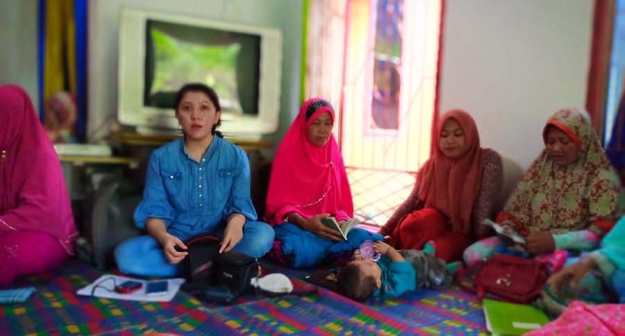
Attended, on invitation, 2 women’s prayer groups and one men’s prayer group and discussed tsunami awareness and preparedness.

Womens group 180424

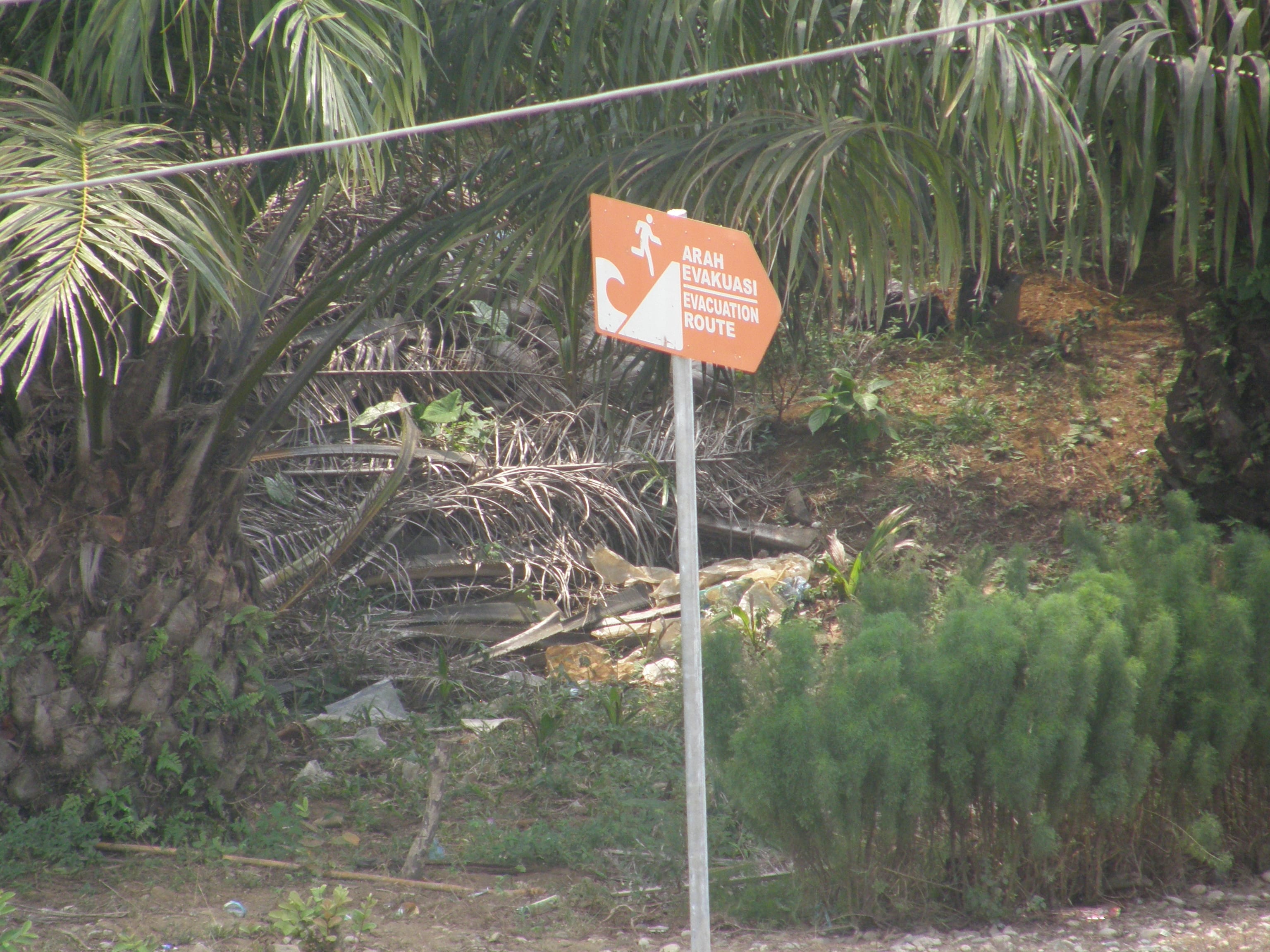
Engaged with the local community groups (POLMAS – Community Police, Tagana (Youth) BANSER and KSB) and sought their input into Actions to be taken, within 5 overlapping themes that had emerged from the initial visit, namely; 1) Shelter Management, 2) Evacuation Planning, 3) Local Access, 4) Resilient Infrastructure and 5) Prepared and Knowledgeable Community.

Poster Mitigasi Bencana Tsunami Desa Rawa Indah
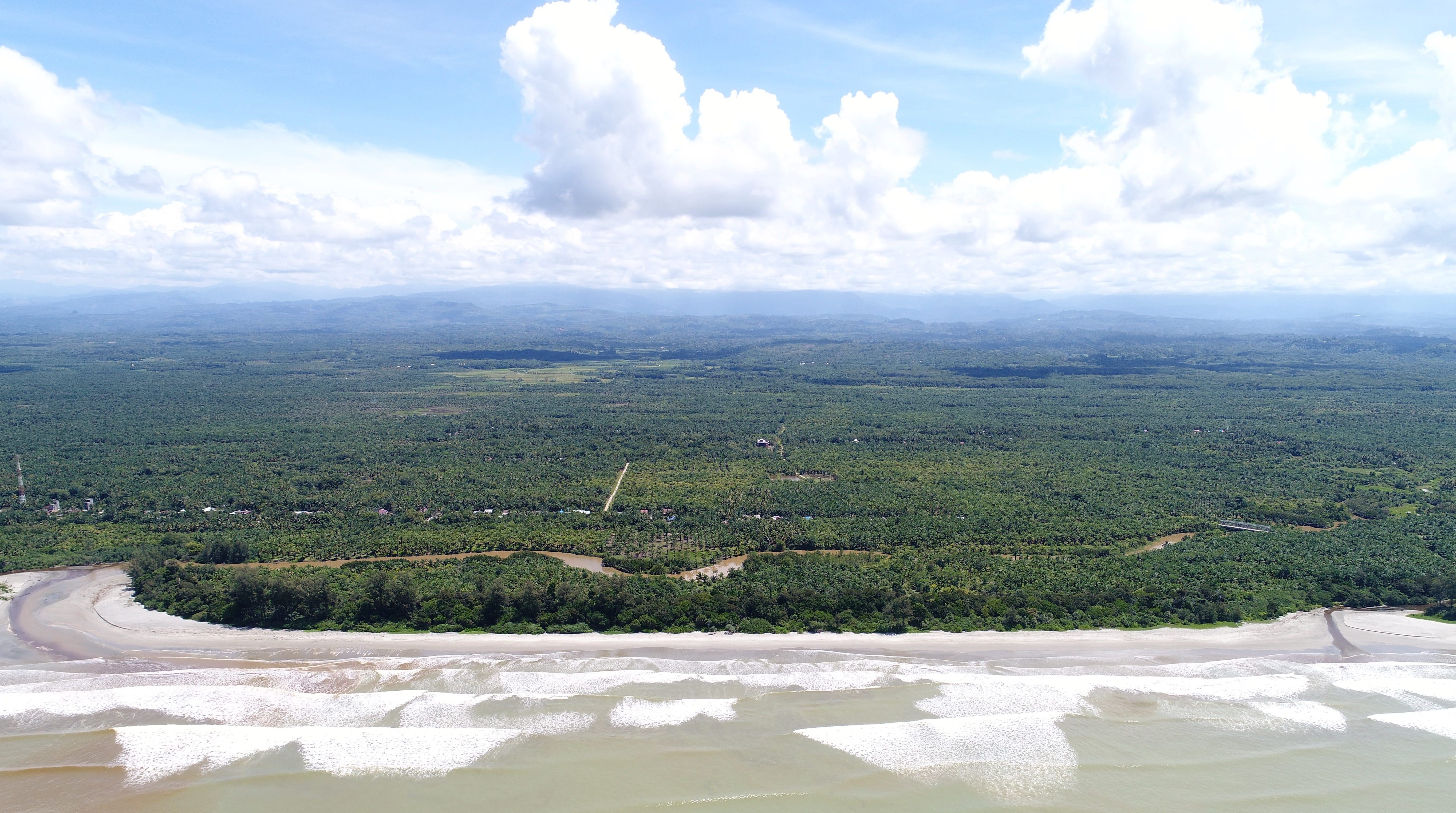
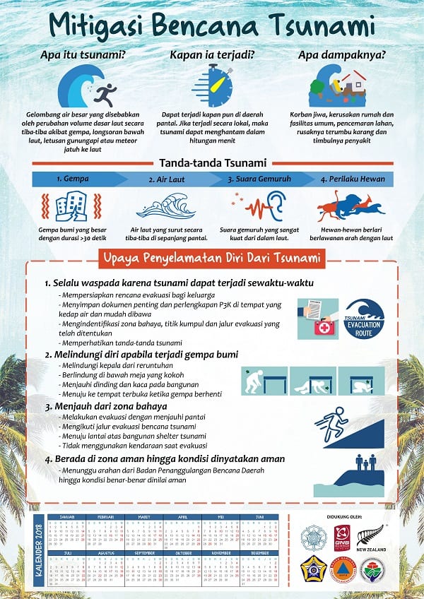
Distributed tsunami awareness and response posters/calendars developed by the team to each household and gifted maps and drone video footage flown on first visit, along with other tsunami preparedness literature and videos.

Attended Friday morning women’s aerobics at the tsunami shelter and were given an opportunity to talk about tsunami preparedness.Friday aerobics 180427Friday aerobics 180427 (2)

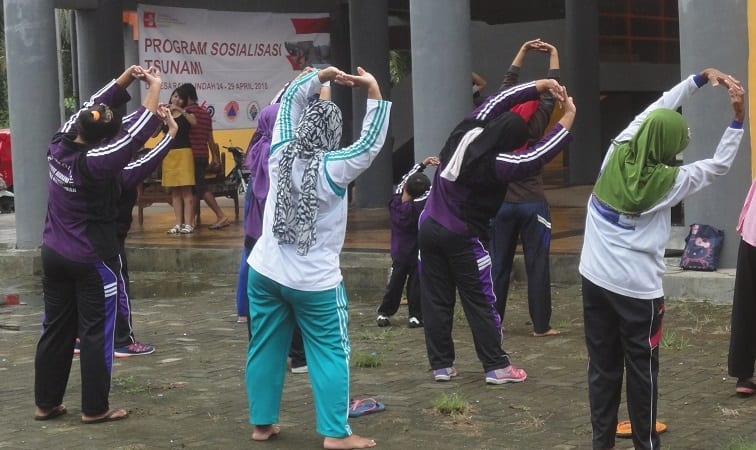
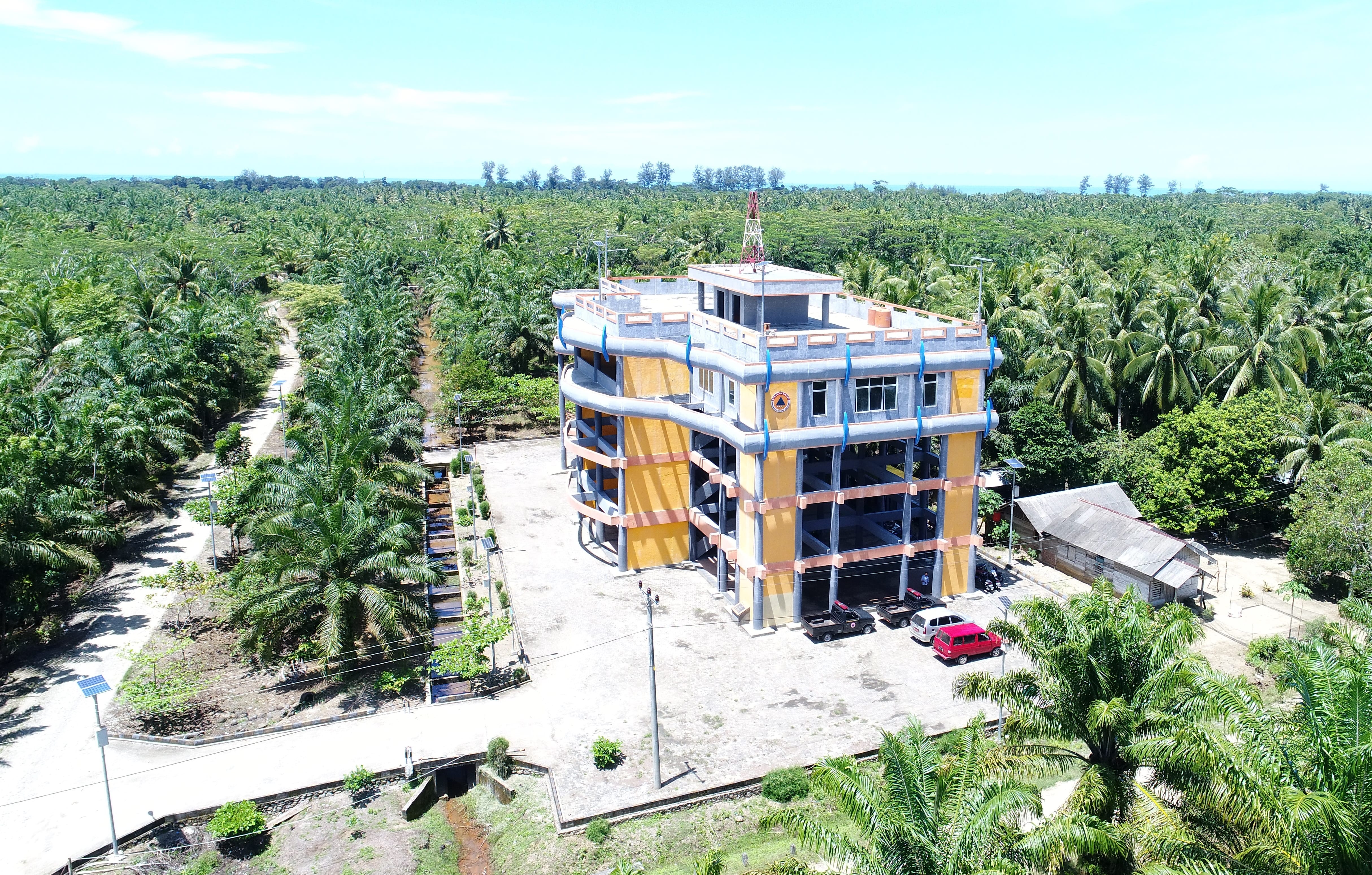
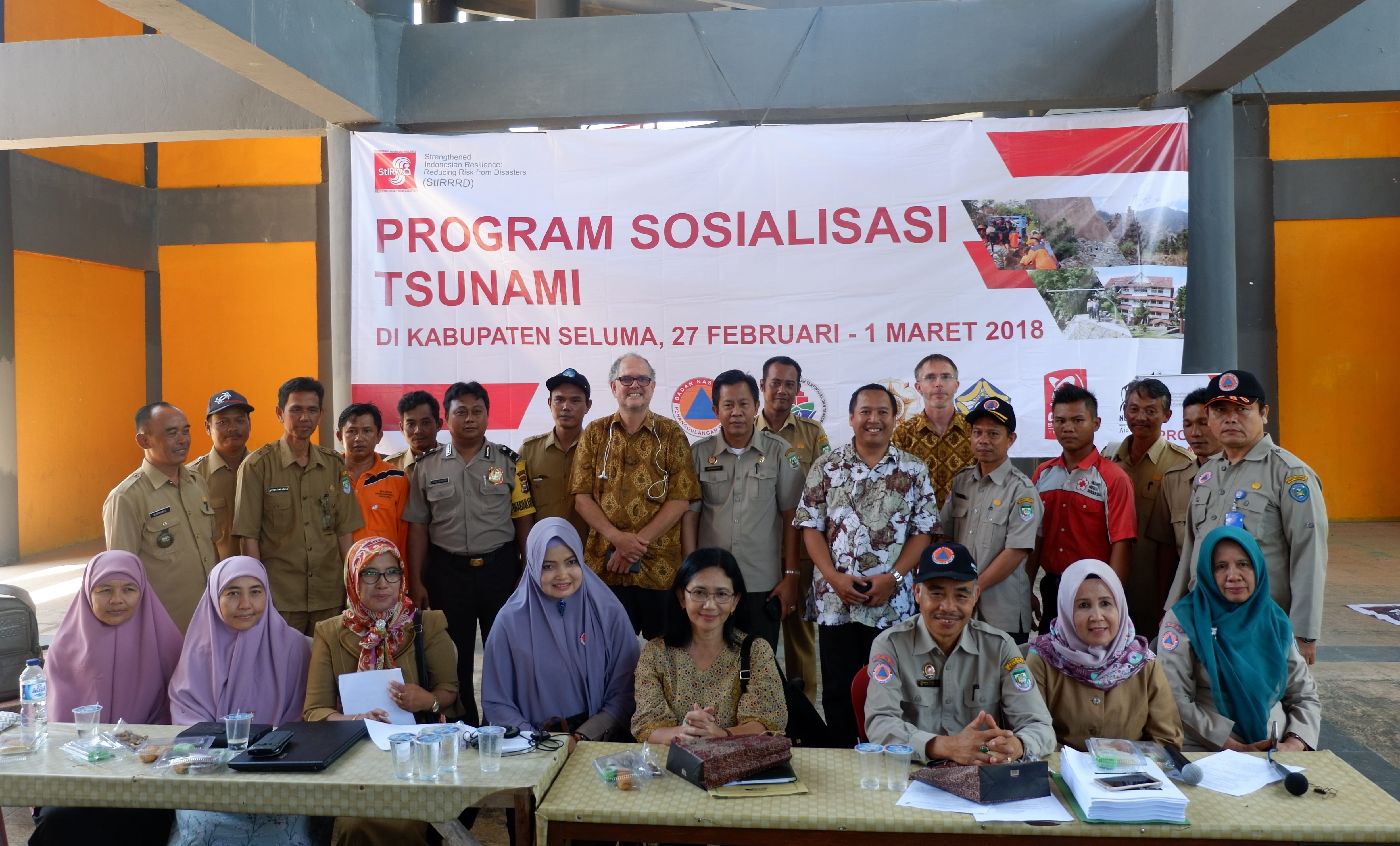
Held a meeting with District OPDs (Social, Public Works (PU), Bappeda (Planning), Education, Health, Marine and Fisheries) at the shelter to present the plan and convey the actions in the plan that were their responsibility. Implementing the plan requires a trusted partnership between the district agencies and the village.

School Simulation 180426 (19)
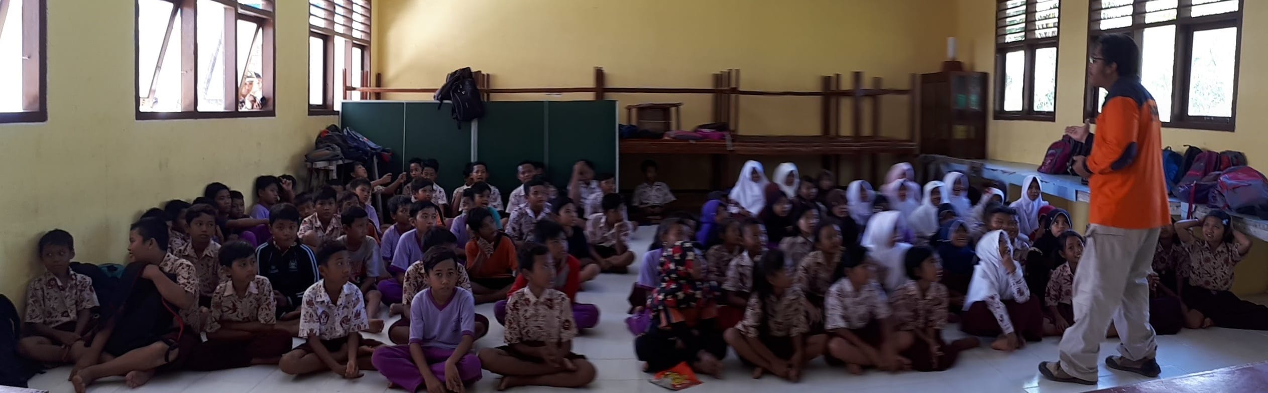
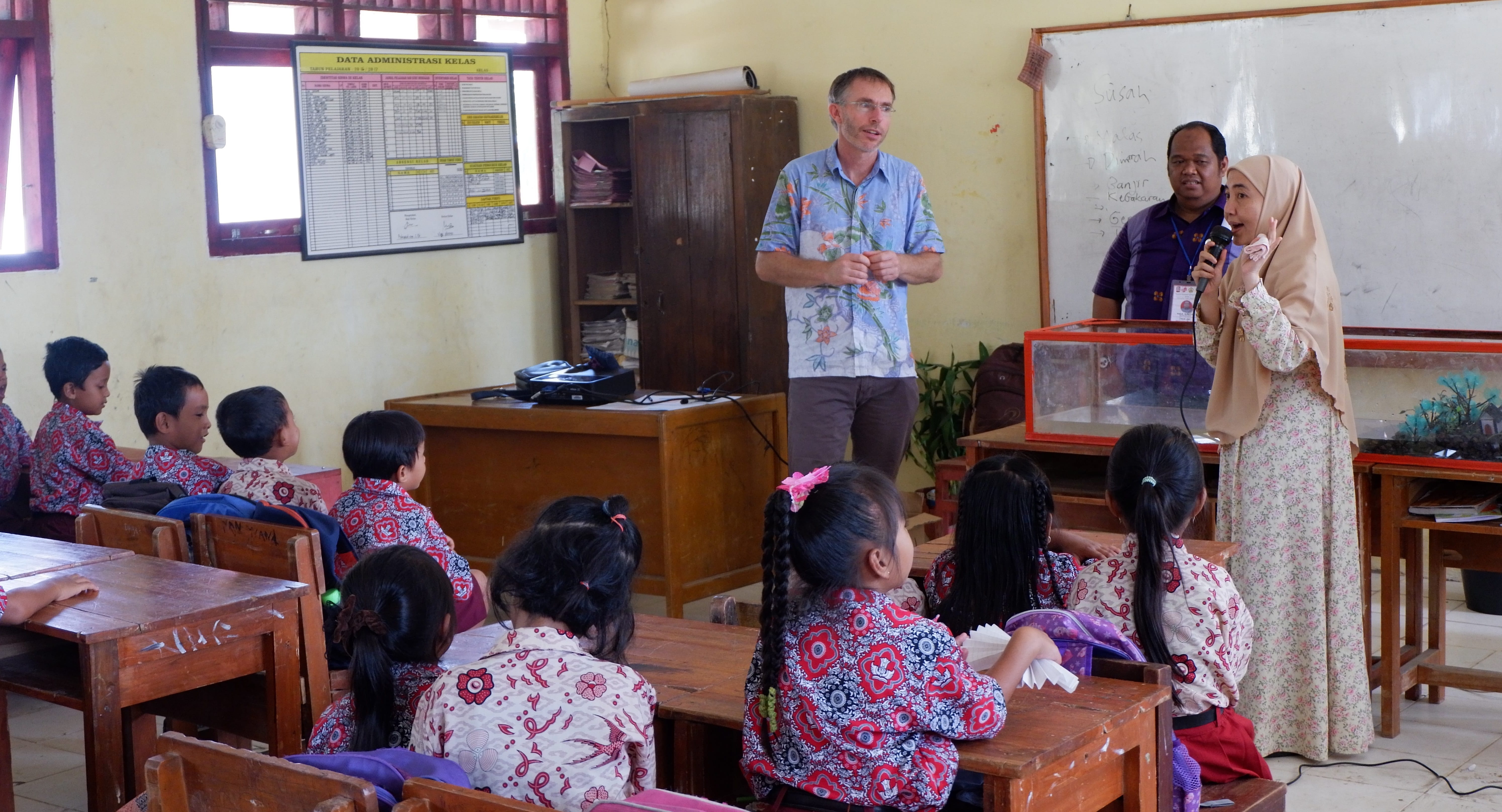
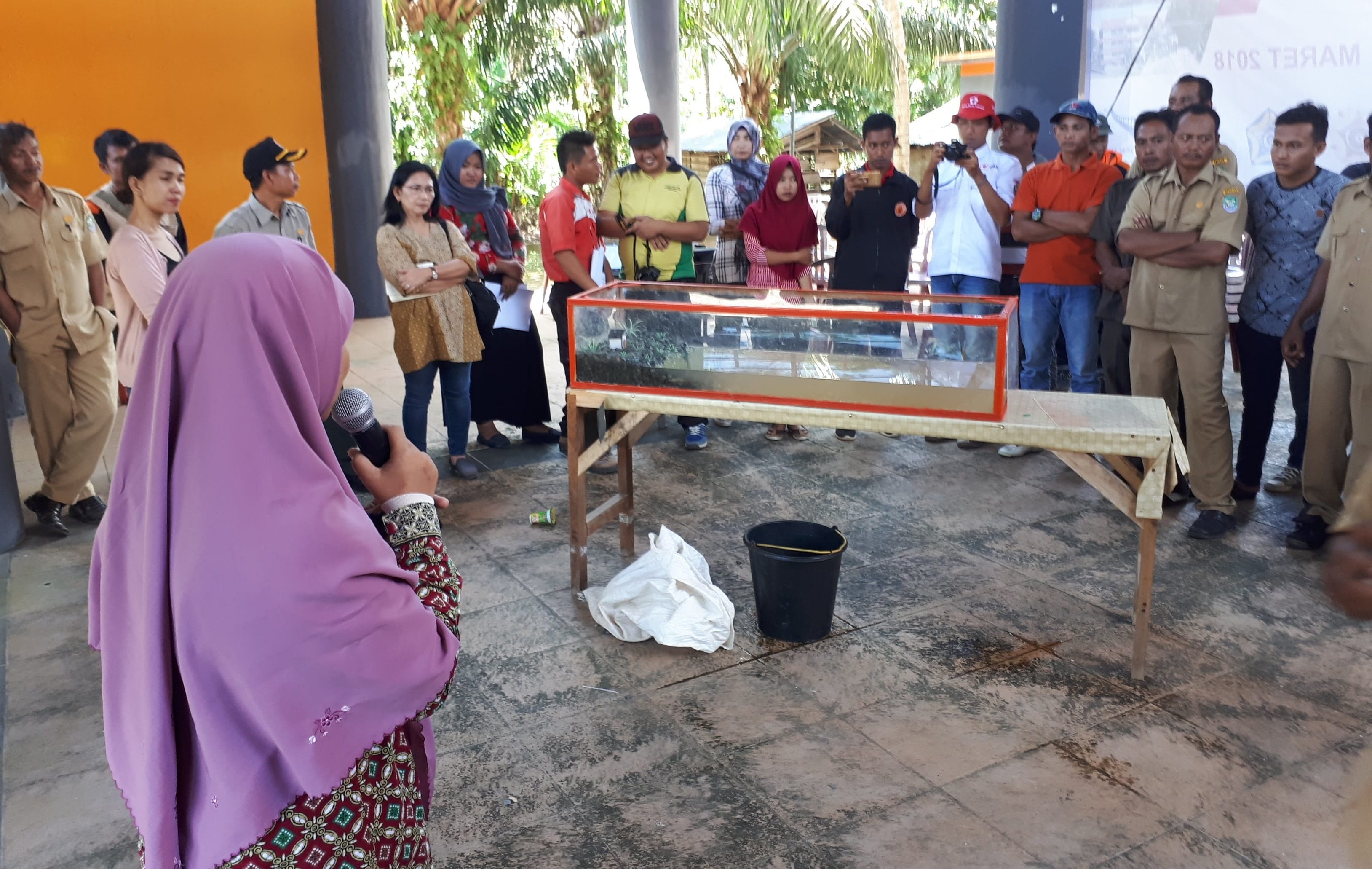
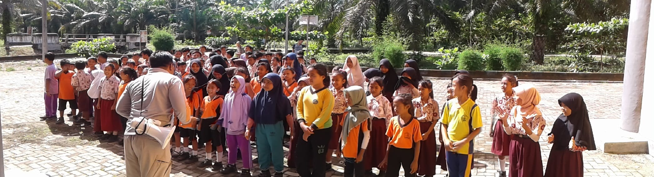
Participated in an evacuation simulation with children in years 4-6 from the local school and then spent some time at the shelter discussing tsunami and disaster preparedness.

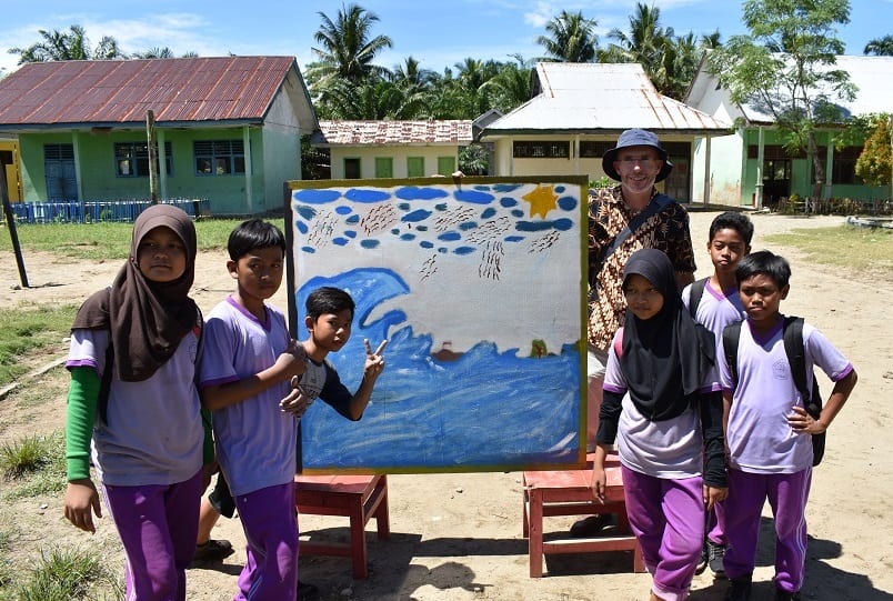
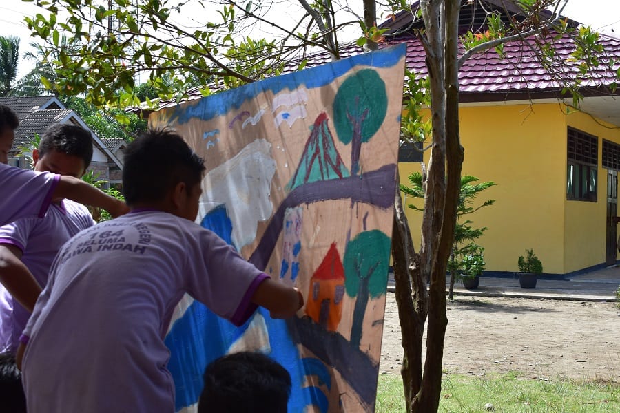
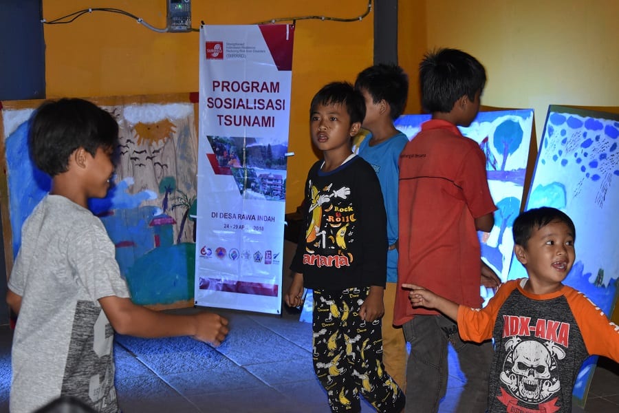
Facilitated a tsunami/disaster art competition for years 5 and 6 at the school, supplying plywood sheets, paint and some concepts. The artwork produced in a 3-hour session is spectacular, and the children stayed well after school was finished to complete their group projects. The intent is that these will be on display in the tsunami shelter.

School Art 180428 (5)

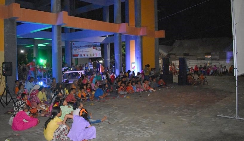
The activities culminated in a movie night at the shelter that about 500 people attended. Prior to the feature movies we showed some tsunami safe preparedness videos in Bahasa Indonesian developed by IOTIC/UNESCO, as well as the aerial video of Rawa Indah taken during the first visit. The school artwork created earlier in the day was on display. The mobile cinema was rented from the Ministry of Education, Seluma.

Movie Night 180428 (7)

Movie Night 180428 (18)

The village head, Pak Rubimanto, expressed his commitment, and that of the village to the plan and restated the intent to help facilitate similar plans in nearby villages also at risk from tsunami. Hopefully the plan and the process will provide a template for the BPBD along with PMI (Indonesian Red Cross) to extend awareness and preparedness.

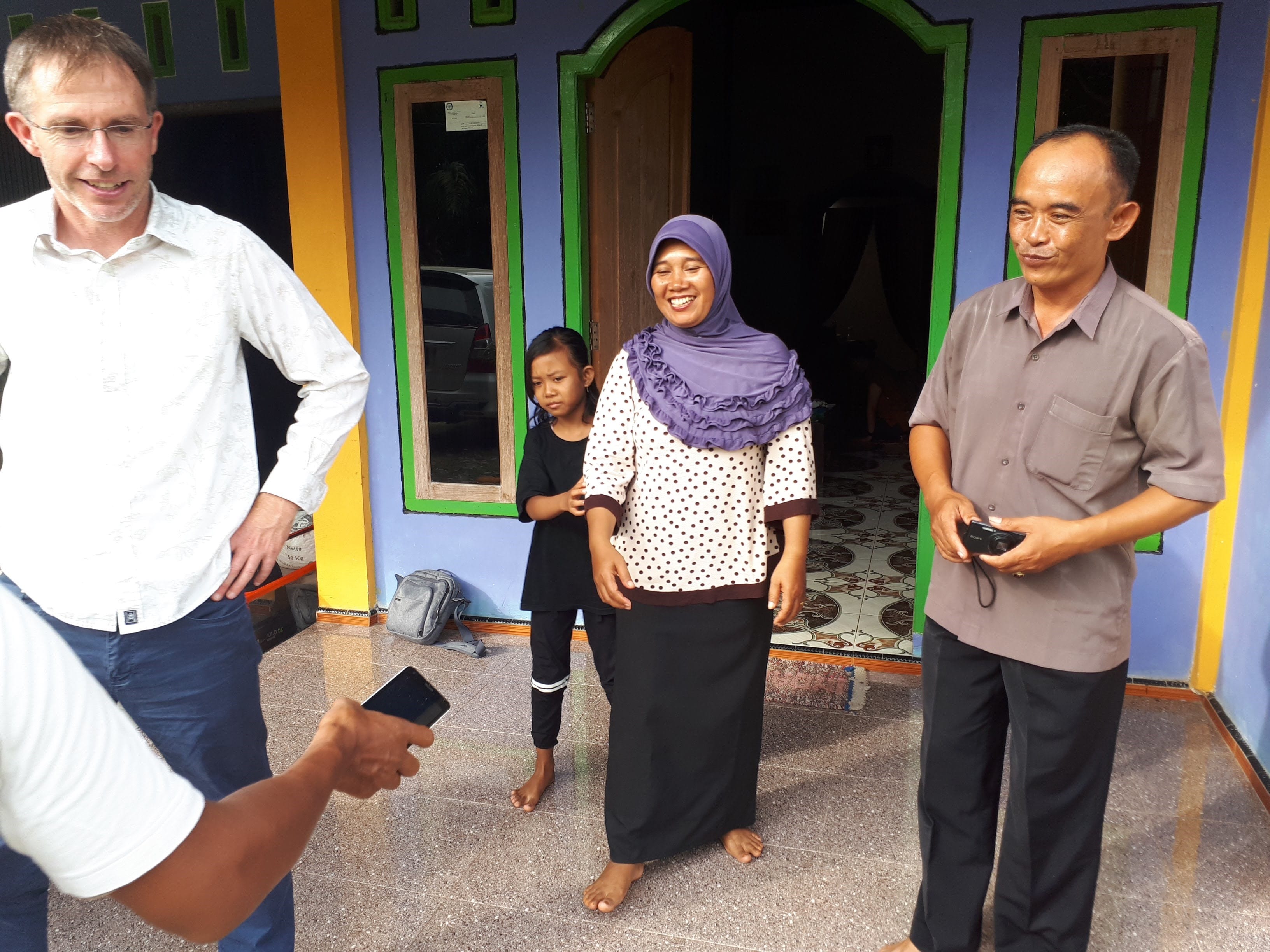
We are grateful Pak Rubimanto, his family and the villagers who generously hosted us for 5 nights and engaged with enthusiasm. We have developed trusted relationships with community leaders and they are extremely keen to instigate the actions they have identified as best they can. We’ll be following up with progress in July 2018 when we hope to finalise the plan and have a village-wide simulation.

Initiating Tsunami Awareness Community Engagement, Rawa Indah, Seluma

The StIRRRD team was in Rawa Indah, Seluma, Bengkulu Province to initiate a tsunami awareness community project. Rawa Indah is a village of about 2500 people located on the broad coastal plain of Seluma and is at risk from tsunami, with no nearby high ground suitable for evacuation. In 2014, BNPB (the National Emergency Management Agency), with the assistance of international development aid and the National Public Works, built a 16-m high tsunami shelter near the village. Responsibility for the shelter has only recently been passed to the local emergency management agency, Seluma BPBD. Little or no work to improve community awareness of tsunami hazard, possible natural warnings or the function of the shelter has been undertaken, and the Seluma BPBD do not have the capacity to maintain the shelter or carry out extensive consultation. As a result, the condition of the shelter has deteriorated.

Rawa Indah Tsunami Sheleter

This initial visit (27 Feb – 1 Mar 2018) of the StIRRRD team was to get to know the people, gain an understanding of their current level of tsunami awareness, and help them to understand the risk associated with this significant hazard.

Rawa Indah Program Sosialisasi Tsunami

Ultimately, the community will develop their own evacuation plan and develop ongoing tsunami awareness centred around better use of the tsunami shelter for village activities. Students from the UNIB (University of Bengkulu) undertook a survey with more than 100 residents, to gauge tsunami awareness and preparedness. With the help of the local Red Cross (PMI), BPBD and UNIB, the team spent a day in the local school discussing hazards, tsunami, preparedness and action with 300 school children as well with the teachers. UNIB also built, and bought with them, a tsunami wave model tank which demonstrates tsunami formation and potential impacts.

Rawa Indah School Visit 1Rawa Indah School Visit 2

Rawa Indah Tsunami Tank Demo

University Gadjah Mada (UGM) flew an aerial survey and took video of the village surrounds.

Rawa Indah Coastal Plain

A good relationship has been established with the head of the village Pak Rubimanto, and he and his family, and the villagers generously hosted members of the team for 3 nights. Village leaders are extremely keen to be involved and want to utilise the shelter as best they can, and instigate other awareness and preparedness initiatives that the StIRRRD team will help facilitate.

Rawa Indah Village Head

It is intended that nearby villages with a similar risk from tsunami will also benefit from this project, as it will provide a template for the development of other evacuation plans. By working closely with BPBD and PMI, it is anticipated that the capacity of these agencies to assist other villages will improve.

Phase 2 of the engagement in April 2018 will involve some workshops and meetings with key village groups and responsible agencies and continued engagement with the school. It is also planned to hold an information drop-in session in the tsunami shelter on a Saturday, where the draft tsunami plan can be discussed, followed by a movie night. The third phase, later in the year will include a whole of village evacuation simulation and a repeat questionnaire survey.

Seluma – observing hazard and risk issues in the field – by Kate Crowley

As part of the DRR Action Plan workshop held in Seluma, 25–26 August 2015, we had a half-day field visit organised by the local emergency management office (BPBD). It was an opportunity for them to show some of the hazard and risk issues they face. Our party consisting of local government staff and university researchers, set off from Pasar Tais just after 8 am and travelled towards Pasar Seluma on the coast. Soon the tarmac road ran out and gave way to a rolling dirt track worn to rubble, which took us through a cross section of Indonesian life from the bustling town to the gentle padi fields. But the watery green terraces are slowly being eaten by groves of palm oil. Busy villages line the road, hinting at the thousands of people who live in this area near the coast. Initially hidden by the palms a great expanse of beach opens out. Here, we are provided an informative presentation by the head of the Preparedness section of the BPBD, Aziman. He describes how they have recently mapped the tsunami hazard in this region and will be using this map in risk reduction planning going forwards.

BEACH

He expresses his concerns that although the national government have built a tsunami shelter, it can hold only 3,000 people. There are many villages that line the 70 km of exposed coast of Seluma and he estimates that they would need 10 tsunami shelters to sufficient provide a safe refuge for them all. The drive from Pasar Tais to the beach is across broad flat coastal plain, which makes tsunami evacuation challenging. Vertical evacuation is a sensible option, but the lack of multi-storey buildings means that purpose built structures, although expensive, are the only option.

Following a ‘bread crumb’ trail of tsunami evacuation signs our dusty convoy travelled on to the purpose built tsunami shelter.

OLYMPUS DIGITAL CAMERA

Exploring this large structure it becomes clear that it is purpose built. It is a solid, open structure and a ramp and broad stairs enable those who are frail, young or disabled to access the higher floors. Toilets are provided on the third floor and solar panels are in place to provide lighting at night. This is an impressive undertaking, following a national standard and is very similar to the one observed in Kota Bengkulu.

OLYMPUS DIGITAL CAMERA

However, the local emergency managers are still waiting for an official handover of the building from the national government before they can start using the building and implementing their community awareness plans. The building could be used as a local community centre, a market, or even a school and this would enable the community to become familiar with the structure and put it to good use.

Click the links here for a videos of a similar shelter in Kota Bengkulu, under construction and finished.

The aim of this second phase is to support the local community to be resilient, enabling them to identify the warning signs of a tsunami and know where to go and when. This outreach is aligned with support for their livelihoods under the “Resilient Village” government program.  It is a holistic approach that aims to improve the lives of those living in the area now and in the future.

SHELTER TALK

Tsunami is not the only hazard that impacts this area. The workshop participants have also identified floods, earthquakes and landslides. Participants noted that they are used to the frequent small earthquakes that shake the surrounding countryside, and they rank earthquakes as the biggest threat. The fear of ‘the large one’ is real.

Our final stop demonstrates the power of a frequent and rapid onset hazard – flooding. We visit a small village that last month woke to find devastation on their door step. Overnight heavy rainfall upstream, in the “dry” season, caused the near-by wide and shallow river to swell and overtop its banks. Flood waters up to 4 m in depth swept through the palm oil plantation and three villages were flooded. Despite the flood occurring rapidly, over only 2 hours, no one was hurt but many lost their belongings.

The field trip provided an insight into this districts progress towards resilience. Just like the road we travelled together today, the path of disaster risk reduction is at times rough and slow but the journey is always worth it.

Tsunami Vertical Evacuation Building

P1030977Near Bengkulu, in Sumatra (see map), we visited a massive concrete construction in the process of being built. It is located in a heavily populated flat area about a kilometre from the coast. This is going to be the local  safe haven for people  to escape to when a tsunami threatens. It is a huge structure (see video) that towers above the surrounding sprawl of single story buildings.

Continue reading Tsunami Vertical Evacuation Building