RiskScape Risk Assessment Tool Workshop at ICUDR Conference in Palu

RiskScape 2.0 made its international debut at a workshop preceding the International Conference on Urban Disaster Resilience in Palu, Sulawesi, on 24 April 2019. RiskScape is an impact and loss modelling tool that performs complex calculations quickly and simply, providing outputs that assist in decision-making.

The workshop was a full-day event, covering the concepts of risk and impact modelling, the evolution of RiskScape from version 1 to 2, and using RiskScape 2.0 to assess building impacts from a tsunami affecting the coastal areas of Palu. The tsunami hazard modelling used was an approximation of the inundation extent of the 28 September 2018 tsunami, which devastated the coastal areas of Palu and Donggala. Approximately 30 participants from diverse backgrounds, including the Universitas Tadulako, Universitas Gadjah Mada and Palu City local government, attended the workshop.

PaluTsunamiExposure

Depending on user preferences, the RiskScape software was provided in two languages: English and Bahasa Indonesia. Participants came prepared with their own laptops. The current version of RiskScape is a command line interface, which requires users to type in commands rather than interact with a graphical user interface (planned for development later this year). Despite the learning curve, participants were able to successfully run the software and visualise the results using GIS software.

IMG_3219

The workshop was not only the first time RiskScape 2.0 had been used outside New Zealand, but the first time it had been demonstrated and used beyond the research and development teams. Participants were highly engaged throughout the day, and there was significant interest in how the software could assist with decision-making. The case study of tsunami inundation in Palu served as a useful example of the applicability of the tool to the local context.

Raspberry Shakes at Palu schools keep on keeping on, providing us a picture of the recent earthquake

Written by Ben Payne

No-one involved in the Seismometers in Schools project wanted to see their work put into action as quickly as it was in Palu. In March 2018, three schools in the City of Palu had Raspberry Shake seismometers installed; on 28 September, a 7.5 magnitude quake in the North Sulawesi subduction zone and a subsequent tsunami killed at least 2100 people in Palu City, Donggala and Sigi. Nearly 700 are still missing and close to 80,000 people remain displaced.

A couple of days later, Richard Woods from the StIRRRD team noticed that the Raspberry Shake at the SMA Negeri Model Terpadu Madani (located in the north of the city of Palu) was back online, as power was restored to the school.

The seismometers in the three schools helped to build a picture of what happened that day. The severity of the shaking was obvious, and we can only imagine how terrifying the earthquake must have been.

The first image below shows the seismic trace up until the M7.5 struck just after 6pm. You can see the M6.1 foreshock earlier in the day and the aftershocks in between the two earthquakes. The second image shows the seismometer had power restored just after 12.15pm on 07/10, and the third image shows the UNTAD seismic trace on the 16th of October, interspersed with many aftershocks.

Image 1 20180928 RF229_EHZ_AM_00
The ‘Raspberry Shake’ seismometer installed at SMA Negeri Model Terpadu Madani school in March, captured the Seismic trace up until the M7.5 struck just after 6pm on September 28. You can see the M6.1 foreshock earlier in the day and the aftershocks in between the two earthquakes.
Image 2 20181007 RF229_EHZ_AM_00
A second image from the Raspberry Shake at SMA Negeri Model Terpadu Madani, which shows that the seismometer had power restored just after 12.15pm on October 7.
Image 3 20181016 RF229_EHZ_AM_00
The image above shows that aftershock sequence is continuing, on seismic trace captured by the raspberry shake on 16 October.

Richard then noticed that the Raspberry Shake located at MAN 1 school in the city  of Palu, had also come back online, and like the first image above, the severity of the shaking is very clear.

R63B3_EHZ_AM_00-1
The Seismic trace up until the M7.5 struck just after 6pm on September 28 captured on the Raspberry Shake seismometer at MAN 1 School in Palu.

For StIRRRD program leader Michele Daly and the wider team, the realities of the recent earthquake and tsunami are confronting. It’s one thing to be aware of the destructive potential of these natural hazards, but quite another to see events play out so soon. The StIRRRD team had visited Palu just six months before, and no-one could have predicted having to deal with such severe impacts so soon.

Michele described it as ‘heart-breaking’ to see so much destruction and human cost. But she was also amazed at how rapidly people have mobilised to support each other. She says that going by her experience of the wonderful people of Palu, she is sure this will continue throughout the recovery.

So, what are GNS Science and the StIRRD team doing to help?

The StIRRRD team is part of the response effort, supporting the Indonesian government and in-country partners with their response efforts. GNS Science has many experts in response and recovery following earthquake and tsunami events, and New Zealand’s Ministry of Foreign Affairs and Trade (MFAT) asked GNS and the StIRRRD team to lead a NZ inclusive approach, providing Palu with technical support in the transition from response to rehabilitation and recovery.

The immediate focus is to support MFAT and local agencies in Indonesia to carry out earthquake damaged building assessments and landslide risk assessment. The StIRRRD team are working with GNS experts and liaising with a variety of NZ and Indonesian partners, and this work is likely to continue in the longer term – with an emphasis on resilience and building back, better.

Final DRR Seminar 2019 in Yogyakarta

Kegiatan StIRRRD bertujuan untuk mewujudkan pengurangan risiko bencana dan peningkatan kesiapsiagaan di tingkat daerah menuju penguatan ketangguhan Indonesia. Kegiatan ini dilaksanakan atas kerjasama UGM dan GNS Science Selandia Baru serta didukung oleh Badan Nasional Penanggulangan Bencana (BNPB), Kementerian Desa, Pembangunan Daerah Tertinggal dan Transmigrasi (Kemendesa) dan Bappenas. Pendanaan kegiatan ini sepenuhnya didukung oleh Ministry of Foreign Affairs and Trade (MFAT) New Zealand.

StIRRRD dimulai sejak 2011-2012 di 2 daerah pilot yaitu Kota Palu dan Kota Padang. Kegiatan yang dilaksanakan meliputi workshop pemahaman tentang kebencanaan, penyusunan rencana aksi daerah, kunjungan dan pelatihan di New Zealand, serta pemantapan dan implementasi rencana aksi. Dalam pelaksanaannya, kegiatan ini mengutamakan koordinasi dan integrasi berbagai pihak seperti pemerintah daerah, universitas lokal, kalangan swasta, LSM, dan kelompok-kelompok komunitas siaga bencana. Atas keberhasilan kegiatan di daerah pilot, kegiatan ini disetujui untuk dilanjutkan selama 5 tahun dimulai dari tahun 2014 dan berakhir pada tahun 2019. Sebanyak 10 kabupaten/kota dilibatkan dari 4 provinsi, yaitu Sulawesi Tengah, Sumatera Barat, NTB, dan Bengkulu. Selain Kota Palu dan Kota Padang, kabupaten/kota lain yang ikut bergabung diantaranya: (1) Kab. Donggala, (2) Kab. Morowali, (3) Kota Mataram, (4) Kab. Sumbawa, (5) Kota Bengkulu, (6) Kab. Seluma, (7) Kab. Pesisir Selatan, dan (8) Kab. Agam.

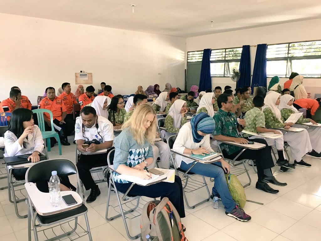
Sebagai rangkaian akhir dari kegiatan StIRRRD, pada tanggal 23-25 Juli 2019 diadakan Seminar Nasional Pengurangan Risiko Bencana di Balai Senat Universitas Gadjah Mada. Seminar secara resmi dibuka oleh Kepala BNPB yang diwakili oleh Direktur Pemberdayaan Masyarakat, Lilik Kurniawan. Dalam sambutannya, Kepala BNPB menekankan perlunya pengurangan risiko bencana di tiap-tiap daerah yang salah satunya dengan menjaga kelestarian alam dan lingkungan. Selanjutnya Rektor Universitas Gadjah Mada yang diwakili oleh Wakil Rektor Bidang Kerjasama dan Alumni dalam sambutannya memaparkan penjabaran umum kebijakan UGM dalam memacu perubahan menuju kejayaan peradaban Indonesia, termasuk dalam pengurangan risiko bencana.

Pembicara kunci lainnya yang diundang adalah Duta Besar Selandia Baru untuk Indonesia yang dalam hal ini diwakili oleh Development Counsellor, Sumi Subramaniam, yang memaparkan tentang hubungan erat antara Indonesia dan Selandia Baru dalam berbagai bidang seperti kebencanaan, energi terbarukan, dan pemberian beasiswa. Pembicara kunci lainnya yang juga memberikan arahan penting dalam seminar ini adalah Suprayoga Hadi (Perencana Utama Bappenas), Raditya Jati (Direktur Pengurangan Risiko Bencana BNPB), Hasman Ma’ani (Direktur Penanganan Daerah Rawan Bencana, Kementerian Desa, Pembangunan Daerah Tertinggal dan Transmigrasi), serta Ali Mundakir (Direktur Utama PT. Pertamina Geothermal Energy).

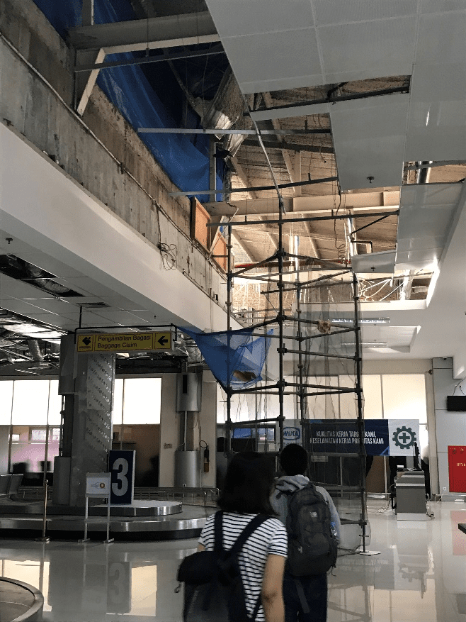
Seminar ini diikuti oleh 200 orang peserta dari pemerintah pusat (BNPB, Kemendesa, Bappenas, PUPR, Kemendagri), Pimpinan Daerah, Ketua DPRD, BPBD dari 70 kabupaten/kota serta provinsi di Indonesia, Bappeda beserta OPD terkait, BASARNAS, berbagai universitas dari seluruh Indonesia, LSM, dan mahasiswa S2/S3. Para ketua pusat studi bencana serta peneliti kebencanaan dari Universitas Andalas (Sumbar), Universitas Bengkulu (Bengkulu), Universitas Tadulako (Sulteng), dan Universitas Mataram (NTB) juga hadir serta memberikan presentasi tentang peran serta perguruan tinggi dalam pengurangan risiko bencana. Seminar ini didukung oleh 7 ahli bencana dari GNS Science Selandia Baru yang memberikan banyak pengetahuan dan tukar pengalaman dalam pengurangan risiko bencana di Selandia Baru, terutama dalam menyusun dan implementasi rencana aksi pengurangan risiko bencana. Acara seminar dilanjutkan dengan kunjungan lapangan untuk mempelajari upaya mitigasi bencana di Bandara Yogyakarta International Airport, serta kunjungan ke shelter tsunami di Kabupaten Bantul.

Atas kerjasama antara Pemerintah Indonesia dan Pemerintah Selandia Baru dengan seluruh pemangku kepentingan yang terlibat dalam pengurangan risiko bencana, maka diharapkan konsep kegiatan StIRRRD dapat menjadi rujukan bagi seluruh pemangku kepentingan, baik di pusat maupun daerah, dalam memperkuat kapasitas di dalam pengurangan risiko bencana, sekaligus dalam membangun ketangguhan Indonesia dalam menghadapi bencana. Peran berbagai pihak (BNPB, Bappenas, Kemendesa, Kemendagri, UGM dan GNS) sangat diperlukan untuk dapat menelurkan gagasan baru serta menjaga keberlanjutan pengurangan risiko bencana berdasarkan capaian-capaian yang telah diraih StIRRRD. Rincian berbagai kegiatan dan dokumen penting yang telah dihasilkan oleh StIRRRD sejak tahun 2011 hingga 2019, termasuk dokumentasi, prosiding, dan laporan Seminar Nasional Pengurangan Risiko Bencana dapat dilihat pada laman web: http://stirrrd.wg.ugm.ac.id/

Dengan akan berakhirnya kegiatan StIRRRD yang telah menghasilkan banyak hal yang diperlukan untuk membangun ketangguhan dan ketahanan bencana di tingkat daerah, maka diperlukan komitmen dari seluruh pemangku kepentingan yang selama ini terlibat, untuk dapat melanjutkan dan terus mengembangkan upaya peningkatan ketangguhan dan ketahanan bencana di masing-masing daerah, sehingga kegiatan StIRRRD akan terus berlanjut melalui prakarsa dan komitmen bersama ke depannya.

Yogyakarta, 25 Juli 2019

Tim StIRRRD

Download:

Proceeding of DRR Seminar_2019

Final DRR Seminar Day 1 – Presentation

Final DRR Seminar Day 2 – Presentation

Documentatation:

Documentation of Final Seminar Day 1

Documentation of Final Seminar Day 2

Damage in sigi district

Much has been made of the damage to Palu city as a result of the Sept 28 2018 earthquake, tsunami and liquefaction induced debris flows, but less mention is made of impacts in surrounding districts. While on a recent visit to Palu we visited Sigi district which was, and still is, very badly affected.
Standing on the margins of the liquefaction induced debris flow in Sigi district. The flow just stopping short of these houses.
Sigi district is more rural than Palu and provides a lot of the food (rice and other crops, plus eggs and poultry) for Palu. The earthquakes changed the drainage patterns, ruined irrigation channels and the debris flows have completely ruined arable land.
Dry main irrigation channel which supplied the rice paddies with water prior to the earthquake.
Water from a bore gushes out providing water for the household as well as small irrigation channels nearby.
Gadjah Mada University (UGM) is supporting farmers in Jono Oge village in Sigi by helping with alternative access to water for irrigation, and providing irrigation equipment and seeds for planting. The water level is only 3-4 metres below the surface and boreholes are easily dug. Portable pumps are moved around the different boreholes.
A second bore on this farmers land will provide water to newly ploughed and planted fields. In the rear are earthquake damaged poultry sheds (complete with fallen coconut palm).
Jono Oge village. This site and the immediate surrounding area once contained around 126 families. The 3m high debris deposit has since been cleared but evidence of the destruction remains. The coconut palms in the distance are 1km from their original location upstream.
Temporary housing in Jono Oge village. The land the housing is on was originally rice paddies. The owner has loaned the land temporarily (2 years) to the local government for the housing after which time permanent housing will hopefully have been built nearby. With the irrigation channels damaged and drained, there is no work for the local people and no alternative livelihoods.
Progress is painfully slow with the provision of permanent housing, livelihoods, schools and water for irrigation. Without the latter, the locals have no opportunity to replant crops. Water is currently not being diverted from the nearby river as the irrigation channels are damaged and there is concern that they contributed to the cause of the liquefaction induced debris flow in the first place. Thanks to UGM for their initiative in Jono Oge village which is bringing water back to one of the villages in Sigi. Here’s hoping more help comes their way soon.

Update! From Balclutha, with love: Rotary and StIRRRD help Rawa Indah School

Author: Michael Goldsmith As reported in October, our work for StIRRRD sometimes provides unexpected opportunities to support the communities we work with – outside of our normal resilience projects. A StIRRRD team member was asked to present to the Balclutha Rotary Club about the project, focusing on the community-scale DRR work undertaken in the village of Rawa Indah.  Rotary kindly offered to donate $500 to Rawa Indah School to help pave the central courtyard, which is dusty and pitted in the dry season, and becomes very muddy during the rainy season. The courtyard also serves as the evacuation meeting point for the entire school in the event of an emergency. This small donation has proved invaluable to the school, and they immediately got to work using the funds to improve a section of the yard. They have plans to raise more funds, and extend this work across the entire yard. Sometimes it is the little things like this which can make a big difference in people’s everyday lives, and it has certainly provided a great deal of satisfaction for the StIRRRD team which helped to coordinate it.  The photos show that is it has given a much-needed lift to the school environment.

New Zealand-Indonesia Palu Tsunami Survey Team

Written by Sheng-Lin Lin, Risk Engineer, GNS Science The tsunami survey is a research initiative funded by the New Zealand RiskScape programme (www.riskscape.org.nz) in partnership with the University of Canterbury and theStIRRRD programme. Summary -15/11/2018 Yesterday (16/11/18) morning we continued ourdamage survey in the east side of bridge but further north, as shown in thesurvey point distribution.
In the afternoon, we visited Balaroa, one of the liquefaction areas near Palu. As shown in the image, the damage/impact is impressive and very sad.
We thought some damage might come from liquefaction, but the majority of the houses were swallowed/damaged by the landslide/mudslide as the scale is unbelievable. I’m on the way back to Wellington, but the team will continue their field survey today (Saturday), and head back Jakarta on Sunday,have debrief meeting on Monday in Jakarta with ITST, and then head back NZ on Monday late afternoon.

New Zealand-Indonesia Palu Tsunami Survey Team

Written by Sheng-Lin Lin, Risk Engineer, GNS Science The tsunami survey is a research initiative funded by the New Zealand RiskScape programme (www.riskscape.org.nz) in partnership with the University of Canterbury and the StIRRRD programme. Summary – 15/11/2018 Yesterday (15/11/2018) morning we continued our damage survey (incl. inundation depth measurement) in the west side of bridge,and we moved to the east side of bridge in the afternoon. As shown, we have covered the majority of the waterfront area, we will continue the east side today, and might check other place this afternoon.
Though it’s an unfortunate event, my observation isthat people are still very positive and keep moving on (exact message from theimage took from a shop near the collapsed bridge) PS. Felt first aftershock since arriving couple hours ago, a moderate one?!, We weren’t worried too much but it came after power outage, so made things interesting. The power is back so we are fine now, and I can share our survey activities with you…?

New Zealand-Indonesia Palu Tsunami Survey Team

Written by Sheng-Lin Lin, Risk Engineer, GNS Science The tsunami survey is a research initiative funded by the New Zealand RiskScape programme (www.riskscape.org.nz) in partnership with the University of Canterbury and the StIRRRD programme. Summary – 14/11/2018 Today (14/11/2018) is our first day on the ground to capture the tsunami impact using RiACT. We have Alamsyah (lecturer) and 4 students from UNTAD Engineering Dept with us to capture the impact as well as translation. As shown in the below image, today’s survey is concentrated in the area between Palu Bridge and Palu Grand Mall.
After we spent the day surveying, we were invited to attend a community meeting to discuss and share our learning from the field survey as well as our experiences in NZ. Over 40 people (incl. Pak Singgih & Dr. Abdullah, 2 key personnel in StIRRRD project) attended to learn the tsunami impact survey as well as share their experience and suggestion. During the meeting, a scientist from Indonesian Science Institute gave a brief overview of recent post-tsunami survey activities in Palu, followed by questions/comment from community members. The meeting was great, the audience was very engaged and willing to share their experience (incl. losses) during this event. We will continue our survey in the Palu, we will first fill the area between the Grand Mall and our hotel (Swiss-belhotel), then probably move to east Palu bay this afternoon.

New Zealand-Indonesia Palu Tsunami Survey Team

Written by Sheng-Lin Lin, Risk Engineer GNS Science The tsunami survey is a research initiative funded by the New Zealand RiskScape programme (www.riskscape.org.nz) in partnership with the University of Canterbury and the StIRRRD programme. Summary – 13/11/2018 Day one the survey team traveled to Palu City from Jakarta on an early morning flight. Gumbert Maylda Pratama met the team at Palu airport before attending a meeting with colleagues at Tadulako University (UNTAD). The New Zealand-Indonesian team carried out a survey recognisance trip along the Tawaeli to Palu City coastline, stopping at key sites such as Kampung Nelayan to observe road infrastructure damage. Palu Tsunami Survey Photo 1 Activities Summary
  • Travel from Jakarta to Palu arriving at 6:30am.
  • Visit Palu River Bridge to see the reconstruction activities.
  • Meeting with Amar Akbar Ali, Pak Ketut, Andi Rusdin and Ida Sri Oktaviana at UNTAD Engineering Department.
  • Travel to Port of Pantoloan with Pak Ketut and Ida Sri Oktaviana for observations of tsunami flow depths and building damage.
  • Travel to Palu City along coastal road, stopping at Kampung Nelayan to observe road and sea wall damage
Tsunami Hazard Observations Tsunami flow depths above ground and inside buildings were observed and measured for buildings and surrounding features at Port of Pantoloan. Flow depths were observed onsite but not systematically recorded using a field data collection application. Tsunami Flow Depths
  • Several measurements from water marks inside ferry service terminal building (Pelabuhan Palu – see image below) indicates flow depths may have reached 1.7m above ground. This height was consistent with debris deposited on wire-mesh fencing within 20m of terminal building.
Palu Tsunami Survey Photo 2 
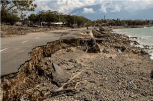
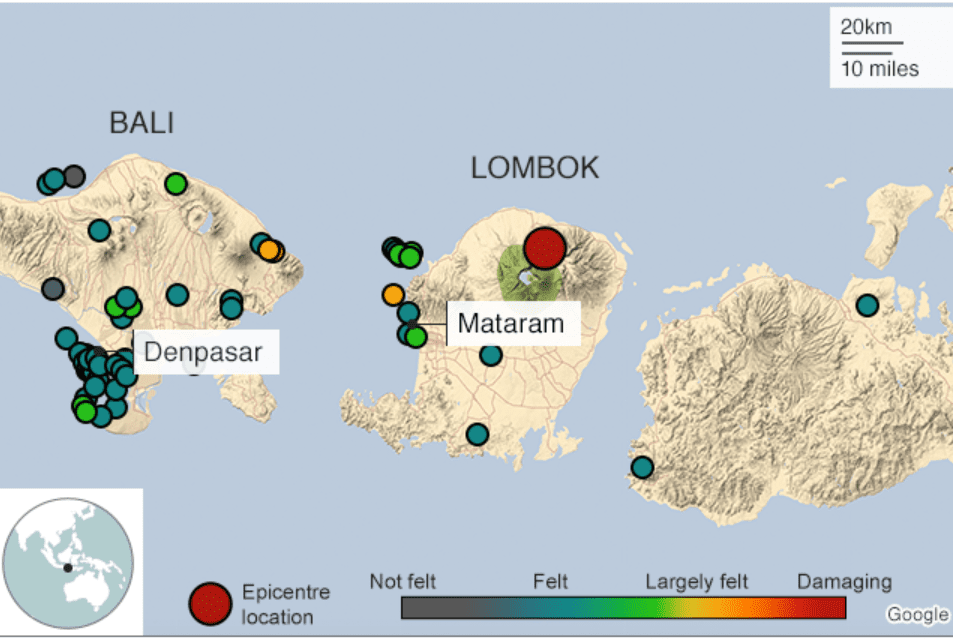
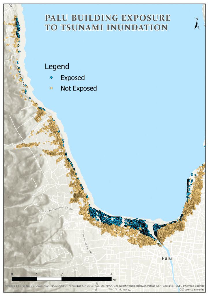
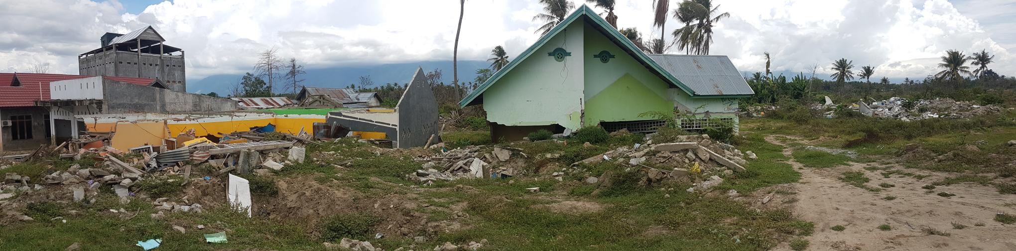
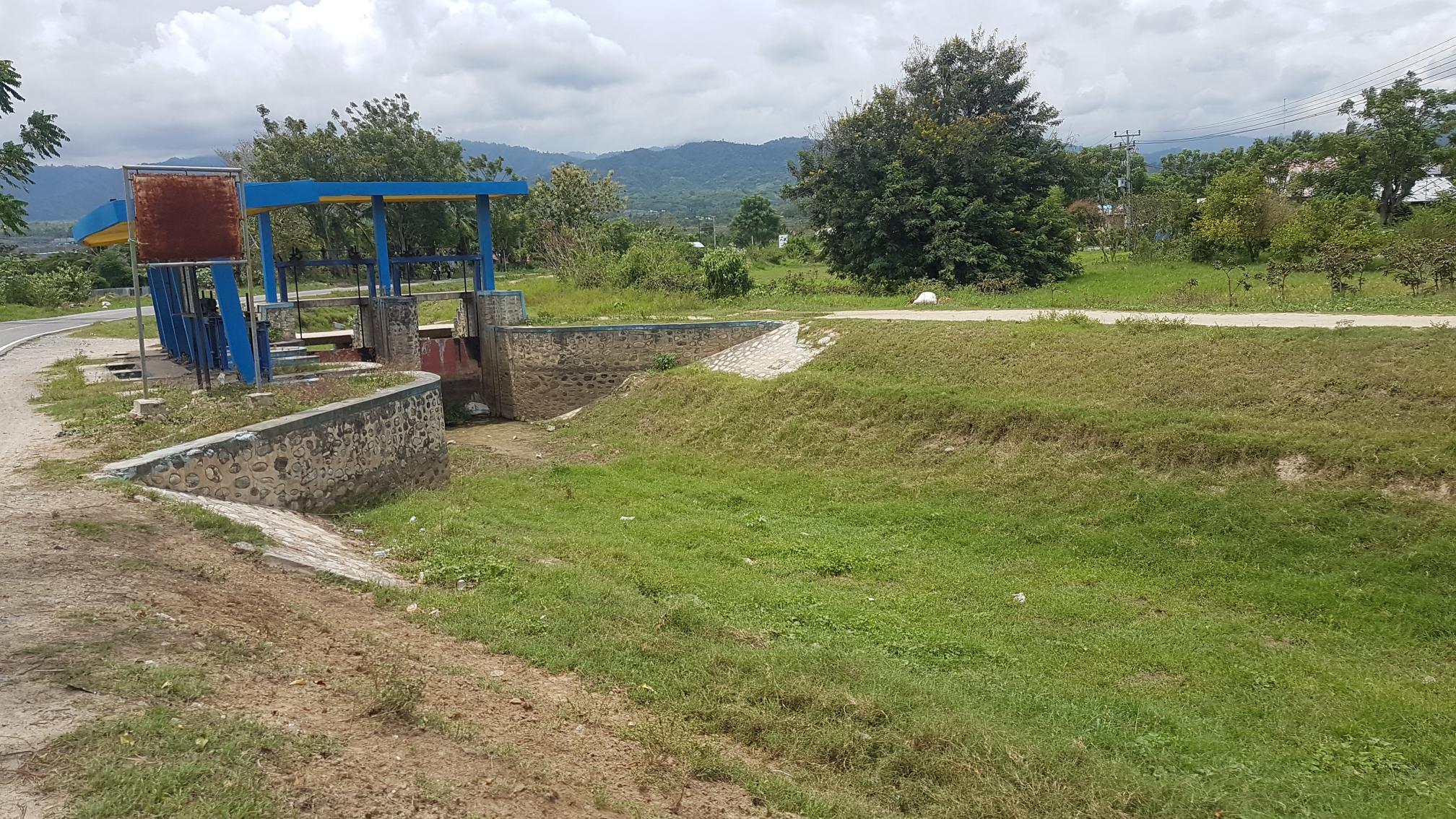
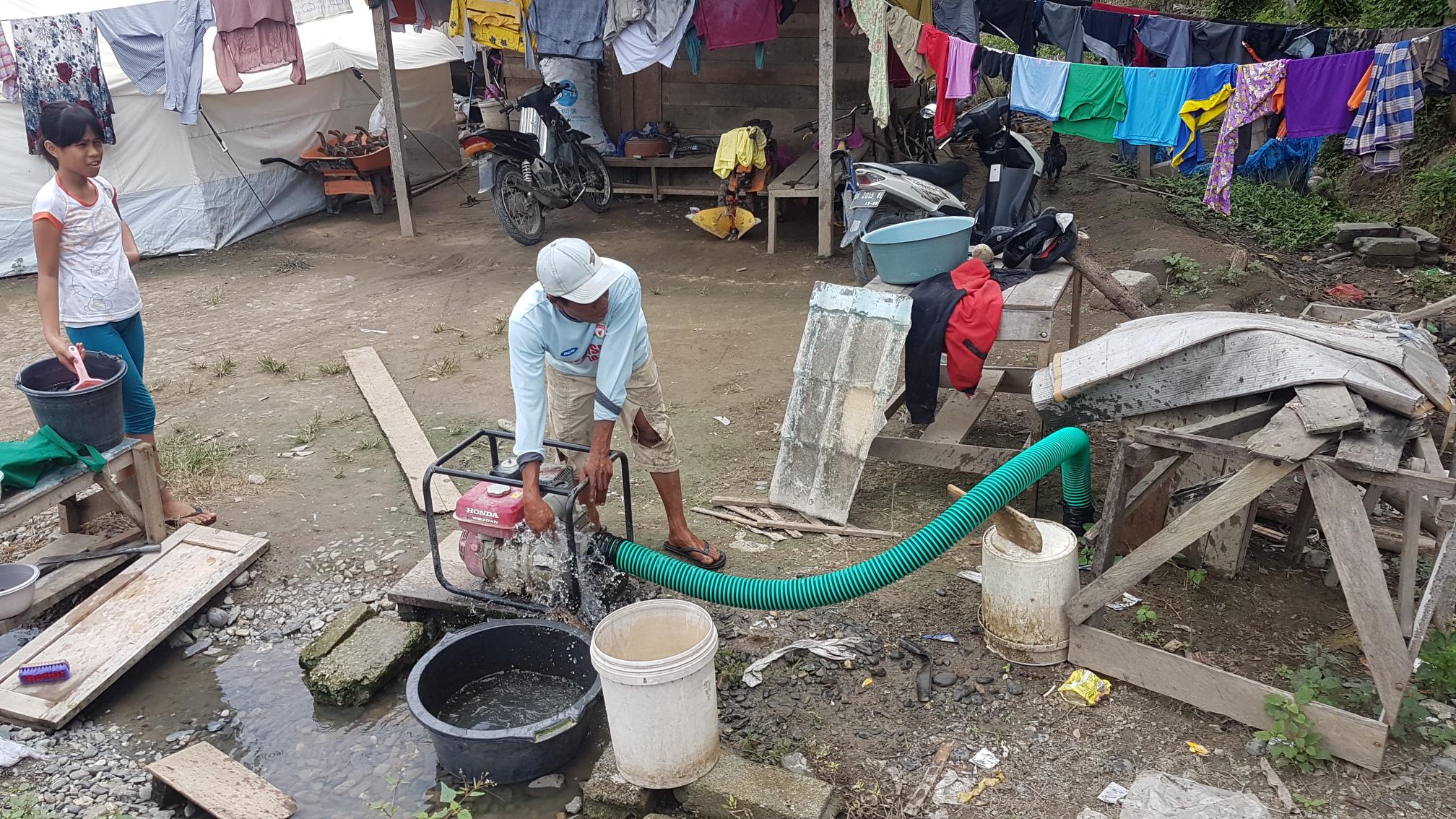
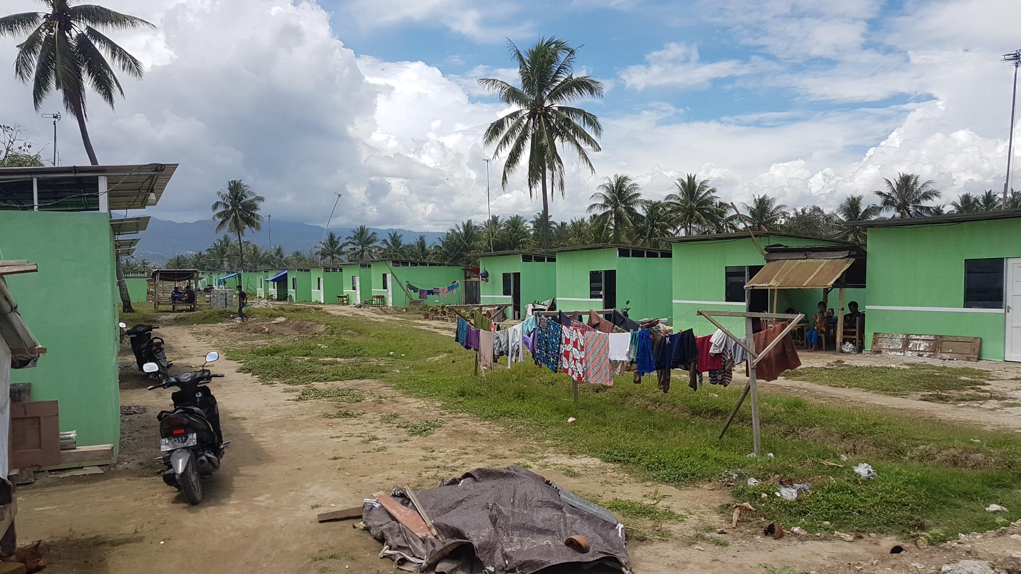
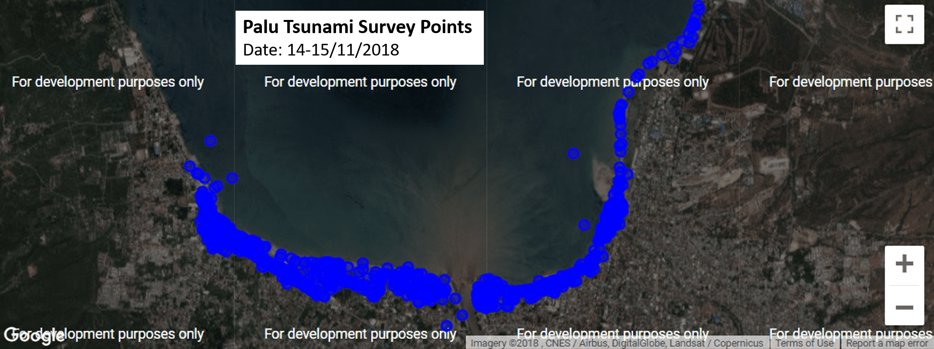
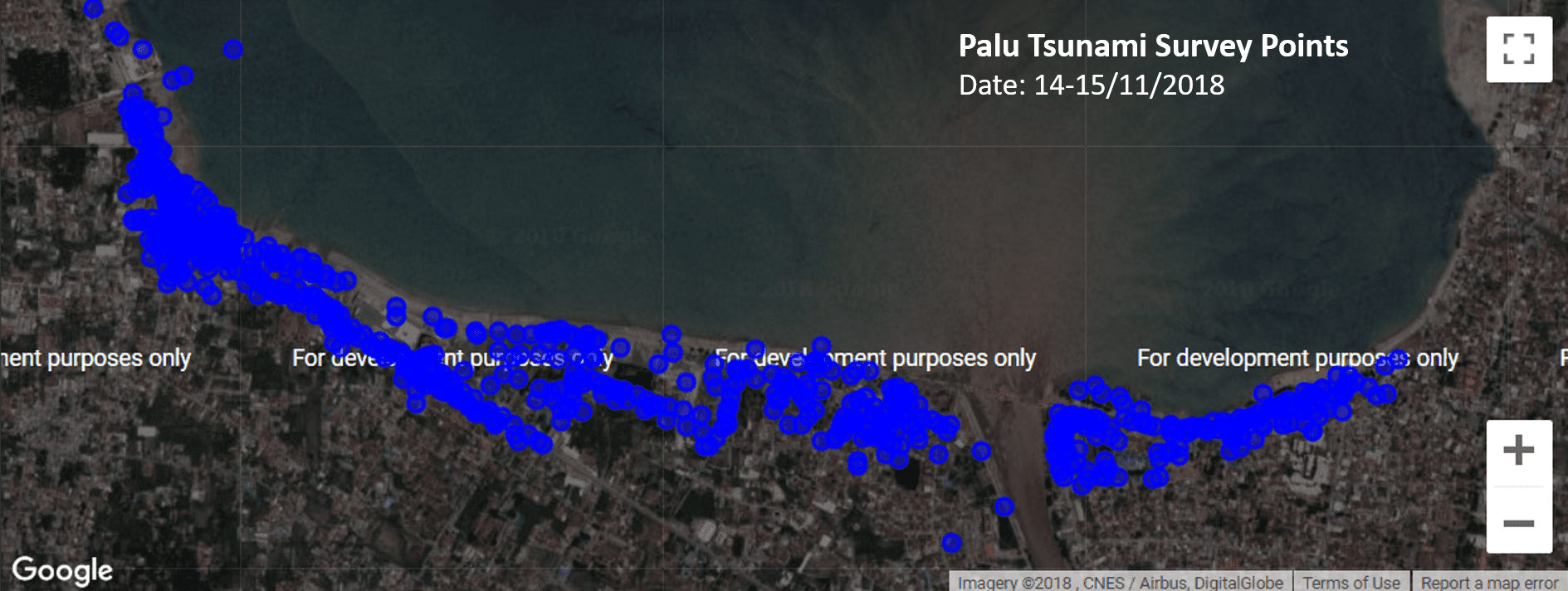
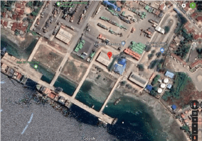
Tsunami Damage Observations Building and infrastructure damage was observed during recognisance along the coastline from Tawaeli to Palu City. The survey team made two stops at Port of Pantoloan and Kampung Nelayan based on the recommendations of UNTAD colleagues. Damage characteristics were observed but not systematically recorded using a field data collection application.
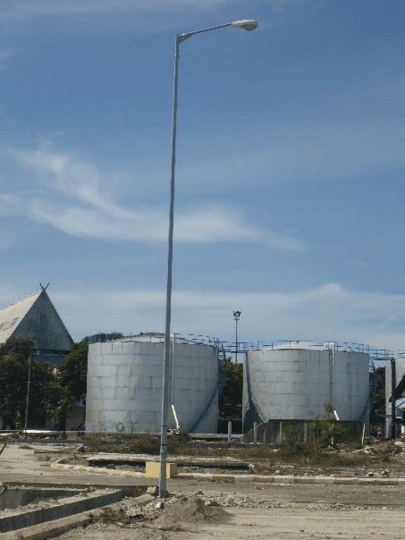
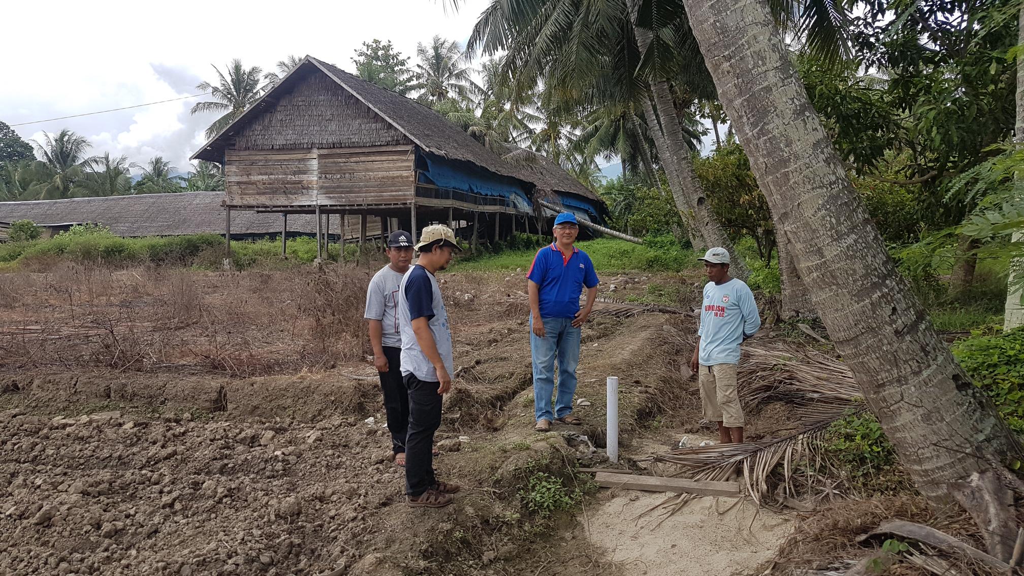
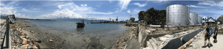
 Palu Tsunami Survey Photo 3 Buildings
  • Port of Pantoloan
    • Flow depths inside ferry terminal buildings reached maximum of 1.7m, though lower depths of 0.33m were measure from debris marks indicating still water levels.
    • No structural damage observed for one and two storey concrete masonry buildings, with non-structural components more readily damaged. Non-structural damage observed on first floor level includes:
      • First floor window frames and glass completely damaged where flow depths exceed 1.5m.
      • Air conditioning service wiring and condenser units completely damage when located low to ground (i.e. <1m).
      • Tiles removed from first floor level, floor material and foundations undamaged.
      • Damage to internal doors i.e. warping and swelling.
      • Fixtures and fittings including joinery were removed from buildings.
      • Electrical items including, power socket and switches were inundated and remained in situ, although replacement or reconditioning would be required before reuse.
      • Minor damage (e.g. impact cavities, stripped paint) to external walls due to floating objects.  No cracking observed.
Palu Tsunami Survey Photo 4 
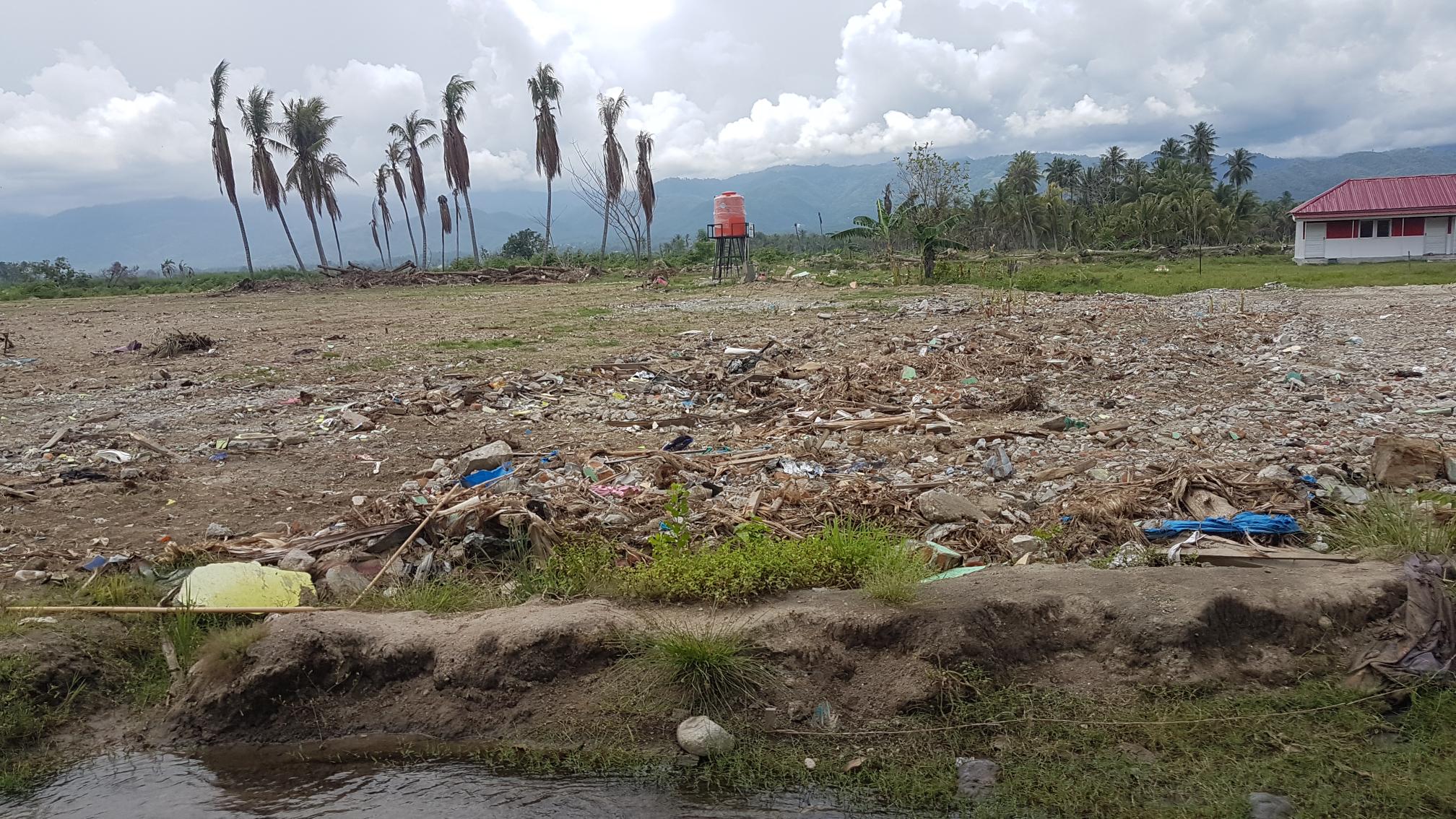
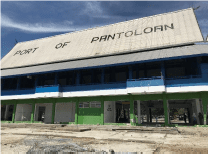
Noted that the ferry service was moved to another further north port prior the Palu-Dongala earthquake tsunami, hence limited human impact during the event.
  • Tawaeli to Palu City
    • Extensive damage on low-lying coastal land, with many buildings potentially experiencing collapse or washed away (we will need to verify with other researchers).
    • A number of damaged building sites identified for survey activities.
    • Caution will need to be exercise during any survey activities as many residents who lost homes have set-up camps.
Roads:
  • Many roads within observed inundation area have performed well (DL0-DL1). Localised damage was observed (DL2-DL3).
  • DL2– DL3 (Moderate – Complete) damage observed South of University of Tadulaku
  • Extensive seawall scour observed with loss of one or two lanes of road. Blow out observed at culvert (DL2).
  • Peeling of pavement observed (DL1).
Electricity: Many utility poles were observed to have performed well (DS0). Bolted embedment type poles observed at Pontaloan Port (where damage was observed on other assets)with no signs of damage (DL0) Localizedareas of damaged utility poles (DS2) observed. Electricitypoles South of University of Tadulaku observed with lines pulled from poles(DL1 – DL2)
Earthquake Damage Observations Though the focus of this survey is Tsunami impact to buildings and infrastructures,earthquake damage was also observed and recorded when available. Palu Airport:
  • The airport is still operating (only ground floor, the upper floor was closed) though its substantial non-structural damage and wall cracks.
Palu Bridge:
  • The demolition of the damage bridge is underway as shown below (left).
  • A multi-story building nearby was also damaged by earthquake shaking (and tsunami?!)
Tadulako University:
  • 70% of buildings in the campus were affected by the earthquake shaking. Some of them was closed due to its severe damage and safety issue, such as the Faculty of Engineering building shown below.
  • Students and staff are back school now. But with limited facilities after the earthquake, some students and staff are relocated to other universities already.
  • Pak Ketut and his team had conducted detailed assessment of damage buildings in Tadulako University as well as buildings within Palu city.
Port of Pantoloan:
  • Some damage in Port of Pantoloan is believed to be caused by earthquake shaking, such as the collapse of crane (left) and the collapse of brick wall (right).

Strengthened Indonesian Resilience – Reducing Risk from Disasters