Written by Sheng-Lin Lin, Risk Engineer GNS Science
The tsunami survey is a research initiative funded by the New Zealand RiskScape programme (
www.riskscape.org.nz) in partnership with the University of Canterbury and the StIRRRD programme.
Summary – 13/11/2018
Day one the survey team traveled to Palu City from Jakarta on an early morning flight. Gumbert Maylda Pratama met the team at Palu airport before attending a meeting with colleagues at Tadulako University (UNTAD). The New Zealand-Indonesian team carried out a survey recognisance trip along the Tawaeli to Palu City coastline, stopping at key sites such as Kampung Nelayan to observe road infrastructure damage.
 Activities Summary
- Travel from Jakarta to Palu arriving at 6:30am.
- Visit Palu River Bridge to see the reconstruction activities.
- Meeting with Amar Akbar Ali, Pak Ketut, Andi Rusdin and Ida Sri Oktaviana at UNTAD Engineering Department.
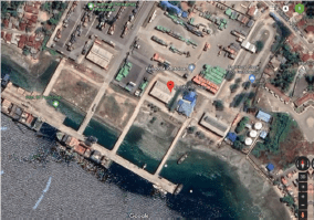
- Travel to Port of Pantoloan with Pak Ketut and Ida Sri Oktaviana for observations of tsunami flow depths and building damage.
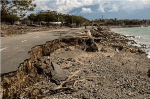
- Travel to Palu City along coastal road, stopping at Kampung Nelayan to observe road and sea wall damage
Tsunami Hazard Observations
Tsunami flow depths above ground and inside buildings were observed and measured for buildings and surrounding features at Port of Pantoloan. Flow depths were observed onsite but not systematically recorded using a field data collection application.
Tsunami Flow Depths
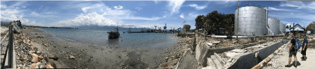
- Several measurements from water marks inside ferry service terminal building (Pelabuhan Palu – see image below) indicates flow depths may have reached 1.7m above ground. This height was consistent with debris deposited on wire-mesh fencing within 20m of terminal building.
 Tsunami Damage Observations
Building and infrastructure damage was observed during recognisance along the coastline from Tawaeli to Palu City. The survey team made two stops at Port of Pantoloan and Kampung Nelayan based on the recommendations of UNTAD colleagues. Damage characteristics were observed but not systematically recorded using a field data collection application.
Buildings
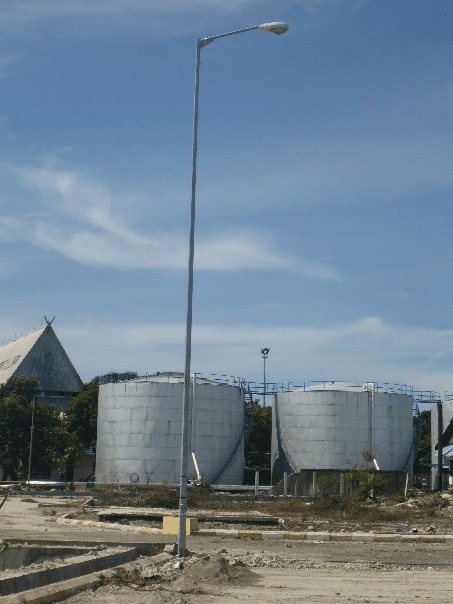
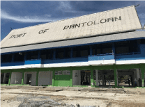
- Port of Pantoloan
- Flow depths inside ferry terminal buildings reached maximum of 1.7m, though lower depths of 0.33m were measure from debris marks indicating still water levels.
- No structural damage observed for one and two storey concrete masonry buildings, with non-structural components more readily damaged. Non-structural damage observed on first floor level includes:
- First floor window frames and glass completely damaged where flow depths exceed 1.5m.
- Air conditioning service wiring and condenser units completely damage when located low to ground (i.e. <1m).
- Tiles removed from first floor level, floor material and foundations undamaged.
- Damage to internal doors i.e. warping and swelling.
- Fixtures and fittings including joinery were removed from buildings.
- Electrical items including, power socket and switches were inundated and remained in situ, although replacement or reconditioning would be required before reuse.
- Minor damage (e.g. impact cavities, stripped paint) to external walls due to floating objects. No cracking observed.
 Noted that the ferry service was moved to another further north port prior the Palu-Dongala earthquake tsunami, hence limited human impact during the event.
- Tawaeli to Palu City
- Extensive damage on low-lying coastal land, with many buildings potentially experiencing collapse or washed away (we will need to verify with other researchers).
- A number of damaged building sites identified for survey activities.
- Caution will need to be exercise during any survey activities as many residents who lost homes have set-up camps.
Roads:
- Many roads within observed inundation area have performed well (DL0-DL1). Localised damage was observed (DL2-DL3).
- DL2– DL3 (Moderate – Complete) damage observed South of University of Tadulaku
- Extensive seawall scour observed with loss of one or two lanes of road. Blow out observed at culvert (DL2).
- Peeling of pavement observed (DL1).
Electricity:
Many utility poles were observed to have performed well (DS0). Bolted embedment type poles observed at Pontaloan Port (where damage was observed on other assets)with no signs of damage (DL0)
Localizedareas of damaged utility poles (DS2) observed.
Electricitypoles South of University of Tadulaku observed with lines pulled from poles(DL1 – DL2)
Earthquake Damage Observations
Though the focus of this survey is Tsunami impact to buildings and infrastructures,earthquake damage was also observed and recorded when available.
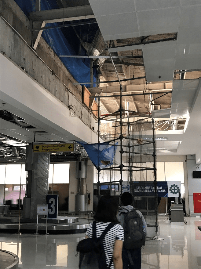
Palu Airport:
- The airport is still operating (only ground floor, the upper floor was closed) though its substantial non-structural damage and wall cracks.
Palu Bridge:
- The demolition of the damage bridge is underway as shown below (left).
- A multi-story building nearby was also damaged by earthquake shaking (and tsunami?!)
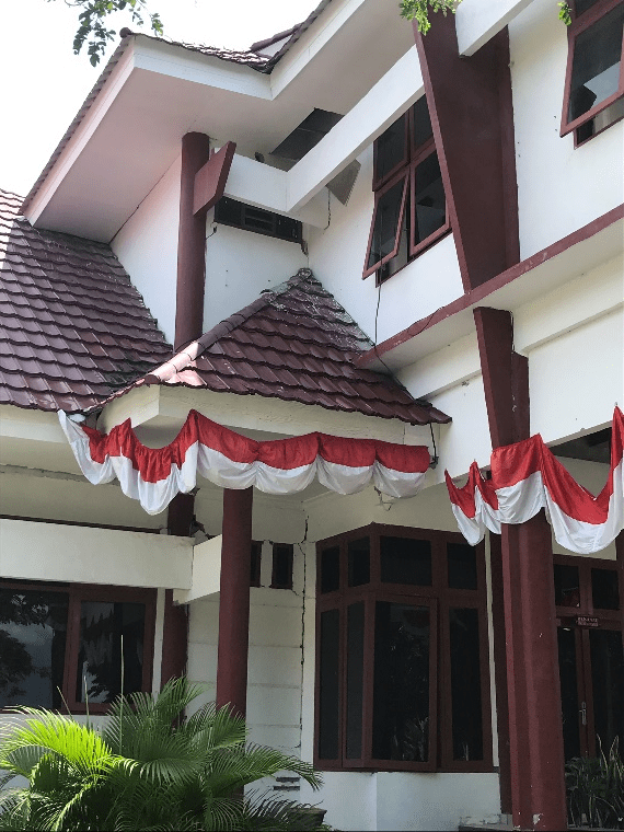
Tadulako University:
- 70% of buildings in the campus were affected by the earthquake shaking. Some of them was closed due to its severe damage and safety issue, such as the Faculty of Engineering building shown below.
- Students and staff are back school now. But with limited facilities after the earthquake, some students and staff are relocated to other universities already.
- Pak Ketut and his team had conducted detailed assessment of damage buildings in Tadulako University as well as buildings within Palu city.
Port of Pantoloan:
- Some damage in Port of Pantoloan is believed to be caused by earthquake shaking, such as the collapse of crane (left) and the collapse of brick wall (right).