
As part of the DRR Action Plan workshop held in Seluma, 25–26 August 2015, we had a half-day field visit organised by the local emergency management office (BPBD). It was an opportunity for them to show some of the hazard and risk issues they face. Our party consisting of local government staff and university researchers, set off from Pasar Tais just after 8 am and travelled towards Pasar Seluma on the coast. Soon the tarmac road ran out and gave way to a rolling dirt track worn to rubble, which took us through a cross section of Indonesian life from the bustling town to the gentle padi fields. But the watery green terraces are slowly being eaten by groves of palm oil. Busy villages line the road, hinting at the thousands of people who live in this area near the coast. Initially hidden by the palms a great expanse of beach opens out. Here, we are provided an informative presentation by the head of the Preparedness section of the BPBD, Aziman. He describes how they have recently mapped the tsunami hazard in this region and will be using this map in risk reduction planning going forwards.

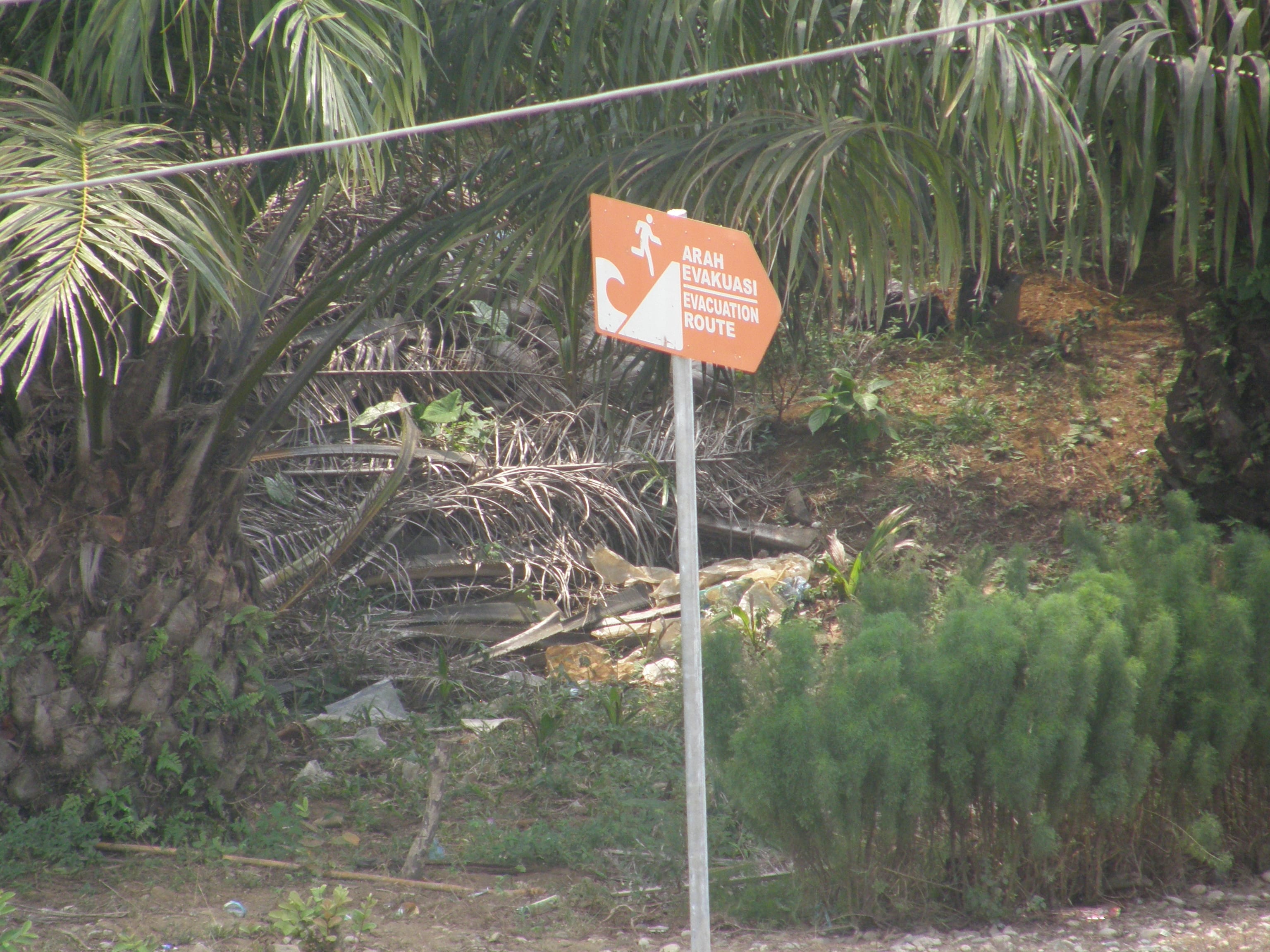
He expresses his concerns that although the national government have built a tsunami shelter, it can hold only 3,000 people. There are many villages that line the 70 km of exposed coast of Seluma and he estimates that they would need 10 tsunami shelters to sufficient provide a safe refuge for them all. The drive from Pasar Tais to the beach is across broad flat coastal plain, which makes tsunami evacuation challenging. Vertical evacuation is a sensible option, but the lack of multi-storey buildings means that purpose built structures, although expensive, are the only option.
Following a ‘bread crumb’ trail of tsunami evacuation signs our dusty convoy travelled on to the purpose built tsunami shelter.
Exploring this large structure it becomes clear that it is purpose built. It is a solid, open structure and a ramp and broad stairs enable those who are frail, young or disabled to access the higher floors. Toilets are provided on the third floor and solar panels are in place to provide lighting at night. This is an impressive undertaking, following a national standard and is very similar to the one observed in Kota Bengkulu.
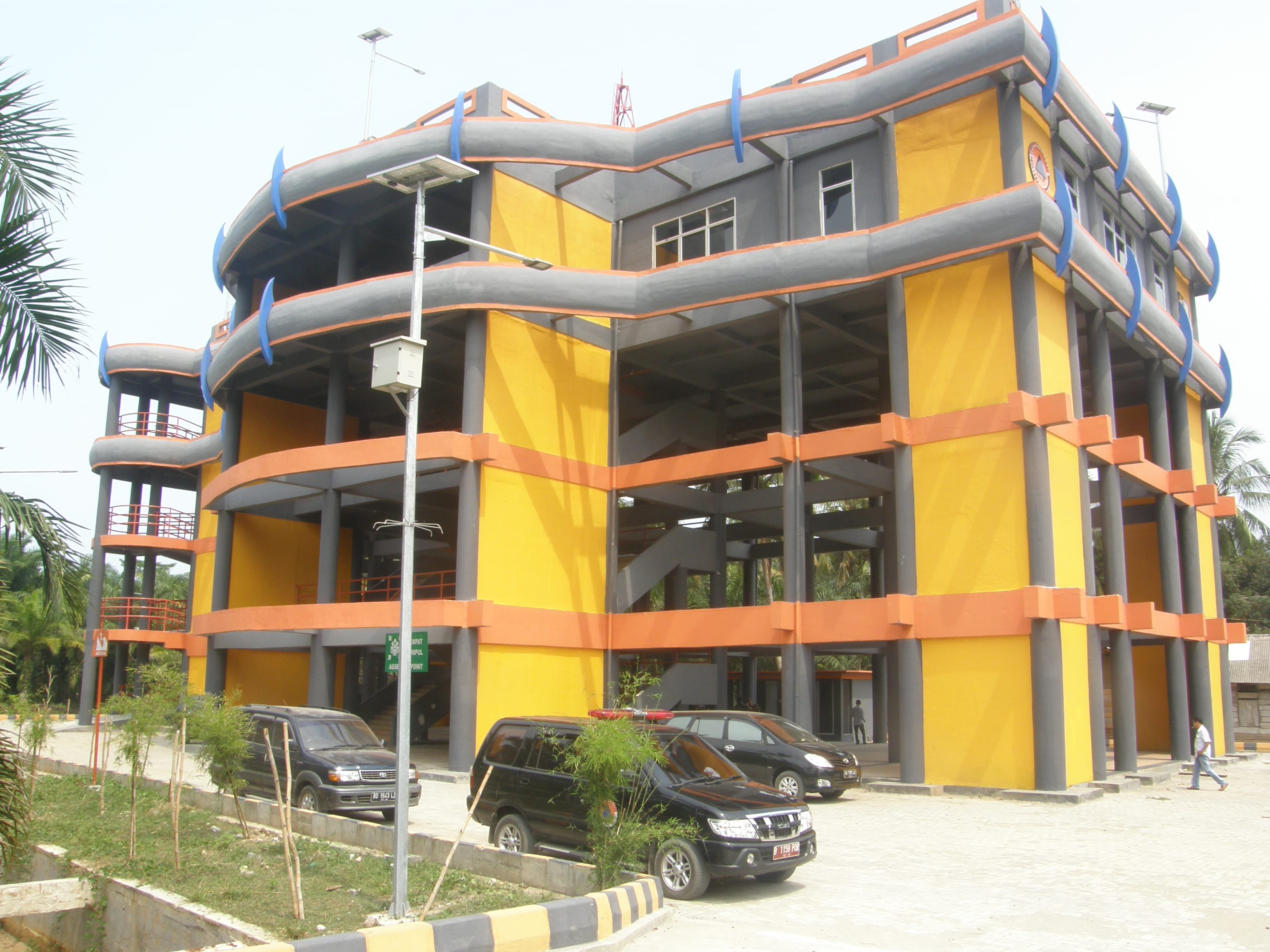
However, the local emergency managers are still waiting for an official handover of the building from the national government before they can start using the building and implementing their community awareness plans. The building could be used as a local community centre, a market, or even a school and this would enable the community to become familiar with the structure and put it to good use.
Click the links here for a videos of a similar shelter in Kota Bengkulu, under construction and finished.
The aim of this second phase is to support the local community to be resilient, enabling them to identify the warning signs of a tsunami and know where to go and when. This outreach is aligned with support for their livelihoods under the “Resilient Village” government program. It is a holistic approach that aims to improve the lives of those living in the area now and in the future.

Tsunami is not the only hazard that impacts this area. The workshop participants have also identified floods, earthquakes and landslides. Participants noted that they are used to the frequent small earthquakes that shake the surrounding countryside, and they rank earthquakes as the biggest threat. The fear of ‘the large one’ is real.
Our final stop demonstrates the power of a frequent and rapid onset hazard – flooding. We visit a small village that last month woke to find devastation on their door step. Overnight heavy rainfall upstream, in the “dry” season, caused the near-by wide and shallow river to swell and overtop its banks. Flood waters up to 4 m in depth swept through the palm oil plantation and three villages were flooded. Despite the flood occurring rapidly, over only 2 hours, no one was hurt but many lost their belongings.
The field trip provided an insight into this districts progress towards resilience. Just like the road we travelled together today, the path of disaster risk reduction is at times rough and slow but the journey is always worth it.