Written by Elizabeth Garlick, Michael Goldsmith & Phil Glassey
Following our previous two visits, the StIRRRD team were again in Rawa Indah, Indonesia in July 2018 to build on the work they’ve already undertaken in developing a Tsunami Safe Community Action Plan with locals. This visit was focussed on facilitating a village-wide tsunami evacuation simulation. It involved working with village leaders, local schools, community groups and the district Disaster Management Agency (BPBD) to finalise the arrangements for the evacuation; as well as measure and observe the evacuation itself to get a better understanding of how the locals responded. The team was once again assisted by its experienced project partners – The University of Bengkulu (UNIB), Indonesian Red Cross (PMI) and the National Board for Disaster Management (BPBD). The team was once again assisted by its experienced project partners – The University of Bengkulu (UNIB), Indonesian Red Cross (PMI) and the National Board for Disaster Management (BPBD).
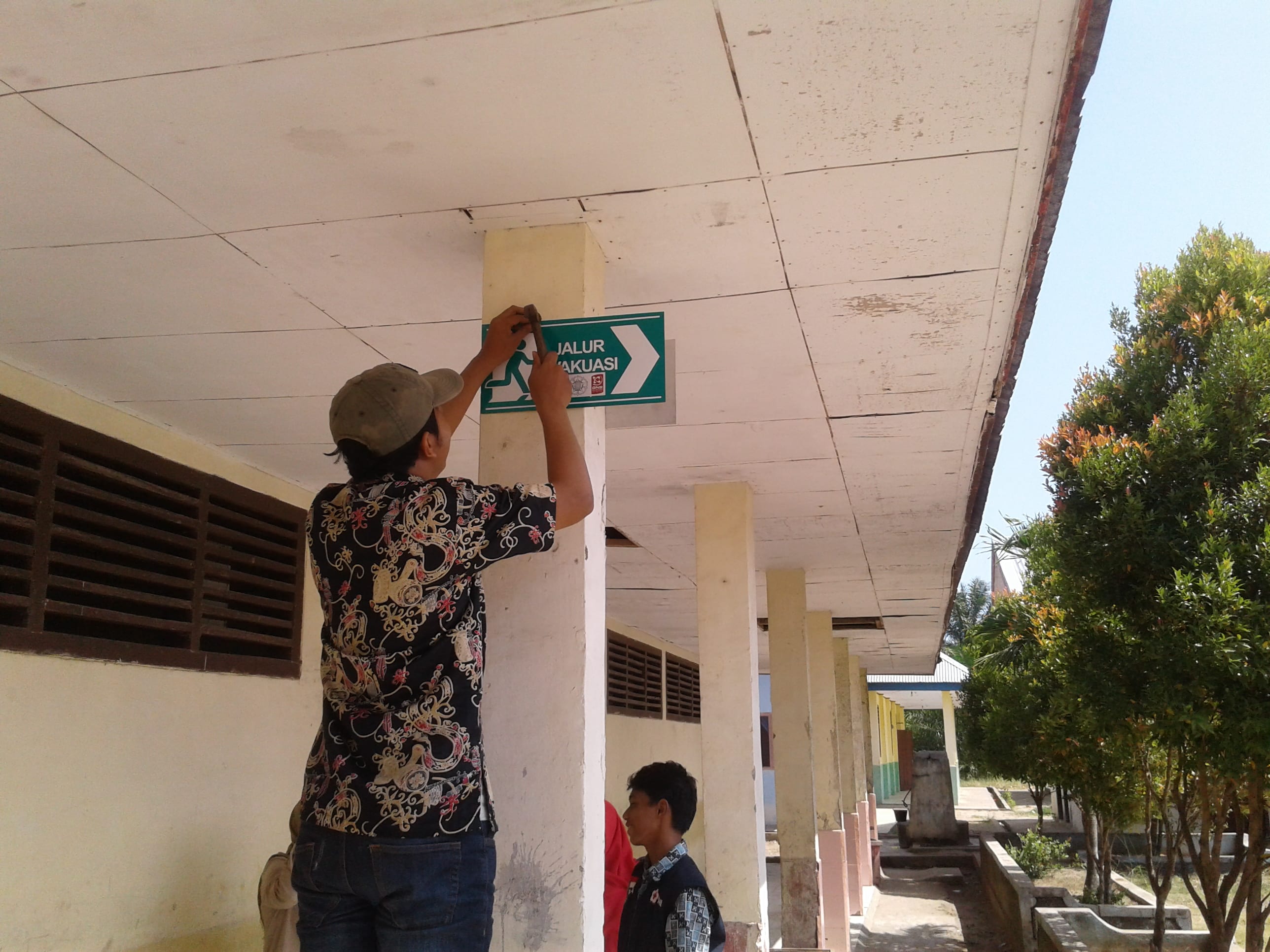
The day before the simulation we visited Rawa Indah school to hand over the resources developed with them during previous visits. These included framed tsunami evacuation posters for each class, signs for the assembly area, evacuation signs and a large information poster to be displayed in a high-traffic area by the school gate. These resources were much-needed and attracted the attention of many students who were eager to learn tsunami safety information. While at the school, we made final plans for the simulation and encouraged the principal to let all classes participate, even new entrants. Children that know about tsunami hazard and response will go home and educate their families, which in turn leads to safer communities.

The simulation worked well, with around 240 people from the village making their way to the tsunami shelter – 177 of these people were children – with most people arriving by motor-scooter. The simulation started at 9.04 am and most people had arrived at the shelter by 9.30 am. After everyone had gathered, local agencies kept the children engaged with hazard education including songs. PMI distributed food packages and we gave away a ‘grab and go’ emergency bag from New Zealand.
We worked with local agencies to debrief after the simulation and created some action points for improvement. Most people heard a warning, either the siren or kentongan (traditional wooden instrument that makes a noise when struck), which was a great start. The kentongan is robust and reliable and has been used for centuries by locals to warn of threats. It was noted that multiple sources of warnings should be used though, and it was noted that BPBD hope to install a system which can provide official warnings directly to the village in the near future.
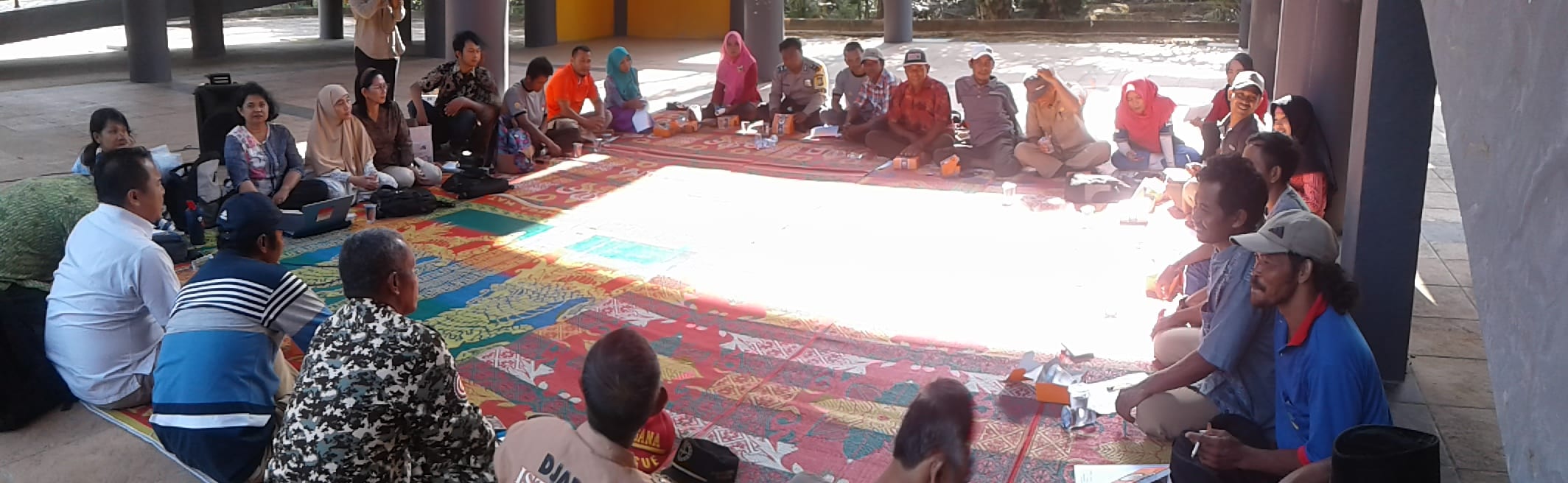
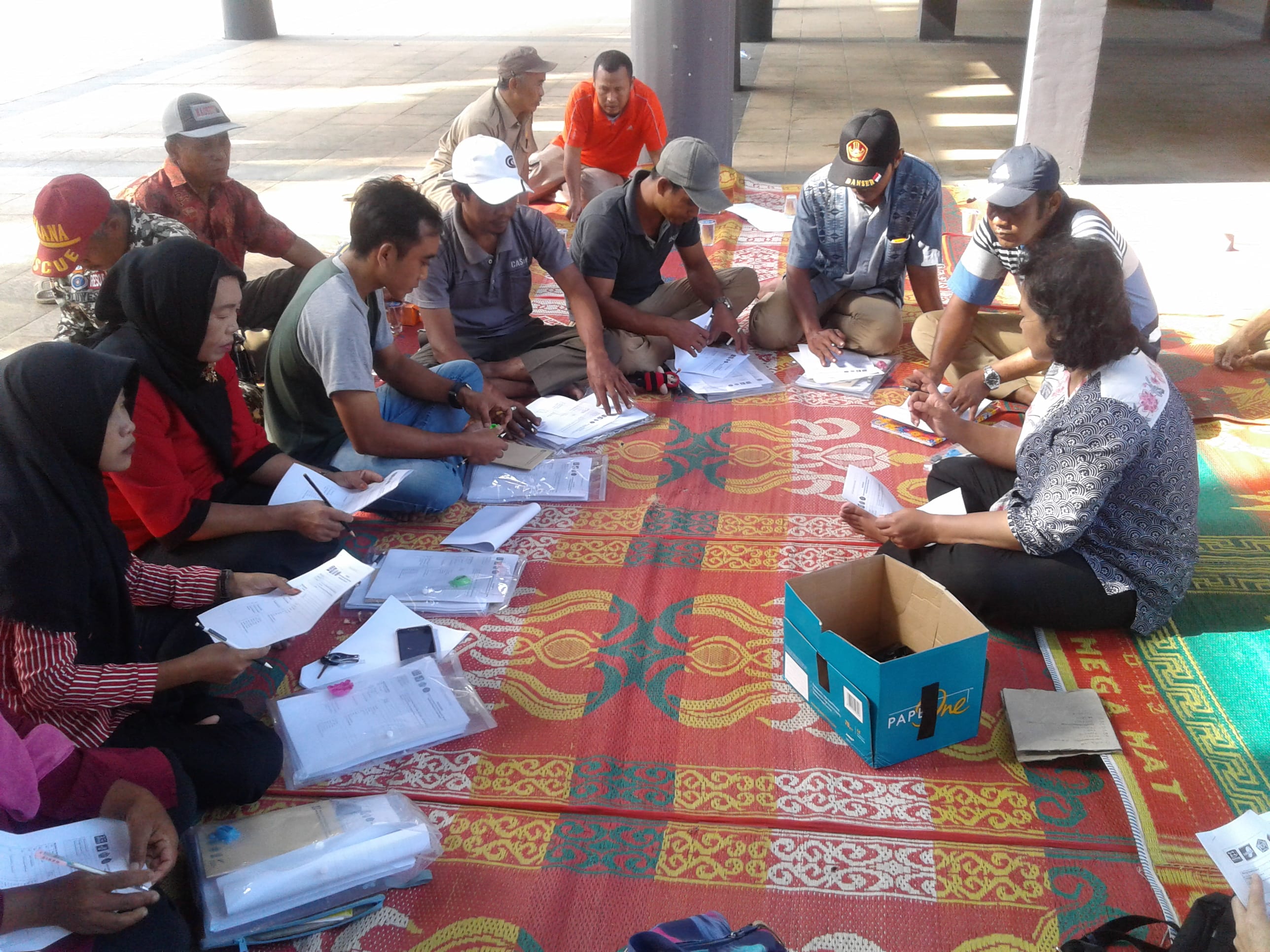
Training workshop with local volunteers, to finalise arrangements for the tsunami simulation
After the simulation, we initiated some actions that will have an impact on how ready the community will be in the event of a tsunami. Another positive outcome from this project is that the school has agreed to run the simulation at the start of every school year to keep the information fresh in the children’s minds. The schoolchildren also picked up the evacuation information quickly due to being familiar with the shelter and from the songs previously learnt.
Also, during the week, we undertook a repeat survey about tsunami hazard and response. The survey will give an insight into the effectiveness of our community education programme as well as highlight issues.
In addition to the Community Project work, the team met with BPBD leaders in Seluma District and also in nearby Bengkulu City, to get an update on the DRR activities they have implemented recently, or are planning in the coming year. Both agencies are making good progress, and are building on the original DRR Action Plans they developed as part of the StIRRRD project. Highlights include:
- Bengkulu BPBD working with the private sector to formalise access to buildings near the coast, so they can be used in the event of a tsunami warning.
- Bengkulu BPBD participating in a large-scale Pacific Partnership Exercise that coordinated a field response to many emergency simulation situations including devastating earthquakes. They were proud of their involvement in this and it has given them further confidence in their response capabilities.
- Bengkulu BPBD are hoping to erect a building using sound construction techniques, that would become an example of sturdy design for locals to adopt themselves. The building could also be used as a station for disaster risk reduction training. The StIRRRD team offered help to gain some additional funding for this project.
- Seluma BPBD have a number of projects underway. These include adding to their early warning system network, evacuation simulations, and facilitating additional ‘disaster resilient village’ programs.
In addition, some of our team attended a workshop about the Safe Schools programme in Seluma. A short presentation was given regarding the simple-action messages used in New Zealand, such as “drop, cover, hold” and “long or strong, get gone” as well as the emergency ‘go bag’ concept. Some of our insights and experiences of the Rawa Indah School evacuation simulation were also shared.
The StIRRRD team have returned to New Zealand with several action points to work on to keep the progress moving along in Rawa Indah. The team is happy with the progress made by local agencies and the community throughout the project, and especially with how well the schoolchildren responded to the evacuation simulation. Thanks to everyone who generously hosted the team during the 3 project visits, and to the local volunteers who gave up their time for an important community cause.
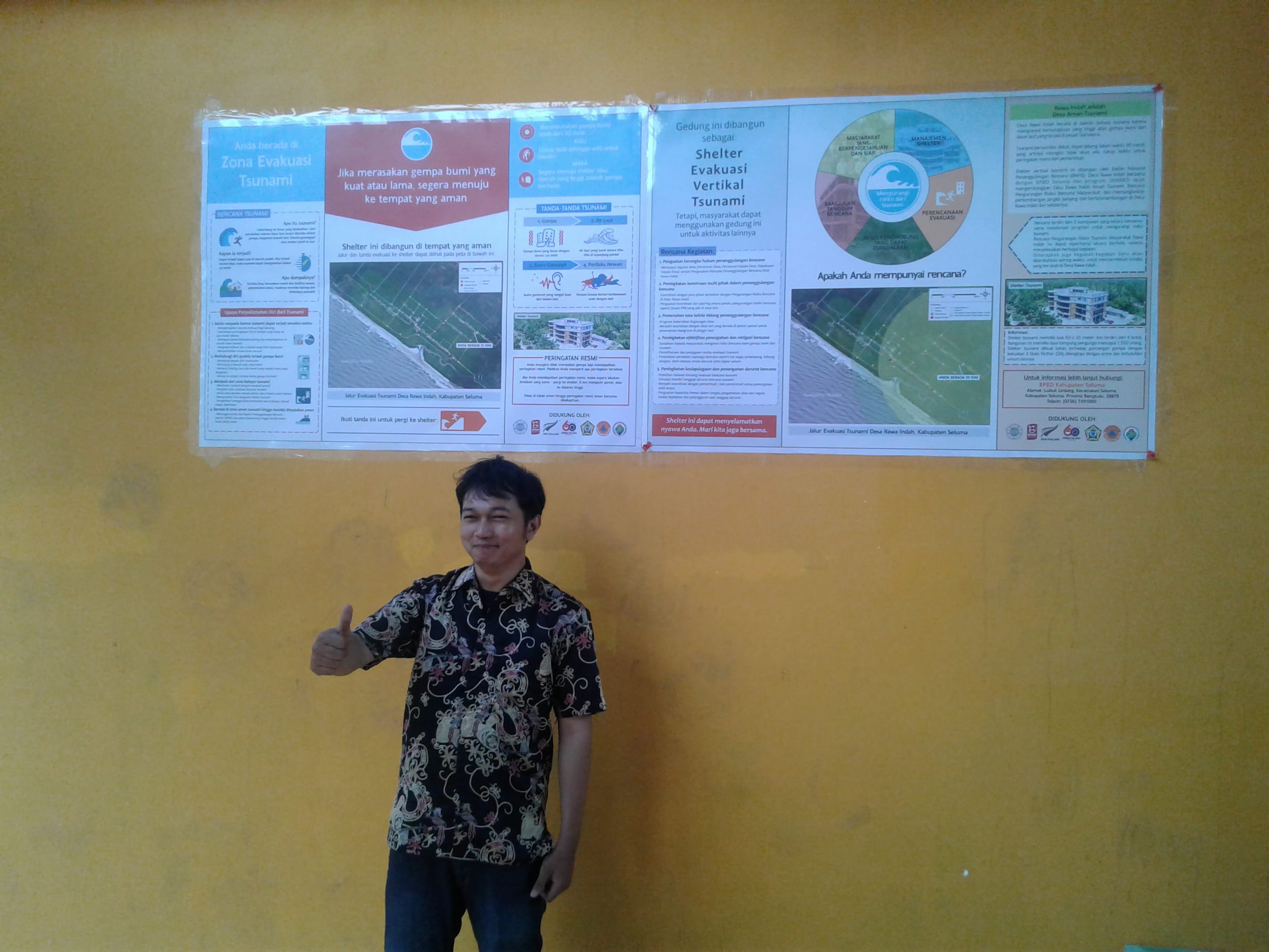
Tsunami information boards at the shelter