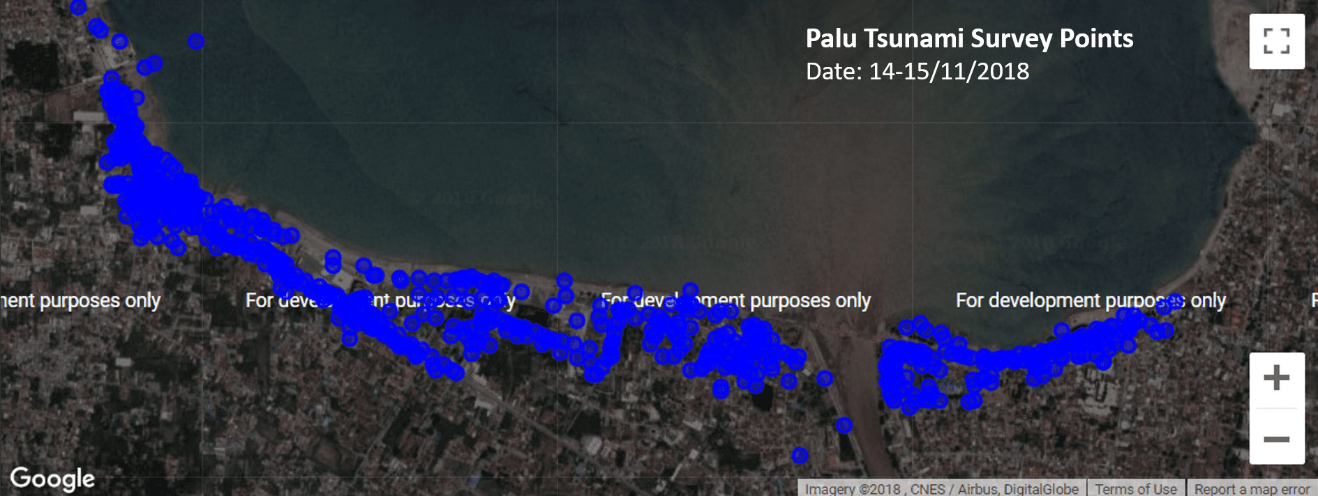
New Zealand-Indonesia Palu Tsunami Survey Team


Written by Ben Payne
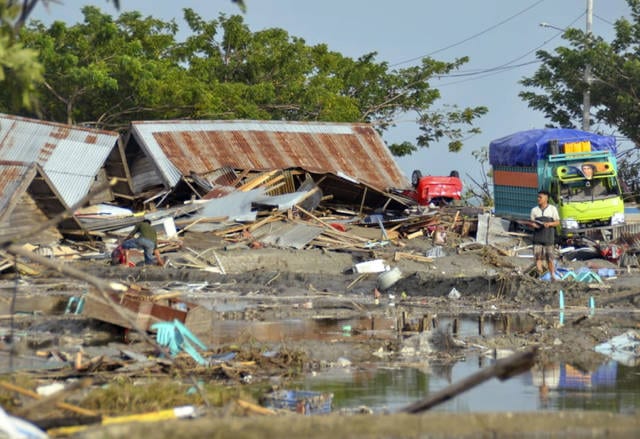
No-one involved in the Seismometers in Schools project wanted to see their work put into action as quickly as it was in Palu. In March 2018, three schools in the City of Palu had Raspberry Shake seismometers installed; on 28 September, a 7.5 magnitude quake in the North Sulawesi subduction zone and a subsequent tsunami killed at least 2100 people in Palu City, Donggala and Sigi. Nearly 700 are still missing and close to 80,000 people remain displaced.
A couple of days later, Richard Woods from the StIRRRD team noticed that the Raspberry Shake at the SMA Negeri Model Terpadu Madani (located in the north of the city of Palu) was back online, as power was restored to the school.
The seismometers in the three schools helped to build a picture of what happened that day. The severity of the shaking was obvious, and we can only imagine how terrifying the earthquake must have been.
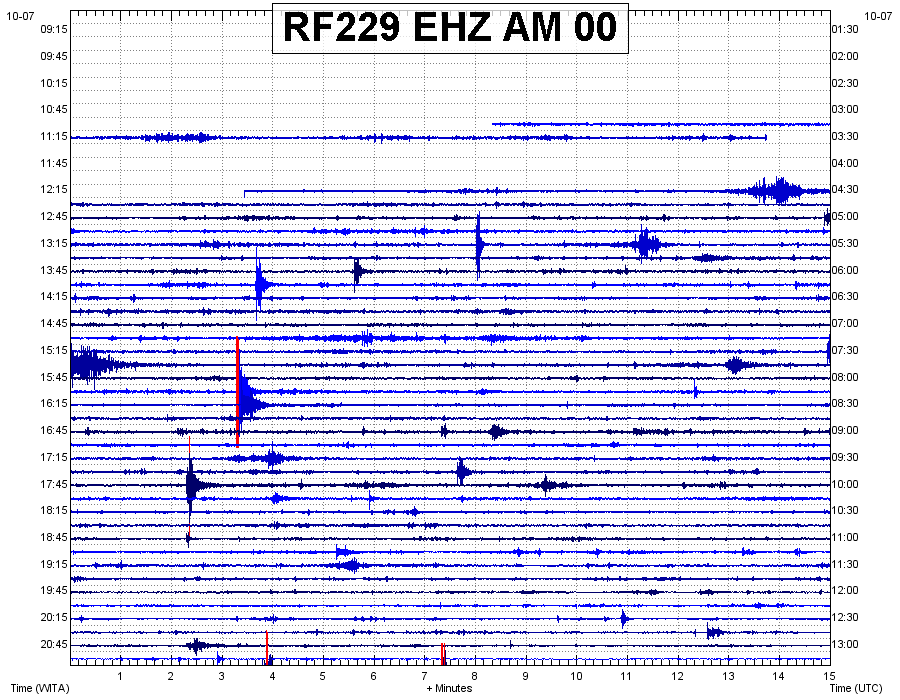
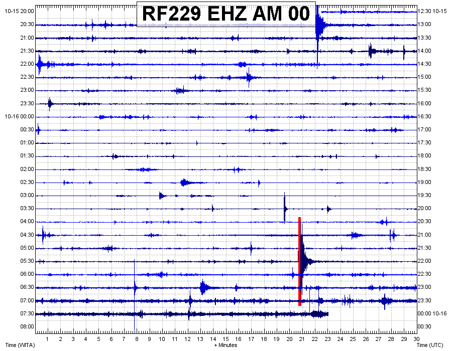
The first image below shows the seismic trace up until the M7.5 struck just after 6pm. You can see the M6.1 foreshock earlier in the day and the aftershocks in between the two earthquakes. The second image shows the seismometer had power restored just after 12.15pm on 07/10, and the third image shows the UNTAD seismic trace on the 16th of October, interspersed with many aftershocks.

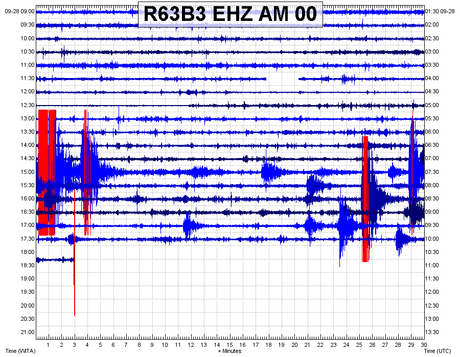
Richard then noticed that the Raspberry Shake located at MAN 1 school in the city of Palu, had also come back online, and like the first image above, the severity of the shaking is very clear.
For StIRRRD program leader Michele Daly and the wider team, the realities of the recent earthquake and tsunami are confronting. It’s one thing to be aware of the destructive potential of these natural hazards, but quite another to see events play out so soon. The StIRRRD team had visited Palu just six months before, and no-one could have predicted having to deal with such severe impacts so soon.
Michele described it as ‘heart-breaking’ to see so much destruction and human cost. But she was also amazed at how rapidly people have mobilised to support each other. She says that going by her experience of the wonderful people of Palu, she is sure this will continue throughout the recovery.
So, what are GNS Science and the StIRRD team doing to help?
The StIRRRD team is part of the response effort, supporting the Indonesian government and in-country partners with their response efforts. GNS Science has many experts in response and recovery following earthquake and tsunami events, and New Zealand’s Ministry of Foreign Affairs and Trade (MFAT) asked GNS and the StIRRRD team to lead a NZ inclusive approach, providing Palu with technical support in the transition from response to rehabilitation and recovery.
The immediate focus is to support MFAT and local agencies in Indonesia to carry out earthquake damaged building assessments and landslide risk assessment. The StIRRRD team are working with GNS experts and liaising with a variety of NZ and Indonesian partners, and this work is likely to continue in the longer term – with an emphasis on resilience and building back, better.
Palu and Donggala are both StIRRRD districts and the StIRRRD team have been working in these areas over the past 7 years. We have many colleagues and friends in the community and we wait anxiously for news of how they are.
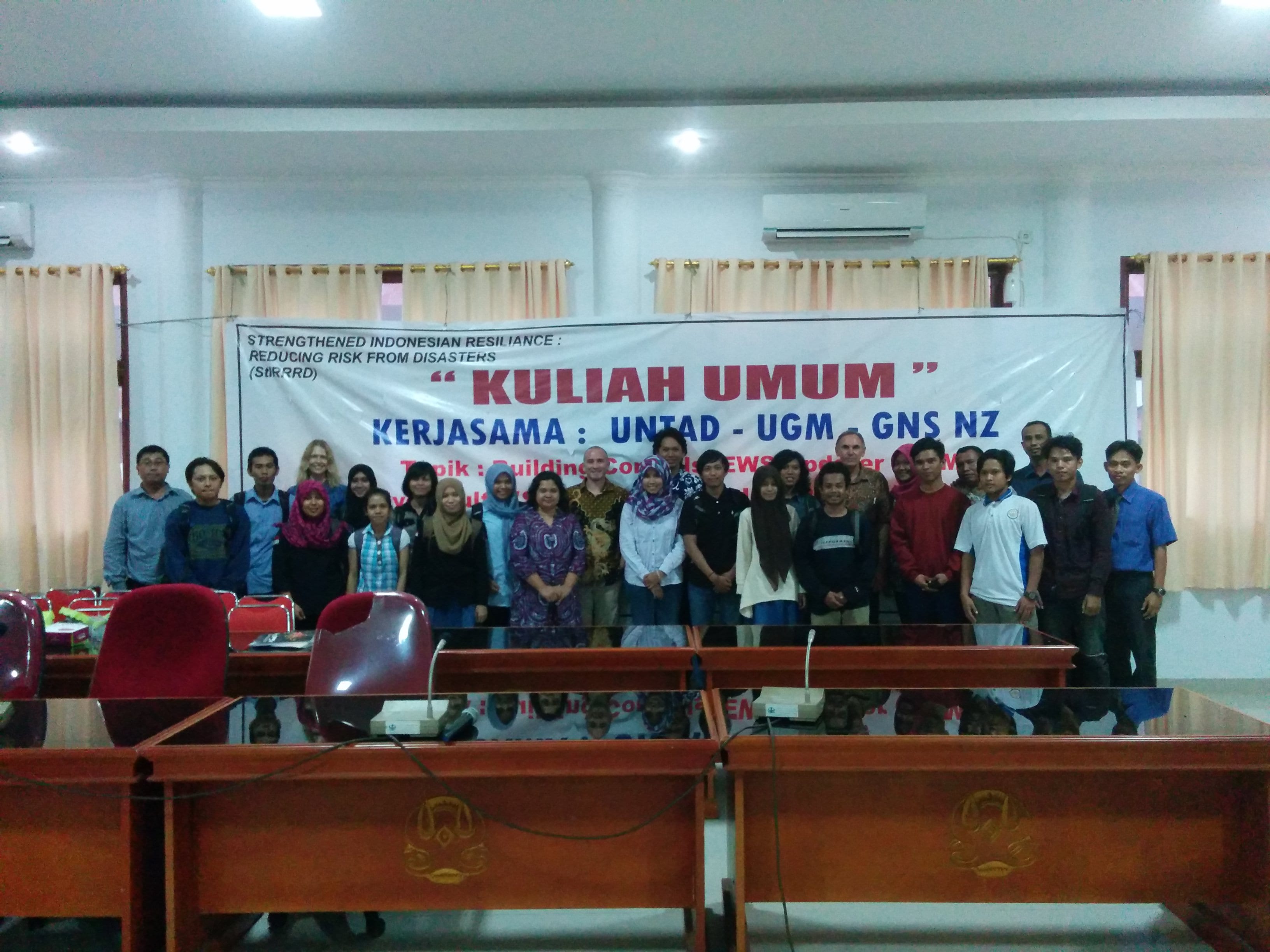
The team were last in Palu and Donggala in March 2018, installing seismometers in 3 schools in the area plus one at the university. The seismometers are intended as an educational tool to help the students understand the seismology of the area and to stimulate discussions about earthquakes and tsunami; their causes, hazard mitigation, preparedness and response actions. Students learned the importance of natural warnings for tsunami, and how to Drop, Cover and Hold. We hope these discussions in March were able to help those teachers and students with their actions in this event.
The current death toll has exceeded 840 and is expected to rise sharply over the coming days and weeks, leaving the StIRRRD team deeply concerned for our friends and colleagues who we’ve not been able to contact. In addition to the death toll, an estimated 2.4M people have been affected, with six hundred people hospitalised and 48,000 people displaced. The isolation of affected communities and the scarcity of resources is making response efforts difficult.

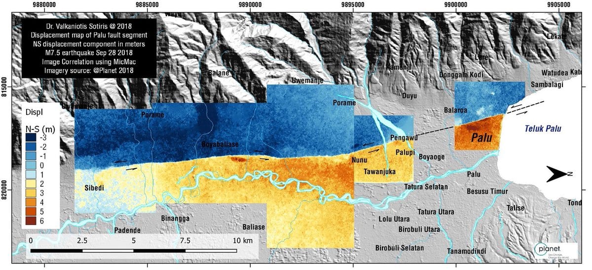
Palu and Donggala have been working towards the implementation of Risk Reduction Action Plans – a set of actions inspired by NZ and Indonesia working and learning together. Since they have been introduced, they have resulted in a number of enhancements: expansion of earth sciences and risk modeling at Tadulako University, a new public education programme, micro-zonation studies in Palu, increased budget for risk reduction, the establishment of a spatial mapping capability in the planning department and a collaborative research and awareness raising programme into the Palu-Koru Fault (http://voinews.id/index.php/component/k2/item/2109-palu-koro-expedition-unveils-the-great-earthquake-potential-in-central-sulawesi ).
Tadulako University was also about to host its first international conference on Urban Disaster Resilience in November 2018: (http://fatek.untad.ac.id/icudr/)
It’s still early days, and building resilience requires a sustained effort over generations. This combined earthquake and tsunami event has been devastating. This has always been possible in this part of the world but it’s not what you ever anticipate will actually happen. This will set Palu and Donggala back, but it has redoubled our resolve to work with our friends and colleagues there to look to the future and ensure risk reduction is built into the recovery process.
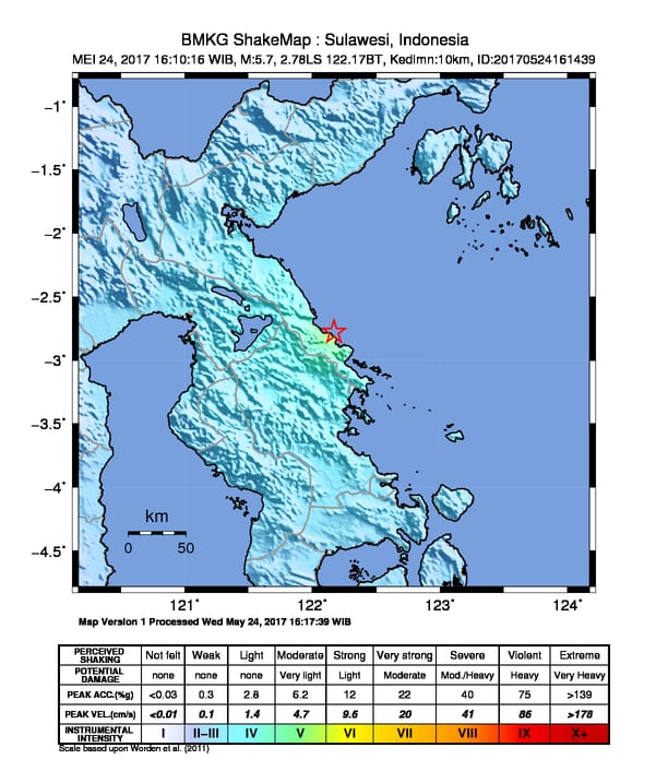
At 4.10pm on 24 May 2017, a magnitude 5.7 earthquake occurred off the coast of South Bungku District, Morowali. The earthquake is thought to have occurred on the Matano Fault at a depth of around 10km. Several felt aftershocks have occurred since the initial earthquake.
Shaking was felt strongly in Morowali with reports of people running from houses. Subsequent media reports note that at least 20 homes were damaged, most lightly, with one house severely damaged in Siumbatu Village, South Bungku District.
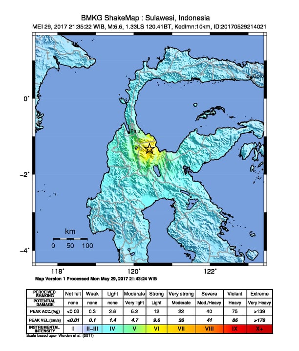
Only five days later, at 9.35pm on 29 March, the province was again shaken, this time by a magnitude 6.6 earthquake centred 38km from the village of Poso. This earthquake was strongly felt in Poso and according to media reports, generally felt in most parts of Central Sulawesi. Media reports indicate that some buildings were damaged in Poso from this earthquake:
[embedyt] https://www.youtube.com/watch?v=CxVqgl2XasI[/embedyt]
Matano Fault and StIRRRD
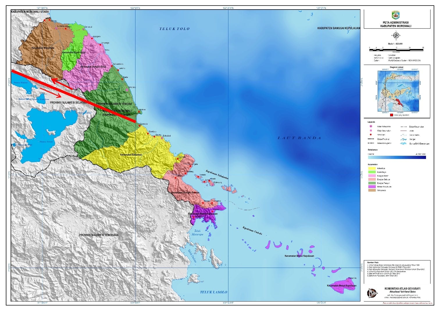
As part of the StIRRRD programme, staff from the Universitas Gadjah Mada (UGM) are working with Morowali BPBD and Action Plan partners to improve knowledge and raise awareness of the risk associated with the Matano Fault. This fault creates a significant hazard for Morowali, cutting right through the district and extending offshore (see figure below). BMKG, Indonesia’s earthquake monitoring agency, estimate that the Matano Fault can generate earthquakes up to around magnitude 7.3.
The Morowali DRR Action Plan, being led by the Morowali BPBD, includes a project to undertake more research on the Matano Fault and the fault’s associated risks. This information will inform planning and development in areas close to the fault and help inform future public education.
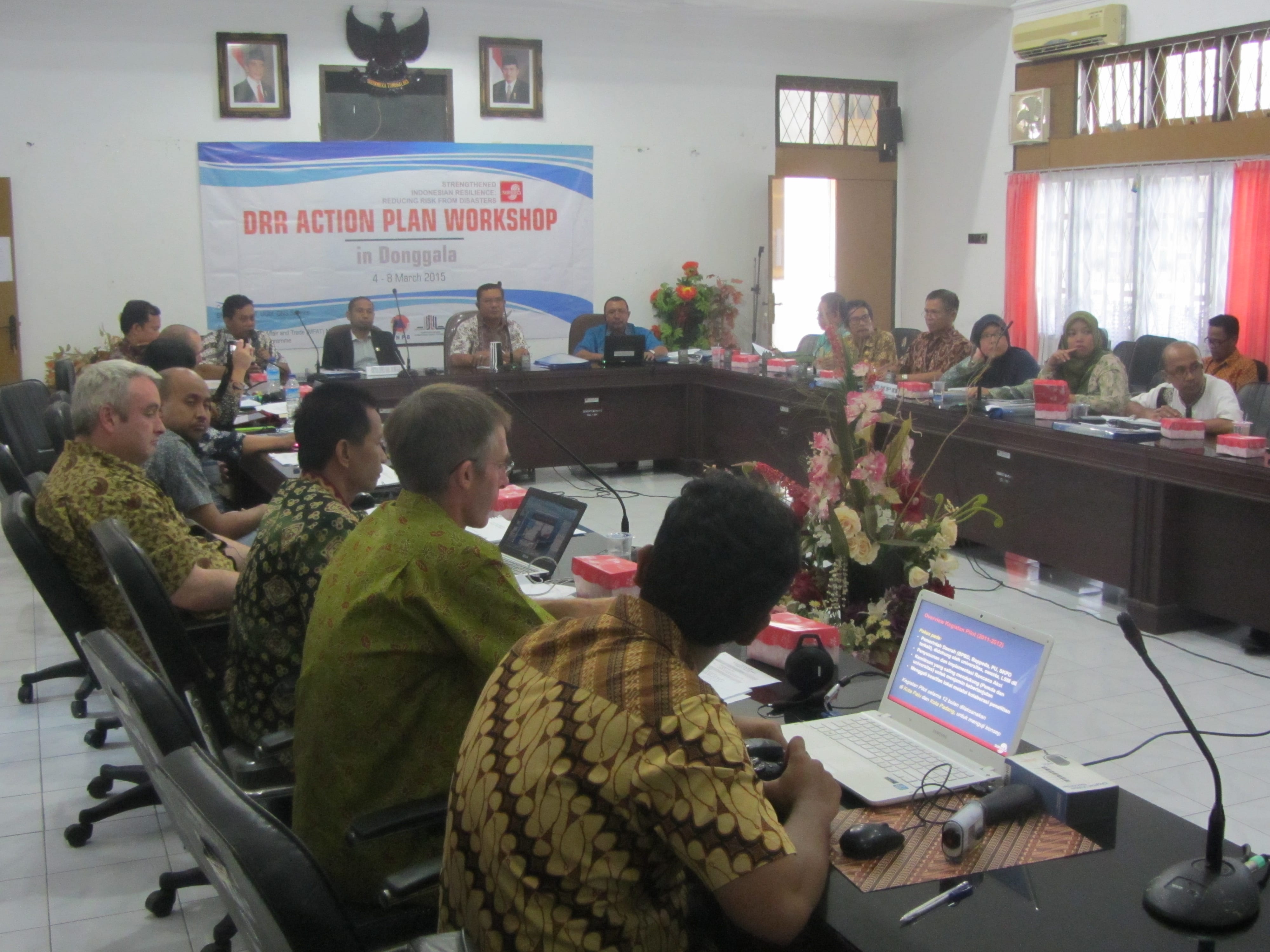
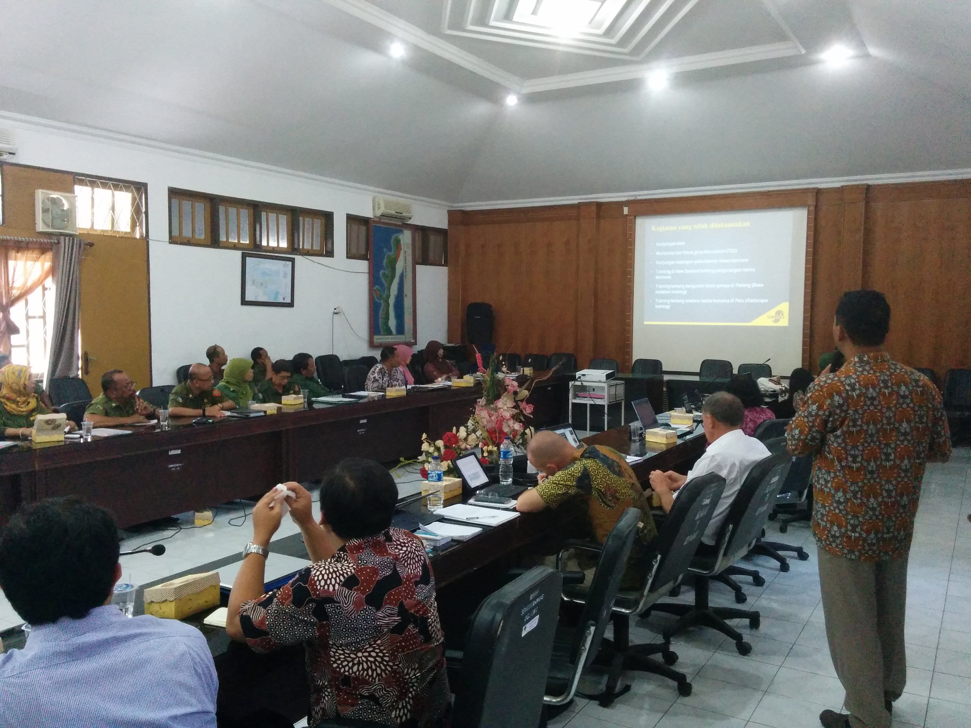
The StIRRRD team were back in Donggala this week on our third visit, supporting the local disaster management agency in its final stages of developing an action plan aimed at reducing risk. Many stakeholders joined the discussion and there will be follow-up workshops to fine-tune the details next week.
The plan is an attempt to coordinate risk reduction activities across different local government work units: development planning, public works, health, disaster management, education, agriculture, environmental management, etc. It also involves and is supported by the local university, Tadulako University, and NGOs.
The plan was presented to Donggala’s parliament which generally supported the workplan. We hope that greater priority will be given to DRR and a greater budget allocated as a result. A robust debate was had about the role deforestation and aggregate mining were having on increasing risk, particularly increasing the frequency of landslides, flooding and coastal erosion. It was great to see the awareness of these issues and local government debating ways of managing these problems. The proof will be in changes over time, one step at a time.
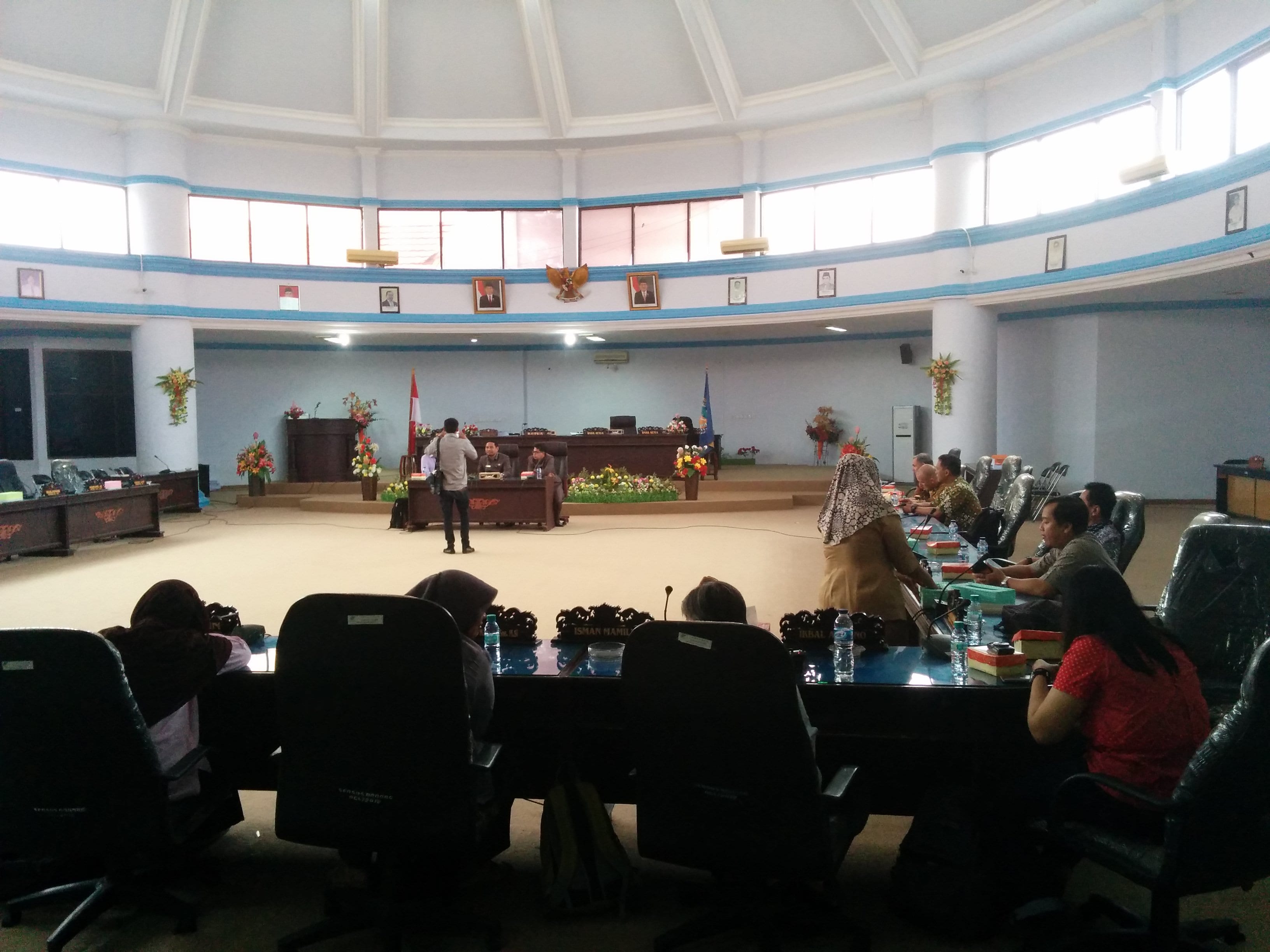
Presenting the Action Plan to Donggala Parliament.
The team also took the opportunity to meet with colleagues from Tadulako University, who are an important stakeholder and who will help local government tackle the DRR challenges in the district. Tadulako are taking initiatives to develop capability in risk modelling and are involving students in capturing building asset data in Palu on tablets in order to better understand the vulnerability of different types of buildings to natural hazards. See an earlier blog on Riskscape training.
As part of the DRR Action Plan workshop held in Seluma, 25–26 August 2015, we had a half-day field visit organised by the local emergency management office (BPBD). It was an opportunity for them to show some of the hazard and risk issues they face. Our party consisting of local government staff and university researchers, set off from Pasar Tais just after 8 am and travelled towards Pasar Seluma on the coast. Soon the tarmac road ran out and gave way to a rolling dirt track worn to rubble, which took us through a cross section of Indonesian life from the bustling town to the gentle padi fields. But the watery green terraces are slowly being eaten by groves of palm oil. Busy villages line the road, hinting at the thousands of people who live in this area near the coast. Initially hidden by the palms a great expanse of beach opens out. Here, we are provided an informative presentation by the head of the Preparedness section of the BPBD, Aziman. He describes how they have recently mapped the tsunami hazard in this region and will be using this map in risk reduction planning going forwards.
He expresses his concerns that although the national government have built a tsunami shelter, it can hold only 3,000 people. There are many villages that line the 70 km of exposed coast of Seluma and he estimates that they would need 10 tsunami shelters to sufficient provide a safe refuge for them all. The drive from Pasar Tais to the beach is across broad flat coastal plain, which makes tsunami evacuation challenging. Vertical evacuation is a sensible option, but the lack of multi-storey buildings means that purpose built structures, although expensive, are the only option.
Following a ‘bread crumb’ trail of tsunami evacuation signs our dusty convoy travelled on to the purpose built tsunami shelter.
Exploring this large structure it becomes clear that it is purpose built. It is a solid, open structure and a ramp and broad stairs enable those who are frail, young or disabled to access the higher floors. Toilets are provided on the third floor and solar panels are in place to provide lighting at night. This is an impressive undertaking, following a national standard and is very similar to the one observed in Kota Bengkulu.
However, the local emergency managers are still waiting for an official handover of the building from the national government before they can start using the building and implementing their community awareness plans. The building could be used as a local community centre, a market, or even a school and this would enable the community to become familiar with the structure and put it to good use.
Click the links here for a videos of a similar shelter in Kota Bengkulu, under construction and finished.
The aim of this second phase is to support the local community to be resilient, enabling them to identify the warning signs of a tsunami and know where to go and when. This outreach is aligned with support for their livelihoods under the “Resilient Village” government program. It is a holistic approach that aims to improve the lives of those living in the area now and in the future.
Tsunami is not the only hazard that impacts this area. The workshop participants have also identified floods, earthquakes and landslides. Participants noted that they are used to the frequent small earthquakes that shake the surrounding countryside, and they rank earthquakes as the biggest threat. The fear of ‘the large one’ is real.
Our final stop demonstrates the power of a frequent and rapid onset hazard – flooding. We visit a small village that last month woke to find devastation on their door step. Overnight heavy rainfall upstream, in the “dry” season, caused the near-by wide and shallow river to swell and overtop its banks. Flood waters up to 4 m in depth swept through the palm oil plantation and three villages were flooded. Despite the flood occurring rapidly, over only 2 hours, no one was hurt but many lost their belongings.
The field trip provided an insight into this districts progress towards resilience. Just like the road we travelled together today, the path of disaster risk reduction is at times rough and slow but the journey is always worth it.
The magnitude M7.1 earthquake located in the Molucca Sea yesterday reminded us of the hazards faced by the Indonesians on a daily basis. Fortunately, at a depth of 46 km, it seems it caused little damage. The closest large city was Mandano which experienced earthquake shaking at about MMIV according to the USGS.
The StIRRRD team was en-route to Jakarta when it occurred,