Category Archives: DRR

Final DRR Seminar 2019 in Yogyakarta

Kegiatan StIRRRD bertujuan untuk mewujudkan pengurangan risiko bencana dan peningkatan kesiapsiagaan di tingkat daerah menuju penguatan ketangguhan Indonesia. Kegiatan ini dilaksanakan atas kerjasama UGM dan GNS Science Selandia Baru serta didukung oleh Badan Nasional Penanggulangan Bencana (BNPB), Kementerian Desa, Pembangunan Daerah Tertinggal dan Transmigrasi (Kemendesa) dan Bappenas. Pendanaan kegiatan ini sepenuhnya didukung oleh Ministry of Foreign Affairs and Trade (MFAT) New Zealand.

StIRRRD dimulai sejak 2011-2012 di 2 daerah pilot yaitu Kota Palu dan Kota Padang. Kegiatan yang dilaksanakan meliputi workshop pemahaman tentang kebencanaan, penyusunan rencana aksi daerah, kunjungan dan pelatihan di New Zealand, serta pemantapan dan implementasi rencana aksi. Dalam pelaksanaannya, kegiatan ini mengutamakan koordinasi dan integrasi berbagai pihak seperti pemerintah daerah, universitas lokal, kalangan swasta, LSM, dan kelompok-kelompok komunitas siaga bencana. Atas keberhasilan kegiatan di daerah pilot, kegiatan ini disetujui untuk dilanjutkan selama 5 tahun dimulai dari tahun 2014 dan berakhir pada tahun 2019. Sebanyak 10 kabupaten/kota dilibatkan dari 4 provinsi, yaitu Sulawesi Tengah, Sumatera Barat, NTB, dan Bengkulu. Selain Kota Palu dan Kota Padang, kabupaten/kota lain yang ikut bergabung diantaranya: (1) Kab. Donggala, (2) Kab. Morowali, (3) Kota Mataram, (4) Kab. Sumbawa, (5) Kota Bengkulu, (6) Kab. Seluma, (7) Kab. Pesisir Selatan, dan (8) Kab. Agam.

Sebagai rangkaian akhir dari kegiatan StIRRRD, pada tanggal 23-25 Juli 2019 diadakan Seminar Nasional Pengurangan Risiko Bencana di Balai Senat Universitas Gadjah Mada. Seminar secara resmi dibuka oleh Kepala BNPB yang diwakili oleh Direktur Pemberdayaan Masyarakat, Lilik Kurniawan. Dalam sambutannya, Kepala BNPB menekankan perlunya pengurangan risiko bencana di tiap-tiap daerah yang salah satunya dengan menjaga kelestarian alam dan lingkungan. Selanjutnya Rektor Universitas Gadjah Mada yang diwakili oleh Wakil Rektor Bidang Kerjasama dan Alumni dalam sambutannya memaparkan penjabaran umum kebijakan UGM dalam memacu perubahan menuju kejayaan peradaban Indonesia, termasuk dalam pengurangan risiko bencana.

Pembicara kunci lainnya yang diundang adalah Duta Besar Selandia Baru untuk Indonesia yang dalam hal ini diwakili oleh Development Counsellor, Sumi Subramaniam, yang memaparkan tentang hubungan erat antara Indonesia dan Selandia Baru dalam berbagai bidang seperti kebencanaan, energi terbarukan, dan pemberian beasiswa. Pembicara kunci lainnya yang juga memberikan arahan penting dalam seminar ini adalah Suprayoga Hadi (Perencana Utama Bappenas), Raditya Jati (Direktur Pengurangan Risiko Bencana BNPB), Hasman Ma’ani (Direktur Penanganan Daerah Rawan Bencana, Kementerian Desa, Pembangunan Daerah Tertinggal dan Transmigrasi), serta Ali Mundakir (Direktur Utama PT. Pertamina Geothermal Energy).

Seminar ini diikuti oleh 200 orang peserta dari pemerintah pusat (BNPB, Kemendesa, Bappenas, PUPR, Kemendagri), Pimpinan Daerah, Ketua DPRD, BPBD dari 70 kabupaten/kota serta provinsi di Indonesia, Bappeda beserta OPD terkait, BASARNAS, berbagai universitas dari seluruh Indonesia, LSM, dan mahasiswa S2/S3. Para ketua pusat studi bencana serta peneliti kebencanaan dari Universitas Andalas (Sumbar), Universitas Bengkulu (Bengkulu), Universitas Tadulako (Sulteng), dan Universitas Mataram (NTB) juga hadir serta memberikan presentasi tentang peran serta perguruan tinggi dalam pengurangan risiko bencana. Seminar ini didukung oleh 7 ahli bencana dari GNS Science Selandia Baru yang memberikan banyak pengetahuan dan tukar pengalaman dalam pengurangan risiko bencana di Selandia Baru, terutama dalam menyusun dan implementasi rencana aksi pengurangan risiko bencana. Acara seminar dilanjutkan dengan kunjungan lapangan untuk mempelajari upaya mitigasi bencana di Bandara Yogyakarta International Airport, serta kunjungan ke shelter tsunami di Kabupaten Bantul.

Atas kerjasama antara Pemerintah Indonesia dan Pemerintah Selandia Baru dengan seluruh pemangku kepentingan yang terlibat dalam pengurangan risiko bencana, maka diharapkan konsep kegiatan StIRRRD dapat menjadi rujukan bagi seluruh pemangku kepentingan, baik di pusat maupun daerah, dalam memperkuat kapasitas di dalam pengurangan risiko bencana, sekaligus dalam membangun ketangguhan Indonesia dalam menghadapi bencana. Peran berbagai pihak (BNPB, Bappenas, Kemendesa, Kemendagri, UGM dan GNS) sangat diperlukan untuk dapat menelurkan gagasan baru serta menjaga keberlanjutan pengurangan risiko bencana berdasarkan capaian-capaian yang telah diraih StIRRRD. Rincian berbagai kegiatan dan dokumen penting yang telah dihasilkan oleh StIRRRD sejak tahun 2011 hingga 2019, termasuk dokumentasi, prosiding, dan laporan Seminar Nasional Pengurangan Risiko Bencana dapat dilihat pada laman web: http://stirrrd.wg.ugm.ac.id/

Dengan akan berakhirnya kegiatan StIRRRD yang telah menghasilkan banyak hal yang diperlukan untuk membangun ketangguhan dan ketahanan bencana di tingkat daerah, maka diperlukan komitmen dari seluruh pemangku kepentingan yang selama ini terlibat, untuk dapat melanjutkan dan terus mengembangkan upaya peningkatan ketangguhan dan ketahanan bencana di masing-masing daerah, sehingga kegiatan StIRRRD akan terus berlanjut melalui prakarsa dan komitmen bersama ke depannya.

Yogyakarta, 25 Juli 2019

Tim StIRRRD

Download:

Proceeding of DRR Seminar_2019

Final DRR Seminar Day 1 – Presentation

Final DRR Seminar Day 2 – Presentation

Documentatation:

Documentation of Final Seminar Day 1

Documentation of Final Seminar Day 2

RiskScape Risk Assessment Tool Workshop at ICUDR Conference in Palu

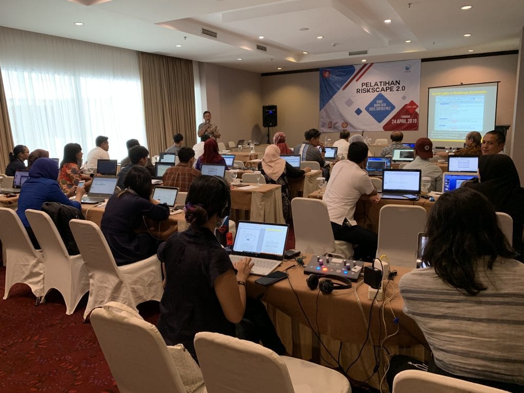
RiskScape 2.0 made its international debut at a workshop preceding the International Conference on Urban Disaster Resilience in Palu, Sulawesi, on 24 April 2019. RiskScape is an impact and loss modelling tool that performs complex calculations quickly and simply, providing outputs that assist in decision-making.

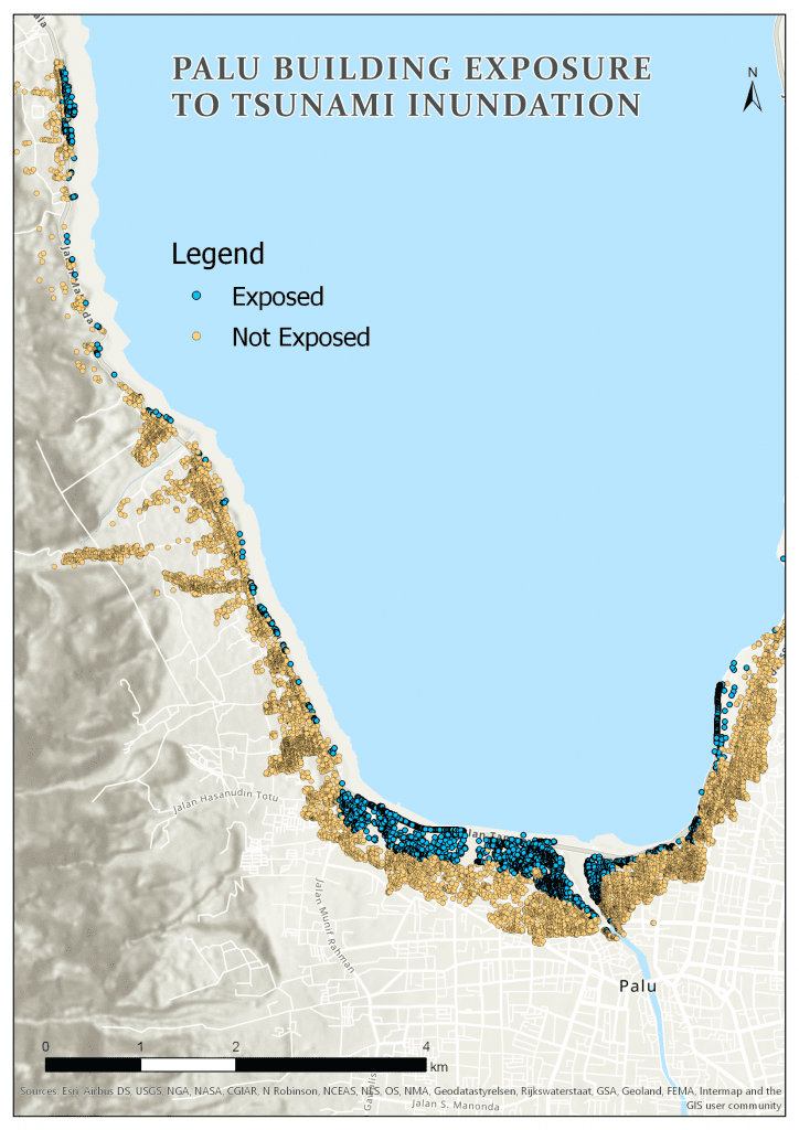
The workshop was a full-day event, covering the concepts of risk and impact modelling, the evolution of RiskScape from version 1 to 2, and using RiskScape 2.0 to assess building impacts from a tsunami affecting the coastal areas of Palu. The tsunami hazard modelling used was an approximation of the inundation extent of the 28 September 2018 tsunami, which devastated the coastal areas of Palu and Donggala. Approximately 30 participants from diverse backgrounds, including the Universitas Tadulako, Universitas Gadjah Mada and Palu City local government, attended the workshop.

PaluTsunamiExposure

Depending on user preferences, the RiskScape software was provided in two languages: English and Bahasa Indonesia. Participants came prepared with their own laptops. The current version of RiskScape is a command line interface, which requires users to type in commands rather than interact with a graphical user interface (planned for development later this year). Despite the learning curve, participants were able to successfully run the software and visualise the results using GIS software.
IMG_3219

The workshop was not only the first time RiskScape 2.0 had been used outside New Zealand, but the first time it had been demonstrated and used beyond the research and development teams. Participants were highly engaged throughout the day, and there was significant interest in how the software could assist with decision-making. The case study of tsunami inundation in Palu served as a useful example of the applicability of the tool to the local context.

Palu and Donggala: working towards resiliency

AP Image
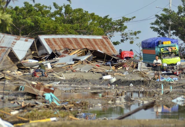
A man stands amid the damage caused by a tsunami in Palu, Central Sulawesi, Indonesia, Saturday, Sept. 29, 2018. [source: Associated Press Photo]
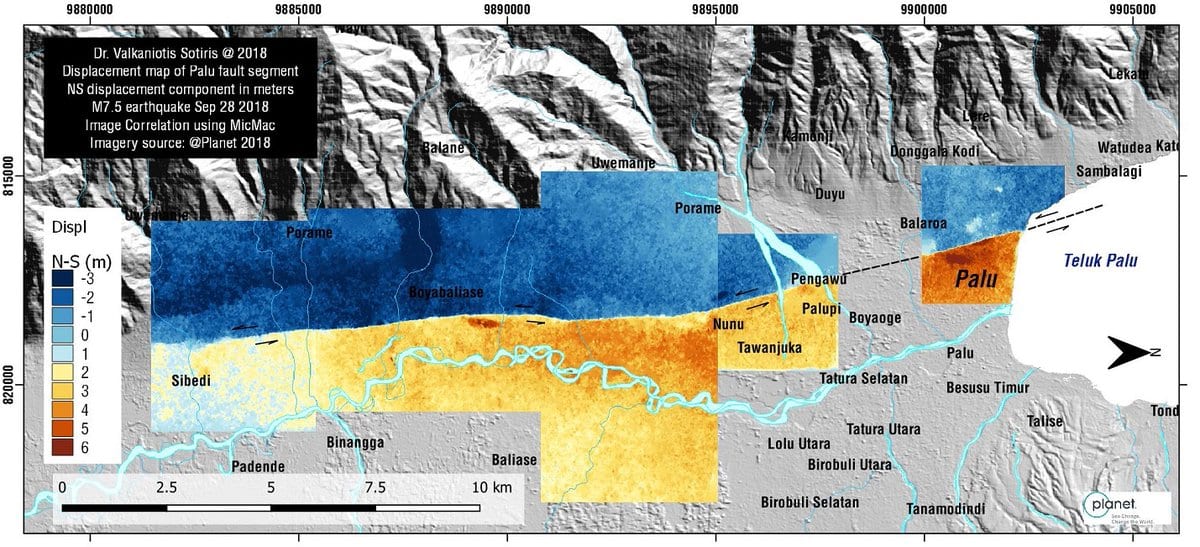
We can only imagine how horrific it currently is for the people of Central Sulawesi, following the magnitude 7.5 earthquake that struck Donggala and Palu on late Friday afternoon 28th Sept 2018.  The damaging tsunami which struck Palu Bay at incredible speeds a reported 30mins after the quake happened, caused wide spread destruction.  This was on top of significant damage due to the earthquakes north of the city and also along the Palu-Koru Fault. Tsunami waves as high as 5.5m crashed ashore in the already damaged city, destroying buildings, smashing vehicles and killing hundreds of people.

Palu and Donggala are both StIRRRD districts and the StIRRRD team have been working in these areas over the past 7 years. We have many colleagues and friends in the community and we wait anxiously for news of how they are.

The team were last in Palu and Donggala in March 2018, installing seismometers in 3 schools in the area plus one at the university. The seismometers are intended as an educational tool to help the students understand the seismology of the area and to stimulate discussions about earthquakes and tsunami; their causes, hazard mitigation, preparedness and response actions. Students learned the importance of natural warnings for tsunami, and how to Drop, Cover and Hold. We hope these discussions in March were able to help those teachers and students with their actions in this event.

The current death toll has exceeded 840 and is expected to rise sharply over the coming days and weeks, leaving the StIRRRD team deeply concerned for our friends and colleagues who we’ve not been able to contact. In addition to the death toll, an estimated 2.4M people have been affected, with six hundred people hospitalised and 48,000 people displaced. The isolation of affected communities and the scarcity of resources is making response efforts difficult.

images
Map and location of Palu and Donggala. [source: The Sun]
The tsunami was bigger than anticipated and the generation mechanism likely more complex than originally thought. The fault that ruptured on Friday was a so-called strike-slip fault, in which the earth movement is largely horizontal. That kind of movement would not ordinarily create a tsunami. However, a strike-slip fault might have some amount of vertical motion that could displace seawater. The fault’s rupture zone, may pass through an area where the seafloor rises or drops off, so that when the fault moves during the quake, it pushes seawater in front of it. Another possibility is that the tsunami was created by an undersea landslide, caused by the intense shaking. Determining the exact cause of the tsunami will have to wait until the sea floor can be examined.  The shape of Palu Bay has no doubt contributed to the size of the waves in Palu, with the waves’ energy being focused (amplified) along the hairpin shaped bay.

DocLj8QW4AEViH7
Map of the Palu-Koru Fault showing the direction of displacement and areas with the greatest shaking.  [source: Dr Valkaniotis Sotiris @Planet 2018] 
In the 7 years the StIRRRD team have been working with Palu, and more recently Donggala, the districts have been making steady progress in improving their resilience. The team have been impressed by the dedication of the local government staff working in this field and Tadulako University’s efforts to improve their teaching programmes.

Palu and Donggala have been working towards the implementation of Risk Reduction Action Plans – a set of actions inspired by NZ and Indonesia working and learning together.  Since they have been introduced, they have resulted in a number of enhancements: expansion of earth sciences and risk modeling at Tadulako University, a new public education programme, micro-zonation studies in Palu, increased budget for risk reduction, the establishment of a spatial mapping capability in the planning department and a collaborative research and awareness raising programme into the Palu-Koru Fault (http://voinews.id/index.php/component/k2/item/2109-palu-koro-expedition-unveils-the-great-earthquake-potential-in-central-sulawesi ).

Tadulako University was also about to host its first international conference on Urban Disaster Resilience in November 2018: (http://fatek.untad.ac.id/icudr/)

It’s still early days, and building resilience requires a sustained effort over generations. This combined earthquake and tsunami event has been devastating. This has always been possible in this part of the world but it’s not what you ever anticipate will actually happen. This will set Palu and Donggala back, but it has redoubled our resolve to work with our friends and colleagues there to   look to the future and ensure risk reduction is built into the recovery process.

IMG_3699
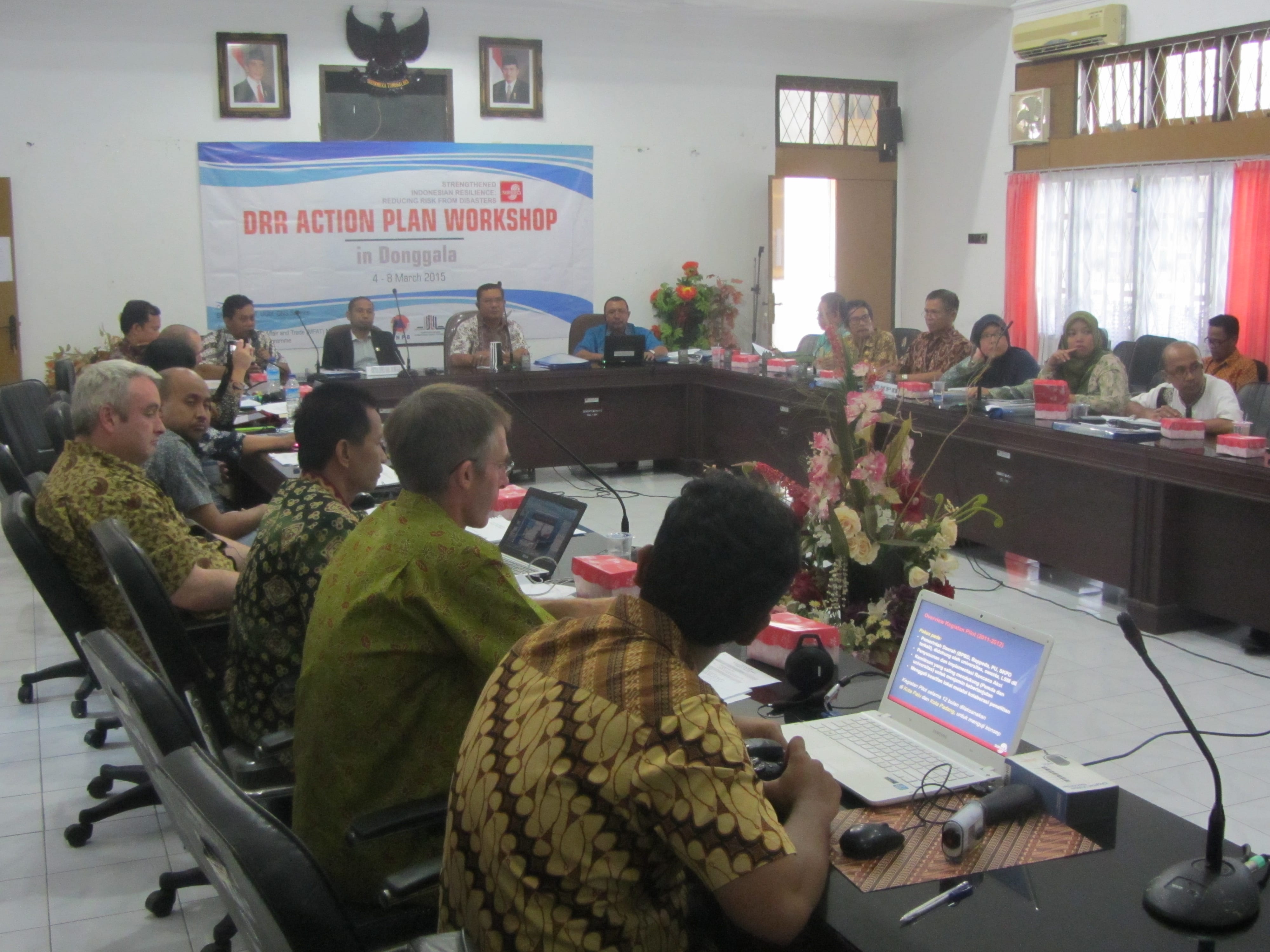
Donggala DRR Action Plan Workshop, March 2015.


Seismometer in Schools Pilot Launched in Central Sulawesi

During the week 5 to 9 March, StIRRRD team members were based in Palu, Central Sulawesi to launch Indonesia’s first Seismometers in Schools (SIS) programme.  Seismometers in Schools is an education initiative already present in Australia, New Zealand and the United States which involves installing seismometers in schools as tools to increase awareness of seismic hazards and risks.  Information from the seismometers can be analysed by mathematics, physics or geography students to assess earthquakes recorded locally or from around the world.

raspberry-shake-original-pi-full-kit-844x844
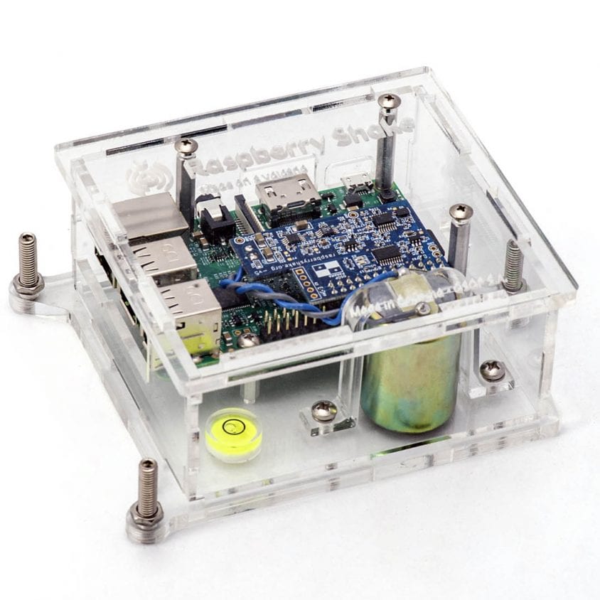
Raspberry Shake seismometers are commonly used in school education programmes around the world.

As a part of the StIRRRD programme, the pilot SIS programme has been established in Central Sulawesi province with seismometers installed in four schools and a more sophisticated three component device installed at the University of Tadulako, Palu.  The participating schools are SMA Negeri Model Terpadu Madani and MAN 1 in Palu City, SMA N 1 Banawa in Donggala and SMA N 1 Bahadopi in Morowali.  Only public schools were selected to be involved in the pilot study.  All installations were undertaken in the first week of March, except for Morowali which will be installed in the coming weeks.

IMG_2072
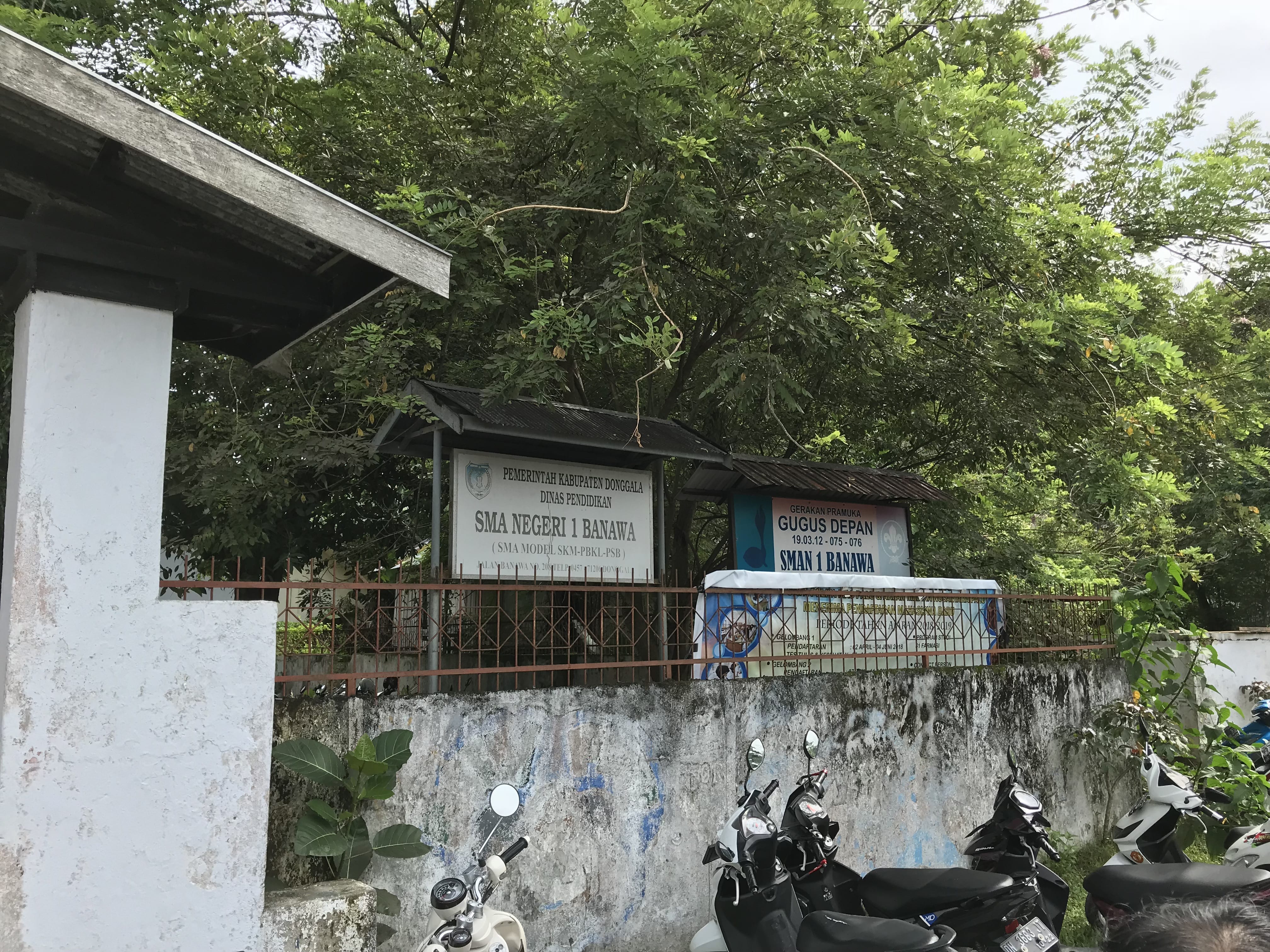
SMA N 1 Banawa school in Donggala

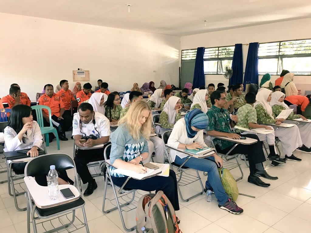
On Monday 5 March, StIRRRD team members visited all schools, in Palu and Donggala, to begin installing the equipment and meeting the school principals and teachers.  The team were warmly welcomed to all schools with teachers expressing gratitude and excitement that their schools were chosen to be a part of the project.  In the following days, installation of the equipment would be completed in each school and training workshops for teachers to increase their knowledge of earthquake and tsunami risks were undertaken.

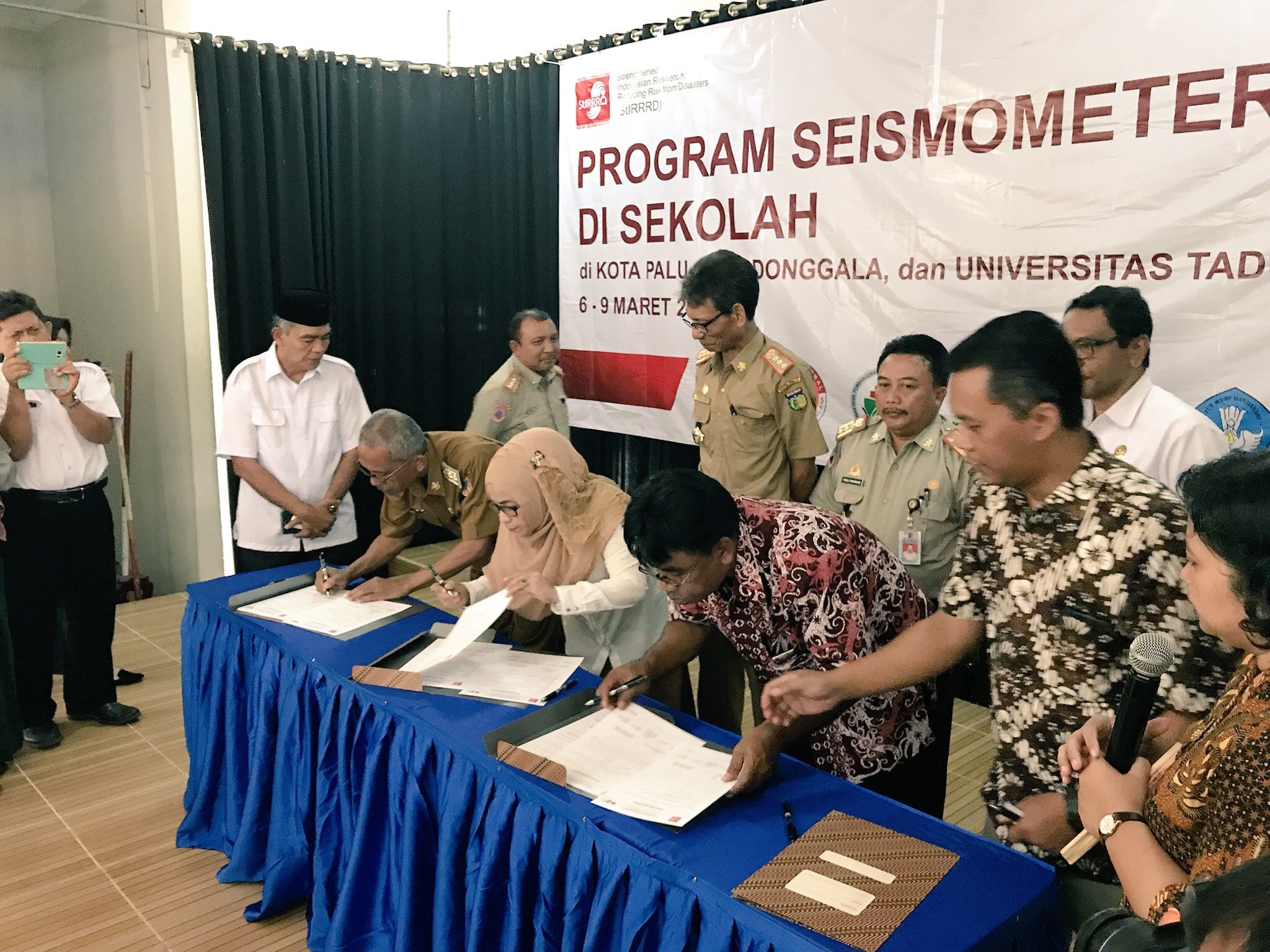
Importantly, the project has been supported by a range of Indonesian agencies willing to assist the schools with technical support and further training.  Their commitment was recognised in a MoU signing ceremony on 5 March.  The agencies signing the MoU include:

  • Palu’s local university – Universitas of Tadulako (UNTAD)
  • The provincial office of the national seismic monitoring agency – Kantor Stasiun Geofisika Palu (BMKG)
  • The local emergency management offices – BPBD Kota Palu & BPBD Kabupaten Donggala
  • The provincial office of the national education office – Dinas Pendidikan Provinsi Sulawesi Tengah­­­­­
  • The provincial office of the national Ministry of Religion – Kakanwil Kemenag Provinai Sulawesi Tengah
IMG_2261
Principals from SIS schools in Palu and Donggala sign the MoU with other agencies
WhatsApp Image 2018-03-08 at 4.47.46 PM
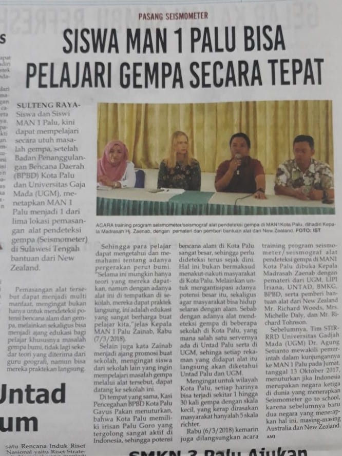
Local Palu newspaper report detailing the SIS pilot activity

All agencies were very enthusiastic about the SIS programme and agreed to help with technical assistance, further capacity building for teachers, help with assessing earthquake traces and providing ideas on how students might develop future projects.  This enthusiasm was further reflected by the extensive media coverage the project received during the week in Palu, some which can be found here:

http://www.kailipost.com/2018/03/ancaman-palu-koro-dalam-konteks-sekolah.html

https://paluekspres.fajar.co.id/deteksi-getaran-palu-koro-terpantau-7-seismometer/

https://paluekspres.fajar.co.id/program-seismometer-di-sekolah-ajarkan-tentang-gemp

IMG_2141
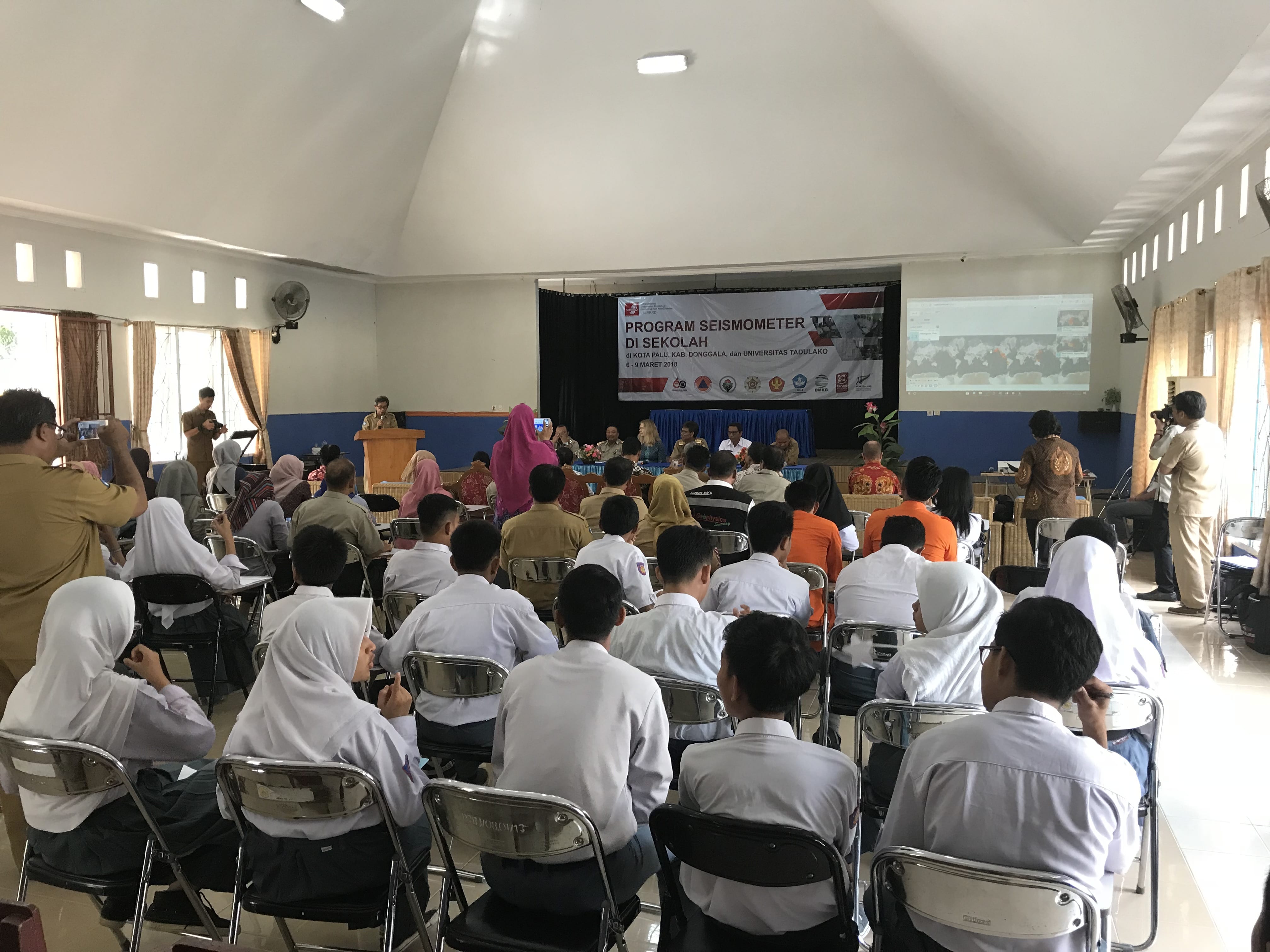
Opening ceremony and morning session at SMA Negeri model Terpadu Madani school, Palu

On Tuesday 6 March, the StIRRRD team visited SMA Negeri Model Terpadu Madani where an initial ceremony was followed by an overview of local seismic hazards and risks and capacity building for teachers and a group of selected students.  This session was largely delivered by Universistas Gadjah Mada (UGM), StIRRRD team members and a representative from LIPI – Indonesia’s Institute of Science.  Teachers and students were highly engaged during the session, while enjoying New Zealand chocolate for answering questions correctly, which was followed by a visit to the recently installed seismometer.  In the afternoon, members of the StIRRRD team led targeted training session for the teachers with input from the agencies noted above.  A demonstration of how the seismometer works by a technician from GNS Science was well received and ideas for future student projects was discussed with teachers.

IMG_2262
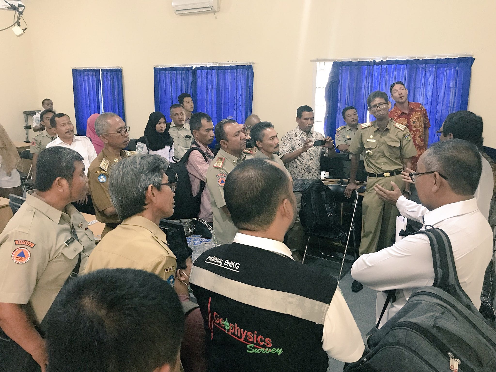
The Head of Central Sulawesi BMKG and GNS Science technician, Richard Johnson, demonstrate a seismometer and equipment to the school principals and partner agencies

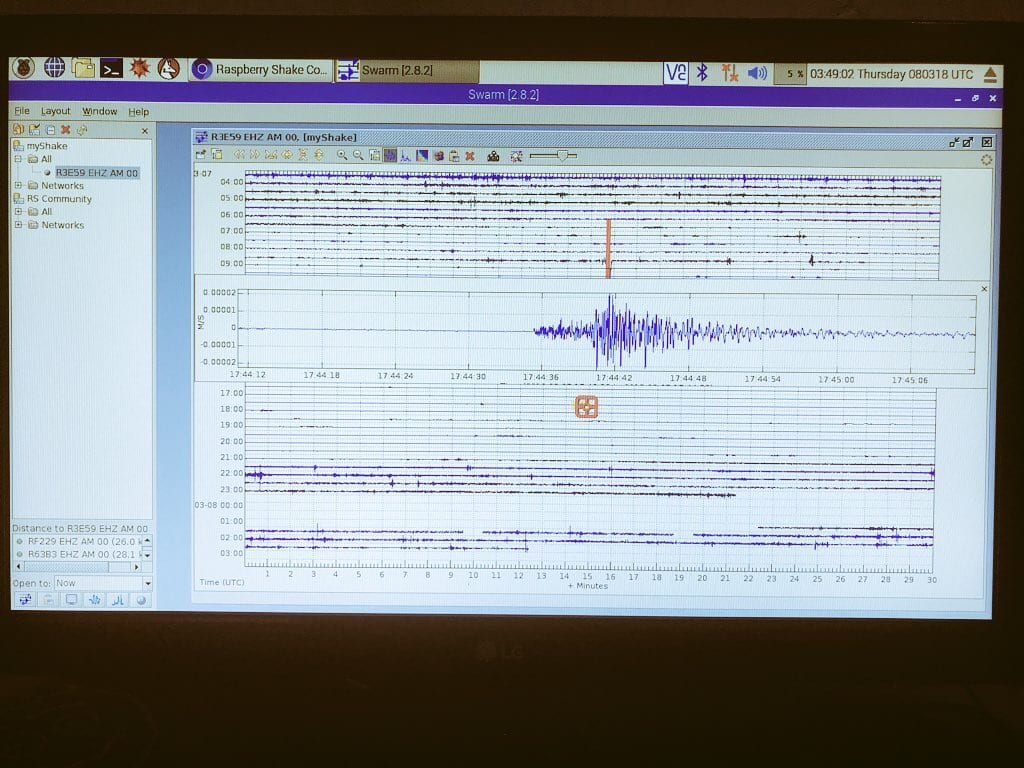
The same programme was delivered to MAN 1 in Palu City and SMA N 1 Banawa in Donggala on 7 and 8 March respectively.  A highlight was returning to Donggala on Thursday and discovering that their seismometer had already detected its first earthquake the night before!  The last seismometer to be installed in SMA N 1 Bahadopi school in Morowali will happen in coming weeks by UGM staff and technicians assisted by BMKG.

IMG_2401
SMA N1 Banawa school in Donggala recorded their first earthquake on the recently installed seismometer

All of the seismometers are now part of the global raspberry shake seismic network with real time data from each of the devices available here: http://raspberyshake.net/stationview

On Friday 9 March, the team completed the installation of a more sophisticated three-component seismometer at the Universitas of Tadulako (UNTAD).  This device will support future research projects on the seismicity of the area and provide further data for the local Palu-Koro Fault seismic network managed by BMKG.

IMG_2415
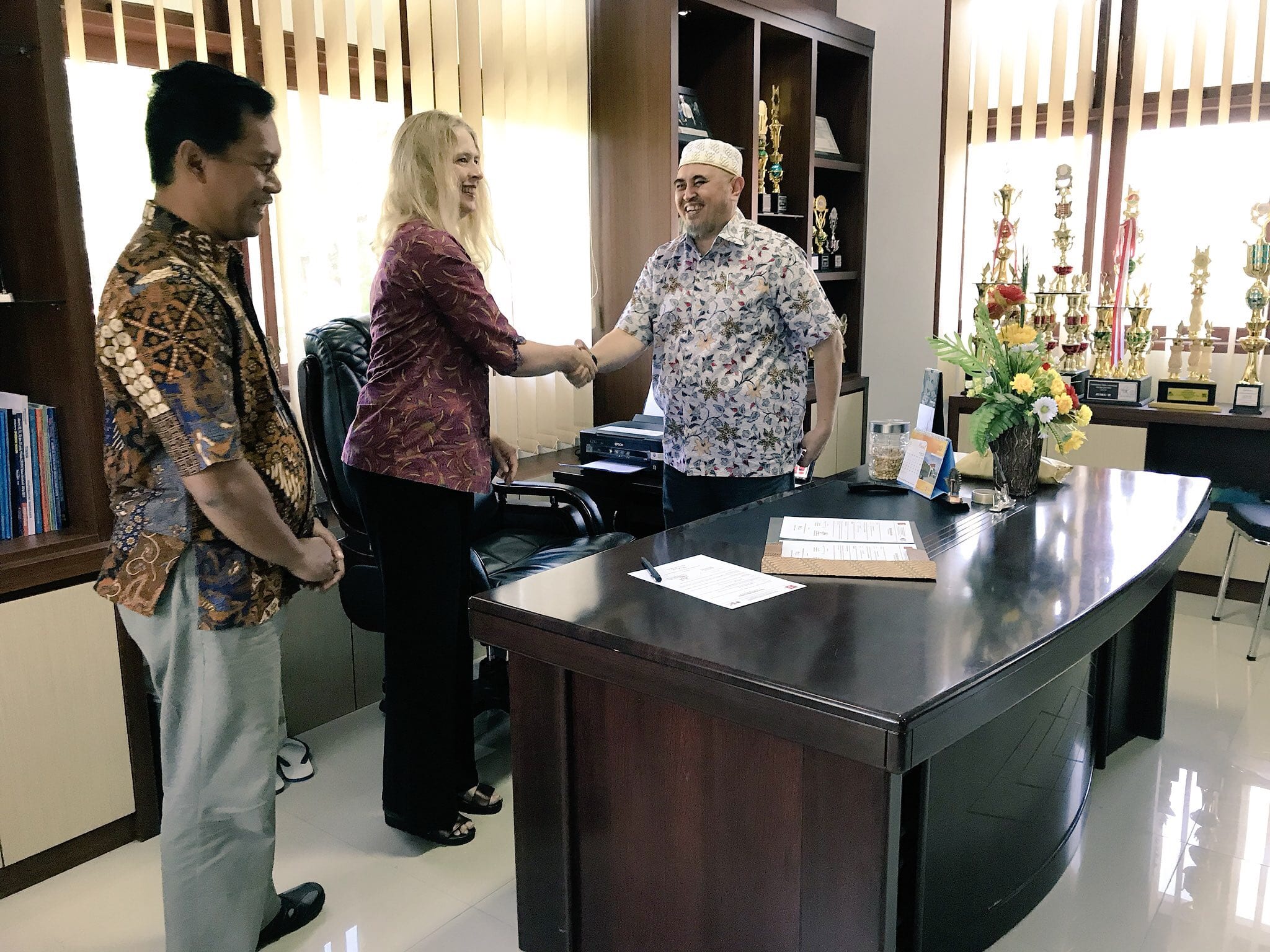
The Dean of Engineering from UNTAD with StIRRRD team members Michele and Pak Agung

That morning, StIRRRD team members met with the Dean of the Engineering and faculty staff to sign an MoU between UGM and UNTAD in support of the Seismometers in Schools programme in Central Sulawesi.  There was much discussion on the disaster management international conference that UNTAD will host in November.  The conference will coincide with the final evaluation of the SIS pilot project and StIRRRD team will have a very active presence at this event, including having a key note speaker.

Overall, there was a lot of excitement about the new seismometers and opportunities to increase the capacity of teachers and knowledge of the high seismic risk present in Palu and Donggala.  This interest was reflected with high engagement across social media (Twitter) with the national emergency management ministry (BNPB), the New Zealand embassy in Jakarta and the Universitas of Tadulako regularly liking and retweeting @StIRRRD tweets throughout the pilot deployment.  Globally, organisations such as the Raspberry Shake Seismometer network (based in Panama), Australian SIS project, the IRIS earthquake programme (based in Washington) and the British Geological Survey seismology project were also very engaged by commenting, liking and retweeting our posts all week!

Tweets
Twitter activity from @StIRRRD during the installation week

National DRR Month Event: Sorong, West Papua

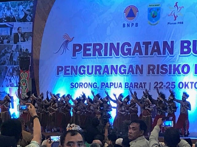
StIRRRD team members and representatives from across StIRRRD districts attended the national DRR month event held in Sorong, West Papua on Monday 23 and Tuesday 24 October.  The Monday morning consisted of an opening ceremony and speeches by dignitaries including an update on the BNPB forward work programme from Willem Rampangilei, Head of BNPB.

Traditional Dancing
Traditional dance at Opening Ceremony

During the afternoon, StIRRRD hosted a special session on DRR and international cooperation.  Chaired by StIRRRD UGM team members, two sessions were held with a focus on cooperation at the national level and international assistance with DRR implementation in the districts.  Presenters at the respective sessions included:

  • Session 1
    • Sumedi Andono Mulyo, Director of Disadvantaged Areas, Transmigration and Rural Areas, BAPPENAS
    • Richard Woods, Natural Hazards Risk Management Specialist, GNS Science
    • Lilik Kurniawan, Director Disaster Risk Reduction, BNPB
2
StIRRRD special session speakers.  Left to right: Lilik Kurniawan (BNPB), Richard Woods (GNS Science), Sumedi Andono Mulyo (BAPPENAS) and session host Tueku Faisal Fathani (StIRRRD).

Presentations from Pak Lilik (BNPB) and Pak Sumedi (BAPPENAS) discussed their respective DRR work programmes.  Of note, Pak Sumedi discussed the strong alignment between the StIRRRD programme and BAPPENAS work programme over the next few years.  In addition, he highlighted the potential for future collaboration on modelling the economic impact of disasters for cost-benefit analyses using existing New Zealand economic models.

  • Session 2
    • Akris Mohamad Yunus Fattah, Head of BPBD, Donggala
    • Selupati SH, Head of BPBD, Bengkulu
    • Drs Zainal Abidin, Head of BPBD, Sumbawa
    • Henry, BPBD Head of Prevention and Preparedness, Padang
4
StIRRRD special session speakers.  Left to right: Henry (BPBD Padang), Drs Zainal Abidin (BPBD Sumbawa), Selupati SH (BPBD Bengkulu), Akris Mohamad Yunus Fattah (BPBD Donggala) and session host Wahyu Wilopo (StIRRRD).

The presentations from BPBD in Donggala, Bengkulu, Sumbawa and Padang provided insights into the strengths and challenges that each district has faced during action plan implementation.On the morning of 24 October, StIRRRD director Teuku Faisal Fathani presented on lessons and good practice from the implementation of early warning systems to detect land movement.  Pak Faisal presented alongside the Chairman of Mat Peci, Usman Firdaus and Medi Herlianto, BNPB Director of Readiness.

6
Tueku Faisal Fathani (UGM – StIRRRD) presents on best practice early warning systems for land movement detection.


DRR action plan activities progressing well in Morowali, Central Sulawesi

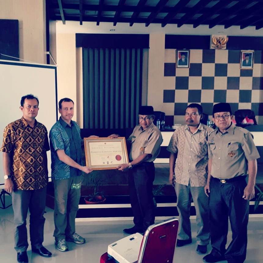
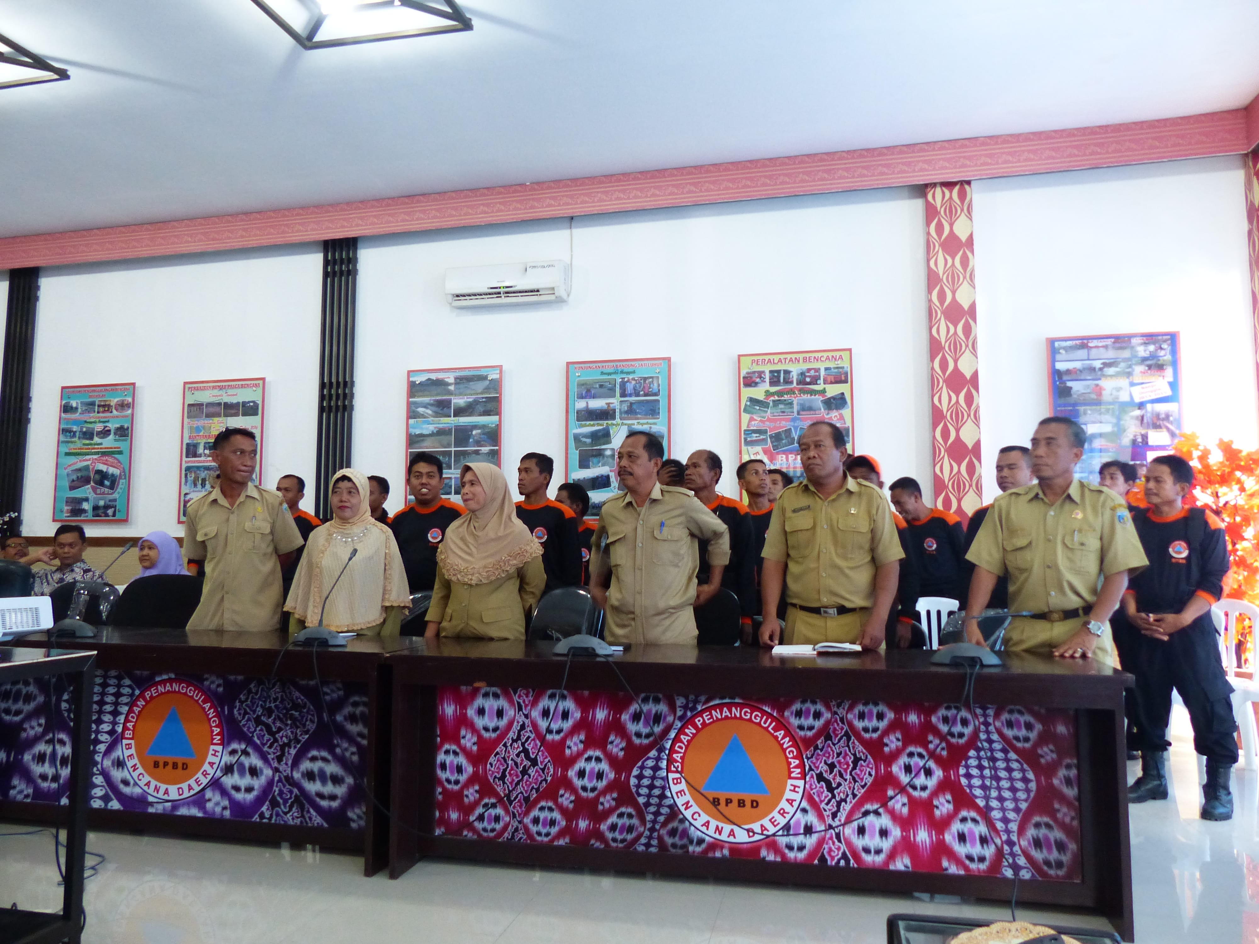
As part of the coaching and mentoring phase, StIRRRD team members visited Morowali on 14 and 15 August.  This was a good opportunity to meet Pak Nafsahu, the new head of BPBD, and congratulate the district on graduating stage one of the StIRRRD programme.  On Monday morning, the team met with staff from BPBD to discuss action plan progress where Pak Nafsahu reiterated the strong support Morowali has for StIRRRD.  That afternoon the District Secretary was presented with a graduation certificate, commemorating Morowali’s graduation of StIRRRD phase one followed by a DRR training session for staff from many local government departments.

IMG_1296
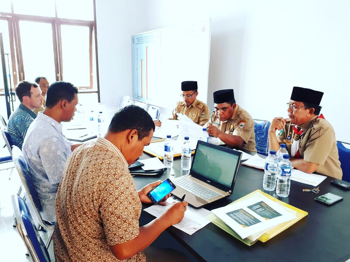
StIRRRD team members meet with BPBD staff
IMG_1297
Morowali phase 1 graduation ceremony

Morowali has made significant progress on action plan activity implementation since the last visit in March, highlights include:

  • The implementation of a text based warning service partnering with BMKG, Telkomsel and Indosat. Morowali was the first district in Indonesia to pilot the implementation of this successful public-private initiative.
  • A disaster management plan was commissioned with the support of BNPB.
  • A district specific risk assessment has been conducted and is being reviewed by BNPB. This document specifically identifies the Matano Fault risk where the fault location is being used to inform spatial land use plan boundaries.
  • A response coordination facility has been erected on Sombori Island.
  • Multiple physical works, to reduce the impacts of flooding and coastal waves, have been constructed across the district.
IMG_1313
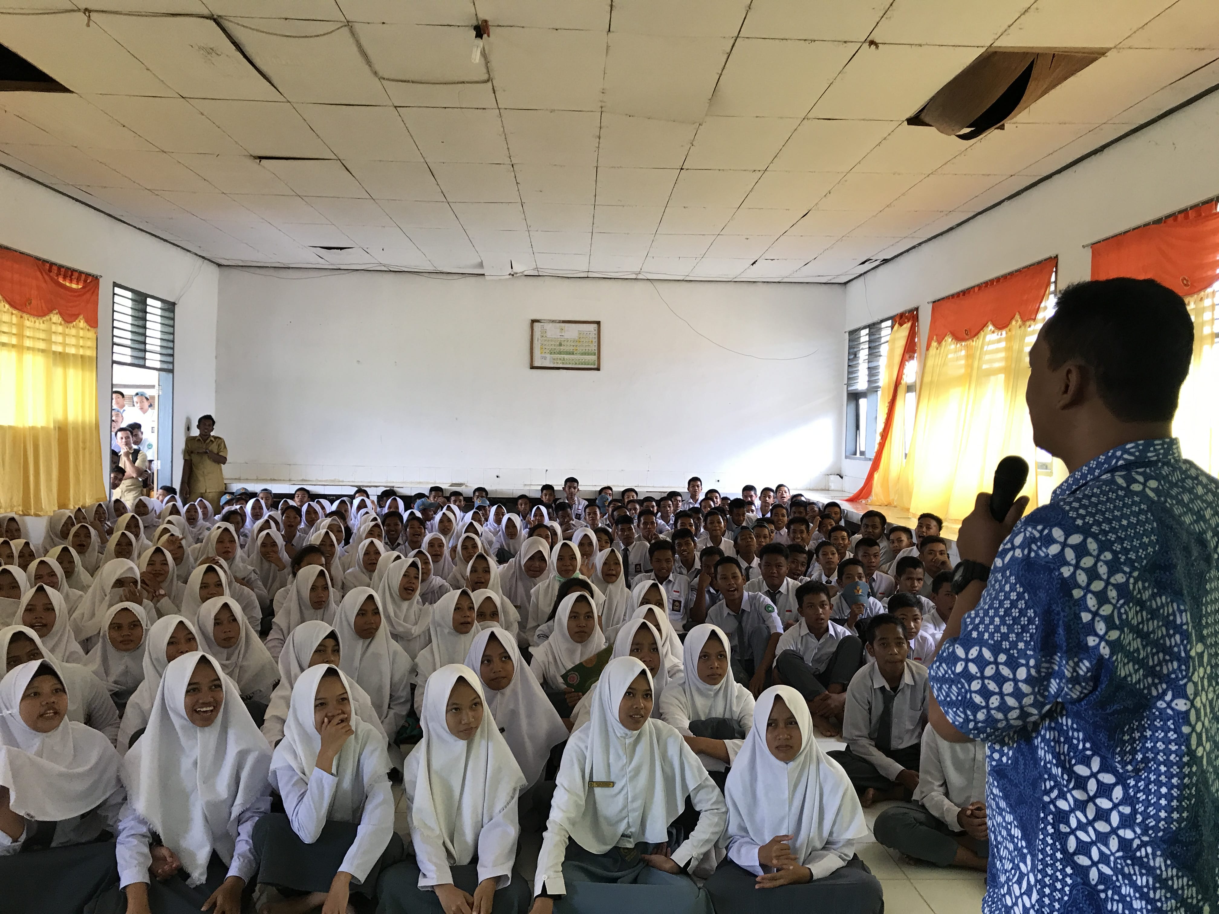
StIRRRD team members discuss DRR activities at a secondary school in Bahadopi Village
IMG_1318
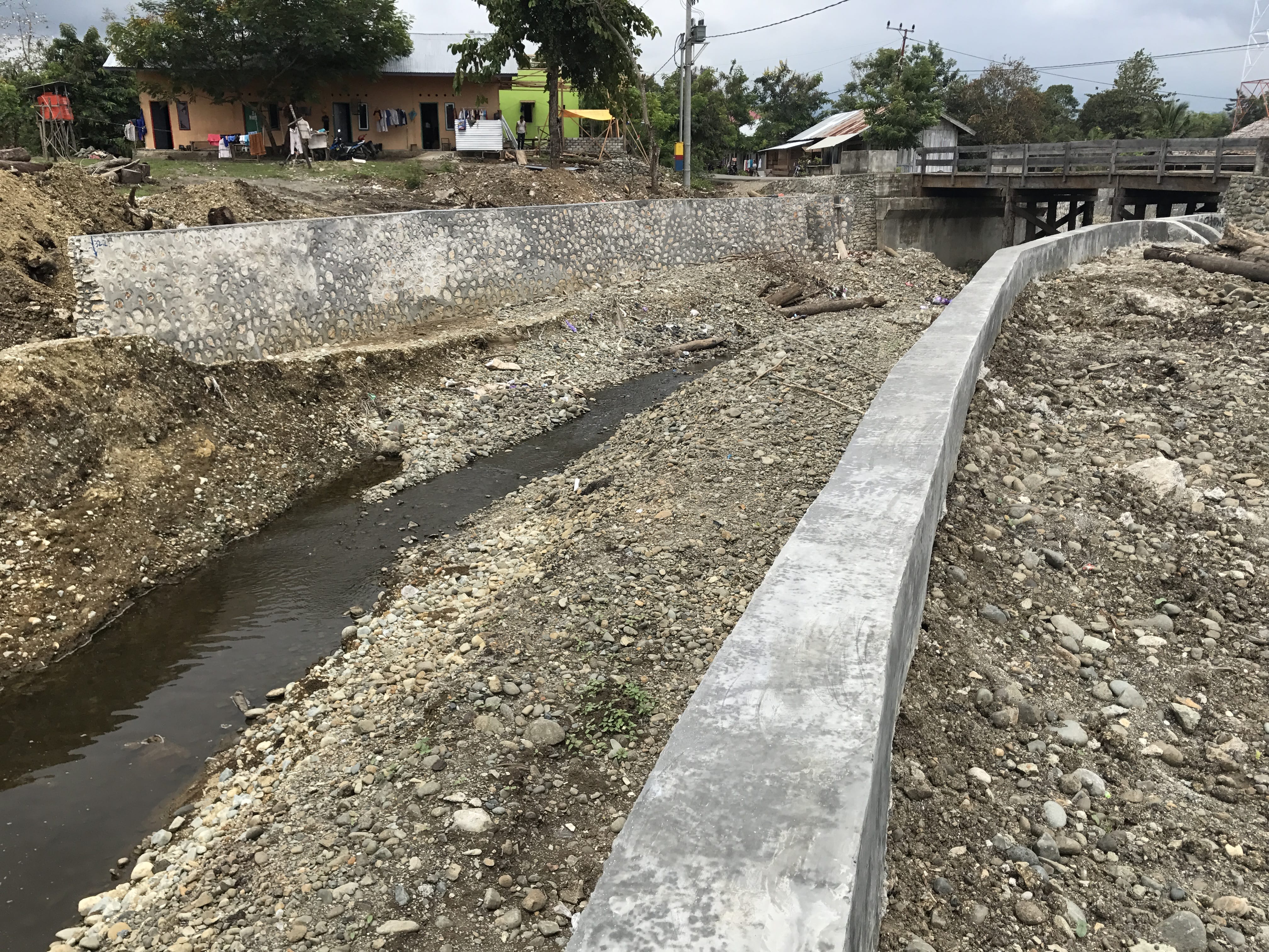
Recent river work improvements to reduce flooding in Bahadopi village

AUGUST EARTHQUAKE SHAKES BENGKULU

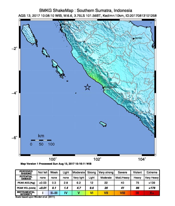
At 10:08 am on Sunday 13 August, a magnitude 6.4 earthquake occurred off the coast of Sumatra, about 75km to the west of Kota Bengkulu (Figure 1). The earthquake occurred at a depth of around 35 km, and resulted in strong shaking in the Bengkulu and Seluma districts. The earthquake was felt as far away as Padang and South Sumatra but did not generate any tsunamis.

In North Bengkulu (the area closest to the quake) strong shaking was felt for about 10 seconds, causing some panic amongst locals. The most common response was to quickly move outdoors. Some minimal damage to buildings was observed, but there were no reports of casualties. The earthquake resulted in power outages in some parts of the district.

Bengkulu BPBD activated in response to the event, with staff undertaking field checks, and reporting for duty if a wider response was required. They were stood down later in the day.

Bengkulu
Figure 1  Map showing the location of the earthquake and modelled shaking intensities. Source: http://www.bmkg.go.id/gempabumi/gempabumi-terkini.bmkg

There is significant seismic risk for many communities on the island of Sumatra, and the districts involved in the StIRRRD program have included a number of activities in their DRR Action Plans to better understand and reduce this risk. StIRRRD alumni are also working on a range of other seismic risk reduction activities. For example, at the University of Bengkulu, Dr. M. Farid is working to understand and map liquefaction hazard; and Universitas Andalas (Padang) staff are trialing a method to retrofit un-reinforced brick buildings with wire mesh, to improve their ability to withstand seismic shaking.

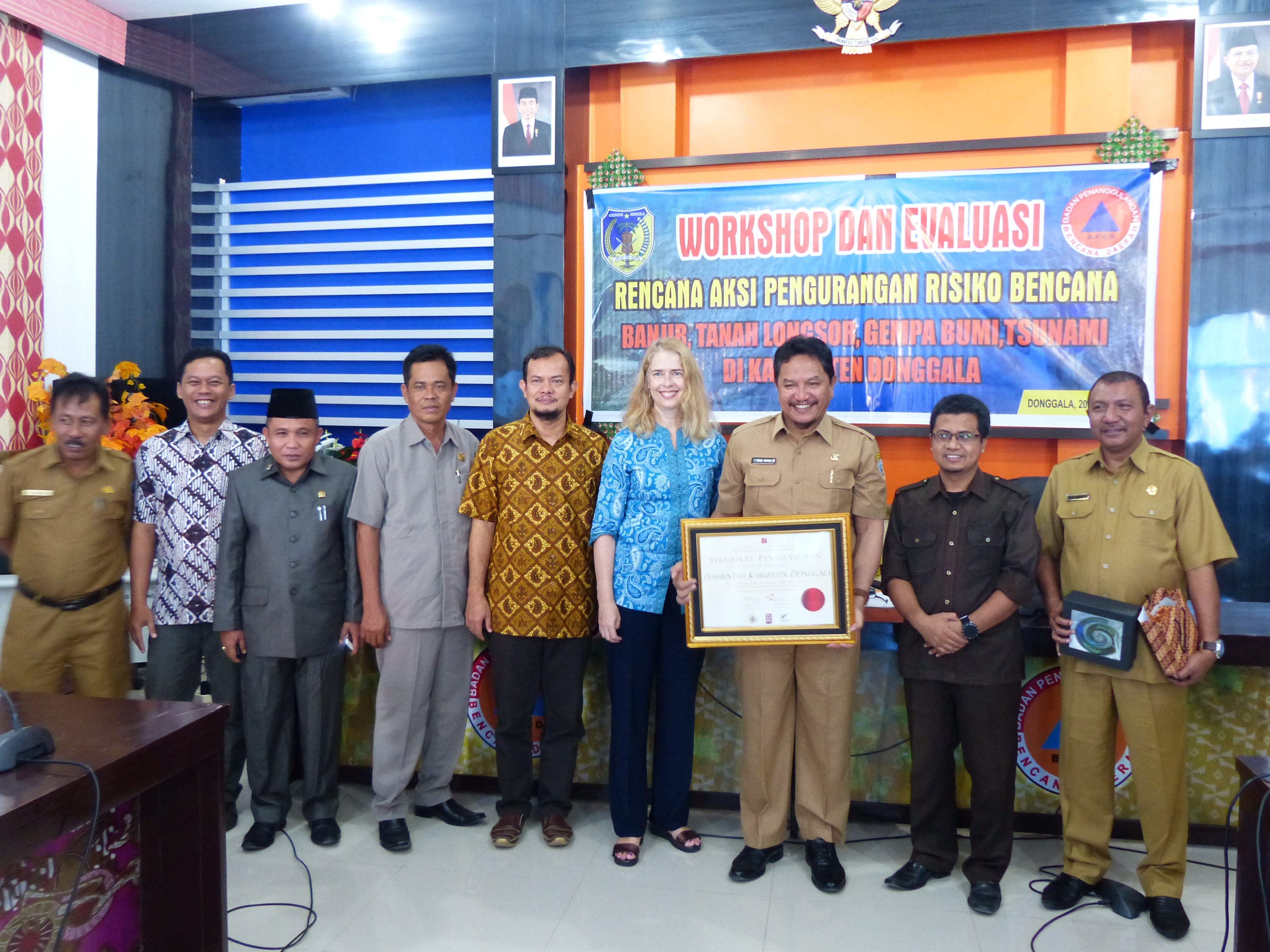
DRR Action Plan Progress in Donggala

As part of the StIRRRD team’s ongoing monitoring and coaching role, during March we visited all districts to gauge their respective progress and where possible, provide support and advice for building on the initial success of the program. In this blog we describe some of the highlights from our visit to Donggala, Central Sulawesi.

Welcome back to Donggala

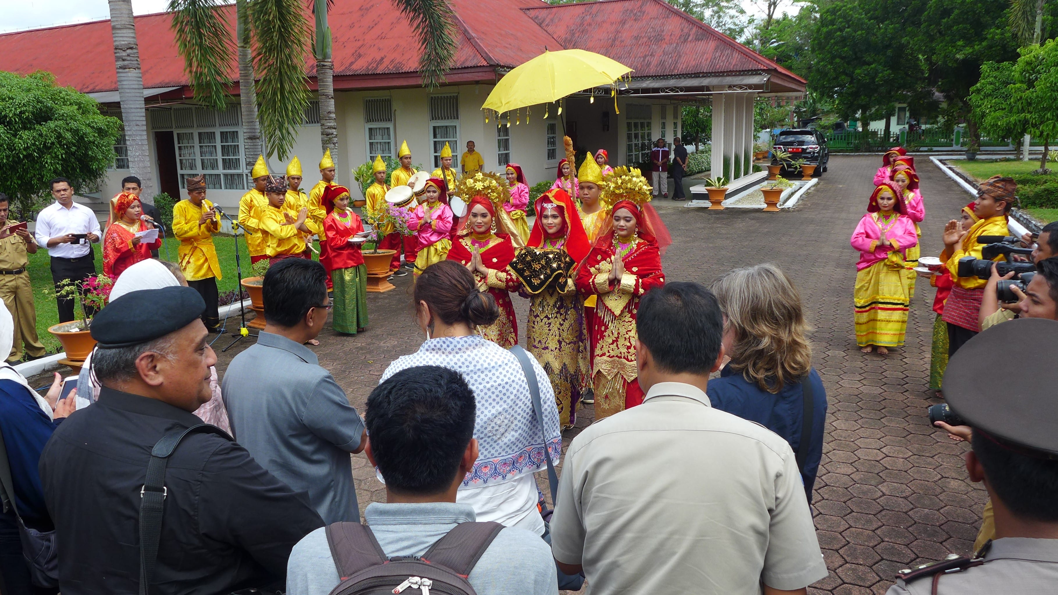
As the StIRRRD programme moves from phase 1 (plan development and training) to phase 2 (implementation and monitoring), districts are presented with a certificate and small NZ-themed gift to recognise their progress.  To mark this occasion, BPBD arranged a ceremony to welcome the StIRRRD team back to Donggala and provided a rousing rendition of the Indonesian national anthem as well as BNPB’s national disaster theme song.

Action Plan Progress

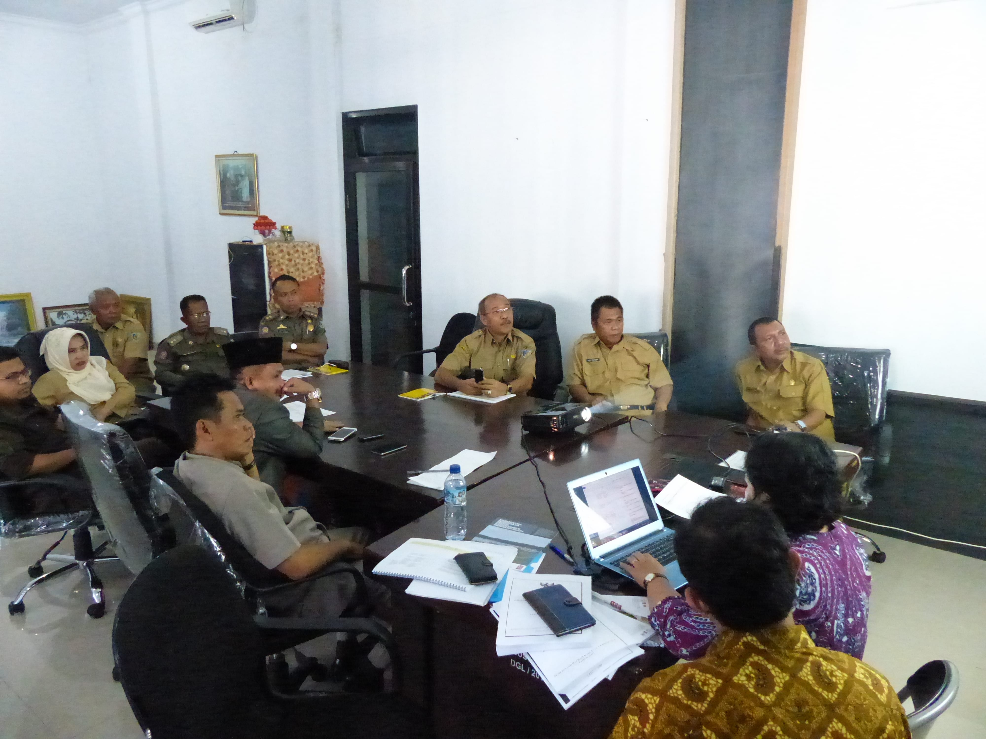
During the morning of 20 March, a workshop was held which included the Secretary Head of District, emergency management, public works and other local government staff to discuss implementation progress in Donggala.  During this session, it was clear the district has made good progress on policy reviews which now include DRR objectives, while further opportunities to align existing socialisation programmes with Action Plan activities were also identified.

P1080477
Members of the Donggala and BPBD and the StIRRRD team

An update of Donggala’s 2010 building regulations has been conducted and were re-published in 2015.  The new regulations now require that new buildings are designed to be ‘earthquake resilient’.  The local government spatial planning office is undertaking a programme for the implementation of ‘earthquake resilient buildings’ in both existing and new development areas.

At the workshop, senior representation from a range of stakeholders, identified the potential for further synergy between work programmes where this was previously not recognised.  For example, the local government Head of Social Agency has identified planned programmes that will now be aligned with BPBD’s socialisation activities.  In addition, the local government Head of Environment Agency provided substantial discussion on the probable exacerbation of flooding and impact on water resources from mining activities.  These discussions provide a strong platform to align existing work programmes with Action Plan activities in Donggala.

Action Plan Forward Plan

During the afternoon, the Action Plan and discussion points from the morning’s workshop were discussed in detail with the emergency management office; as custodians of the Action Plan.  At this session, it was important to have not only the Head of BPBD but each BPBD Division Head, Readiness and DRR, Logistics, Rehabilitation and Reconstruction and BPBD staff to review the Action Plan.

P1080455
Heads of local government departments and stakeholders discuss Action Plan progress

Vision Matauranga visit to Agam

A recent GNS Science project involved a small team of Maori community leaders visiting the Agam Regency in West Sumatra, Indonesia.

P1200842
The team are welcomed to Agam Regency, with the pasambahan dance ceremony

The purpose of the journey was to exchange cultural knowledge and experience of natural disasters between representatives of Maori and the local Minangkabau people of Agam . Maori participants included Tui Warmenhoven and Jean Palmer of Ng?ti Porou and Robyn Rauna, Ng?i T?manuhiri all from the Gisborne District, and Joe McLeod of Te Pringa O Te Awaikairangi in Lower Hutt. Accompanying the visitors were Phil Glassey and Julian Thomson from GNS Science, Dr Megan Collins, a musicologist who has extensive knowledge of the local Minangkabau culture indigenous to Agam, along with Drs Esti Anantsari and Arry Retnowanti from University of Gadja Mada (UGM).

P1210008
After a traditional ceremonial greeting by the Regent, the first location of our visit was the Tiku community on the Agam coast. The people here depend largely on fishing for their livelihoods. They are also subject to a serious tsunami hazard as the coastline faces a major plate boundary fault.

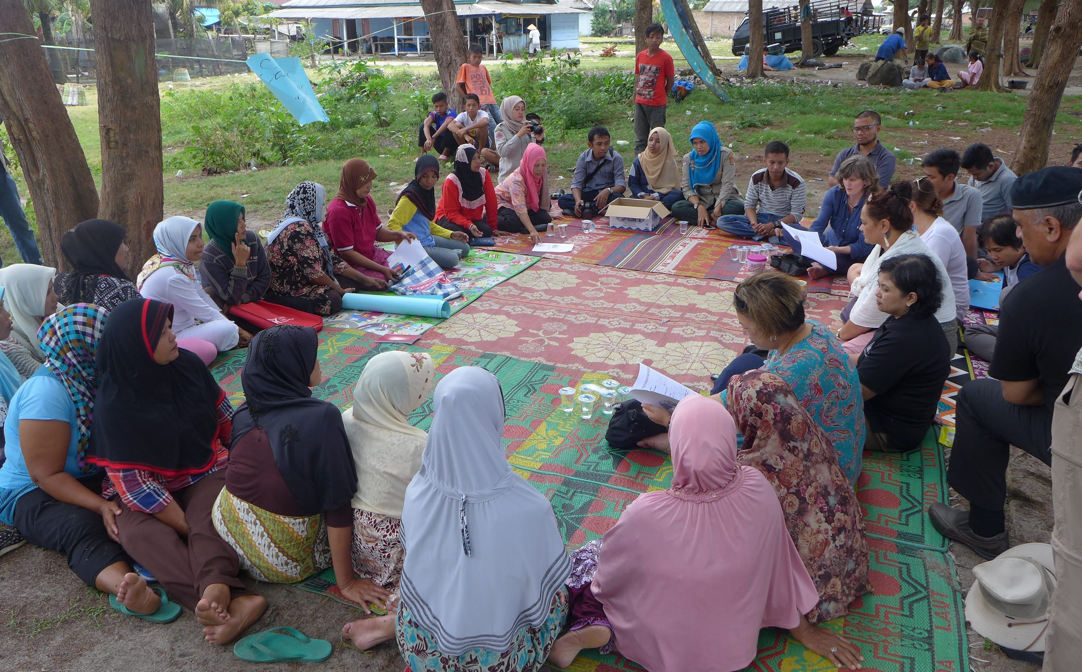
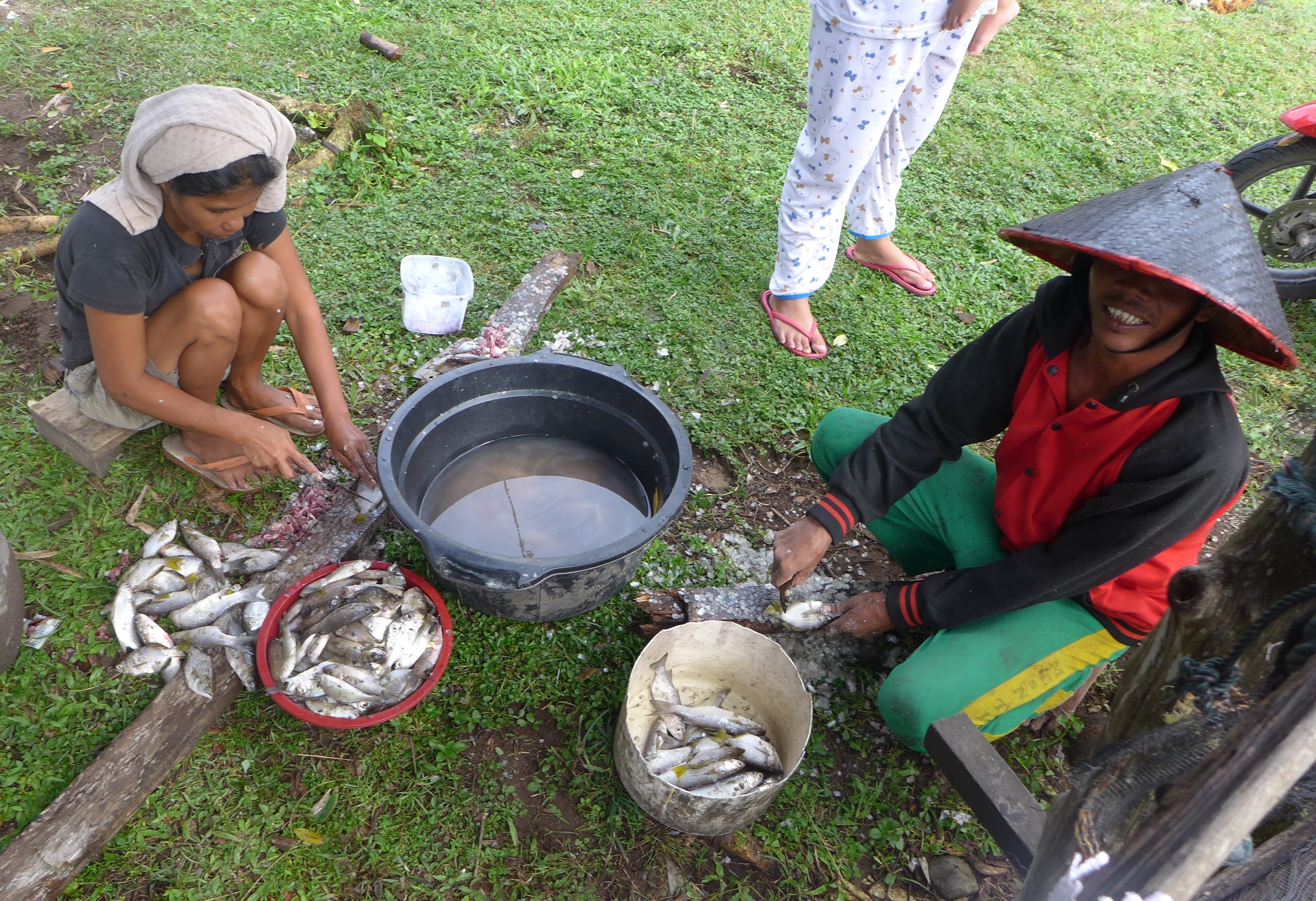
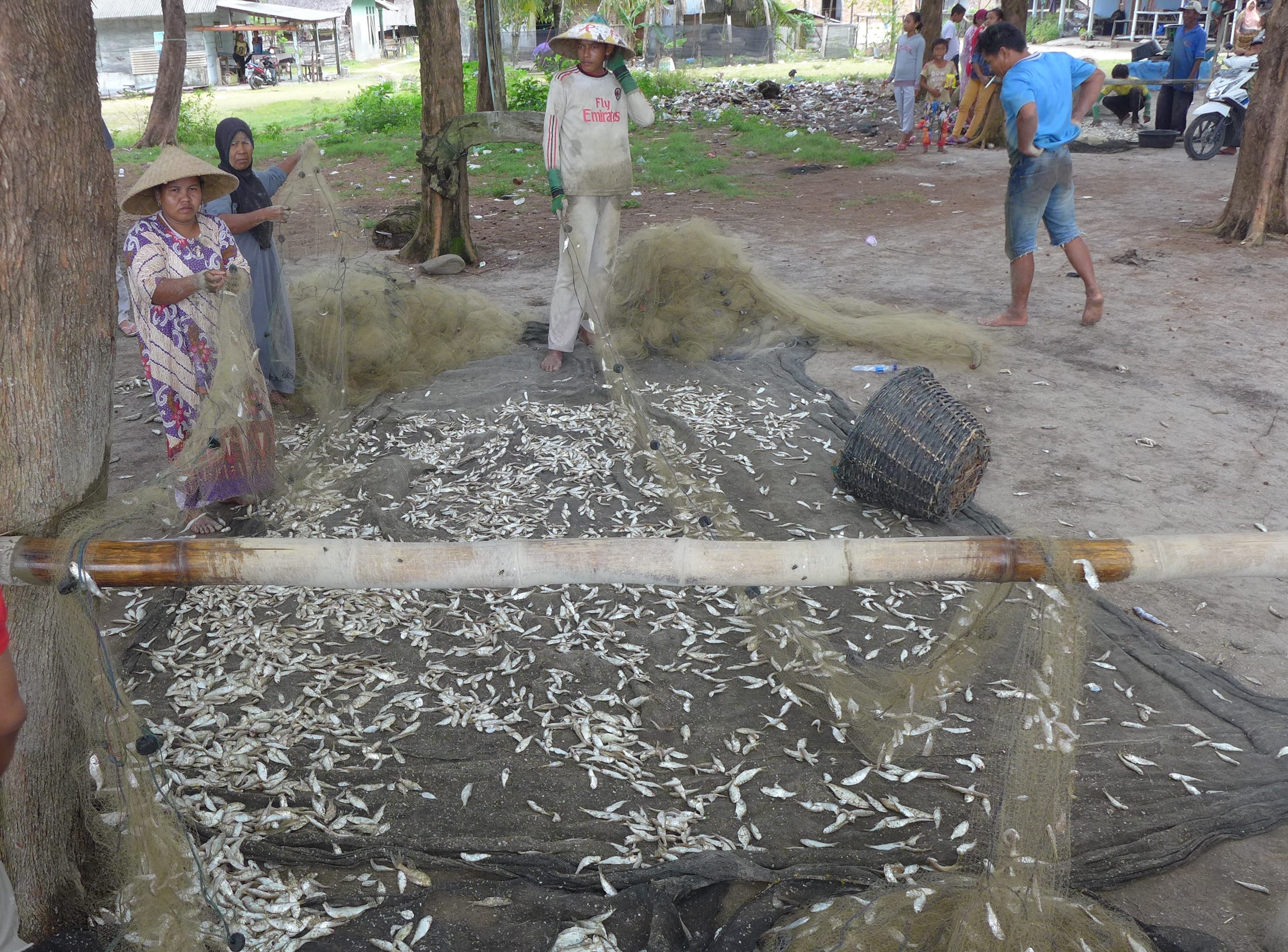
P1210202We were introduced to a group of local women who had taken steps towards self-empowerment and community resilience through micro businesses related to fishing. This had different aspects, including economic, educational and disaster planning elements.
P1210167

The women showed us how they had developed dried seafood products, which they sell under the label, ‘Beautiful Coral’, that can be stored long term which  added value to the fish that were caught by the men in the community.

P1210242

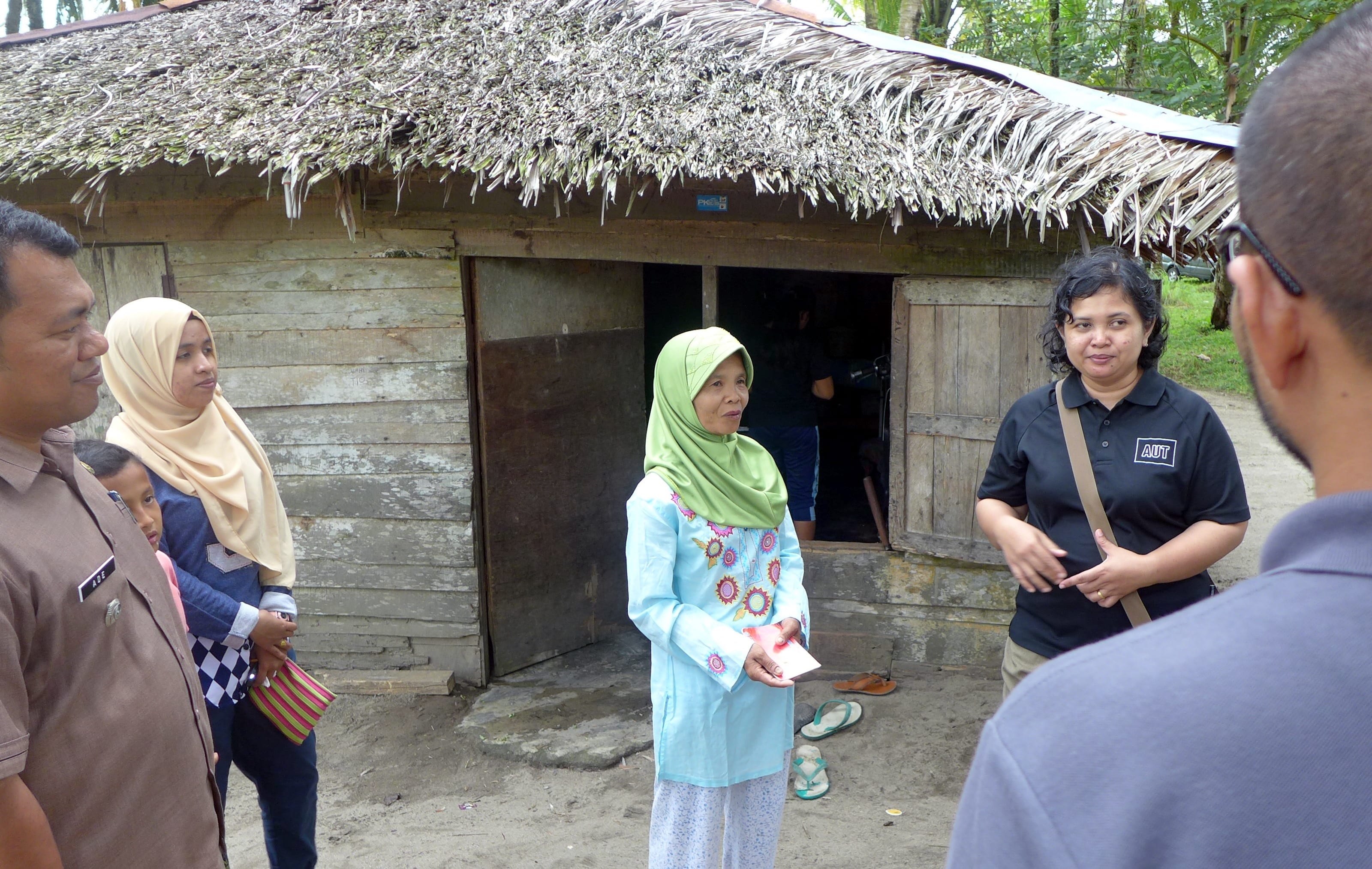
This local lady lived nearby. Although her husband died some years ago, as a couple, they had purchased land together, which she has now been able to develop with the assistance of  Jemari Sakato, a local NGO supported by Oxfam. They gave her some chickens and a couple of goats. Over time she has expanded her livestock and, along with selling coconuts and caring for the neighbours cows, she has become financially independent. She is able to afford micro-insurance that protects her livelihood in case of a natural disaster.

P1210299

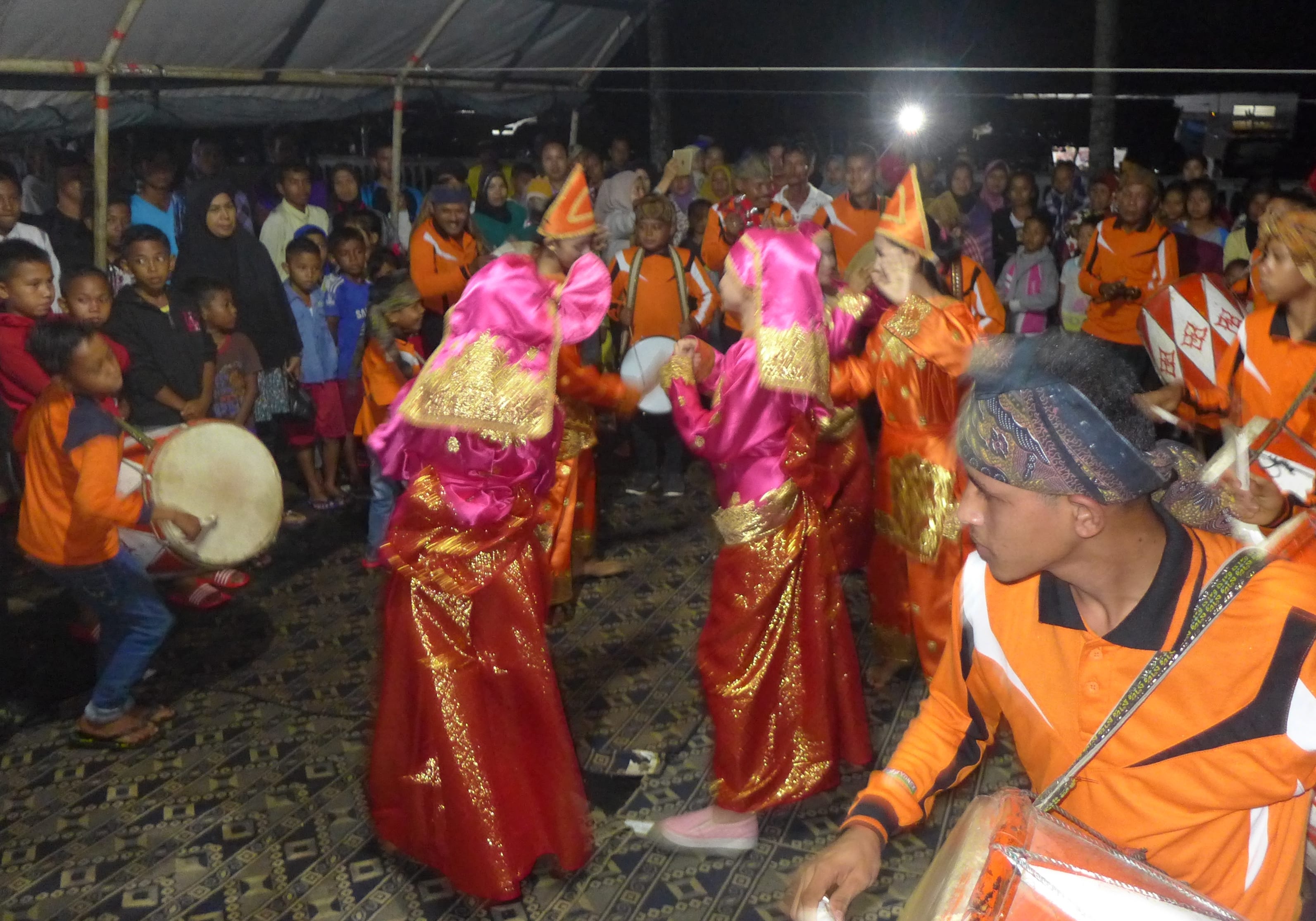
There were many cultural treats for our group during our visit. Here is a performance of the Shi’a Islamic music called Tambuah Tasa (bass and snare drum ensemble), from Bukik Malintang, with dancers from the randai theatre group ‘Santan Batapih’. The drumming  performance was incredibly powerful.

P1210376

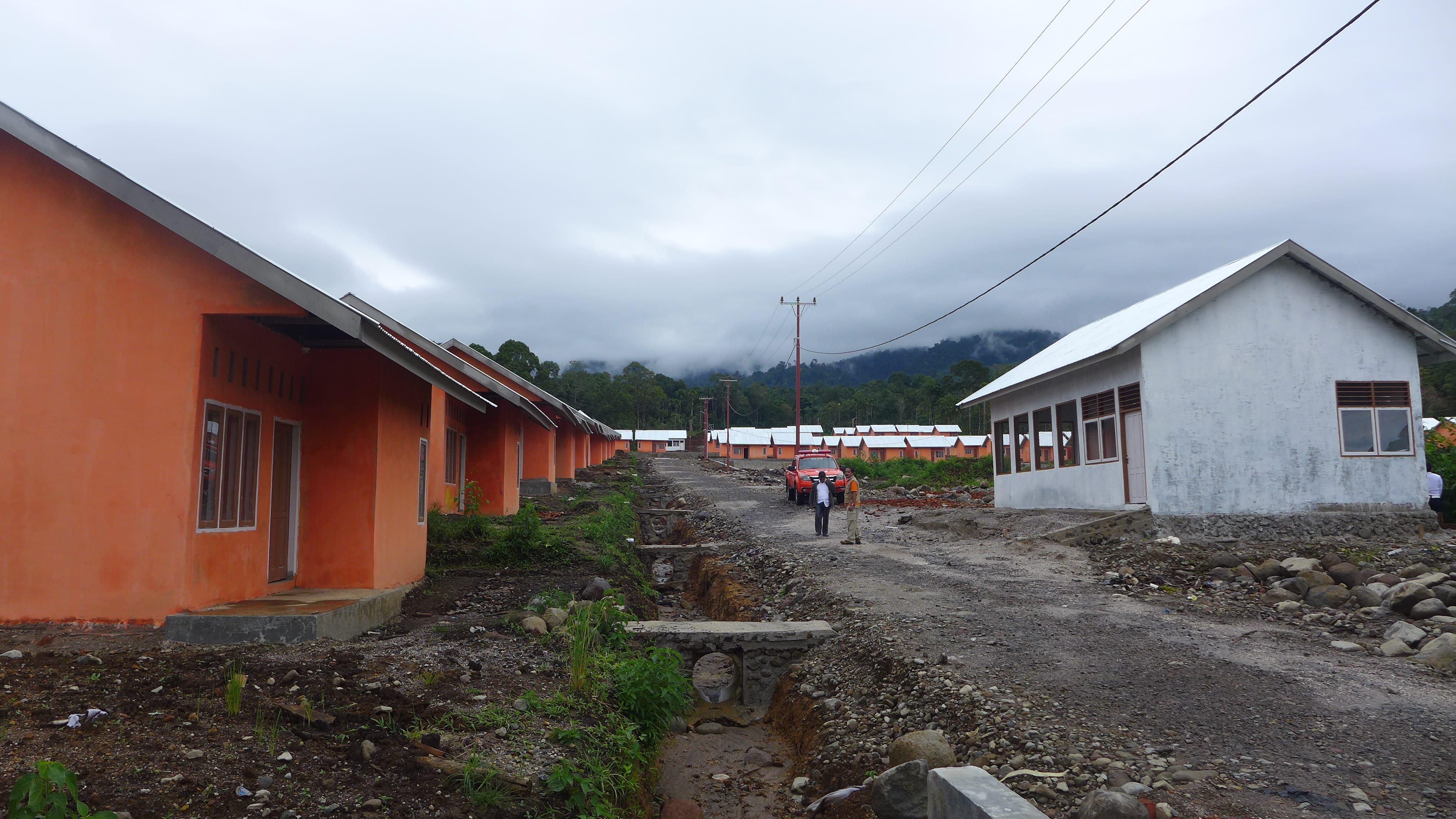
Next we headed inland and stopped at a village that had been designed and built in a Sumatran jungle clearing to house people who had been impacted by a large earthquake in 2009. There were roughly 120 identical houses, along with a mosque and community centre. The village is more or less ready, but yet to be occupied.

P1210545

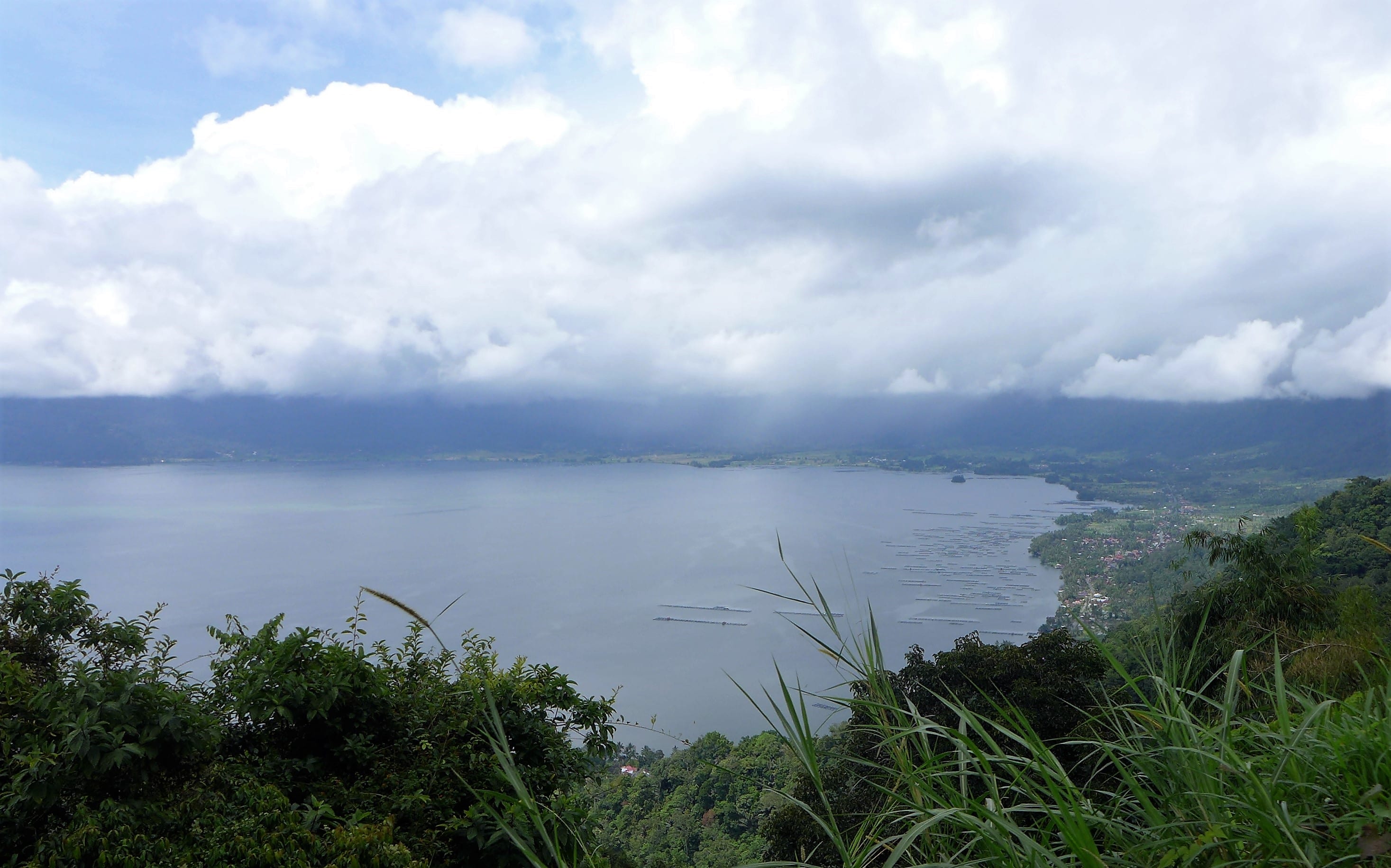
We then travelled on to Lake Maninjau. This is a dormant volcanic crater (caldera).

P1210500

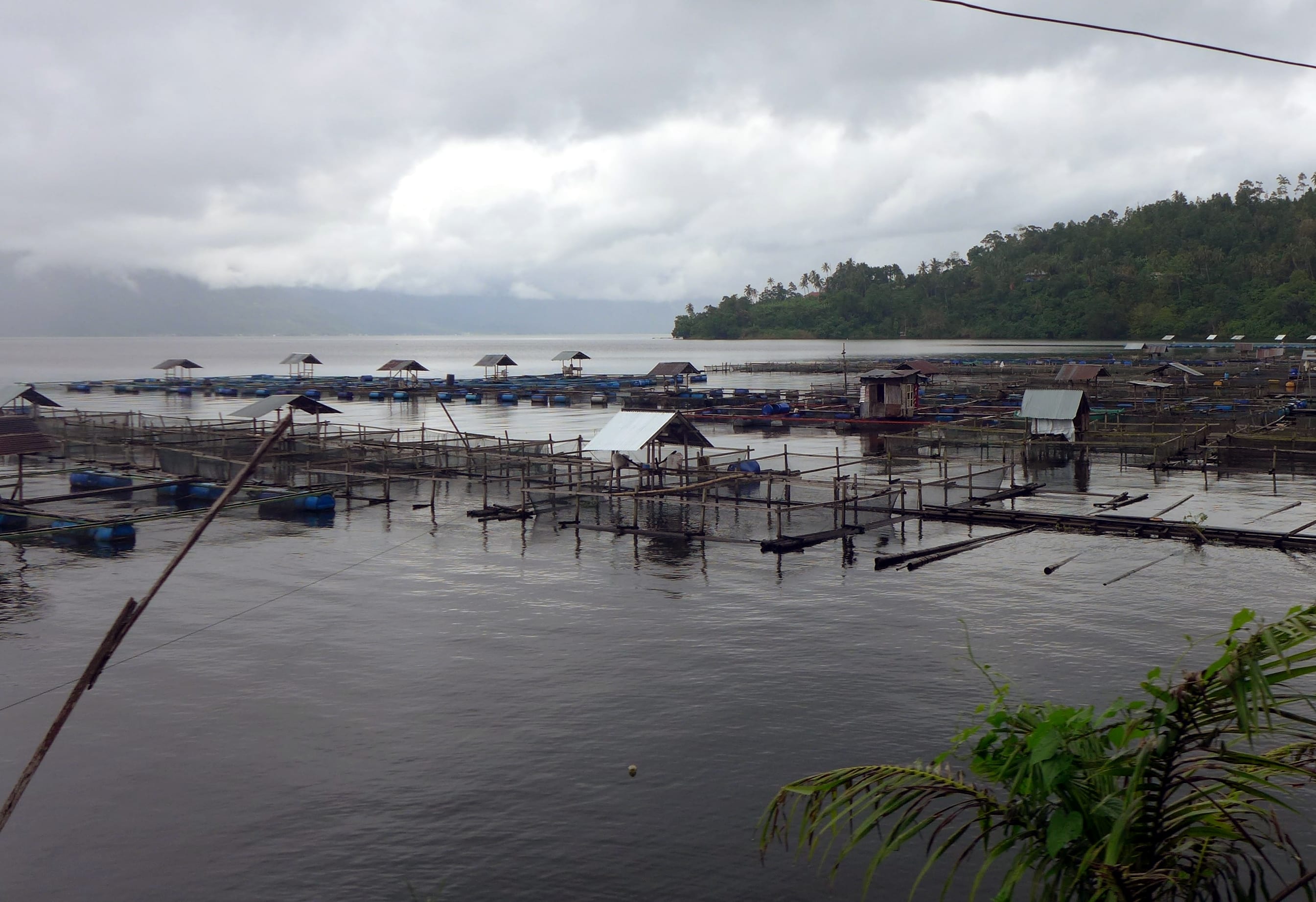
The people living on its shores rely on fishing also. The photo shows the nets used for intensive fish farming.

P1210417

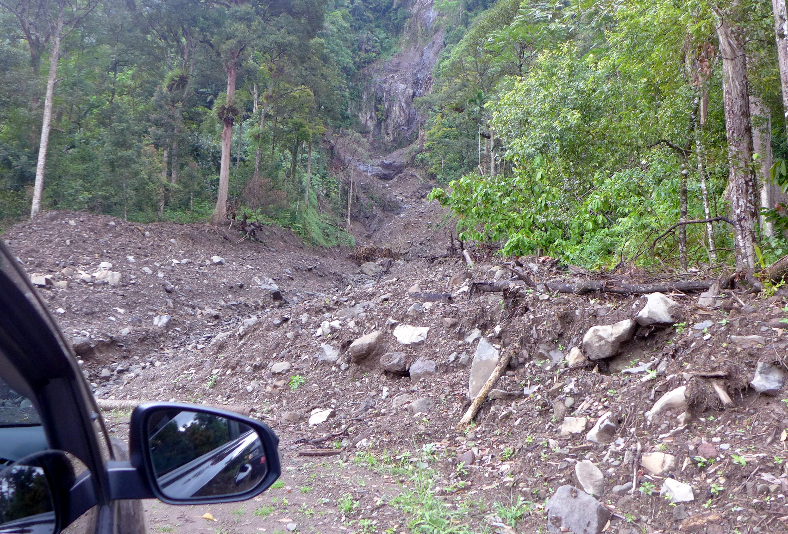
Because the sides of the crater are so steep, they are subject to many landslides that endanger the locals. This is one that we drove across and must have been very recent. The road had not yet been properly repaired.

P1210422

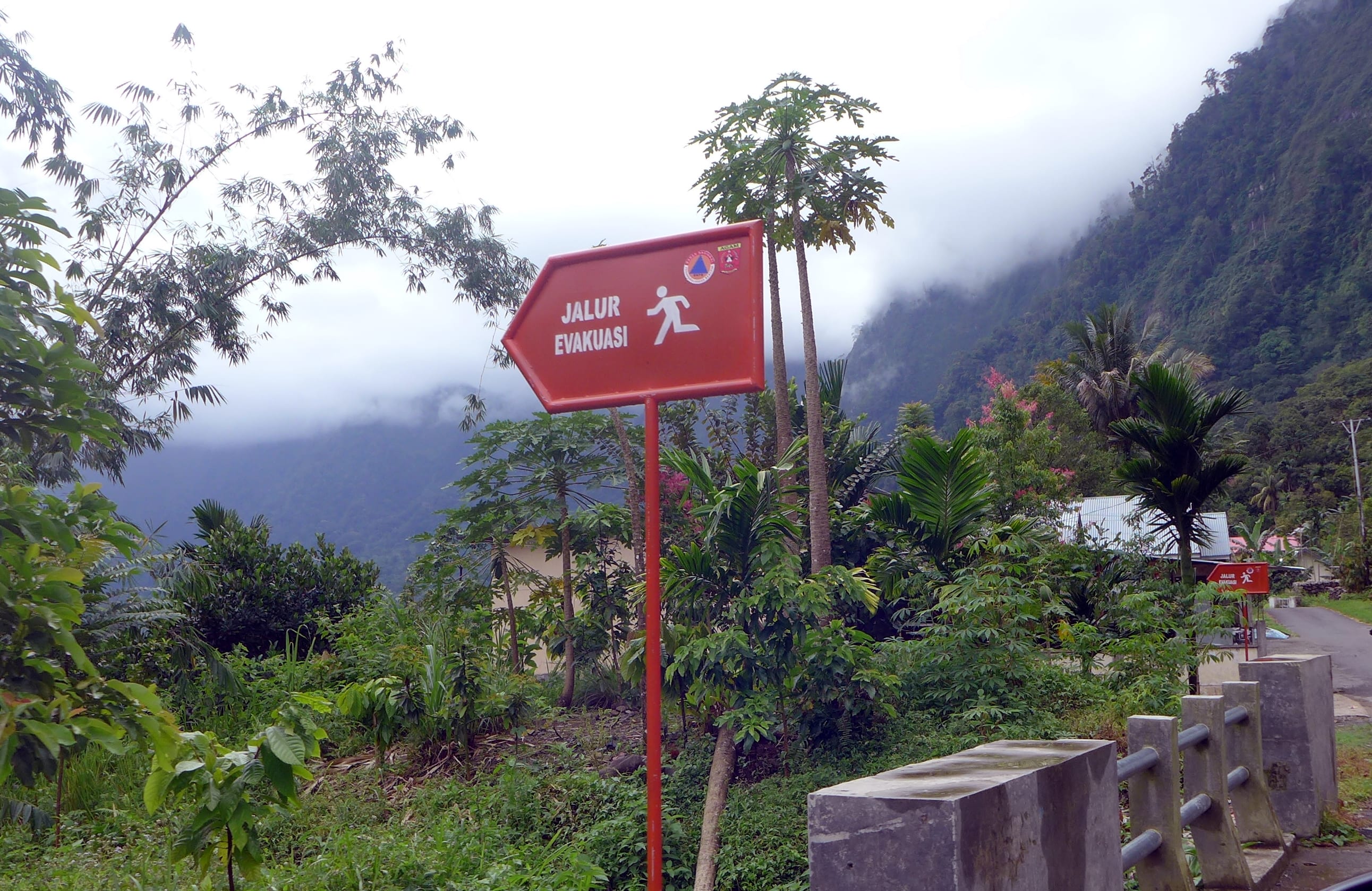
These signs indicate evacuation routes down to the lake shore in case of an emergency.

P1210678

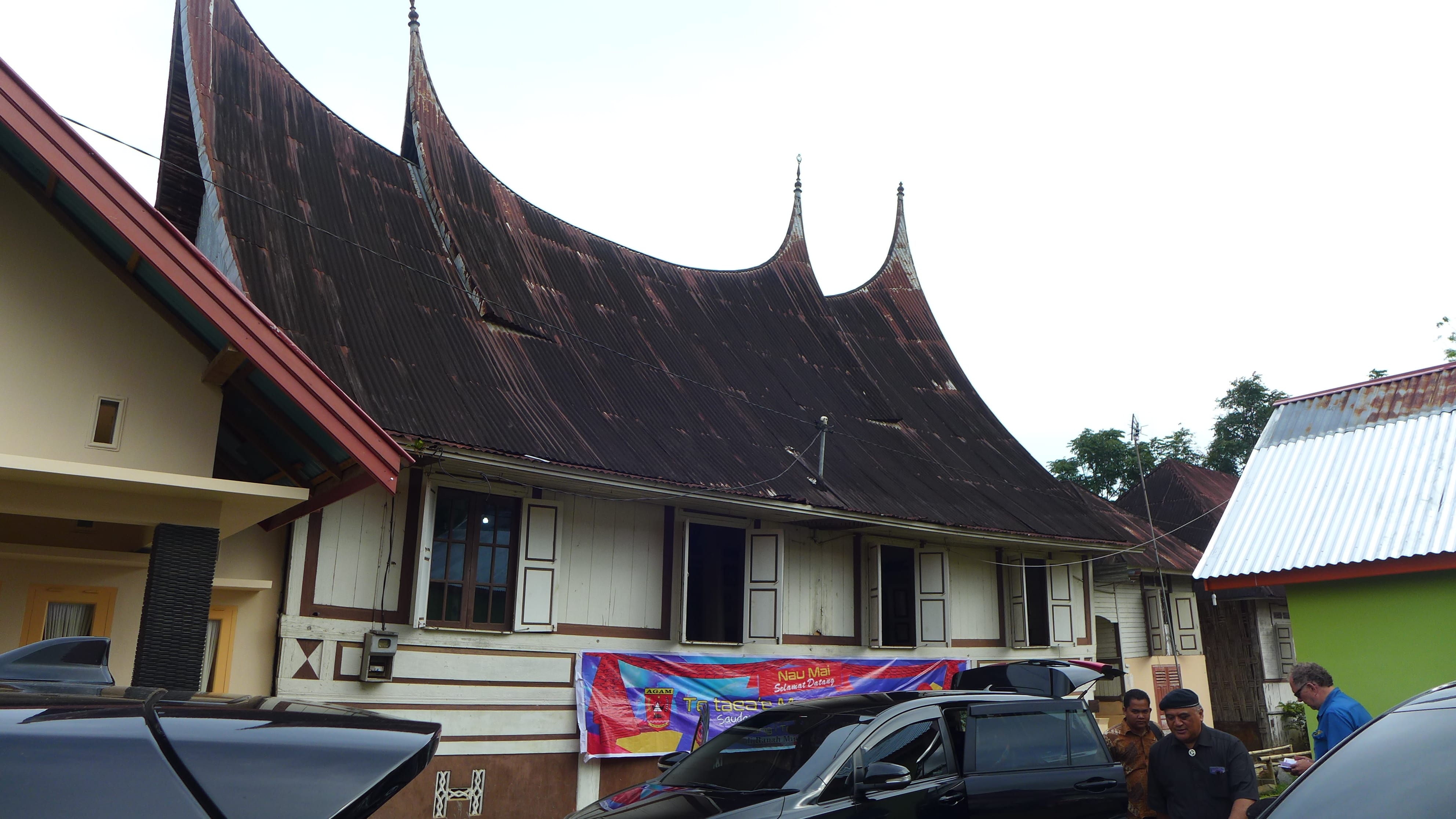
From the lake we made our way to to Canduang and a traditional house called a Rumah Gadang, where we had been invited to stay the night. The traditional architecture of the roof is typical of the Padang area. The points represent buffalo horns from a legend in which a buffalo saved the local minangkabau people from invasion by the Javanese.

P1210622

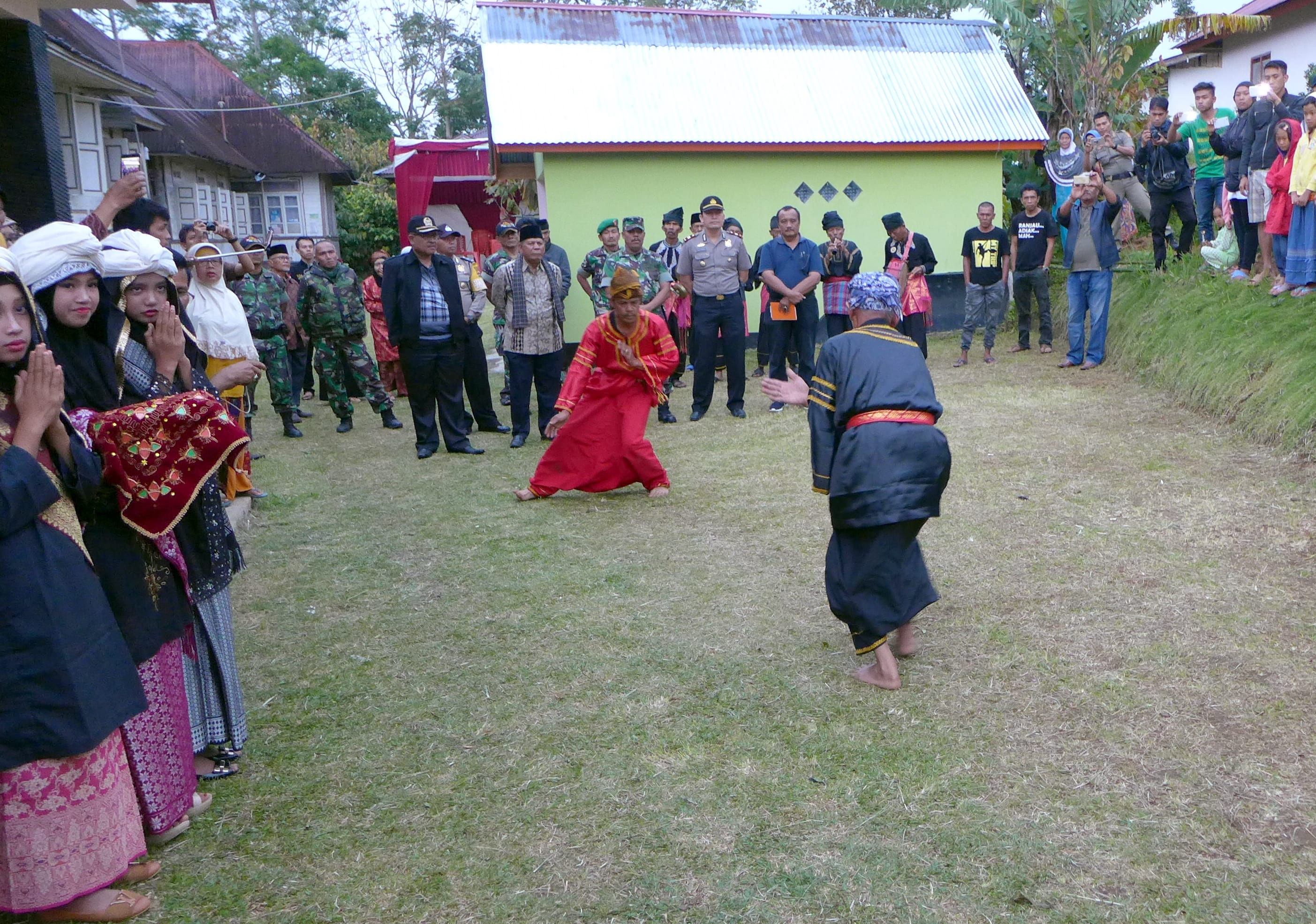
In Canduang  we were again welcomed with by the Pasambahan dance, which this time included silek martial arts, demonstrated by senior masters. The two men were sparring with knives.

OLYMPUS DIGITAL CAMERA

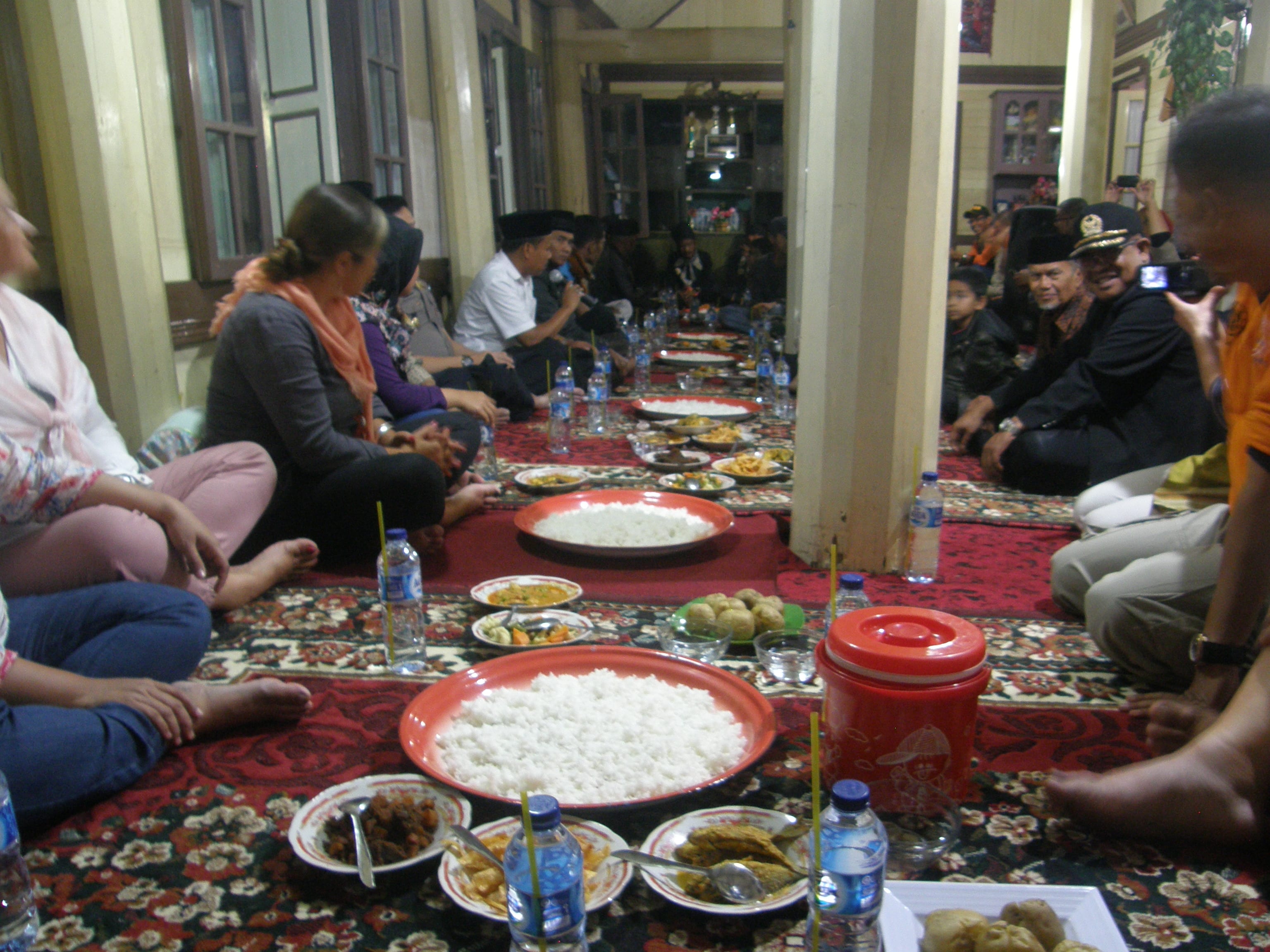
We shared a community meal inside the big house, which belongs to Mrs Zulharty and her extended family.

P1210673

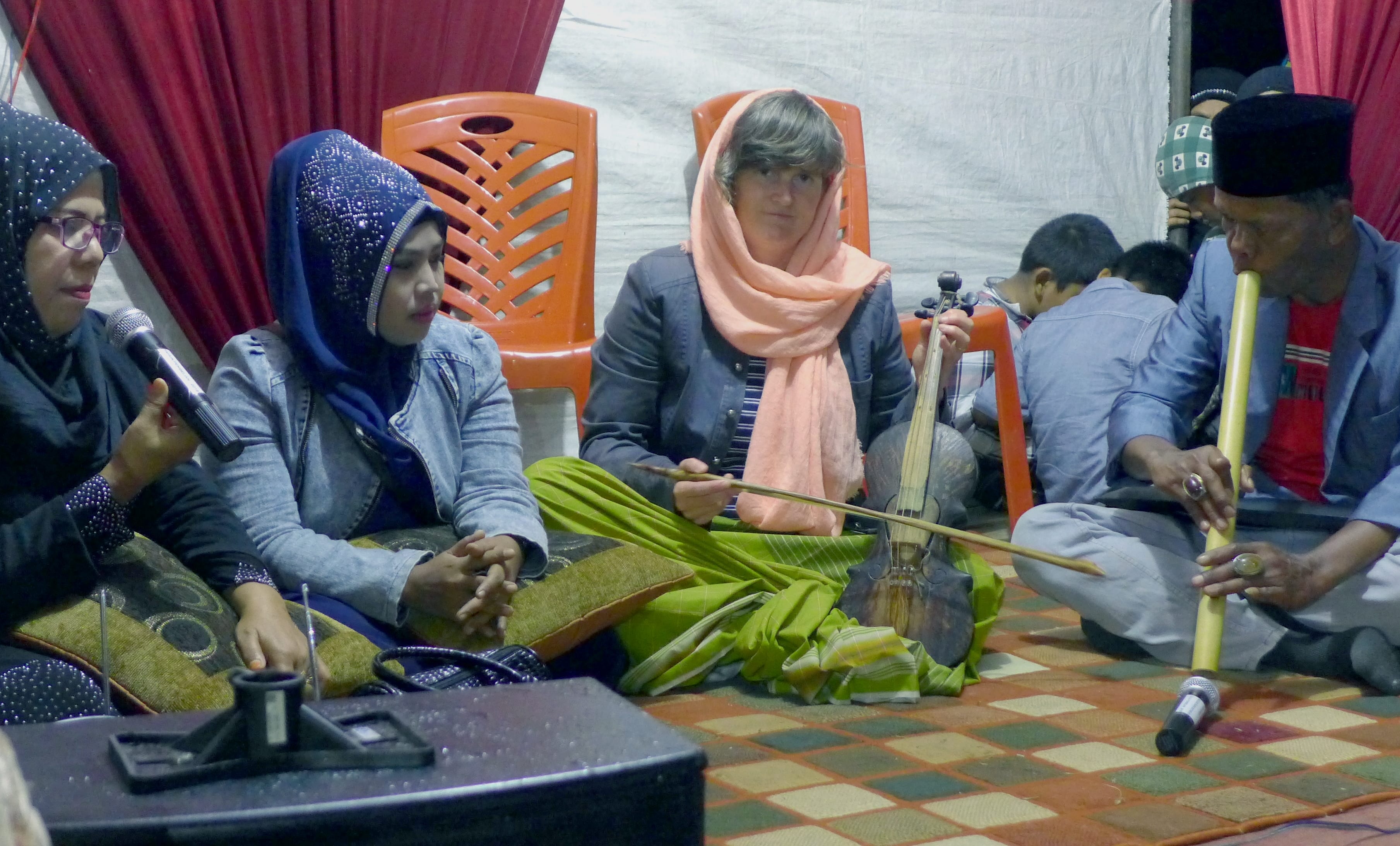
Afterwards, the team where treated to a performance of Saluang jo Dendang (flute and voices). Megan Collins also gave a performance on the rabab Pasisia Selatan (fiddle from the South Coast) singing the opening of a kaba narrative that was much appreciated by the local audience.

P1210633

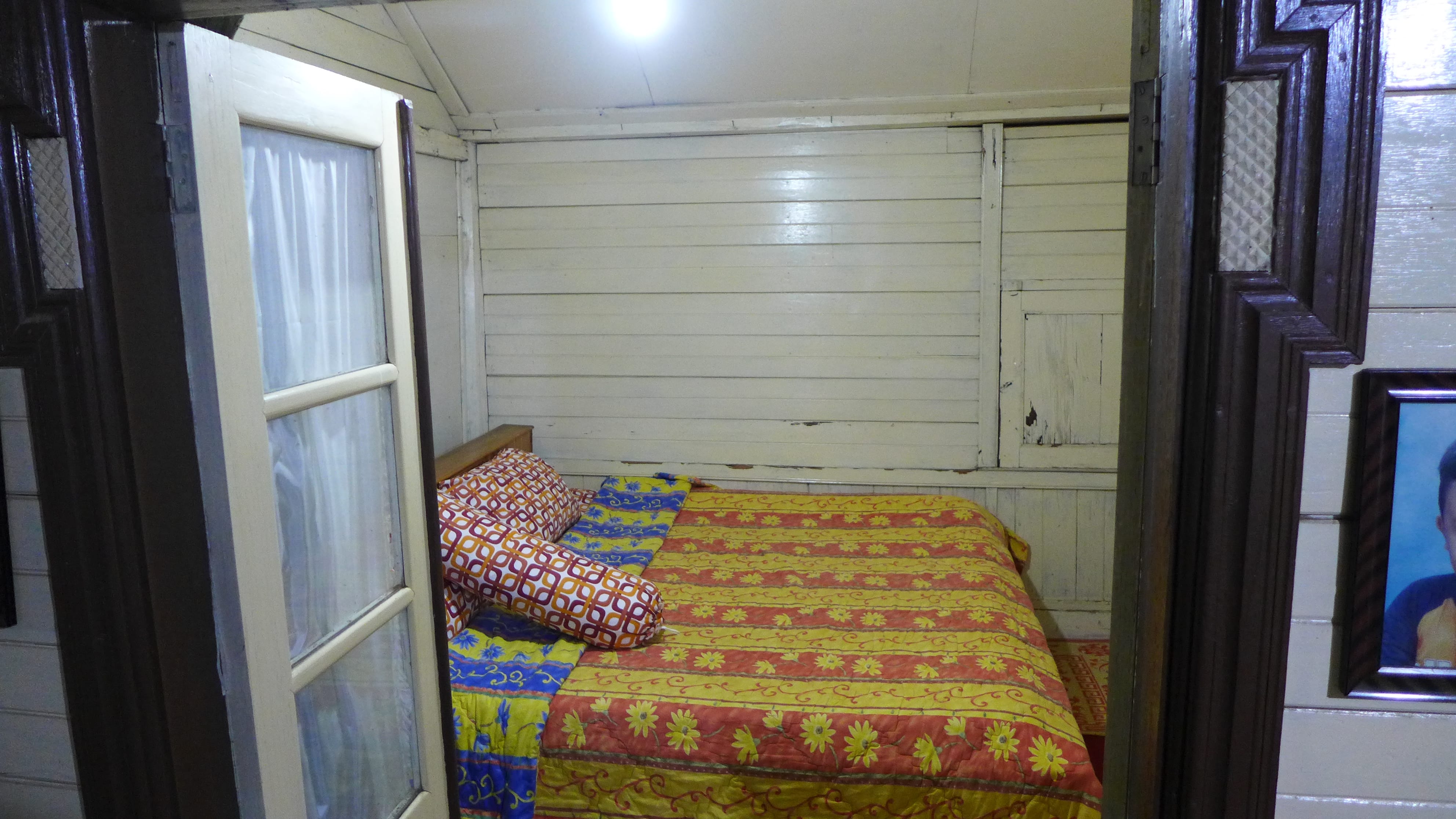
The Rumah Gadang is a meeting space with  several bedrooms at the back. Communities in this area are based on small extended family units that live in each Rumah Gadang, and the family structure is matrilineal. Women have the main authority in the family and the oldest woman in the family owns the house. Her daughters each have a bedroom allocated and when they marry, their husband moves in to the house with them.

P1210697

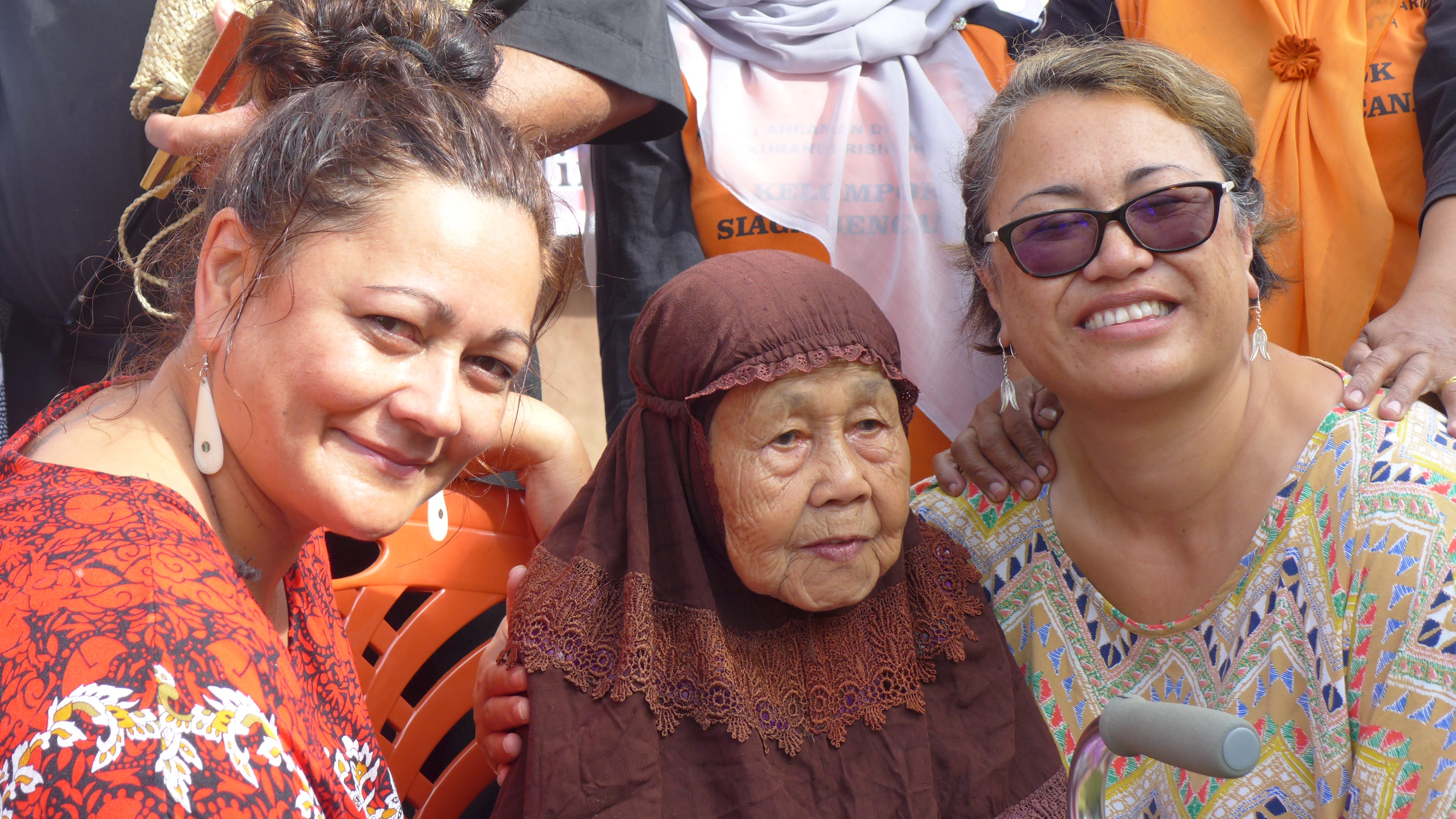
Here Jean and Robyn sit with the matriarch of the household , who is highly respected and is 92 years old.

P1210971

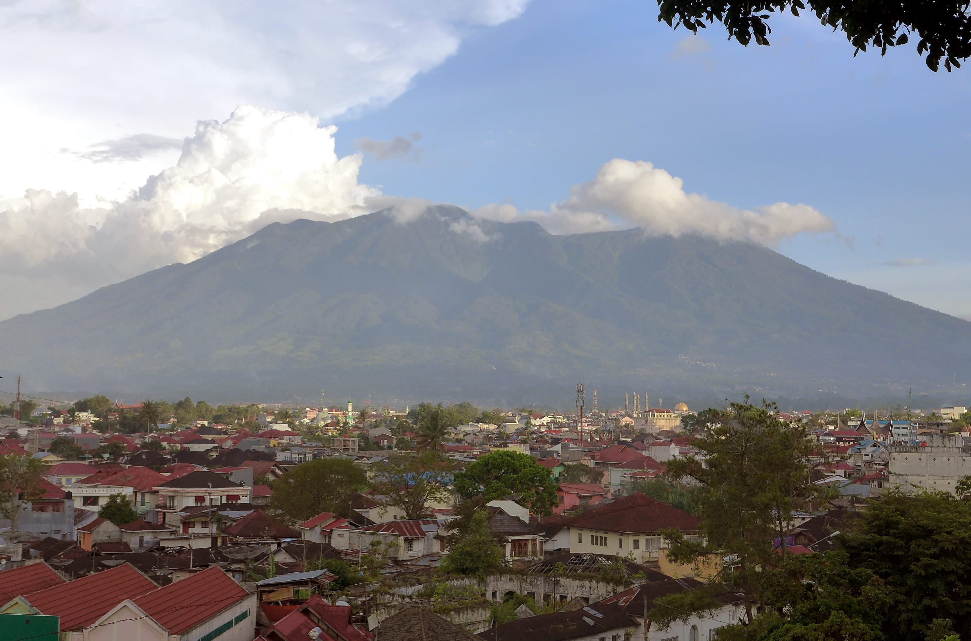
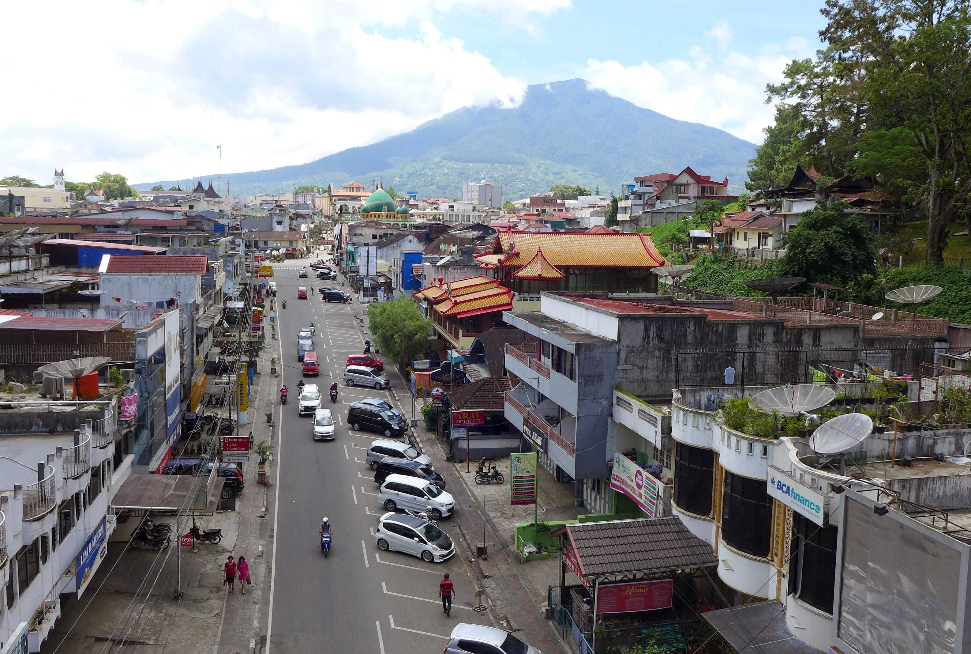
Our next visit was up on to the slopes of Mount Marapi, a volcano that actively threatens surrounding settlements. In this photo it is seen from the town of Bukittinggi.

P1210705

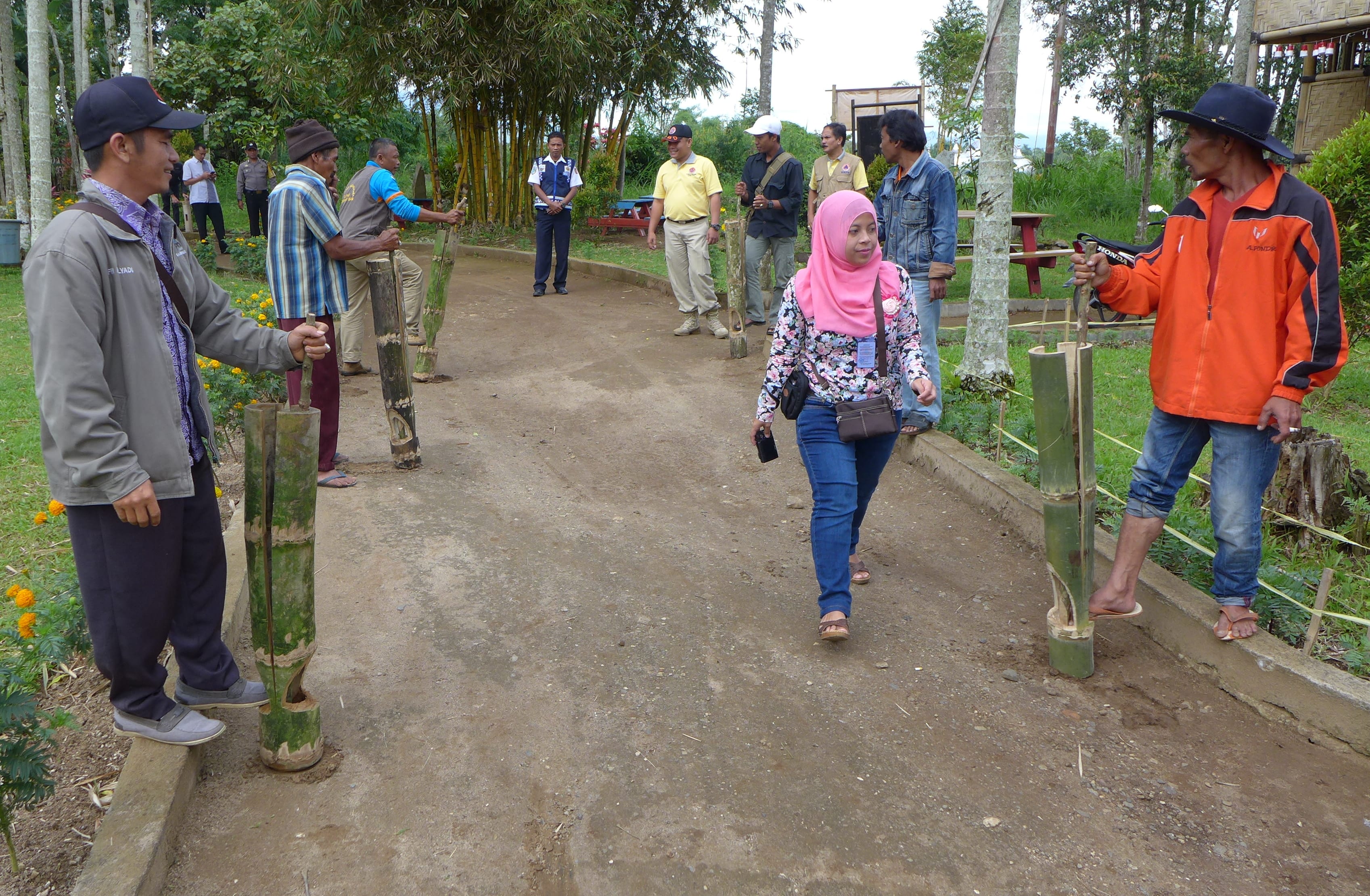
We were welcomed to Lassi village, on Mount Merapi, by the local disaster management group ‘Marapi Alert’ who demonstrated their katentong bamboo ‘clappers’. These make a very loud drumming noise when the handle is pushed back and forth, and are used as an alarm system to relay warnings of volcanic activity from village to village. Cellphones are also used.

P1210732

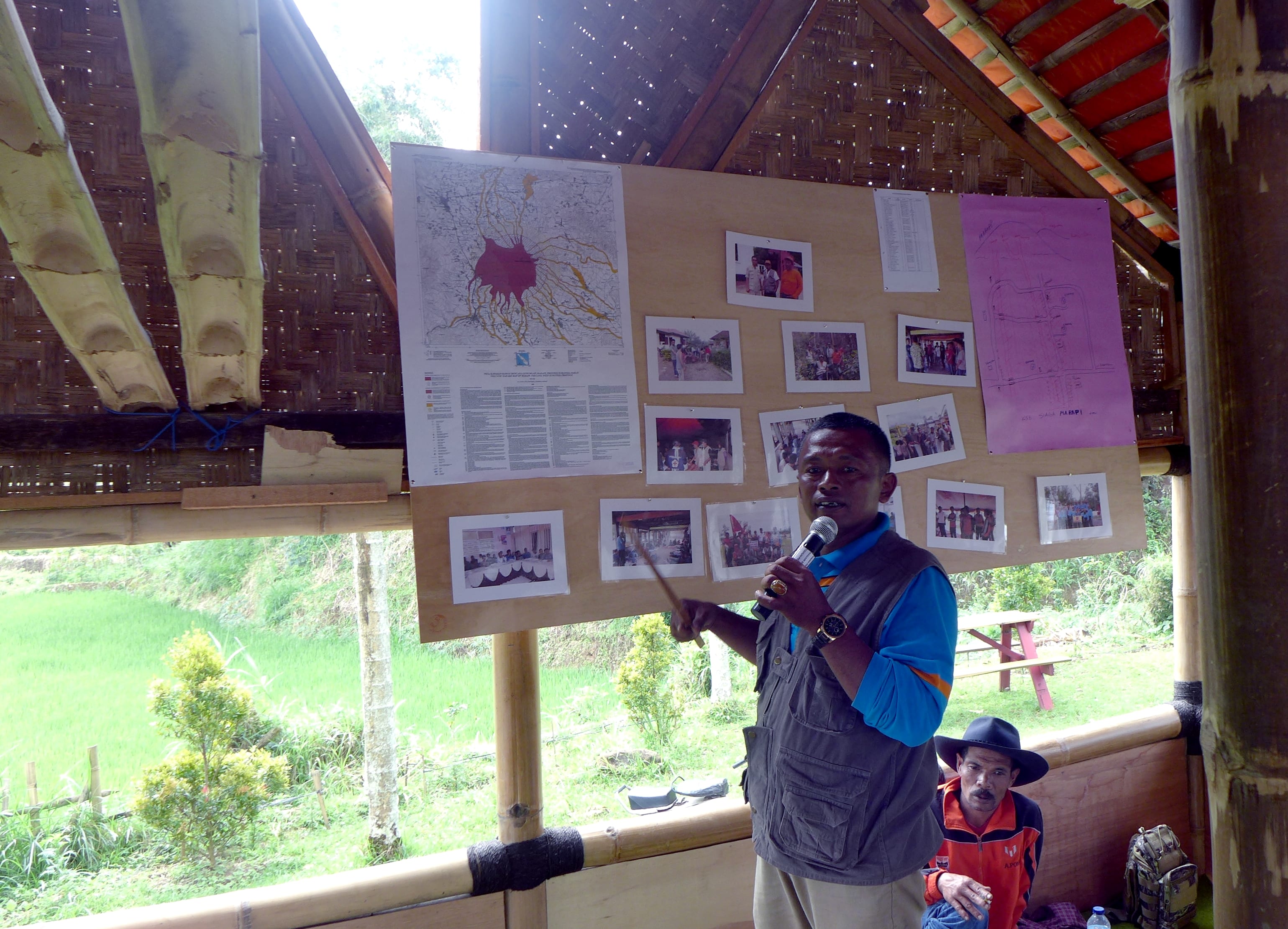
Edi is the local co-ordinator for disaster risk reduction (DRR) activities in Lassi village. Here he explains the local volcanic hazards and about some of the projects that are used to develop local resilience and safety.

P1210782

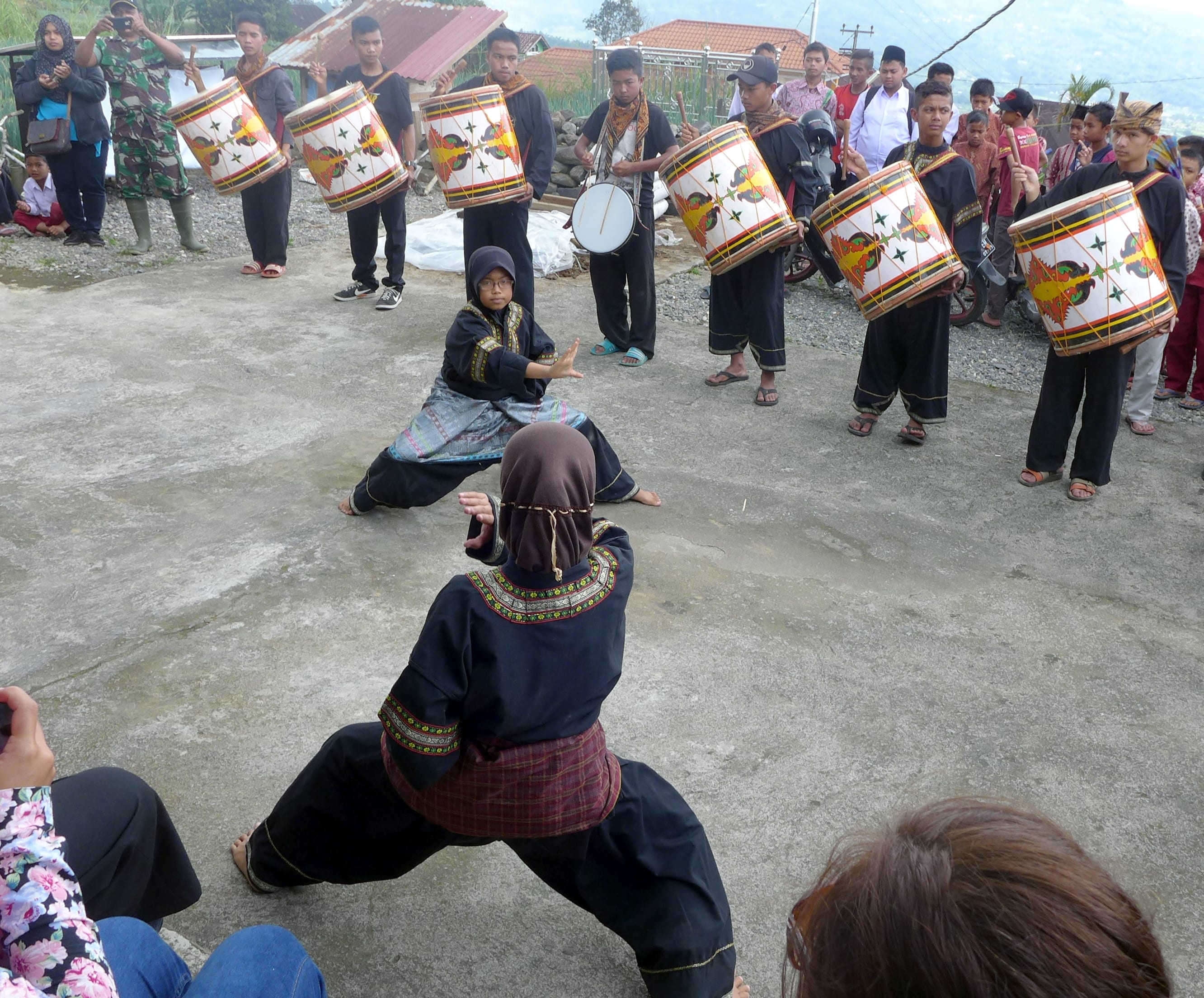
A powerful display of traditional martial arts from two teenage girls accompanied by boys playing the Tambuah Tasa drums at Sungai Pua, Mount Merapi.

P1210843

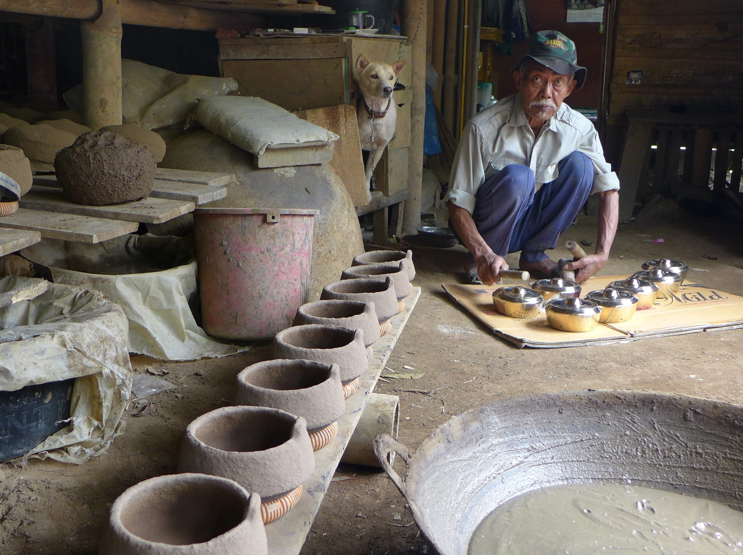
Mr Datuak Mangkato Saripadois a master craftsman of the West Sumatran talempong gongs. His family has been making these classical instruments for nine generations. exports them all over Indonesia and Malaysia.

P1210952

Mount Singgalang is the second large volcano that looms over Bukittinggi.

P1210984

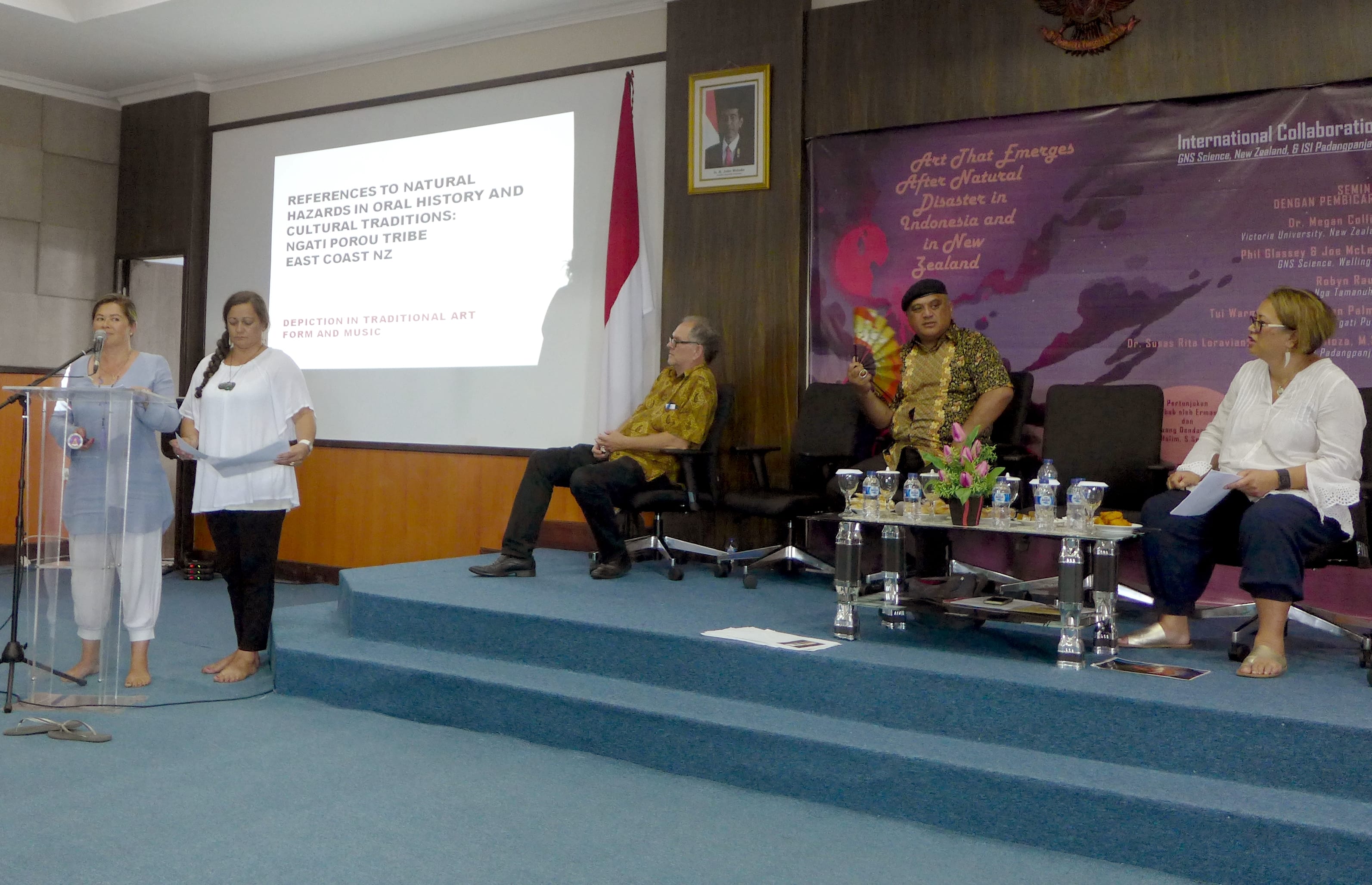
On our final day we visited Institute Seni Indonesia (ISI) Padang Panjang, a Tertiary Arts Institute. We learnt how performers of local music include stories of natural disasters that give information about the particular impacts they had on the lives of people. These stories are even woven into modern pop music and include recent events such as the damaging Padang earthquake of 2009 and flash floods in Kambang in 2011.  Tui Warmenhoven and Jean Palmer give a talk on how knowledge of natural disasters in embedded in Maori traditional stories of the creation of Aotearoa.

Mrs Susasrita Loravianti, Mr Rafiloza from ISI and Megan Collins gave talks about West Sumatran music and dance, indigenous knowledge and disasters.

P1210993

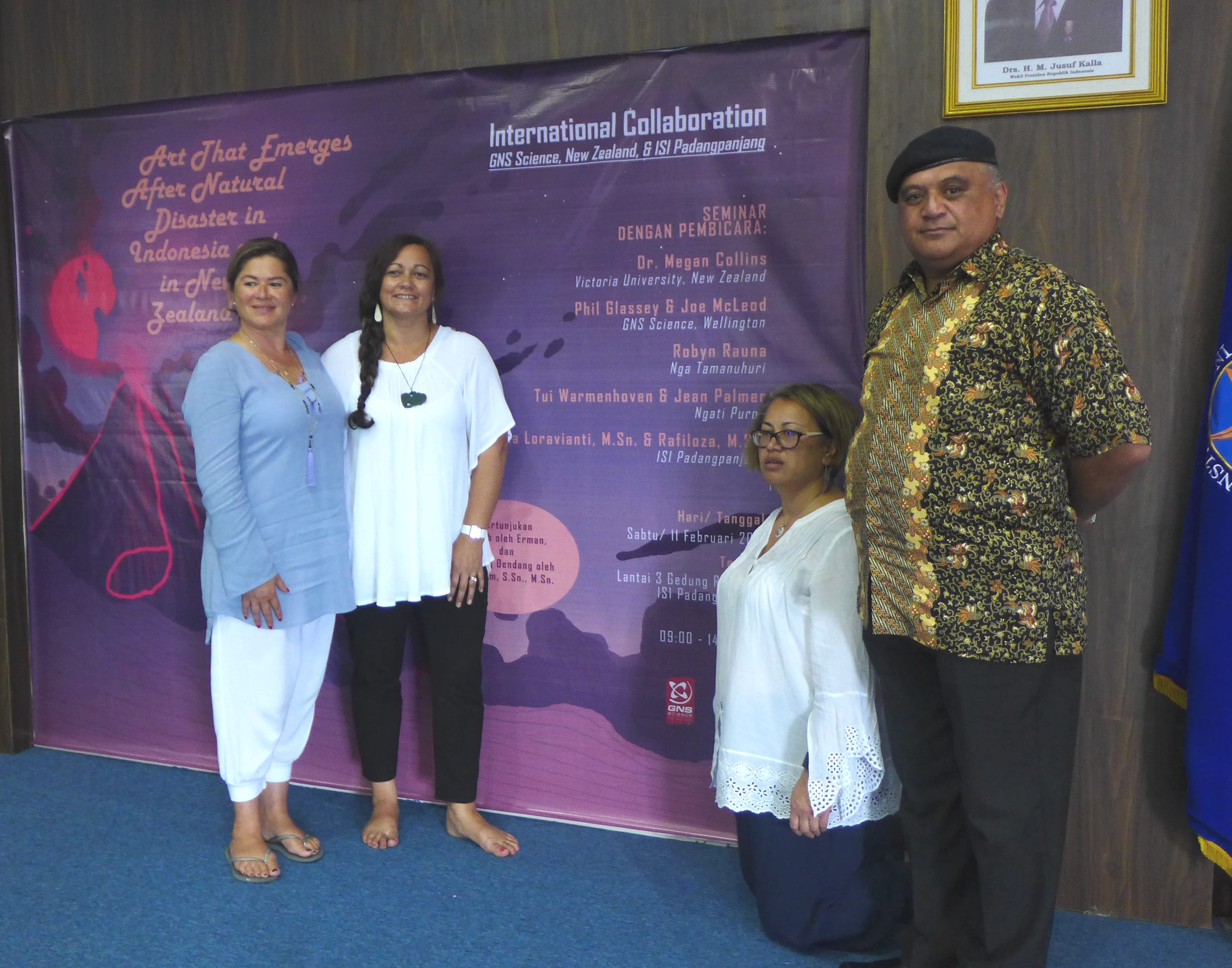
In this photo L to R: Tui Warmenhoven, Jean Palmer, Robyn Rauna and Joe McLeod


P1220021

Better Recognition of Morowali Earthquake Risk

Held on 16 February, Morowali’s Action Plan workshop received positive feedback from local stakeholders and parliamentarians.  Having experienced frequent flooding and coastal abrasion issues in recent years, local authorities have been concentrating reduction efforts on mitigating the impacts of these natural hazards, largely through physical works.

Picture1
Morowali action plan workshop participants, 16-17 February 2016.
Morowali Blog 1
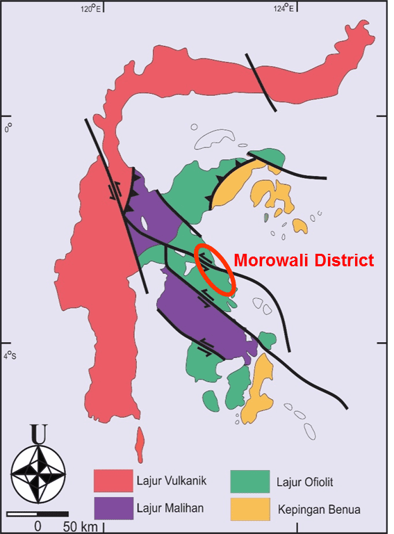
Central Sulawesi, Indonesia showing locations of major active faults. Image: Dr Agung Setianto, UGM.

Morowali’s Vulnerability Profile

Working through Morowali’s vulnerability profile showed that while flooding and coastal abrasion are frequent occurrences, the threat of large earthquakes affecting the district is very high.  Due to the presence of active faulting across Central Sulawesi and the specific location of some faults (see image), Morowali ranks in the top 40 out of 500 districts prone to earthquake activity across Indonesia.

Earthquakes: So what’s the risk Morowali?

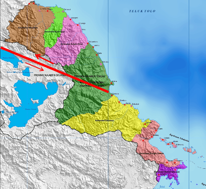
In his presentation to workshop participants, Professor Iman Satyarno from UGM University, described the prevalence of the Matano Fault in central Morowali (see image).  On 16 April 2012, a magnitude 5.8 earthquake occurred, located on or nearby this fault.  The earthquake heavily damaged houses in two communities while also damaging Morowali’s government buildings.  Two years later another earthquake occurred further to the east, causing less damage but still being felt across central Morowali.  This recurrent activity is a reminder of the prevalent earthquake risk across the district.

Morowali Blog 2
Morowali District, Central Sulawesi showing the location of the active Matano Fault. Image: Dr Agung Setianto, UGM.

Earthquakes: What are the DRR options?

While large earthquakes are relatively infrequent in Morowali, compared to other natural hazards, their impact may be substantially larger than the combined impact of smaller events.  This concept has been recognised by members of local government, the emergency management agency (BPBD) and other key stakeholders attending the workshop.

Morowali Earthquake blog 3
Morowali workshop participants discuss the district’s vulnerability profile. Photo: Richard Woods.

These members of the community are now considering many initiatives to reduce the risk from future earthquakes.  Such initiatives include methods to strengthen existing buildings, socialisation of information on building earthquake resistant structures, microzonation of land in close proximity to active faults and regulations for future development and construction.

A Quick Win for Morowali and StIRRRD

Having a wide representation of stakeholders to consider disaster risk reduction initiatives is key to ensuring efforts are coordinated.  On 17 February, the StIRRRD team visited the local parliament to raise awareness of the project’s focus on Morowali District and seek support for the community’s action plan going forward.

During this meeting, local parliamentarians (DPRD) raised concerns regarding Morowali’s earthquake risk, particularly in regard to the Matano Fault, which had only been located in the district after boundary changes in recent years.  DPRD representatives attending the previous day’s workshops were able to convey the district’s vulnerability profile to decision makers within a matter of hours.  As a result, Morowali is now considering implementing earthquake resistant regulations and micro-zonation of properties in close proximity to the Matano Fault.

A great result for Morowali District and StIRRRD team from their short visit!  The StIRRRD team will return to Morowali later in 2016 to provide feedback on the district’s risk reduction action plan.