RiskScape – Risk Modelling Training, Palu

For some, it wasn’t easy to get to Palu for the Risk Modelling training conducted in Palu 19 – 23 October 2015. Smoke from wild fires closed Palu Airport, and a few participants, and some of the training team missed the first day. Contingency planning wasn’t in place for such an event. Perhaps the economic losses and disruption to people from wild fire in Indonesia could be included in the future risk modelling. Tragically, some hikers died in a wild fire in Java on the day before the workshop. Flights were cancelled many times during our week here and we weren’t sure we were going to get flights out.

The R Team

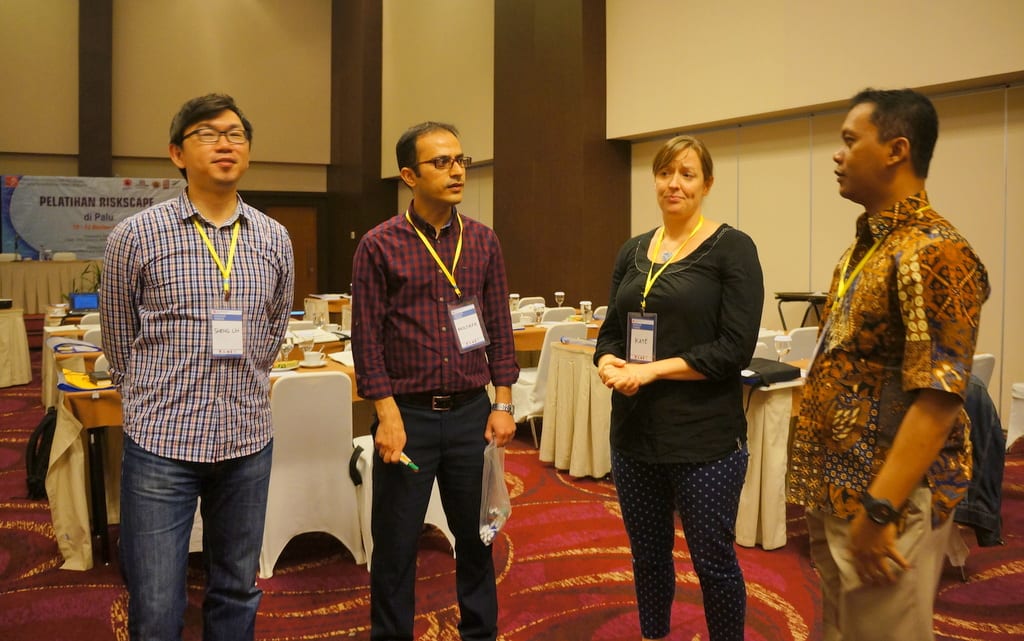
The training was facilitated by members of the RiskScape team Kate Crowley (NIWA), Sheng-Lin Lin and Mostafa Nayyerloo (GNS Science) along with members of the StIRRRD team from UGM ( Agung Setianto,  Iman Satyarno, Wahyu Wilopo). Gumbert Maylda Pratarma from UGM provided able logistic support.

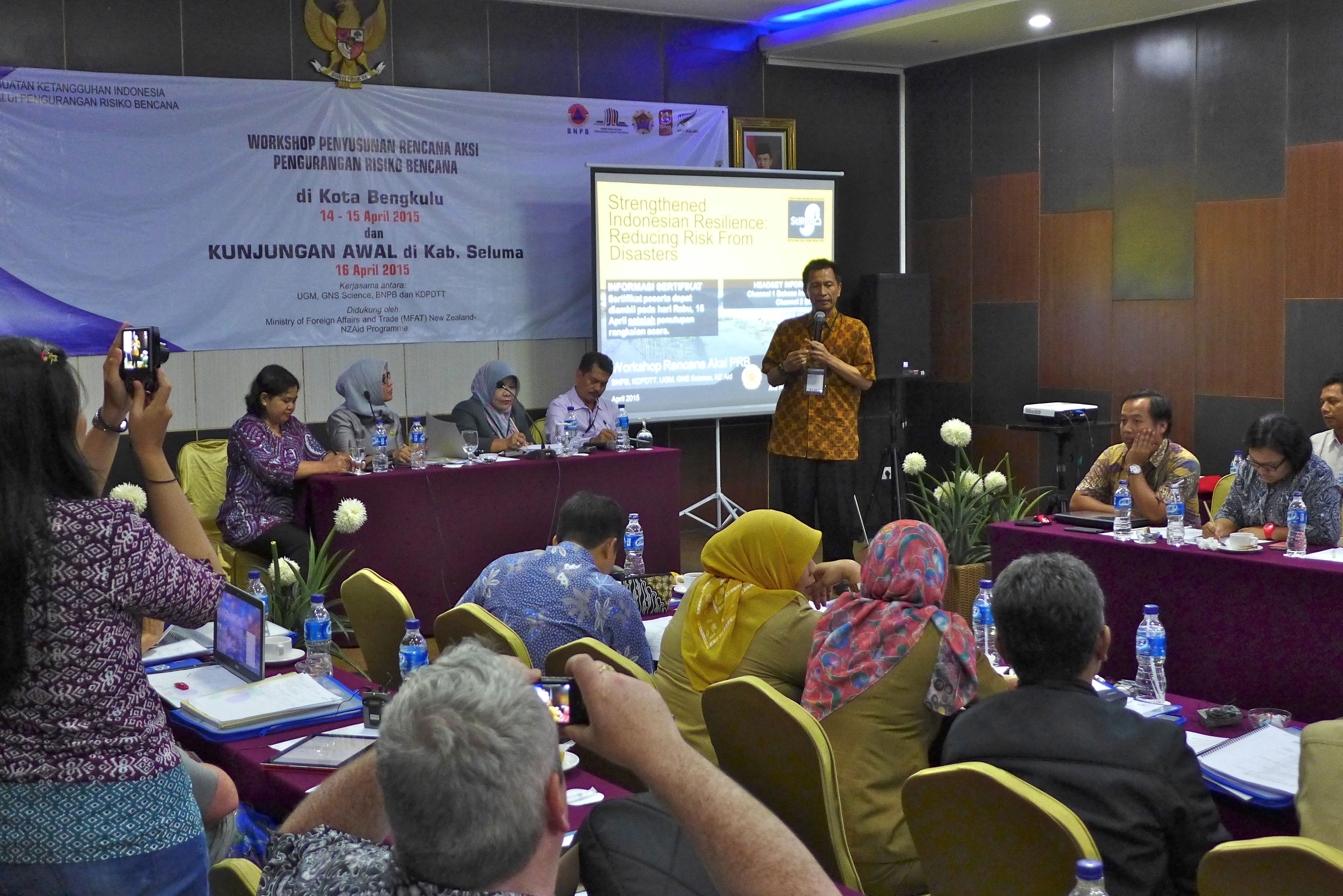
About 40 participants attended the training coming from the 4 universities that are part of StIRRRD project; Tadulako University (UNTAD), Andalas University (UNAND), Mataram University (UNRAM), and Bengkulu University (UNIB), and from the Emergency Management, Planning, and Public Works offices of Palu, Donggala, and Morowali, Padang, Agam, Kota Bengkulu and Mataram.

The training started with the fundamentals of Risk – Hazards, the exposed Assets (buildings, infrastructure and people) and the interaction between the assets and population and the hazards, known as the Vulnerability. RiskScape is the tool that combines these to calculate the impacts of hazard events in terms of damage and casualties, and the trainees were given a quick look at how the tool works.

Using Riskscape

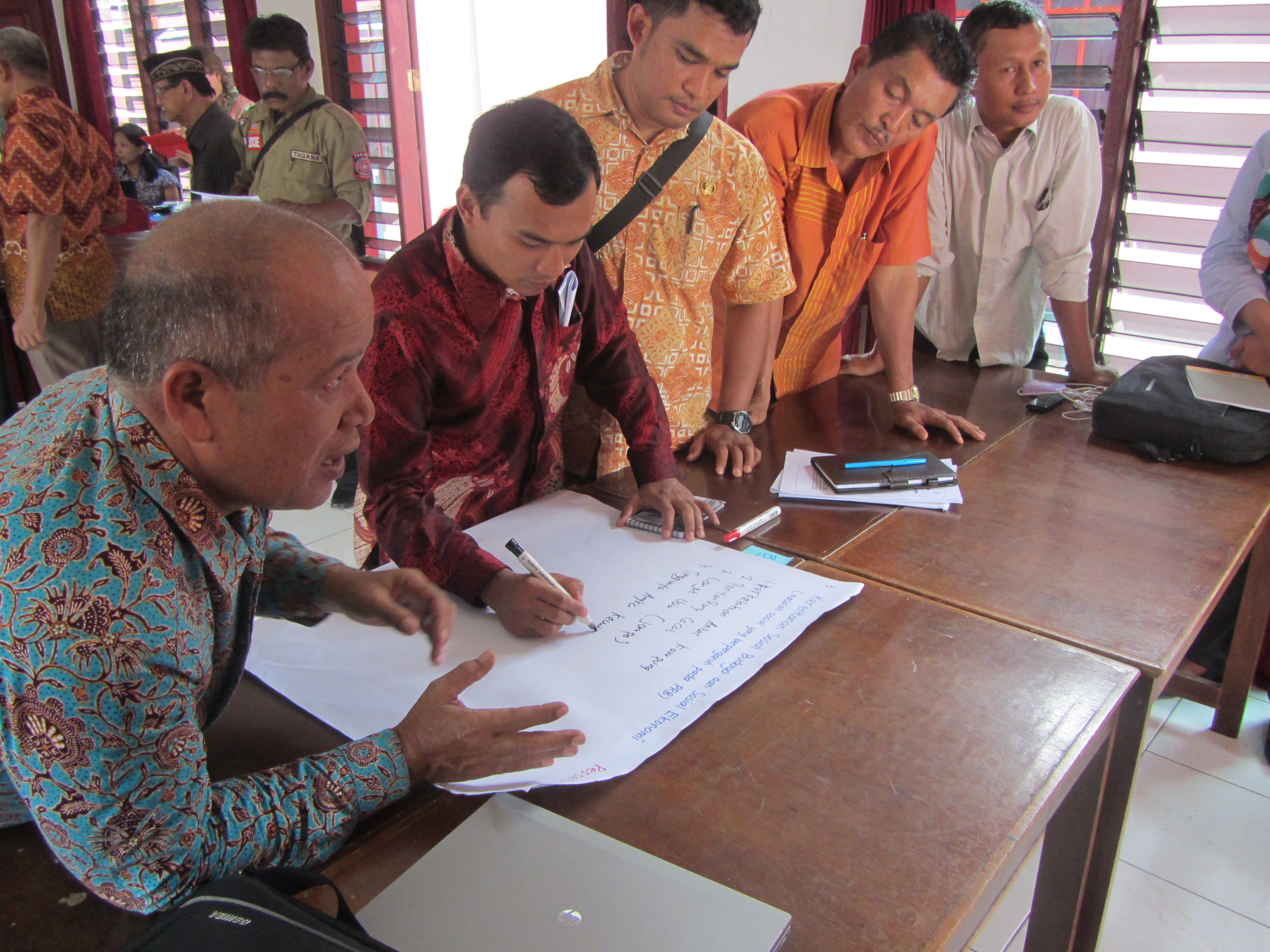
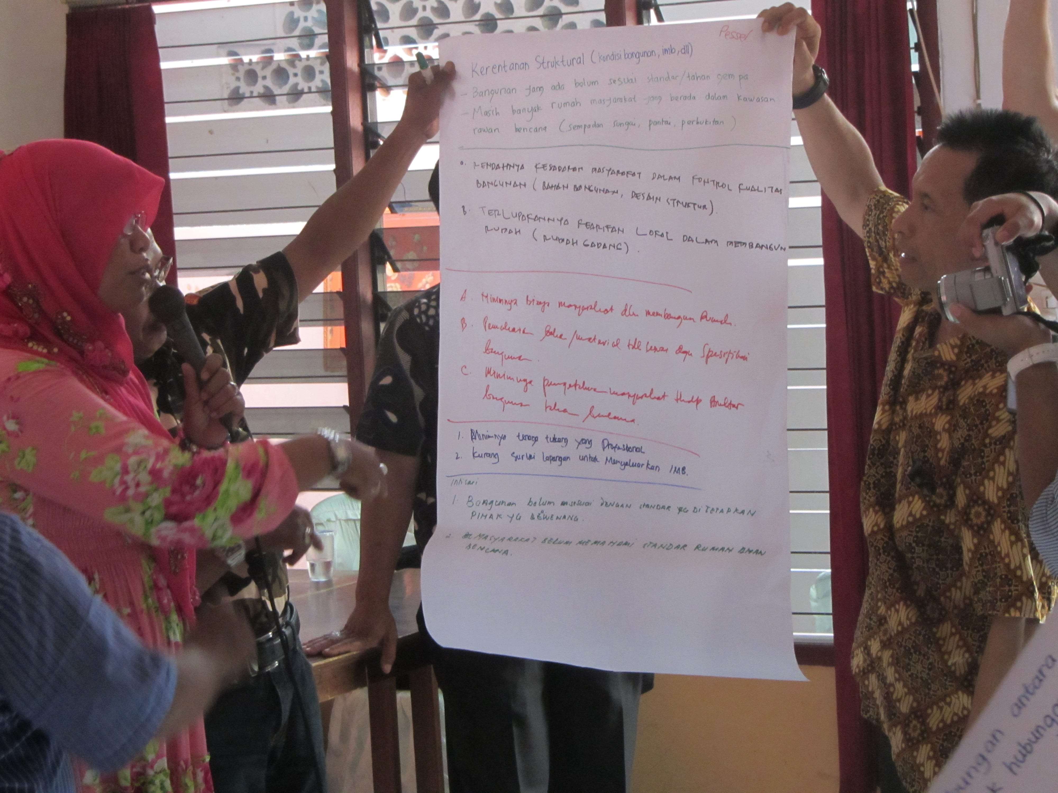
To reinforce risk fundamentals, group exercises were used to discuss how risk modelling could support DRR activities in their districts and to list the possible impacts of hazards on the exposed assets.

Discussing the issues

For the more technical minded, a look under the hood of RiskScape enabled them to see how hazard layers and vulnerability functions can be loaded into the tool. Concurrently, the remainder discussed the development of hazard values and the basics of developing measures of vulnerability.

Outdoor riskscape session

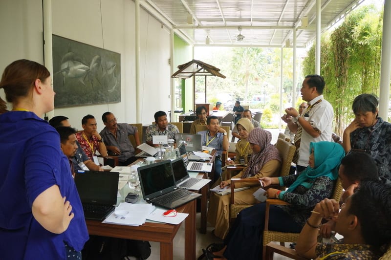
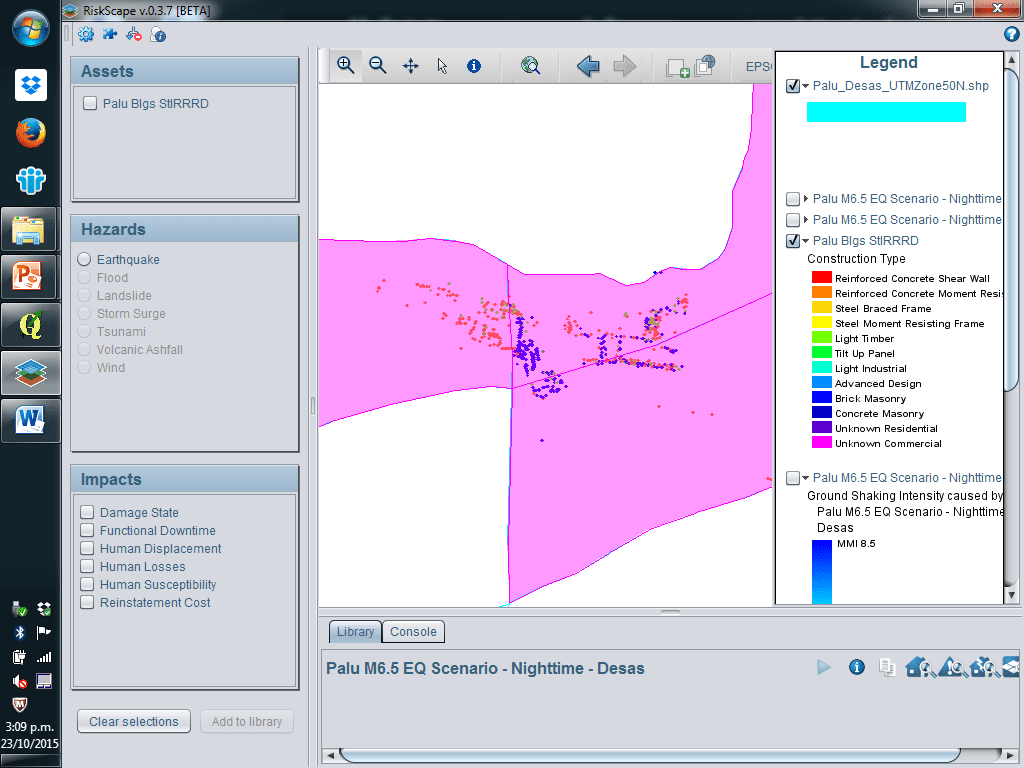
This led into a discussion about the asset information required, including building and infrastructure attributes and typology, as well as population data, and involved a demonstration of the RiACT tool (Real Time Asset Collection Tool), to be used the next day in the field exercise. Being in Palu, Tadulako University had helped with organising the training, and had gathered significant asset data prior to the workshop using paper forms, the results of this survey presented by Dr Ketut of Tadulako University.

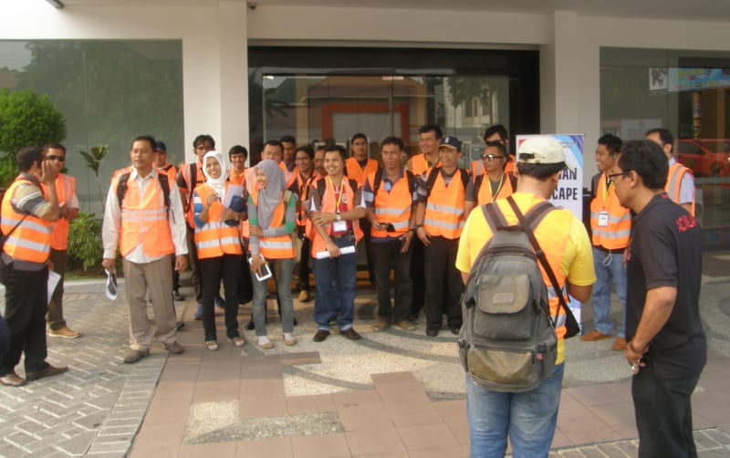
The following morning one half of the group went into the streets of Palu, armed with tablets to collect asset data using the RiACT tool. They collected 75 assets in 2 hours work and downloaded them to a database server.

Getting ready for field action

Field data capture

The remaining group worked through RiskScape tutorials and discussed ‘what if’ scenarios. They also came up with questions/scenarios that they might wish to have modelled in RiskScape to assist in Risk Reduction investment, and the data they would need to do so. These scenarios provided the basis of RiskScape Indonesia action plans to be developed later in the training. The groups swapped sessions the following morning.

Using the data they had collected, and earthquake hazard scenario and vulnerability functions from New Zealand, a Palu earthquake scenario was modelled using RiskScape.

Palu Scenario

The final sessions of the workshop were devoted to developing actions to take the training forward to develop and model the scenarios developed through the workshop. These will require collaboration between the district government departments and the universities involved. Tadulako University and Palu indicated they had data and resources and were ready to go, especially with the asset data collection.

Via the network established here, risk modelling in Indonesia can be developed and inform Disaster Risk Reduction decisions and investment.

Seluma – observing hazard and risk issues in the field – by Kate Crowley

As part of the DRR Action Plan workshop held in Seluma, 25–26 August 2015, we had a half-day field visit organised by the local emergency management office (BPBD). It was an opportunity for them to show some of the hazard and risk issues they face. Our party consisting of local government staff and university researchers, set off from Pasar Tais just after 8 am and travelled towards Pasar Seluma on the coast. Soon the tarmac road ran out and gave way to a rolling dirt track worn to rubble, which took us through a cross section of Indonesian life from the bustling town to the gentle padi fields. But the watery green terraces are slowly being eaten by groves of palm oil. Busy villages line the road, hinting at the thousands of people who live in this area near the coast. Initially hidden by the palms a great expanse of beach opens out. Here, we are provided an informative presentation by the head of the Preparedness section of the BPBD, Aziman. He describes how they have recently mapped the tsunami hazard in this region and will be using this map in risk reduction planning going forwards.

BEACH

He expresses his concerns that although the national government have built a tsunami shelter, it can hold only 3,000 people. There are many villages that line the 70 km of exposed coast of Seluma and he estimates that they would need 10 tsunami shelters to sufficient provide a safe refuge for them all. The drive from Pasar Tais to the beach is across broad flat coastal plain, which makes tsunami evacuation challenging. Vertical evacuation is a sensible option, but the lack of multi-storey buildings means that purpose built structures, although expensive, are the only option.

Following a ‘bread crumb’ trail of tsunami evacuation signs our dusty convoy travelled on to the purpose built tsunami shelter.

OLYMPUS DIGITAL CAMERA

Exploring this large structure it becomes clear that it is purpose built. It is a solid, open structure and a ramp and broad stairs enable those who are frail, young or disabled to access the higher floors. Toilets are provided on the third floor and solar panels are in place to provide lighting at night. This is an impressive undertaking, following a national standard and is very similar to the one observed in Kota Bengkulu.

OLYMPUS DIGITAL CAMERA

However, the local emergency managers are still waiting for an official handover of the building from the national government before they can start using the building and implementing their community awareness plans. The building could be used as a local community centre, a market, or even a school and this would enable the community to become familiar with the structure and put it to good use.

Click the links here for a videos of a similar shelter in Kota Bengkulu, under construction and finished.

The aim of this second phase is to support the local community to be resilient, enabling them to identify the warning signs of a tsunami and know where to go and when. This outreach is aligned with support for their livelihoods under the “Resilient Village” government program.  It is a holistic approach that aims to improve the lives of those living in the area now and in the future.

SHELTER TALK

Tsunami is not the only hazard that impacts this area. The workshop participants have also identified floods, earthquakes and landslides. Participants noted that they are used to the frequent small earthquakes that shake the surrounding countryside, and they rank earthquakes as the biggest threat. The fear of ‘the large one’ is real.

Our final stop demonstrates the power of a frequent and rapid onset hazard – flooding. We visit a small village that last month woke to find devastation on their door step. Overnight heavy rainfall upstream, in the “dry” season, caused the near-by wide and shallow river to swell and overtop its banks. Flood waters up to 4 m in depth swept through the palm oil plantation and three villages were flooded. Despite the flood occurring rapidly, over only 2 hours, no one was hurt but many lost their belongings.

The field trip provided an insight into this districts progress towards resilience. Just like the road we travelled together today, the path of disaster risk reduction is at times rough and slow but the journey is always worth it.

StIRRRD New Zealand Comparative Study Field Trip: Wellington-Taupo-Rotorua 13-14th June 2015

The Comparative Study Programme finished with a two day field trip from Wellington to the central North Island exploring landslide and volcanic hazards, monitoring and early warning systems. Mike Page and Brenda Rosser from GNS led the field trip with assistance from Nico, Phaedra and Noel.  We left Wellington in glorious sunshine which unfortunately did not continue as we drove north. Continue reading StIRRRD New Zealand Comparative Study Field Trip: Wellington-Taupo-Rotorua 13-14th June 2015

StIRRRD New Zealand Comparative Study Programme 5-19th June 2015

The New Zealand StIRRRD team recently hosted a 27 strong delegation from Indonesia for a Comparative Study Tour of Disaster Risk Reduction.  The delegation consisted of representatives from UGM, regional governments and parliaments from the four districts Pesisir Selatan, Bengkulu, Donggala and Mataram, central government representatives including the Director for Disaster Risk Reduction from the National Disaster Mitigation Agency, National Planning and the Ministry for Rural and Underdeveloped Regions and Transmigration. Partner universities, Universitas Andalas, Universitas Bengkulu, Universitas Tadulako, and Universitas Mataram, also attended.  The delegation was led by UGM Vice-Rector for Cooperation and Alumni, Dr. Paripurna Sugarda and was accompanied by a translator, Zamira Tatapamang. Continue reading StIRRRD New Zealand Comparative Study Programme 5-19th June 2015

Bengkulu Action Plan Workshop

Part of the StIRRRD team spent last week in Kota Bengkuku, Sumatra running an DRR Action Plan Workshop and renewing contacts in the Kota. The aim of this visit was to facilitate the production of a draft DRR action plan for Kota Bengkulu. The draft plan was developed during the course of the workshop by participants from local government, NGOs, Bengkulu University and volunteer organisations.

P1120882The first day was largely taken up with technical presentations including introducing the tectonic setting of western Sumatra, the regional geology, the earthquake and tsunami hazard, using GIS to map hazard and risk, coastal erosion, flooding and landsliding.

Continue reading Bengkulu Action Plan Workshop

Action Planning in Donggala, Central Sulawesi

We’re back in Donggala, Central Sulawesi, following on from our introductory visit here in November 2014.

A aerial view of the tip of the western peninsula of Donggala District. Palu Bay to the left and the Malacca Straits to the right.

This time we’ve worked with local government staff and NGOs to develop a natural hazard risk reduction action plan for Donggala. To prepare for the action plan we first discussed Donggala’s hazards, risks and current risk reduction practices and discussed a range of risk reduction options. As well as StIRRRD team expertise in earthquake engineering, landslide early warning systems, GIS mapping, social science and risk reduction expertise, we also included in our team river flood and debris flow management expertise from local government in New Zealand (James Flanagan and Michael Goldsmith) and tsnuami expert Gegar Prasetya.

Continue reading Action Planning in Donggala, Central Sulawesi

Mataram DRR Action Plan workshop

Part of the StIRRRD team was recently back to Mataram, in the island of Lombok, in the West Nusa Tenggara province. Last year’s introductory visit highlighted main issues around vulnerability to coastal erosion, floods, earthquakes and tsunami. This year, we came back to run a DRR Action Plan workshop with our local BPBD partners, officials and local university. Aside the usual suspects from UGM, GNS Science and NZ MFAT, the StIRRRD team was joined by former-GNS tsunami expert Gegar Prasetya and flood expert James Flanagan from the Wellington Regional Council.

Continue reading Mataram DRR Action Plan workshop

DRR in action around Merapi

As part of the combined KPDT-StIRRRD workshop on Human Recovery Needs Assessment and Disaster Risk Reduction (DRR) held in Yogyakarta, 24-26 November, we visited examples of DRR in action at a community level. The countryside around the active volcano of Merapi (see Map) is a very process active environment with many lahars and debris floods filling the river channels. There are about 270 gravel entrapment dams on the rivers running off the mountain and extraction of gravel is a large local industry.

Continue reading DRR in action around Merapi

Strengthened Indonesian Resilience – Reducing Risk from Disasters