
As part of the combined KPDT-StIRRRD workshop on Human Recovery Needs Assessment and Disaster Risk Reduction (DRR) held in Yogyakarta, 24-26 November, we visited examples of DRR in action at a community level. The countryside around the active volcano of Merapi (see Map) is a very process active environment with many lahars and debris floods filling the river channels. There are about 270 gravel entrapment dams on the rivers running off the mountain and extraction of gravel is a large local industry.
This is also a hazard management strategy, allowing the wet seasons gravel deposits replenish the mined areas, although the extraction often can’t keep pace with deposition. At one location a debris flow and lahar blocked the existing river channel and spilled out over the road and into the village. A new bridge had to be constructed over the new river channel.

At the village of Kemiren staff from University of Ghadja Mada (UGM) have been working with the locals since 2007, to help them manage their risk from the hazards posed by Merapi, and at the same time maintain and develop sustainable livelihoods. The village has a mining, tourism and disaster management committees. The villagers have made land use plans, where development on the upper slopes is restricted to plantation and crops. They control the extraction of gravel, and have delineated areas for mining, such that it doesn’t undermine the retention dams and make other infrastructure and crops vulnerable. They have developed a Merapi tourist industry, taking visitors on 4WD and motorbike adventure tours up the mountain, and have built a swimming pool that allows them to generate income to fund DRR activities.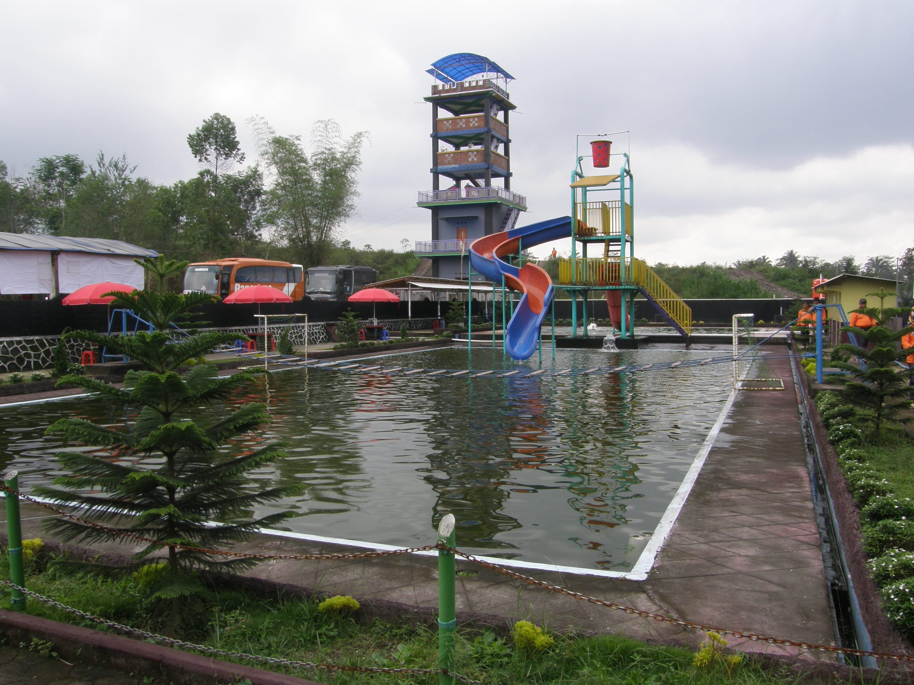
Swimming pool and warning/watch tower, Kemiren Village

UGM, with partners, have helped develop a lahar and debris flow early warning system on Merapi utilising ultrasonic sensors and telemetry. This combined with other eruption sensors provide the village with an early warning such that the mine workers can get out of the riverbed, or the villages can evacuate if need be. They have an evacuation map which is displayed in the village.

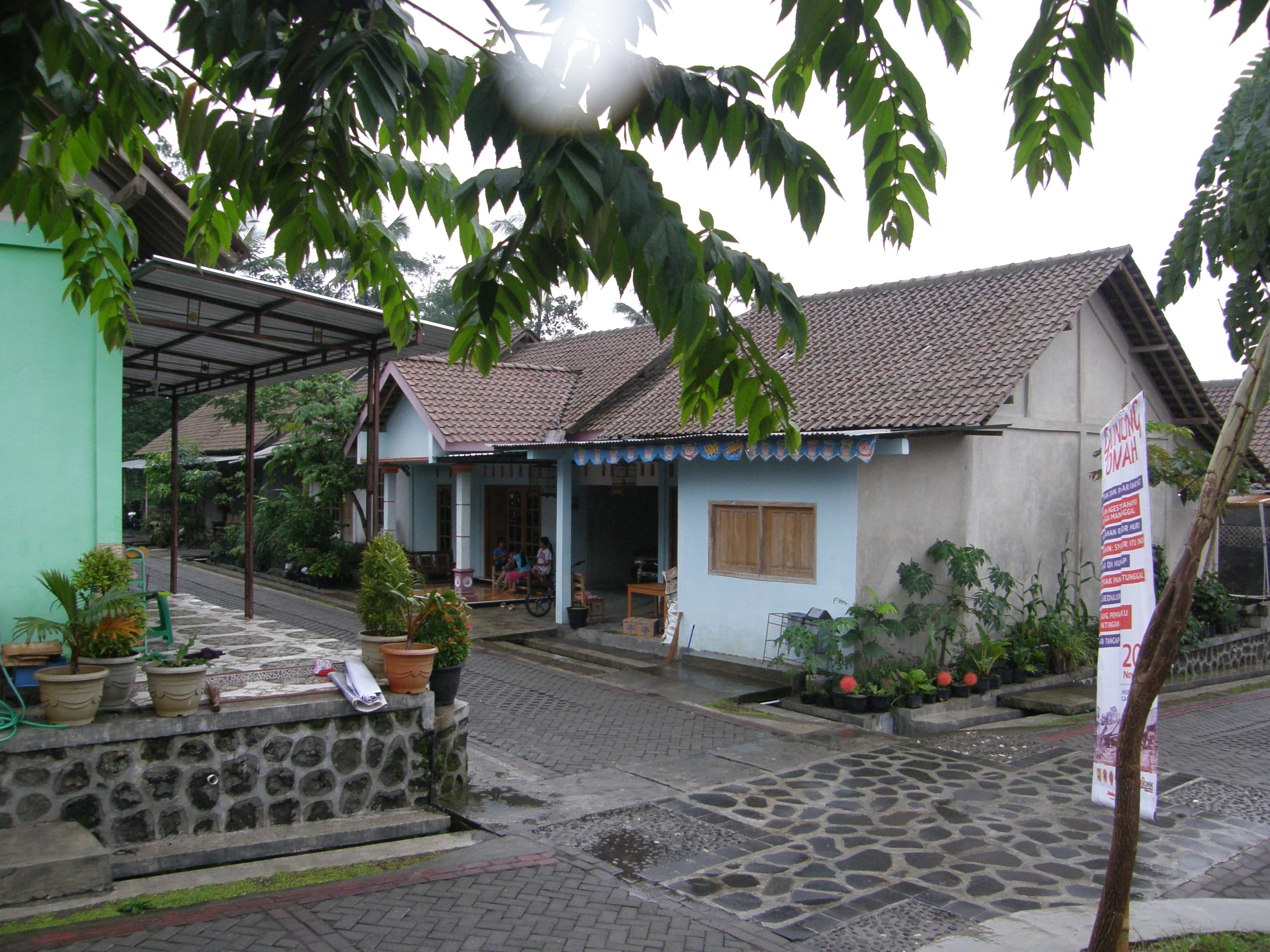
Following the eruption of 2010, some villages decided to relocate. At one location, 300 new houses along with community facilities were built on government land. The villagers seemed happy to be in this relatively safer environment, despite having to travel 3 kms or more to get to their crops and plantations.
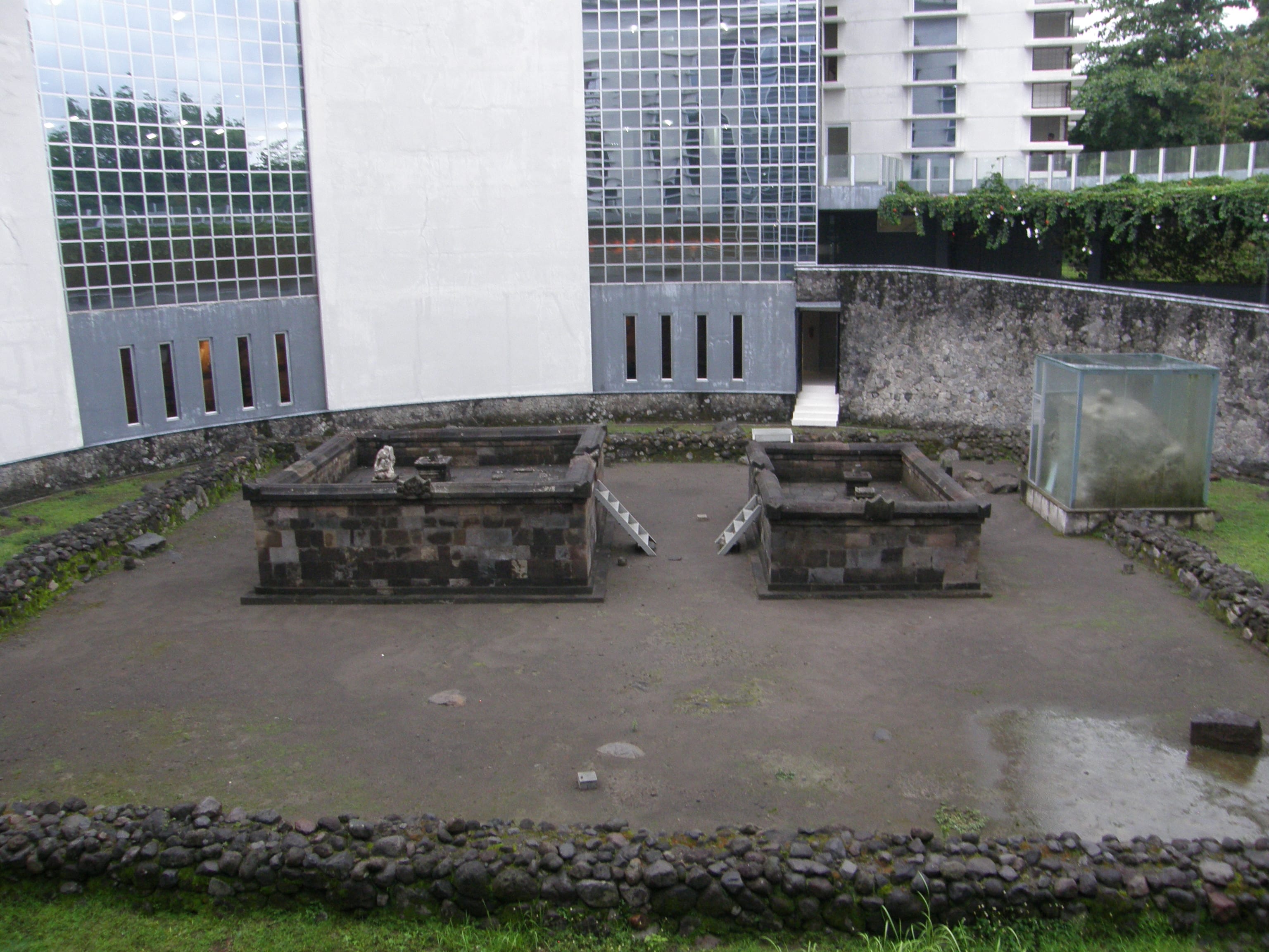
Yojyakarta is surrounded by temples dating back to the 7th and 8th centuries. Many have been buried or destroyed by the activity of Merapi. Borobodur was one such temple, and many are yet to be discovered around Yogyakarta, buried by the volcanic power of Merapi. The Islamic University recently discovered the remains of a temple when excavating the foundations for a new building 5 or 6 meters below ground level. They have preserved it as part of a small museum at the university.